Lying on the ancient Silk Road, Xinjiang 新疆 is a must-see! With a total area of 1.6 million km² (1/6 of China’s territory) and a population of 23 million, it is unearthly beautiful with grasslands, plateaus, deserts, sand dunes, oases, gorges, lakes and Siberian Altay mountain scenery. It is also rich in history and has been a melting pot of people from different cultures.
Background
Xinjiang is famous for its golden autumn foliage. I made my first trip the Silk Road in August 1991 and travelled from Urumqi烏魯木齊 to Dunhuang 敦煌and Xian 西安. Since late September is the peak tourist season, I decided to join a 13-day tour organized by Modern China Travel Agency. The group had 24 members and was accompanied by Mr. Yeung (who prefers to be called ‘Sun’).
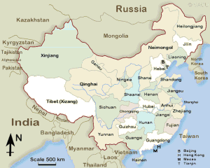
Xinjiang
Xinjiang borders Mongolia to the east, Russia to the north and Kazakhstan, Kyrgyzstan, Tajikistan, Afghanistan, Pakistan and India to the west, the Tibet Autonomous Region and India’s Leh District to the south and Qinghai 青海 and Gansu甘肅provinces to the southeast.
 |
Most of Xinjiang is young geologically formed from the collision of the Indian plate with the Eurasian plate. It is a major earthquake zone. Its highest point is the peak of K2 at 8611m (the world’s second highest peak) on the border with Pakistan while the Turpan Depression at 155m below sea level is China’s deepest depression. The east-west chain of the Tian Shan separate Dzungaria, a dry steppe in the north from the Tarim Basin which contains the massive Taklamakan Desert (world’s second largest desert) in the south.
This region has large deposits of oil and mineral. The oil and petrochemical sector account for 60% of Xinjiang’s local economy. It is also known for its fruit and produce including grapes, melons, pears, apples, pears, cotton, wheat, maize, walnuts and sheep.
Thirteen ethnic groups live in Xinjiang. According to the 2010 census, the three biggest ethnic groups are Uyghur (43.6%), Han (40.6%) and Kazakh (8.3%). The Uyghurs are the majority in southwestern Xinjiang and in Turpan prefecture in eastern Xinjiang while the Han in eastern and northern part (Dzungaria) and Kazakhs in the northernmost part of Xinjiang respectively.
Day 1 September 20 Friday: Hong Kong – Shenzhen – Urumqi
I left home at 10:30am, met up with the group at 11:15am at the Element, a modern shopping mall above the Airport Express Kowloon Station. The bus heading to Shenzhen深圳 Airport via Shenzhen Bay control point left at 11:45am. The immigration arrangements here are most efficient. We boarded the coach on the Chinese side again and arrived at the Shenzhen Airport before 2pm. (Of course, I still prefer to fly from the Hong Kong airport direct saving at least 2 to 3 hours’ time)
Our flight took off at 4:10 pm with a brief stop in Changsha. We arrived in Urumqi at 11pm. After having a light supper, we arrived in our hotel at 1am. Janice was my roommate and I did not sleep till 1:45am. What a terribly long day!
Day 2 September 21 Saturday: Urumqi – Yining – Nalati (280km)
I got up at 6am and departed for the airport before 7am. The one-hour flight to Yining 伊寧 took off at 9:20 a.m. and we were met by Ms. Huang, our local guide and a driver on arrival.
The weather was not good: cool and grey with a few raindrops. The original plan was to visit the old town on a 6-horse-drawn cart. But all the horse carts had been taken up. Ms. Huang therefore arranged an early lunch and we departed for Nalati after lunch. It was a long drive and we arrived at our destination at 5:30pm. The weather was fine and there was still sunshine when we finished our dinner. I was dead tired and went to bed early.
Day 3 September 22 Sunday: Nalati Grassland – Bayanbulak Swan Lake –Bayanbulak (90km)
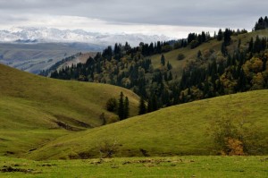
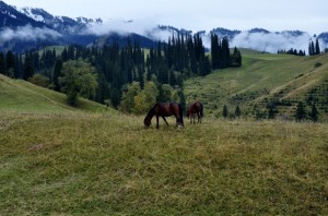
I recovered after a sound sleep. The breakfast was uninviting with few cold side dishes and thin rice porridge. It was raining when we left the hotel at 9am. It was a short drive to the famous Nalati Grassland 那拉提草原, one of China’s highland grasslands and China’s second largest grassland.
 |
 |
 |
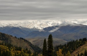 |
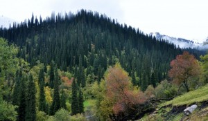
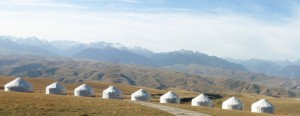
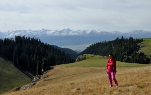
The Nalati scenic area covers an area of 400km² and is home to 1/10 of China’s Kazakh community. The landscape is most beautiful: the rolling hills, plains and ridges look like sculptures covered by a silky shiny grass carpet. The fairylike grassland is dotted by yurts and herds of goats, sheep and cows and cypresses, cedar and pine trees.
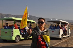
Visitors must travel in tour bus provided by the management inside the scenic area. There are two scenic routes i.e. one to the hanging grassland and another to the valley. Owing to the rain, the hanging grassland was closed and we had to take the valley route. The bus ride was short and we were left at the bottom of a valley. Most of us took another ride in a trolley bus for RMB150 in order to go over a ridge/pass for panoramic views.
We were rewarded with fantastic views of several mountain ranges. At the end of the ride, we saw a few yurts and some locals were selling grilled mutton for RMB10 a stick. I started having trouble with my skin which was itchy and red. I stopped myself from scratching by hitting myself. I felt better an hour later.
 |
 |
 |
 |
We had lunch at Nalati before proceeding to Bayanbulak Grassland (meaning grassland with abundant spring water in Mongolian). It is China’s second largest grassland at an altitude of 2400m covering an area of over 23,000 km². It is a scenic route: there are beautiful cedar and pine trees on the steep mountain sides.
As the weather had improved, visitors rushed in from all directions. There were over 100 visitors at the ticket office at 4pm. The toilet facilities are totally inadequate: there are only five toilets for ladies. I had to queue for some 20 minutes. There is no proper exhaust system and the smell permeated the whole building. It is one of the worst newly built tourist ticket/entrance building I have seen in China.
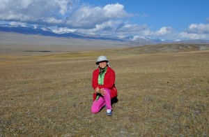
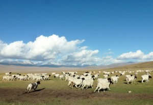
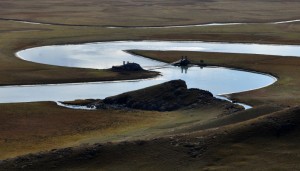
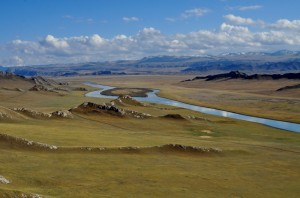
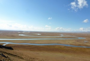
As usual, we took a special tour bus which took us to the ‘Nine Turns and 18 Bends” lookout point. This is a favourite spot for watching sunset where one can take pictures with nine suns! We strolled around for an hour and before 6:30pm.
 |
 |
 |
 |
 |
 |
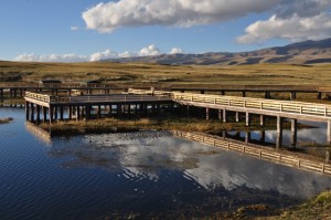
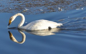
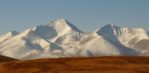
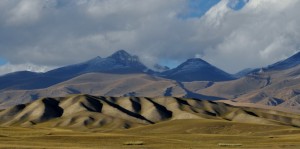
The second stop was the Swan Lake, an expansive wetland made up of many interconnected small lakes. Thousands of swans gather here in the summer but they have gone now. The lake can only be reached on horseback or with a horse-cart. There is no point visiting the lake without swans. So we left and arrived at the last stop which is an artificial lake serving as a refuge for those swans that have been hurt or too weak to fly. Several swans were paddling leisurely here. (But it is nothing compared with the pond with thousands of swans that I visited in Hokkaido in end April)
 |
 |
 |
 |
We left around 8pm and stayed in a hotel nearby. Around 9pm, we met a group of tourists from Hong Kong returning from the grassland after watching sunset at the Nine Turns and 18 Bends. I wish similar arrangements had been made for our group.
Day 4 September 23 Monday: Bayanbulak – Eight-Diagram City (350km)
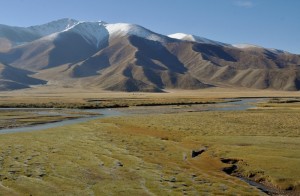
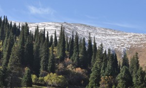
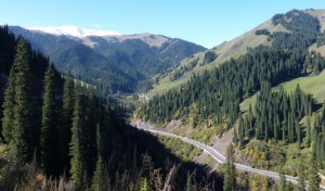
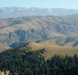
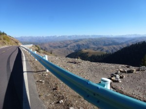
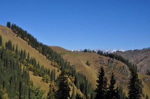
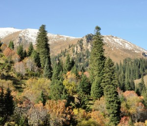
Today we spent most of the time on the road. First, we had to take the same way back to Nalati. Colours of the foliage are fascinating. I enjoyed watching the Alpine scenery with cedars and pine trees with red, orange and golden hues. We had four photo stops.
 |
|
 |
 |
 |
|
 |
 |
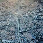
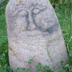
After lunch at Nalati, we spent four hours on the road before arriving in the Eight-Trigrams City (also known as Takesi). It claims to be the first town in China to be laid out according to eight diagrams based on the yi-yang principles. We spent an hour in the park with a local guide who explained briefly about the layout of the city which has a centre with four rings roads and a total of 64 streets. I was amazed by a few stone carvings with the head of a man and a deer which are said to be over 3000 years old.
We had a surprisingly delicious dinner as the chef has spent over ten years in Guangzhou. Our room in the hotel was so dark that I could not read. I went out with other members and had lots of fun in a food street. We ordered two roast chickens, local beer (kavaz which I had in Russia) and BBQ mutton and beef on sticks. It only cost us RMB 15 each. Good value and great fun!
Day 5 September 24 Tuesday: Side trip to Karaqi Grassland – Yining (200km)
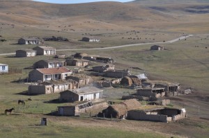
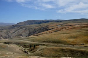
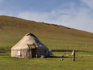
We set off at 9am and arrived at the Karaqi (meaning ‘dark/black’) Grassland 60km from the town. This grassland at an altitude of 2000-3600m measures 80km long and 30km wide with a total area of 2800 km². In the past, it was kept for the exclusive use of the ruling chiefs.
 |
 |
 |
 |
 |
 |
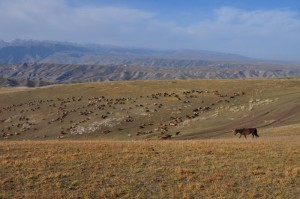
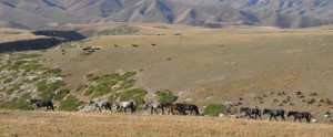
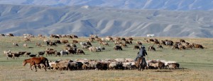
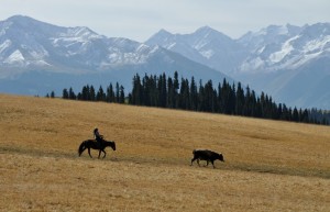
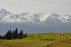
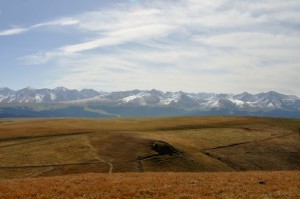
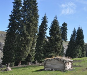
We took the park’s tour bus which only made two stops. The views are fantastic: green pasture, virgin forest of cedars and pine trees, a wide valley between the Karaqi Grassland and the Tien Shan mountain range. Between mid-June and mid-September, some 200,000 horses, sheep and cows graze here.
 |
 |
 |
 |
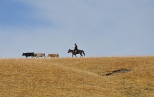
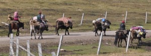
I watched a nomadic Kazakh family passing by with several cows carrying their tent and utensils. I am glad to see they are carrying on their traditional nomadic and carefree life.
 |
|
 |
 |
 |
 |
We got back to the city for lunch and had rice with mutton and carrot at a local café. Some members of the group were not pleased with the quality of the food but I enjoyed the delicious rice which had many times in Central Asia last year.
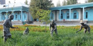
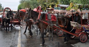
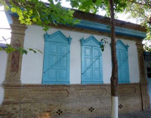
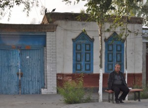
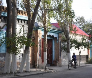
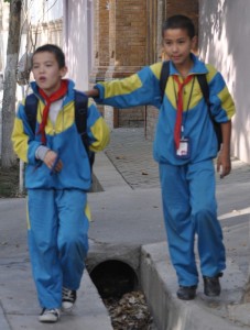
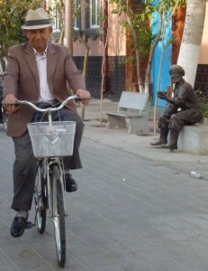
 After lunch, we proceeded to Yining (for the second time). Immediately upon arrival, a local guide took us to a local art gallery, a museum located in a restored house of a rich family from Russia where we had hand-made ice-cream. Then our group took six horse-carts and had a short ride to the old town which must be the loveliest part of the city. The streets are quiet, clean, leafy and peaceful and the houses are colourful built in Kazakhstani style.
 |
 |
 |
 |
 |
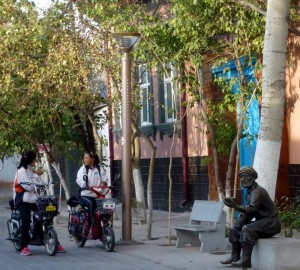 |
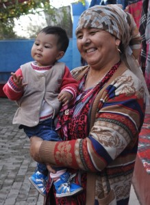
We visited two families and saw how the locals live. Each house has a courtyard which looks similar to those in Central Asia. There is a huge wooden/iron bed in the yard where the family sits and eats. The kitchen is located in the courtyard where grapes are grown. I love to stroll around and soak in the atmosphere. But the group moved so quickly that the carts were ready to go. I rushed out just in time. Otherwise the carts would be leaving without me!
 |
 |
 |
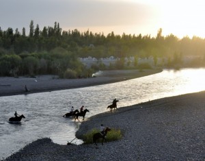
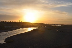
Yining River is the largest river in Xinjiang. We spent almost an hour by the Yining Bridge to watch sunset which was so-so.
 |
 |
 We then had dinner with 12 persons on each table. The food was average and some members were not satisfied with both the quality and quantity of the dishes. Instead of taking this up with Ms. Huang and Sun, a member sent photos and lodged a complaint to Hong Kong. (As a result, Ms. Huang was put under a lot of pressure and was at tears on a couple of occasions. After this incident, Ms. Huang and Sun arranged 10-12 dishes each meal. Frankly, I find it excessive and wasteful)
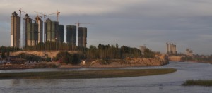
Yining is located about 70km east of the border with Kazakhstan and 700km west of Urumqi. It has a population of over 400,000 and is surprisingly modern. Many high-rise residential blocks are being constructed near the river. We had a pleasant stay in a 4-star hotel which is the second best hotel of the trip.
Day 6 September 25 Wednesday: Yining – Bole (300km)
Today, we set off at 8:45am after having a nice and leisure buffet breakfast. We had four stops before reaching Bole博樂.
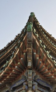
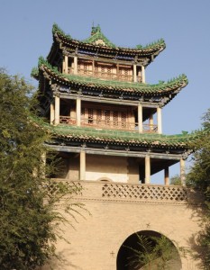
Ancient Huiyuan City was established the Qing government in 1762 as the General’s Office by whose was responsible for protecting the frontier and taking charge of the military and political affairs of Xinjiang. Its importance dwindled after the seat of the government moved to the present day Urumqi in 1884. The main attractions are the Bell-Drum Tower in the middle of the city and the General’s Office.
 |
 |
 |
 |
 |
 |
 |
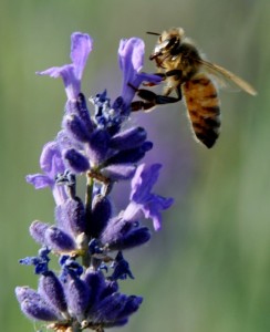
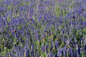
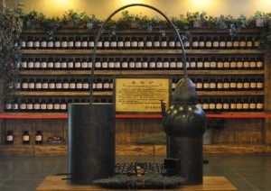
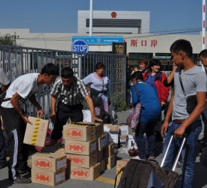
As this area lies on the same latitude as Provence in France, the climate and soil are suitable for growing lavender. We visited the Lavender Museum. The best season to come is August. We only saw some lavender plants in the field. We then proceeded to the Xinjiang-Kazakhstan border at Horgos which is a free trade zone. A lot of goods from Russia and Kazakhstan can be purchased here.
 |
 |
 |
 |
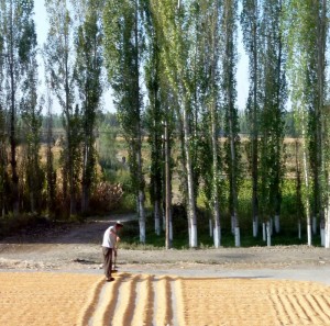
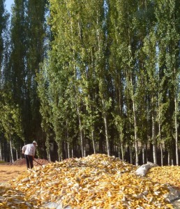
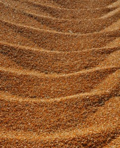
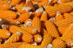
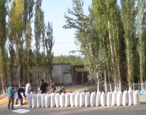
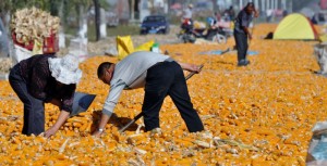
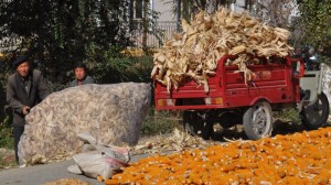
Along the route, we saw local farmers drying maize along the road. It was an impressive sight – the whole road turned golden. Some even set up a tent and stay there for a week to guard their property.
 |
 |
 |
 |
 |
 |
 |
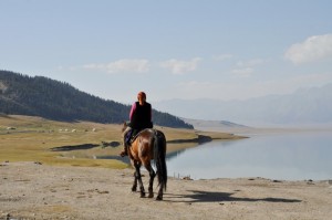
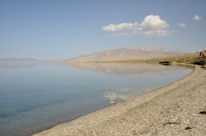
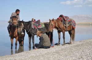
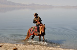
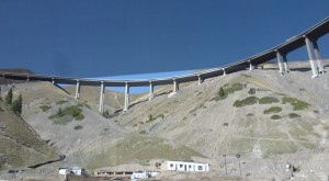
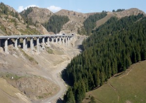
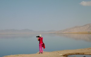
After lunch, we continued our journey to Bole. The new highway is impressive. We had 30-minute break at the Sayram Lake赛里木湖. The lake is Xinjiang’s highest lake at 2072m above sea level with an area of 467 km². It is said to be wonderful and beautiful like a brilliant emerald inlaid in the basin surrounded by the Tianshan Mountain with flocks of ducks and swans in the crystal clear lake. Unfortunately, it was a hazy day and I did not see the lake at its best.
 |
 |
 |
 |
 |
 |
We arrived in Bole about 7:30pm. The area of the county is about 7,517km² with a population of over 400,000. Cotton is one of the main crops and the cotton farmers have high income. Bole looks prosperous and modern with many newly completed high rise residential blocks. Our hotel is good too.


hi
I would like to get some photos of the following sight because I did not go to see it due to high altitude sickness that day.
天鵝湖自然保護區(九曲十八灣)
Please note that I have also left a message to your email.
Thanks.
Correction: Sorry, the photos required are for the hills and mountains view (requiring long walking on the high altitude grassland) after 天鵝湖自然保護區(九曲十八灣). Thanks.
Nice photos, so many!
I am going to Iran for 13 days tomorrow but I still cannot get back my tablet and Modern China is just not helpful.
Good photos showing a variety of scenes and life in Xinjiang/ but I wish you would put the names in Chinese too.