
Day 21-24 (Dec 18-21) at Sea
24 Days in French Polynesia (22/12/2025 – 14/1/2026)
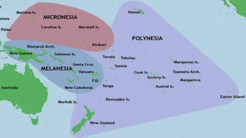
French Polynesia comprises 121 geographically dispersed islands and atolls stretching over more than 2,000 km in South Pacific Ocean with a land area of 3,521 sq km and a population of 282,596 as of September 2025. It is divided into five island groups, namely the Austral Islands, Gambier Islands, Marquesas Islands, Society Islands and the Tuamotus. Of the 121 islands, 75 are inhabited as at 2017 census. Tahiti is the most populous with almost 70% of the population. French Polynesia has three UNESCO World Heritage Sites (WHS): the Taputapuatea Marae (cultural), the Fakarava Biosphere Reserve (natural) and the “Te Henua Enata -The Marquesas Islands (mixed).
History. It is believed that the Great Polynesian Migration commenced around 1500 BC. The first islands of French Polynesia to be settled were the Marquesas Islands in about 200 BC and the Society Islands were discovered around 300 AD. Europeans began to arrive in the 16th century. Ferdinand Magellan, Portuguese explorer, was the first European to sight Puka-Puka in the Tuamotu – Gambier Archipelago in 1521 followed by a Spanish expedition in 1606 and the Dutch in 1722. British explorer Samuel Wallis visited Tahiti in 1767 followed by French explorer Louis Antonie de Bougainvillein 1768 and James Cook in 1769 whose mission was to observe the transit of Venus. Cook travelled in the area again in 1773 and 1777. A short-lived Spanish settlement on Tahiti was created in 1774 with arrival of Spanish priests. Protestants from London Missionary Society settled permanently in Polynesia in 1797. Threats from the Europeans forced King Pomare II of Tahiti to flee to Mo’orea in 1803 and his subjects were converted to Protestantism in 1812.
French missionaries arrived in Tahiti in 1834 and their expulsion in 1836 caused France to send a gunboat in 1838. In 1842, Tahiti and Tahuata were declared a French protectorate to allow Catholic missionaries to work undisturbed and Papeete was founded as the capital in 1843. French action led to a war with Tahiti (1844-1847). In 1880, France annexed Tahiti changing its status from a protectorate to that of a colony. In 1889, France officially annexed the island groups and established a French protectorate. Many native resistances and conflicts called the Leewards War lasted until 1897. In 1903, the colony’s name was changed to French Establishment in Oceania. During World War II, the American military based in Bora Bora was prepared for attacks from the Japanese. But the Japanese were not able to launch an actual invasion of the French islands. In 1946, Polynesians were granted French citizenship and the islands’ status was changed to an overseas territory. In 1957, the island’s name was changed to French Polynesia. In 1977, it was granted partial internal autonomy and the autonomy was extended in 1984. It became a full overseas collectivity of France in 2003.
Day 25 – 27: 3 Days in Bora Bora, Society Islands
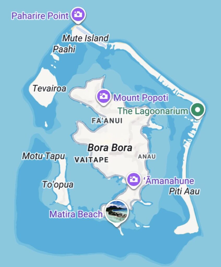
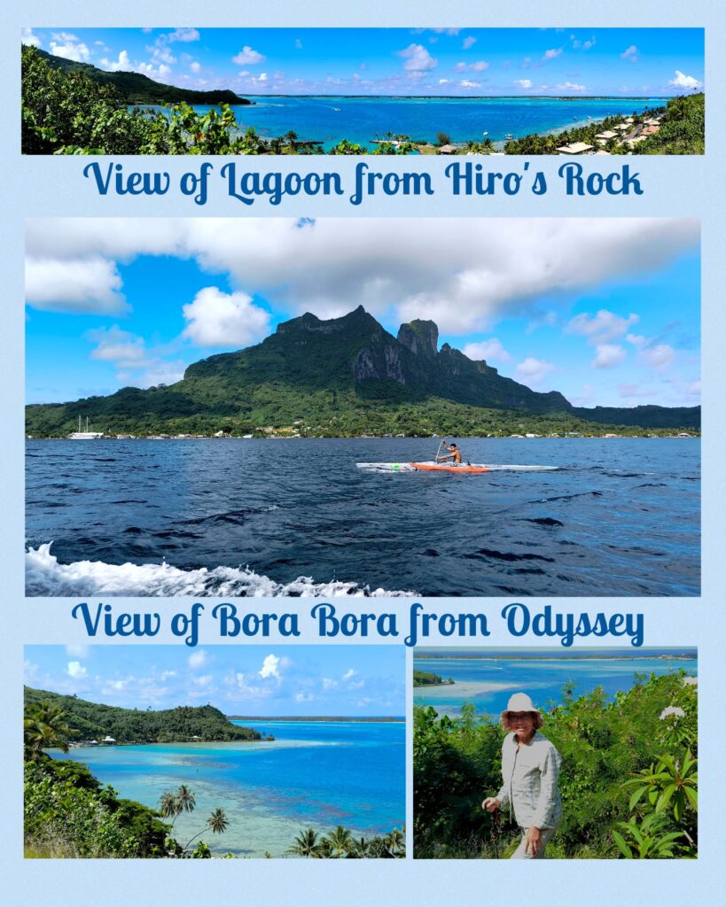
Bora Bora with a total land area of 30.55 sq km and a population of 12,000, is surrounded by a lagoon, and a barrier reef. In the centre of the island are the remnants of an extinct volcano rising to two peaks, Mount Otemanu (727m) and Mout Pahia (661m). The name of the island in Tahitian language is Porapora mai te pora meaning “created by the gods”. Dutch explorer Jacob Roggeveen was the first European to set foot on the island in 1772. It remained an independent kingdom until 1888 when the French annexed the island as a colony forcing its last queen Teriimaevarua to abdicate. During World War II, the US chose Bora Bora as a South Pacific military supply base and constructed an oil depot, an airstrip, a seaplane base, and defensive fortifications. The expedition was known as “Operation Bobcat” comprising nine ships, 18,000 tons of equipment, and nearly 7,000 soldiers. Eight guns/cannons set up at strategic points around the island still remain to this day.
Tonight, I watched a musical “Maggie and JJ” with some 40 residents taking part. The story was based on a true story and the actor and actress and supporting cast did a fantastic job. It started at 8 pm and finished at 10:30pm. A fairly professional production given all the constrains including poor lighting and sound, and inadequate technical support.
Dec 22 Odyssey was at anchor off the Viatape Pier Bora Bora around 7am. It took longer to clear immigration and customs: the first passengers did not get off the ship till almost 9am. As I had only booked a 4×4 island cultural tour in the afternoon, I was not in a hurry. I took a tender at 9:30am and spent two hours strolling a short stretch of the main road looking at a few souvenir shops selling black pearls, art and craft. I joined a small group 4×4 tour (8 passengers) at 1 pm and had an interesting island tour with many photo stops. The Circle Island Road is approximately 32 km.
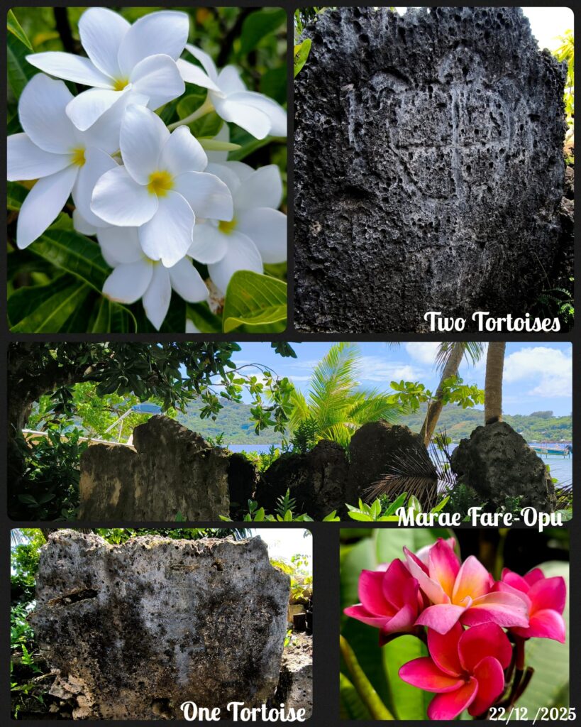
main coastal The first stop was Marae Fare-Opu which belongs to the family of chief Ma’i who reigned on a large part of Bora Bora in the 15th or 16th century. Marae means spiritual temple. In the past there existed 42 Marea on the island: today only twelve are visible and Marae Fare-Opu is the largest. Petroglyphs depicting turtles were carved into two of the stone slabs on the facade of the altar. Turtle was regarded as sacred holding mana (spiritual power) of the Ocean Gods who guided navigators across the seas.
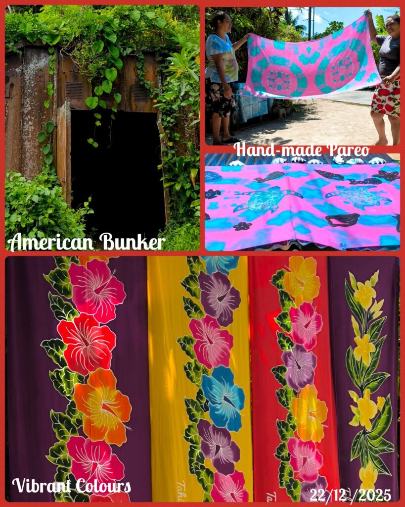

We had a nice break at a stand close by that sold beautiful hand-made pareos. We watched how they dyed the cotton with natural dye before lying the piece of cotton under the strong sun for ten minutes.
The next stop was at the Hiro’s Rock offering spectacular views of the Mt Otemanu and the lagoon. From here one can take a 15 minutes’ hike to see two American cannons. After walking for ten minutes, I decided to turn back: the path is rocky and I am too slow. We stopped here for some 45 minutes. Later we stopped by the coast looking across the lagoon at the rock which looks like a head!
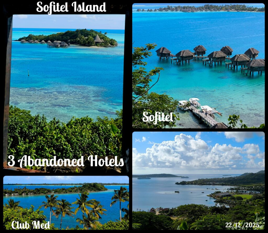
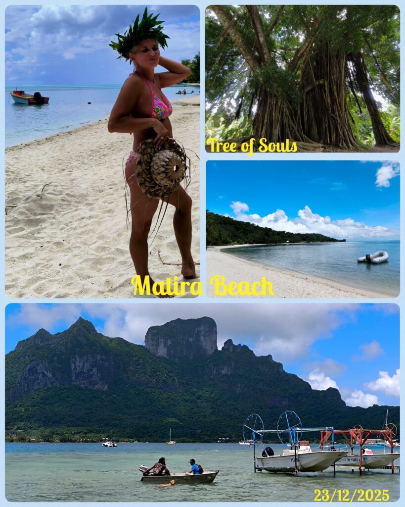
The next two photo stops were at lookout points. At the first hilltop, the guide pointed out three ghost hotel developments, namely Club Med, Sofitel and Sofitel Island Resort. At the second location, we saw a bunker one of the 300 around the island built by the American. We also had great view of the harbour which was formerly a crater/caldera. The last stop of the day was at the Maitrea beach.
Dec 23 Today Dianne was renting a car for four hours. Ilana, I and another passenger from the ship joined. (28 USD pp). We set off on the Circle Island Road again and we stopped at many places that Dianne and I had no chance to visit. Dianne picked up a map from Avis which shows half a dozen places of interest with good description of location and details. We followed the map, stopped at the Marea Fare-Opu and the pareo stand before snorkelling at a cleaning station frequented by manta rays. We did not see any ray but enjoyed a dip in the ocean. We had many photo stops along the way. A leisure trip!
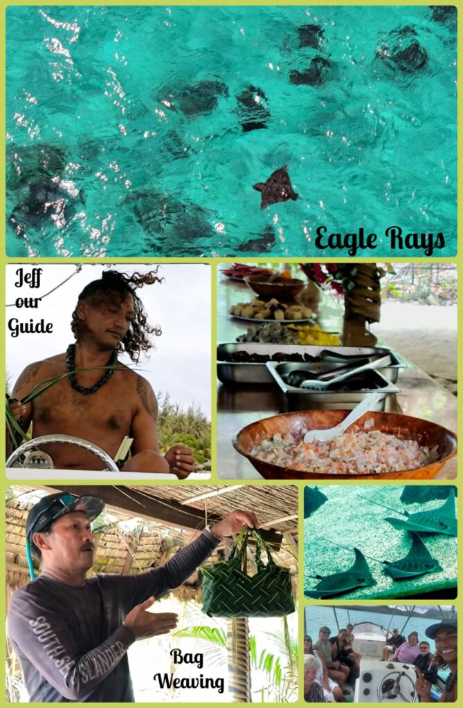
Dec 24 Today I joined a full-day snorkelling trip organised by Nancy. I was in the boat with a most entertaining guide cum captain, Jeff. We first stopped at Motu Tapu where we found a majestic manta ray (about 4 m wide): I floated comfortably watching it swimming towards me half a dozen times. On a few occasions, I stood right above it or stared into its mouth! Then the boat moved to another shallow part of the lagoon where we found countless reef sharks! I snorkeled so that I could see them underwater. It was like an aquarium with lots of butterfly fish swimming with us. I also saw a sting ray while snorkeling. Before leaving the area, we spotted two eagle rays!

The third stop was at a bay where we had lunch on a private island. Before lunch, we watched and swam with eagle rays. I stayed in the water near the boat and watched five five eagle rays coming and going. The strong swimmers followed a family with 12 rays! We had an excellent lunch with local Polynesian dishes (cerviche, fish, chicken, taro, banana cooked with coconut milk, papaya, pineapple etc). The fish and chicken were so delicious that I had a second helping!

It was Christmas Eve. Though I was not hungry, I went to the main restaurant and had beef for dinner. I sat with Kim and her friends (Michael and Jim). Jim who joined the ship in Belfast May last year, is a walking dictionary knowing over 200 residents on the ship! At 8:30pm, we all went to Neptune Lounge for Christmas celebration with carol singing and music for 45 minutes. The organisers had indeed put in a lot of efforts with some 50 people taking part. Afterwards, there was another party at the Morning Light Lounge with cookies and drink! I was tired and retired to my room soon after 10 pm. A great day!
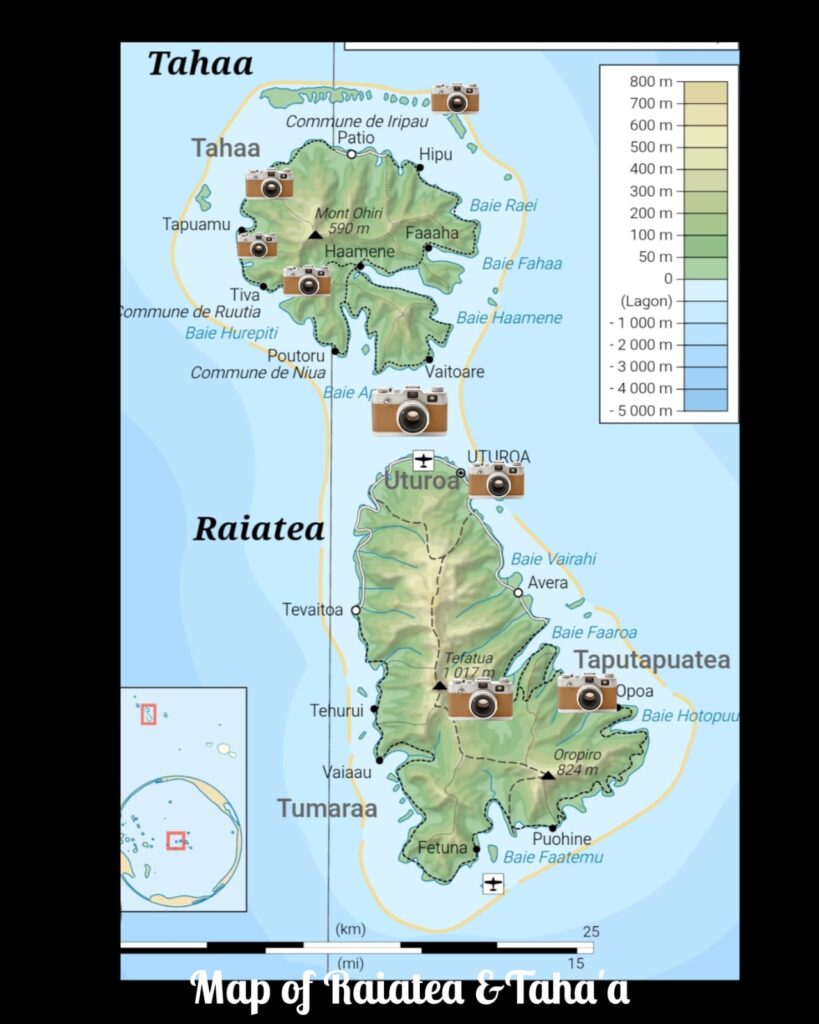
D 28-29 2 Days in Raiatea, Society Islands
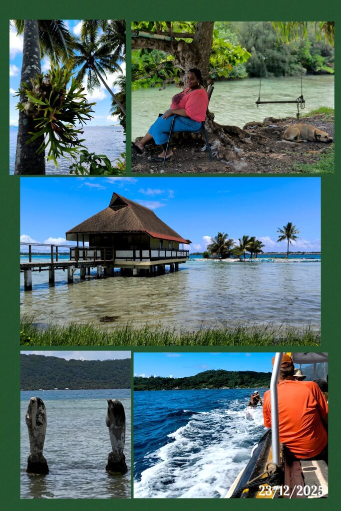
Raiatea is the second largest of the Society Islands after Tahiti with an area of 168 sq km. It is widely regarded as the “centre” of the eastern islands in ancient Polynesia. A traditional name of the island is Havai’i, homeland of the Maori people. It is likely that the organised migration to the Hawaiian Islands and other parts of East Polynesia, started at Raiatea. The historical Taputapuatea Marae established by 1000 CE as the political and religious center of eastern Polynesia for several centuries, has been inscribed as a UNESCO World Heritage Site since 2017. The island has a population of 12,000, and Uturoa is the main town on the island.
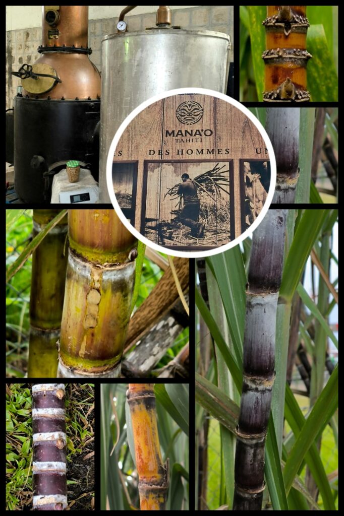
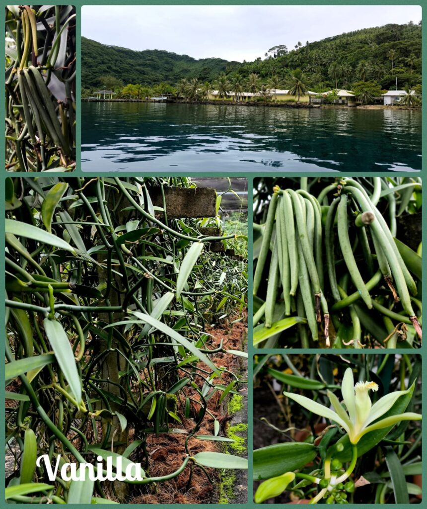
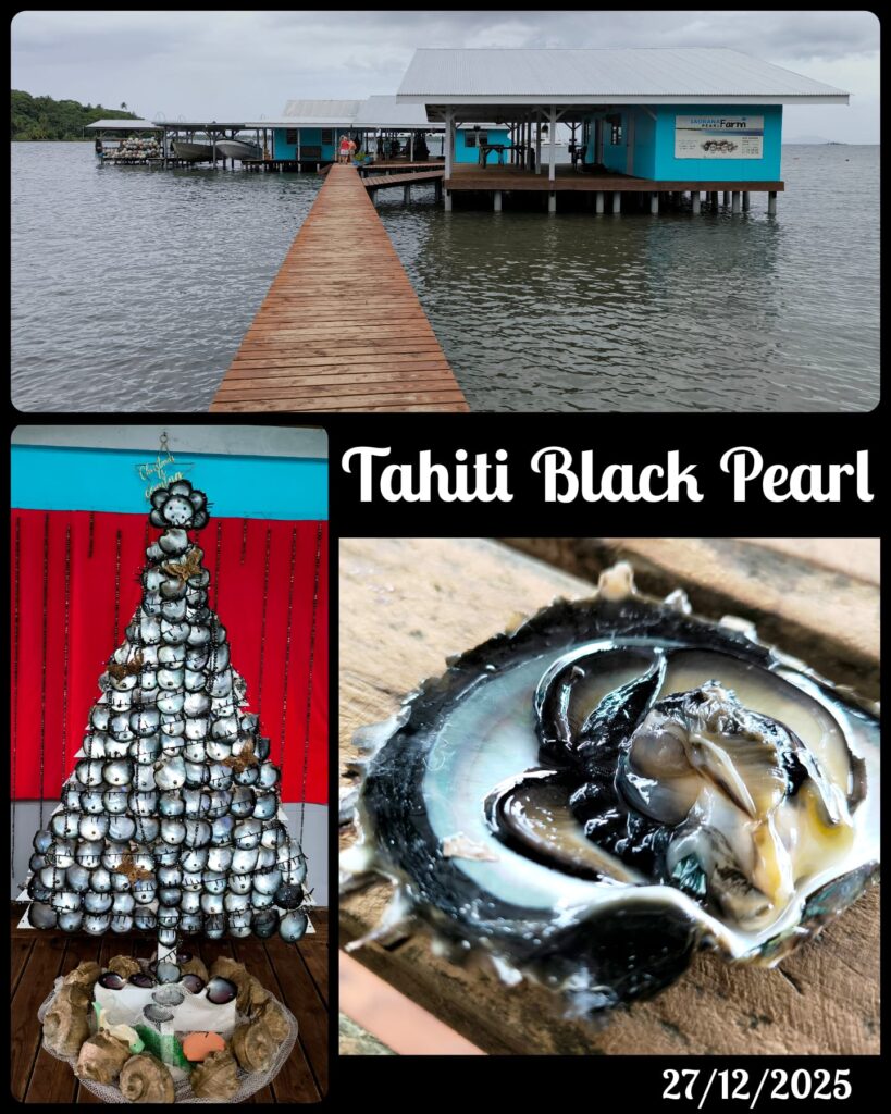
Dec 25 Merry Christmas. A Day Trip in Taha’a. The ship was docked beside a modern pier at Uturoa after 7am. After the clearance, we were able to step ashore before 8:15am. Nancy had organized a full-day trip for 14 persons (120 USD pp). We got on a comfortable boat next to the pier and sped towards Taha’a (with an area of 90 sq km and a population of about 5,000). The island which is known as the “Vanilla Island” is tranquil off the beaten track. We first visited a vanilla plantation with a talk on the plant and production of vanilla which is a labour of love and highly price produce worldwide. Then we stopped at a rum distillery. It was interesting to see different sugar cane plants – two are local species while several have been imported from other parts of the world. The canes look slender as compare with those I have seen in Asia or the Caribbean. It is a small production plant and we had a chance to taste several rum and gin. The last stop was at a pearl farm with demonstration on how the famous black pearl is cultured.
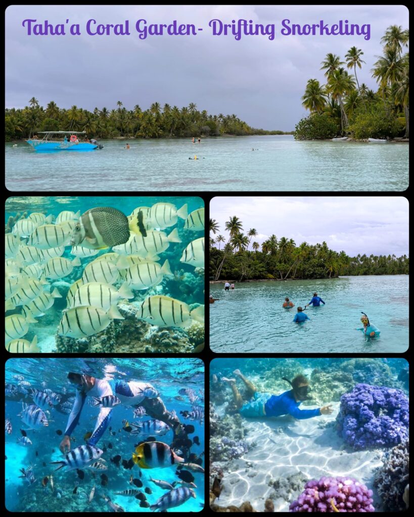
Then the boat took us to the Taha’a Coral Garden located between two islands not far from the edge of the lagoon. We first waded across a shallow lagoon to step on a small island where we followed a path to the end which is the beginning of drifting snorkel. This spot is close to the edge of the lagoon. As water is chanelled through two islands, it creates strong currents especially at the beginning. Our guide told us to float and let the currents carry us through the coral garden and back to our boat. As soon as I got myself afloat with a noodle below my chest, I was shooting off immediately. I hardly had time to gaze the coral formations and fish in the water. With a noodle, I found it difficult to flow naturally with the currents. I lost my control and balance a couple of times and brushed against coral which is close to the surface of the water. Luckily, I had long-sleeved top, long pants and shoes on. Hence, I was not hurt! I had done drift snorkelling in Indonesia. But this time the experience is totally different and a bit scary as my belly and legs were brushing against coral. I would have had a much better experience had I worn my own mask and snorkeled without a noodle.
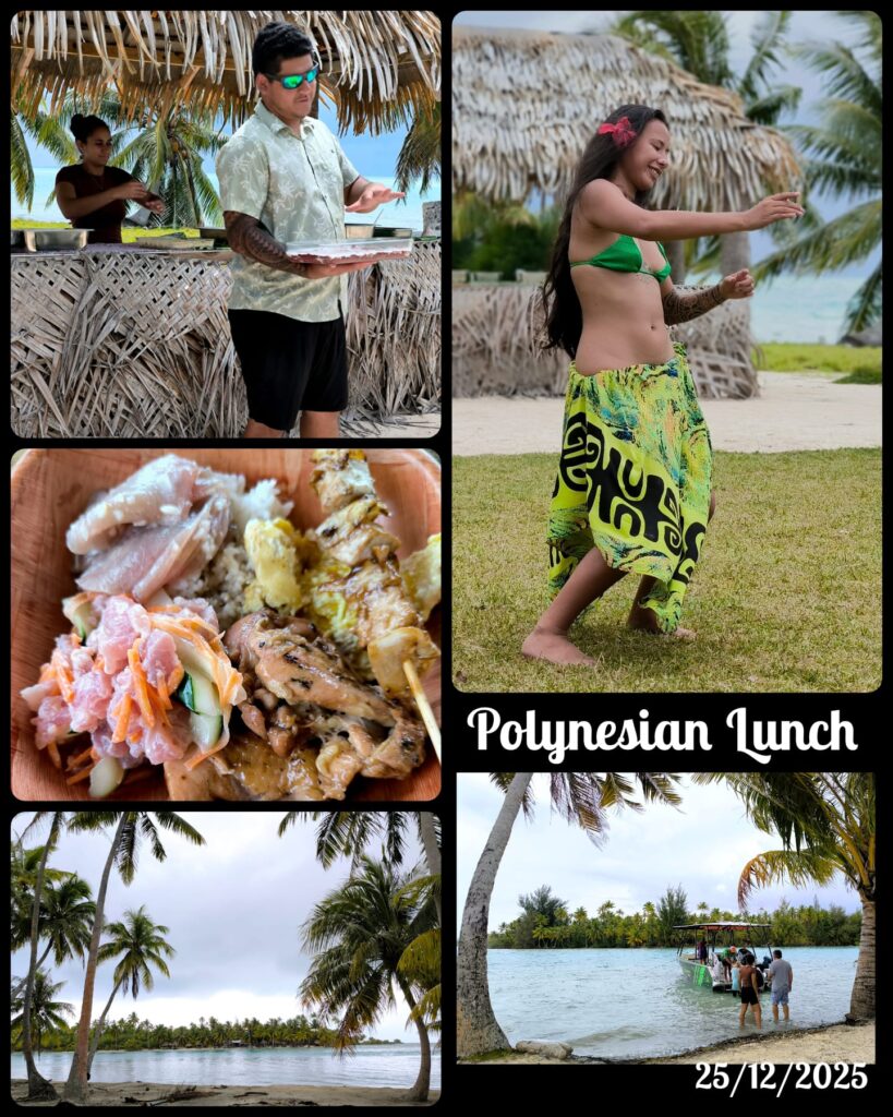
After an exciting snorkelling experience, we had lunch in a private island. It was a delicious meal with raw tuna, tuna skewer and BBQ chicken. During lunch, we had a lovely girl performing the traditional dance. On the way back to Uturoa, we watched a group of at least 30 reef sharks swimming around the boat for some 15 minutes.
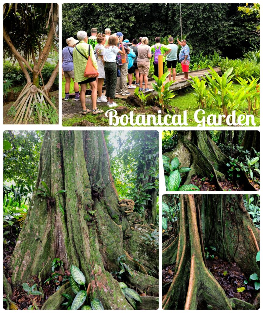
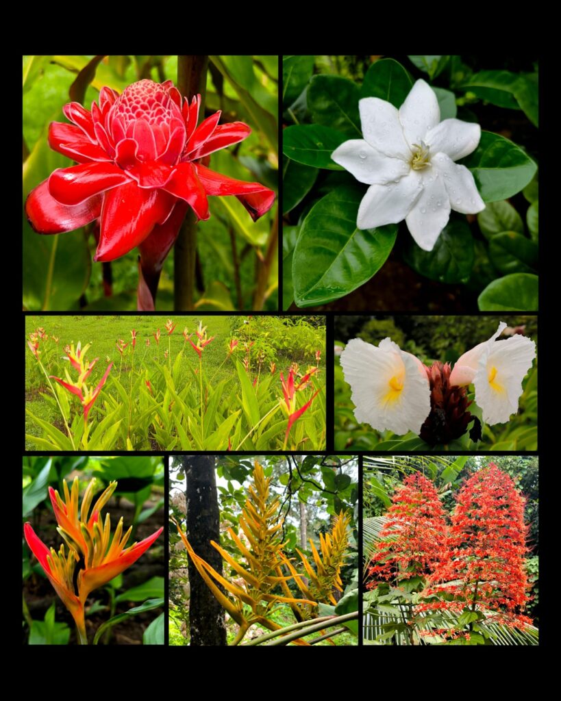
Dec 26 Today, I joined a half-day trip to visit the Botanical Garden, Taputapuatea Marae, and a pearl farm on Raiatea. The local guide was cheerful and informative. He and the driver sang cheerfully when he was not briefing us on the history, people, culture and places of interest. In the Raiatea Botanical Garden, we had a guided walk for over half an hour. The garden with an area of over 3 hectares is a tropical oasis with a diverse collection of over 300 plant species. We learned Tahitian Gardenia (known as tiare flower) is the national flower of French Polynesia and the Cook Islands.
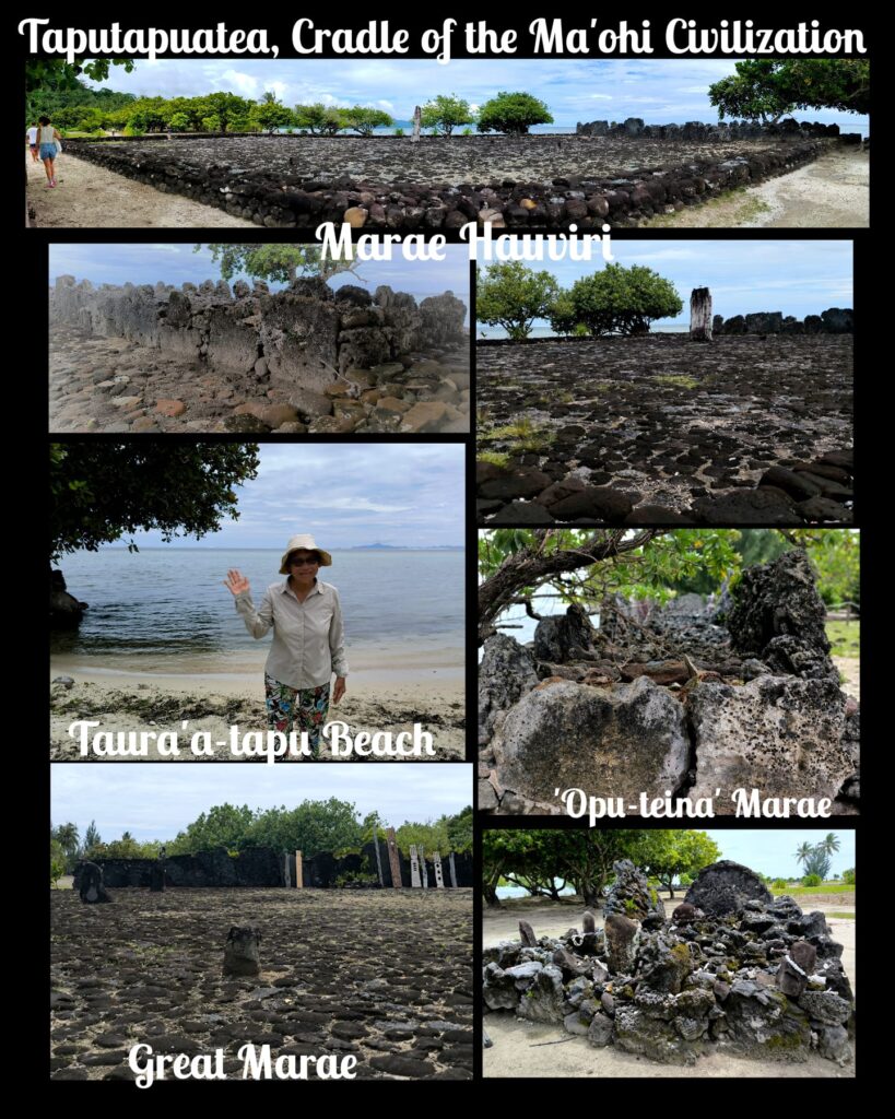
The next stop was the Taputapuatea Marae, a WHS. It is a sacred, ancient Polynesian ceremony site with stone platforms. The site stretches over nearly 6 hectares located between land and sea, on the tip of the Matahiraitera’i peninsula. The history of this high place begins with the cosmogonic myth and the creator god of the Ma’ohi universe, Ta’aroa-Nui, and ends at its last period with the god ‘Oro, whose cult was widely spread in Eastern Polynesia.
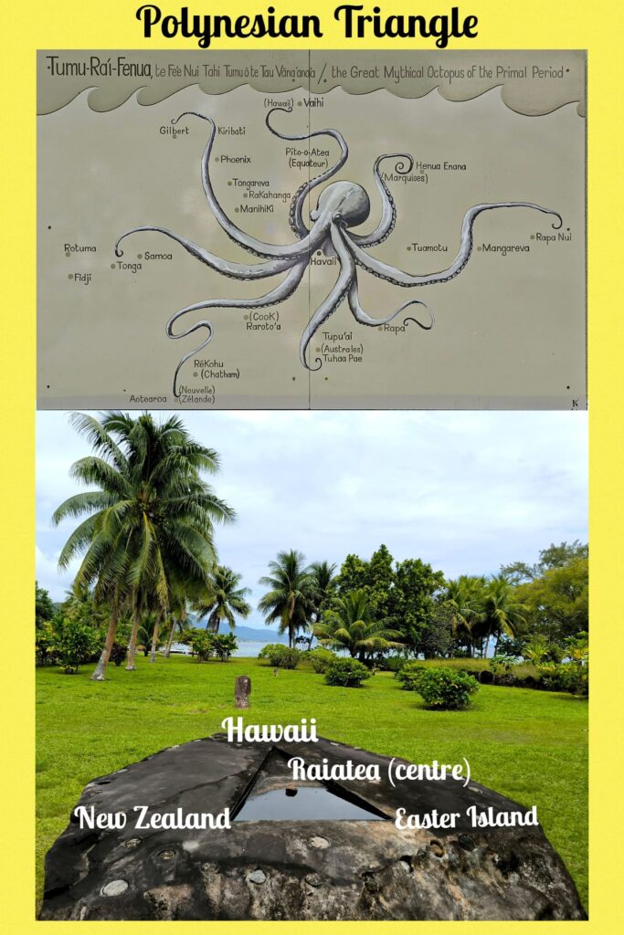
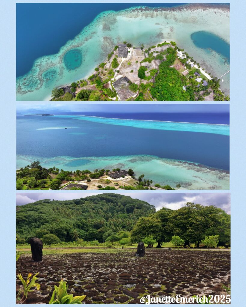
On arrival at the site, our guide asked us to take a drawing of an octopus depicting the various maritime routes originating from Raiatea. To fully understand the history and significance of the site, visitors can follow a path with ten stops with illustration. Our guide had time only to show us the three key sites. The old great Marae Taputapuatea is the most emblematic and most deified element of the WHS. The Marae Hauviri, the investiture temple of the paramount chiefs of the Tamatoas’ great lineage that ruled the Leeward Islands until Christianisation, is next by the Taura’a-tapu Beach the landing point for large canoes of the allied or younger chiefdoms invited to major inter-island gatherings or returning to their origins, besides their elders to renew alliances or share and acquire knowledge.
I stayed behind for a few minutes to look at the “Opu-teine’ marae next to the beach and noted it belonged to the younger lineages, who left the Great Ocean during the expansion period, following the great maritime routes plotted out by the mythical octopus Tumu-Ra’i-Fenua. I wished I had come here on my own so that I would be able to follow the path at my own pace and to soak in the ambience.
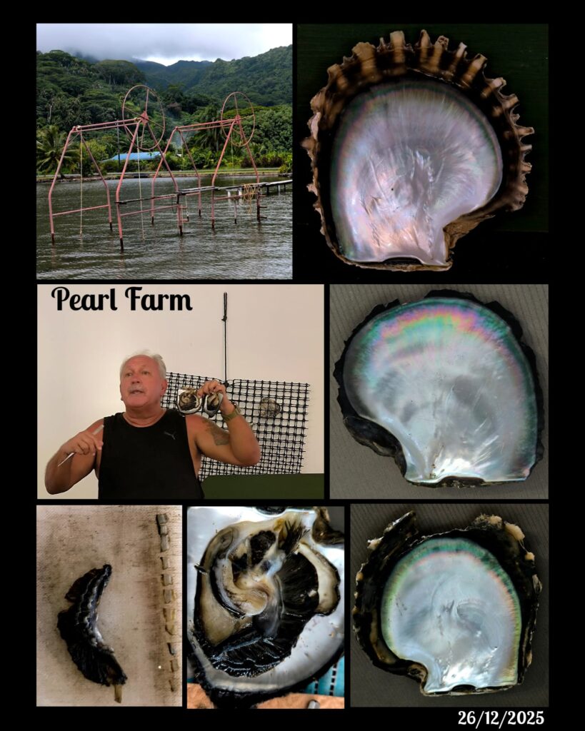
Our last stop was a pearl farm not far from the pier. This time, the operator/owner of the farm explained in details about the history, technique and production of black cultured pearl with demonstrations. We were back on the ship well before 1 pm. Unfortunately, I had problems and pains when walking the whole morning. So, after lunch, I rested in my cabin and massaged my legs, knees and the back. The massage and rest seemed to work: I was able to walk in the evening. The ship set sail for Moorea as scheduled at 6pm.