
D10 Tashkurgan – Kashi (300km)
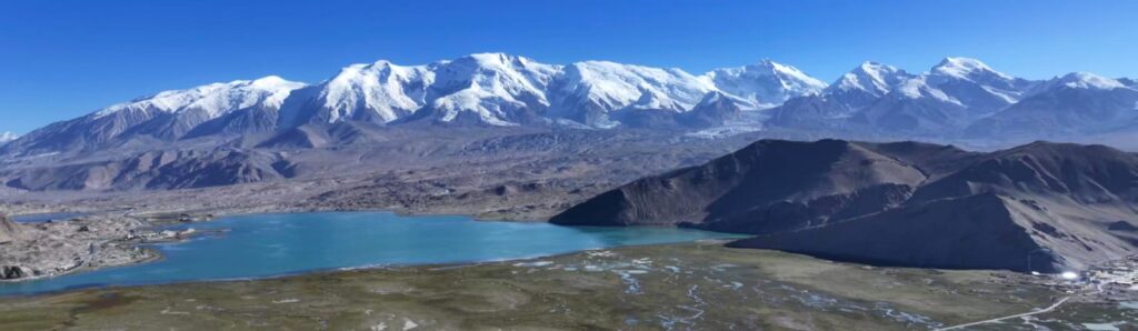
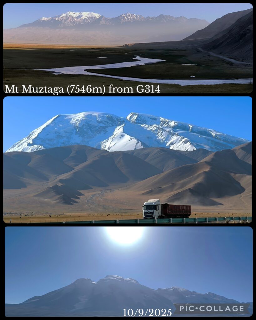
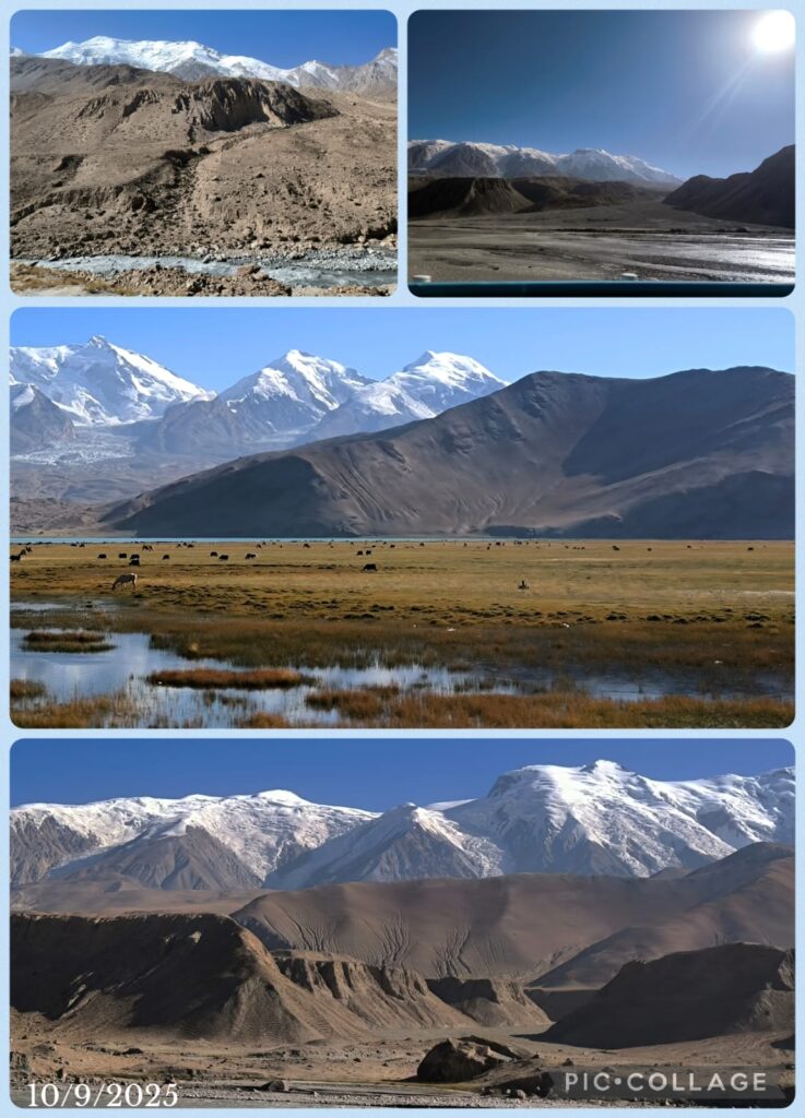
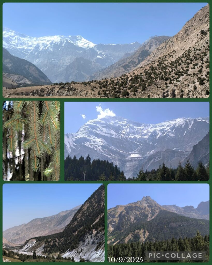
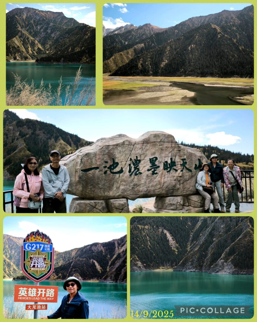
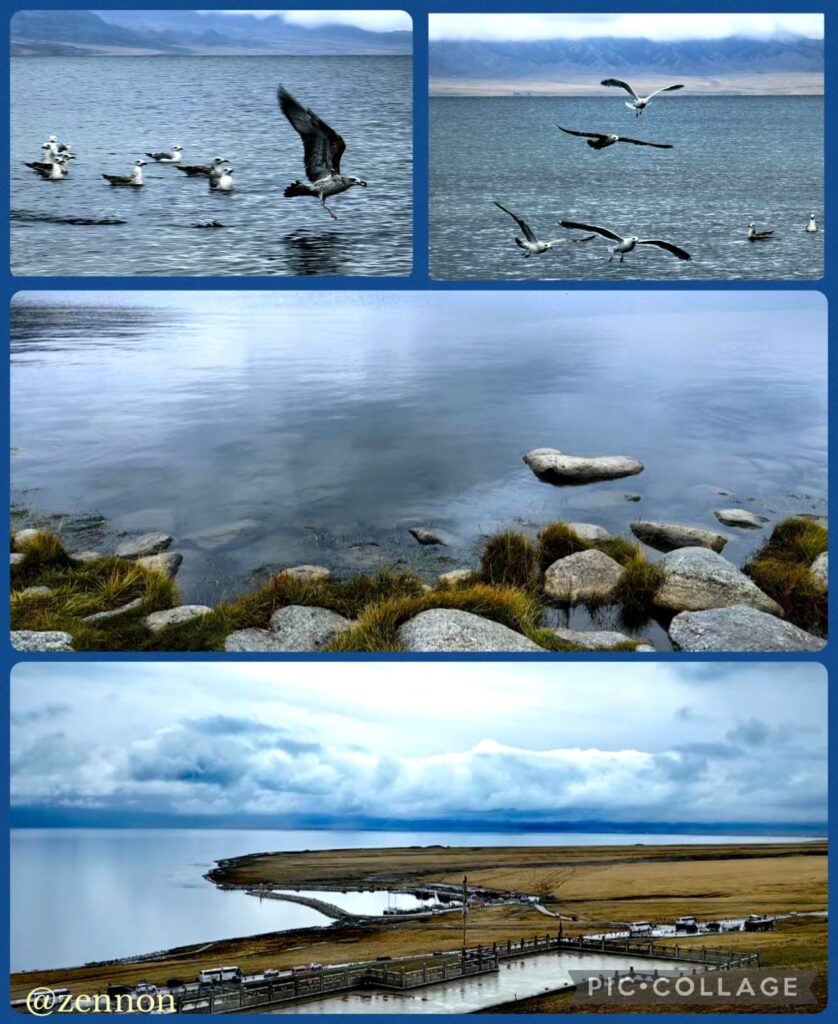
We set off at 9am and had two nice photo stops to take photos of Mt Muztaga and the grassland. The panorama photo of the snow-capped mountains and the lake was taken with drone by our driver Wang.
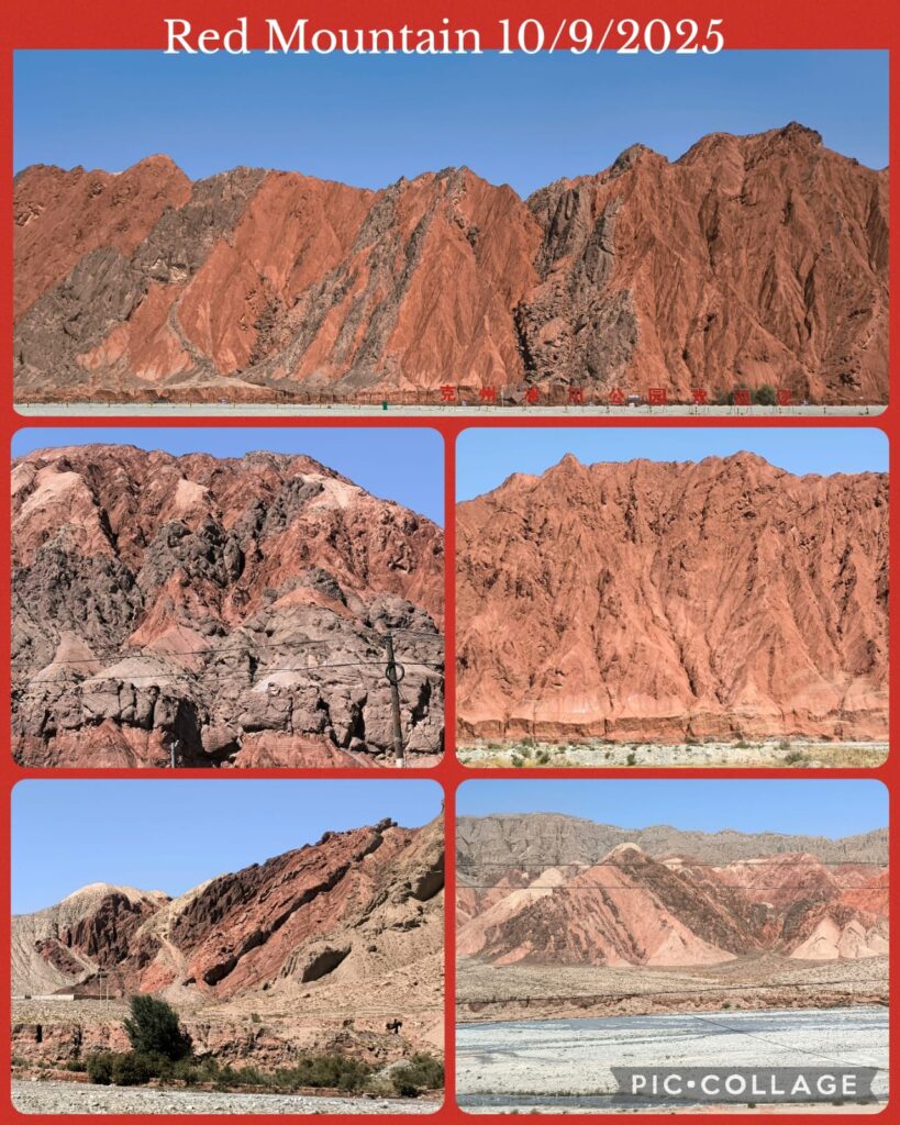
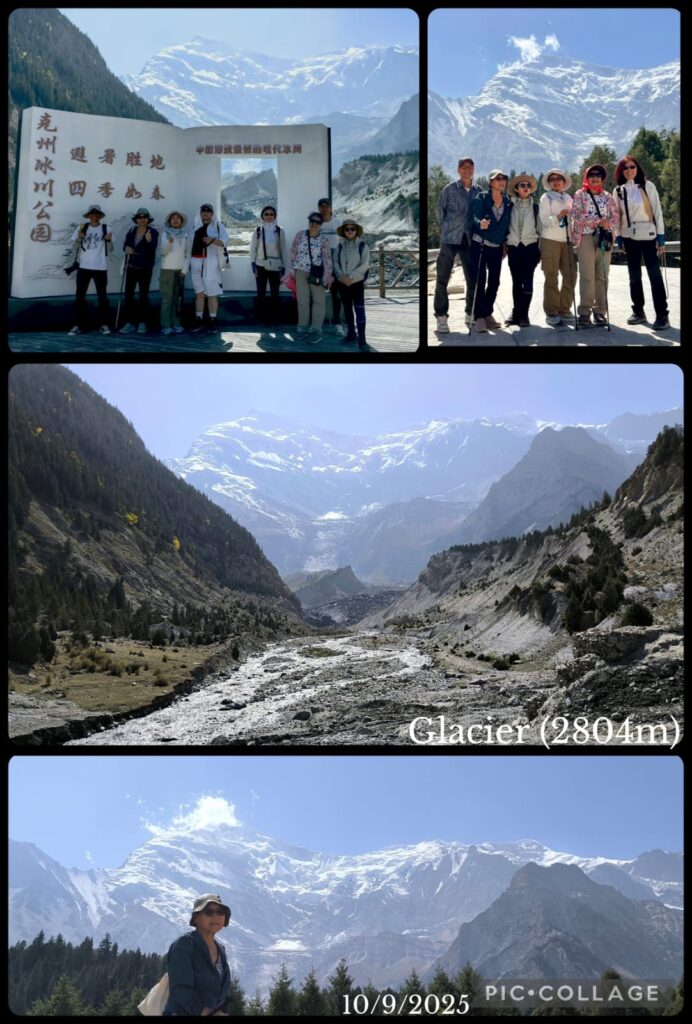
On our way back to Kashi, we would visit the Oytak Glacier Park 奥依塔克冰川公园 after lunch. We turned off G314 driving 30 km to reach the glacier park through an amazing area with deep red mountains and cliffs.
At the visitor centre, we had to take a short ride on another bus and walked 1.5 km uphill to reach a viewing platform. Unfortunately owing to a landslide, the platform was closed. We could not get a closer look of this glacier. We were back in Kashi after 6 pm.
D11 Kashi
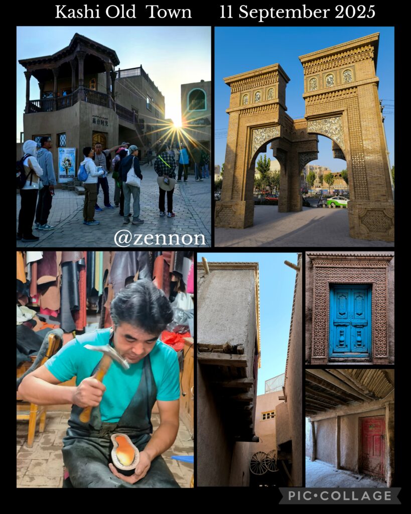
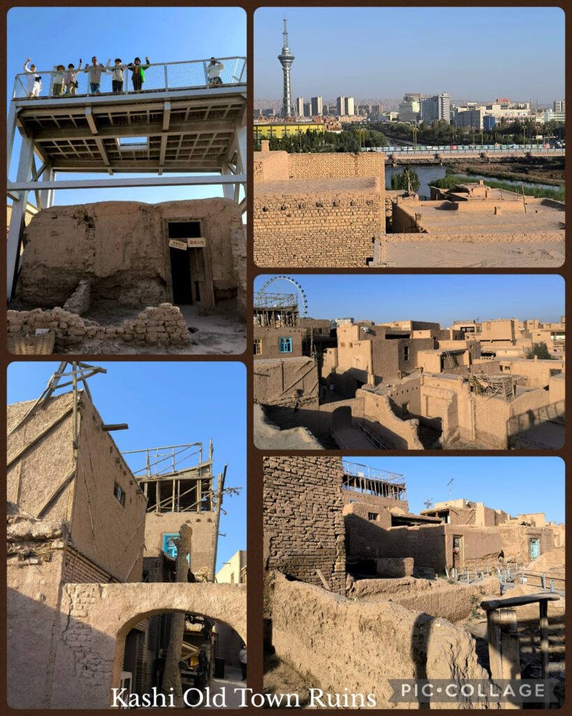
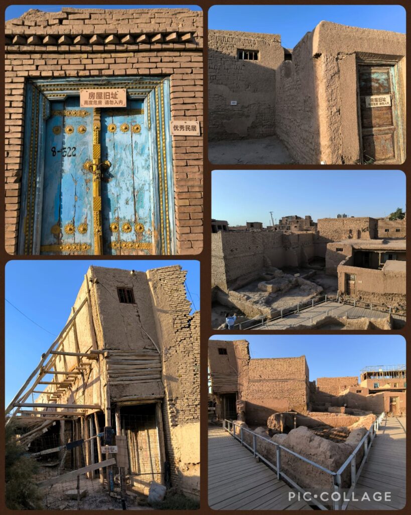
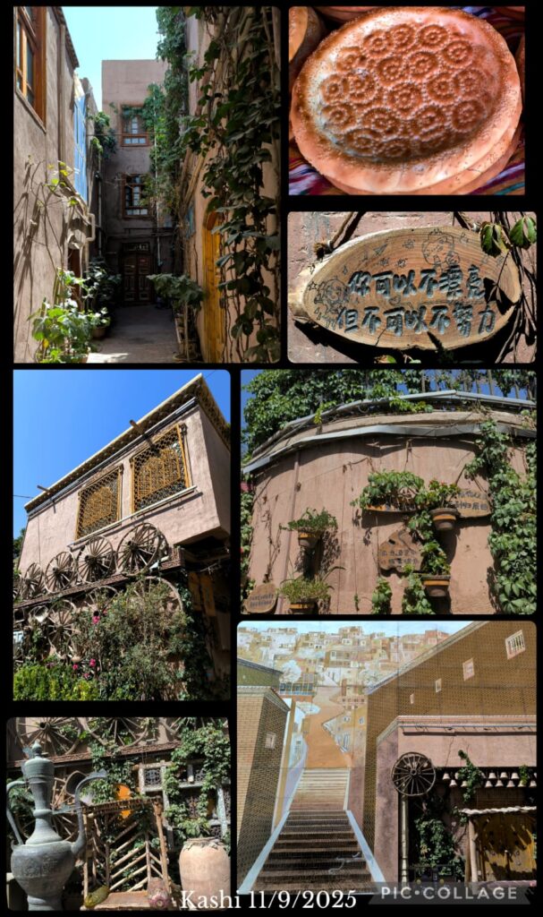
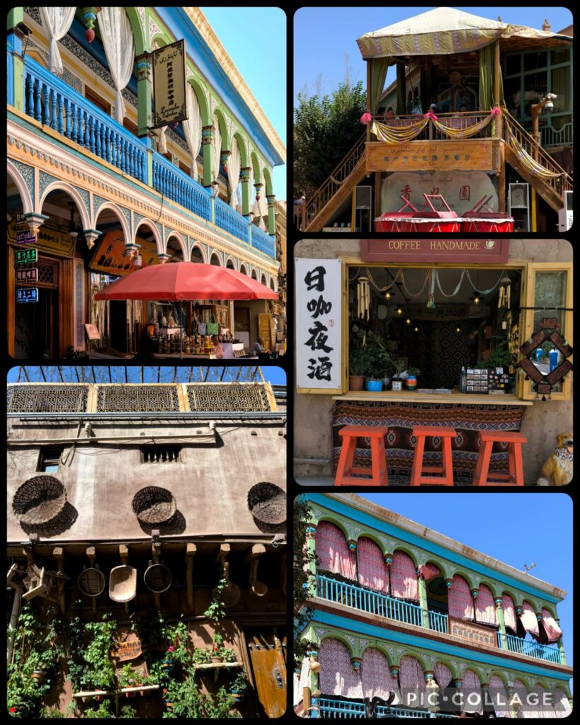
We had another leisure day in Kashi. We first visited the Kashi Old Town喀什老城 which is an ancient city with over 2,000 years of history. It is the historical centre of Uyghur culture, trade, religion and art. I enjoyed looking at the ruins in this old town.
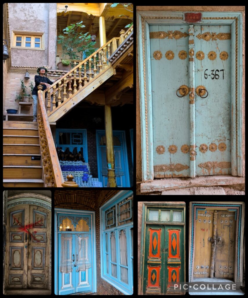
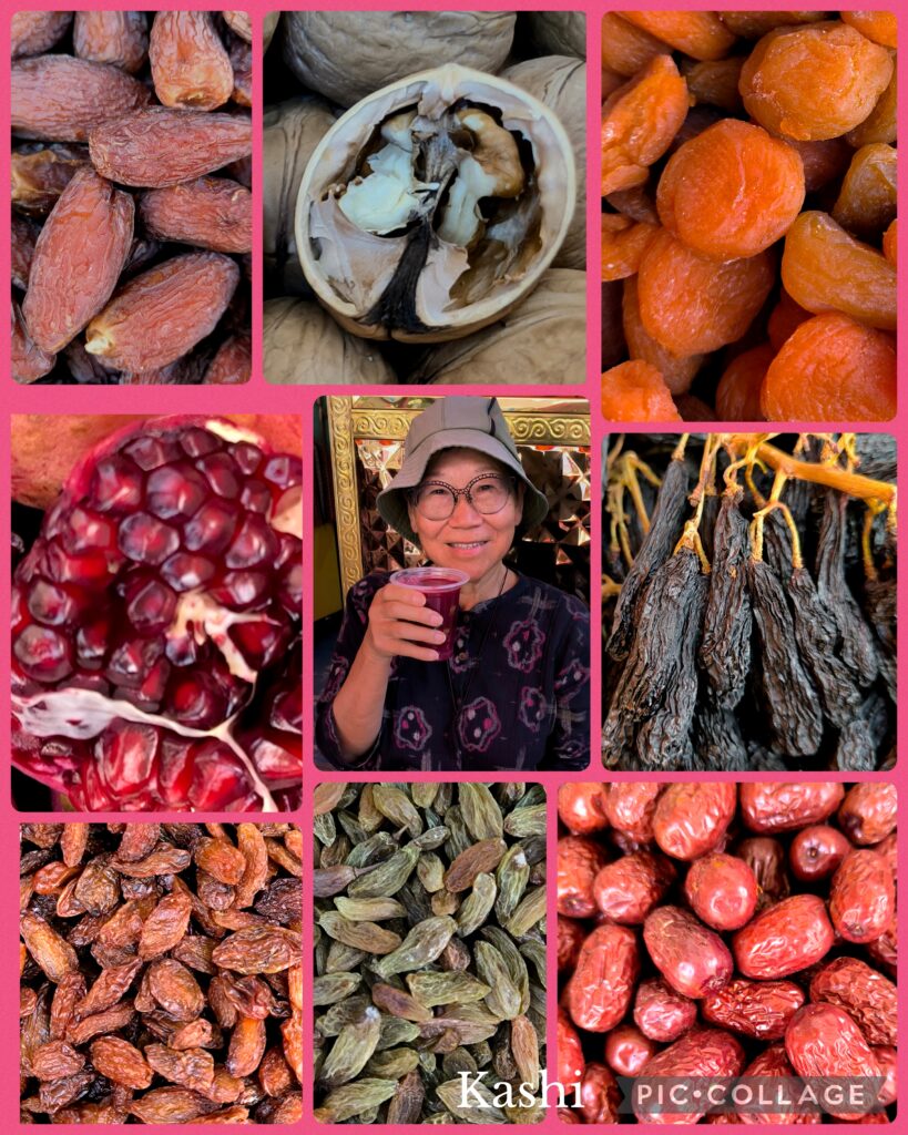
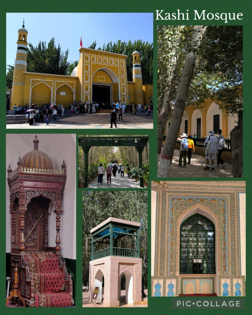
Then we walked across the road to the Kashi old town scenic area 喀什古城景区modeled on the old town. It is all about shopping! After lunch, we walked across the road to reach the mosque 艾提尕尔清真寺and explore the area around it. I walked slowly on my own and had a most refreshing pomegranate juice (15 RMB). I reached the Rainbow Alley彩虹巷 before walking back to the mosque to meet up with the group at 4 pm. We had a quick tour of the mosque which is smaller than I have thought. I wonder whether it is still in use: it looks more like a museum!
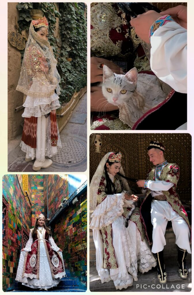
Bing, Ellen, Cynthia, Sam, Roger, Masy and I returned to a popular local restaurant for dinner. We ended up having a feast with roast pigeon, grilled fish, mutton, and red wine. There was a wedding banquet and we were delighted to see the beautiful bride and her family.
D12 Kashi – Aksu City 阿克蘇市 (450km)
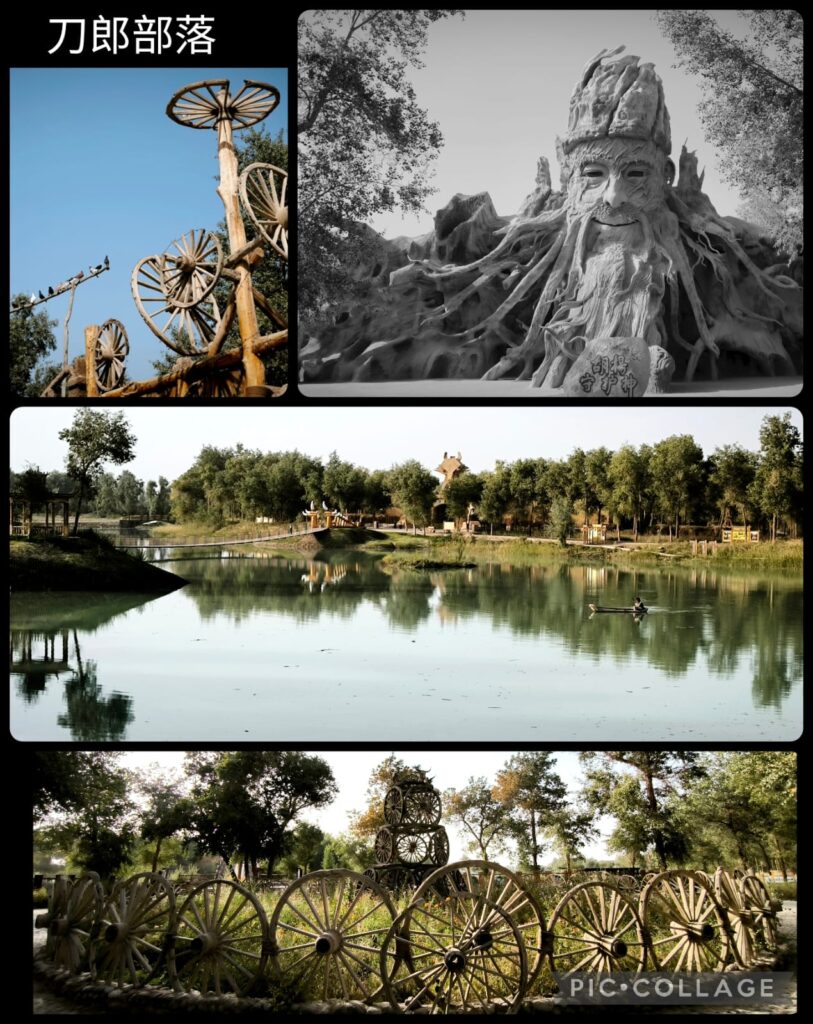
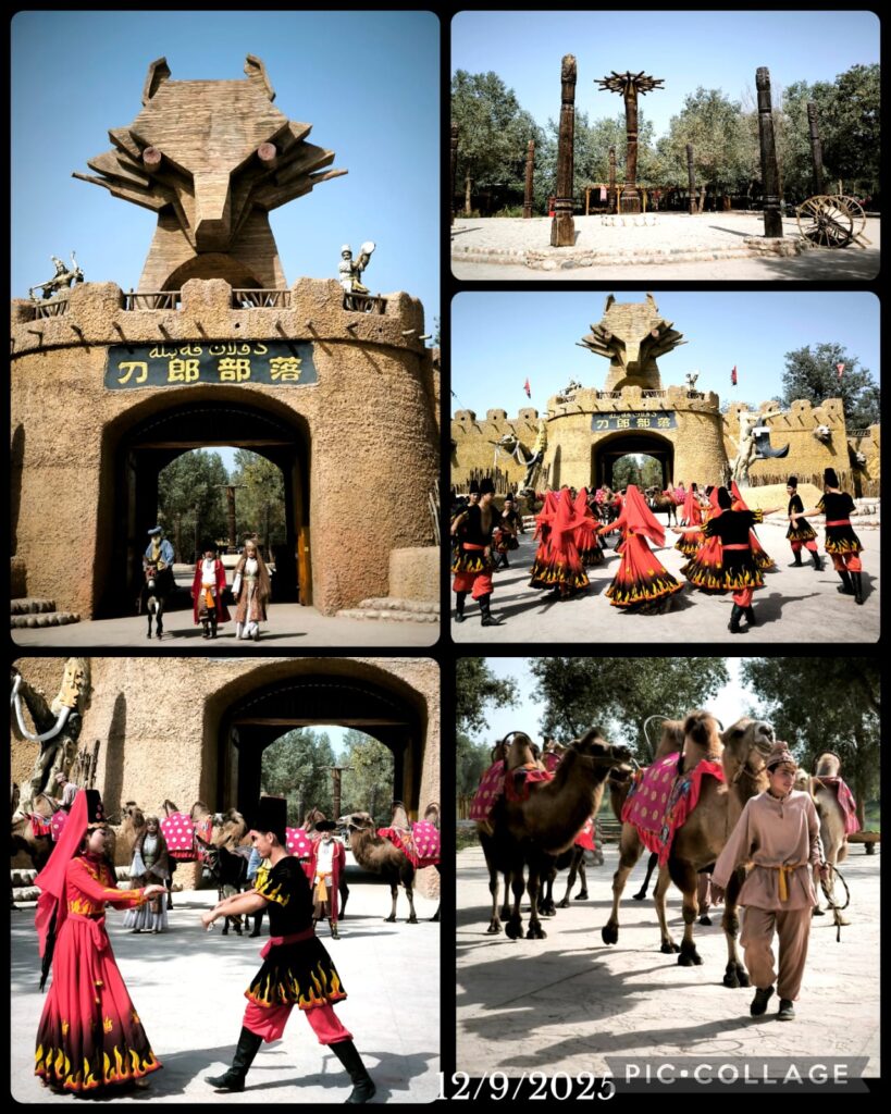
We had a long drive today with a stop at Dao Lang 刀郎. We arrived before 4 pm just in time to watch a city-gate opening ceremony with dance and music performance. Dolan culture refers to the dance, music and culture of a tribe of the Uyghurs. We entered the gate and stopped at various places that showcase their life style including iron-making, their house etc. Then we had a guided tour to several museums with exhibitions on populus euphratica and sculpture, culture life style and musical instruments, and stones from the region. The area is expansive eco-park with plenty of plants, hundreds of populus euphratica, a lake, an aviary in addition to the museums. I enjoyed the visit and we left about 7 pm. We stayed in Vienna Hotel which is nice and comfortable.
D13 Aksu City – Kucha 庫車市 (400Km)
We set off at 9 am and had two attractions to visit namely Tianshan Tomur Canyon and Kizil Caves, both World Heritage Properties.
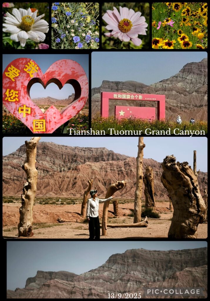
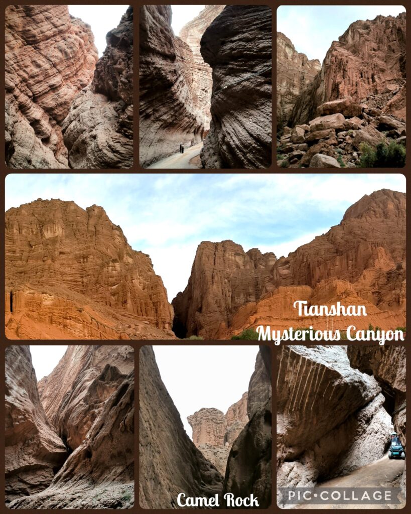
Tianshan World Heritage Site comprises four components – Tomur, Kalajun-Kuerdening, Bayinbukuke and Bogda, with a total area of 606,833 hectares. The Tianshan Tomur Scenic Area 托木尔峰大峡谷include the grand canyon, Tagelake Village and Bozidun. This region is described as a “living museum of geological evolution” that displays ancient rock formations and impressive canyons. The Danxia and Yadan landforms feature dramatic red sandstone canyons (Danxia) and unique Yadan geological wonders. It also has rock salt karst landform with salt rivers and 36 giant salt mountains.
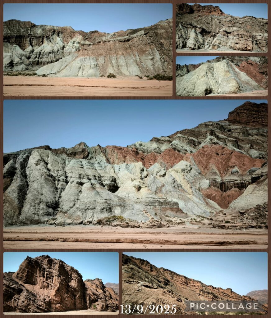

The grand canyon is a typical fissure gorge stretching 20km in length and approximately 25 in width. It is composed of three main valleys and 12 tributary valleys. The scenic area visitor centre provides visitors with transportation to visit the canyon. We only had time to visit two valleys. First we went to No 4 Valley (Source of Life) where we stayed for an hour. There are six viewing platforms. I managed to climb up and down some 400 steps to reach three platforms which afford wonderful views of the majestic landscape. Then we took a ride to No. 3 Valley and walked along the wide valley floor with close up views of the canyon. Different perspectives!
We had a wholesome lunch after the visit before driving to the Kizil Caves. The caves have an important role in Central Asia art and in the Silk Road transmission of Buddhism. They are said to be the earliest major Buddhist cave complex in China with development occurring between the 3rd and 8th centuries CE. This complex is associated with the ancient kingdom of Kucha. When the caves were first created, the area of Kucha was following the orthodox Sarvastivadin school of early Buddhism. Other famous sites nearby include the Kizilgaha caves, the Kumtura Caves, Subashi Temple and the Simsim caves.
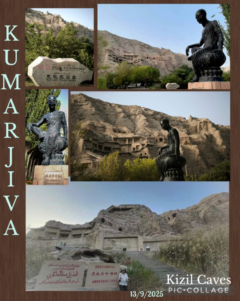
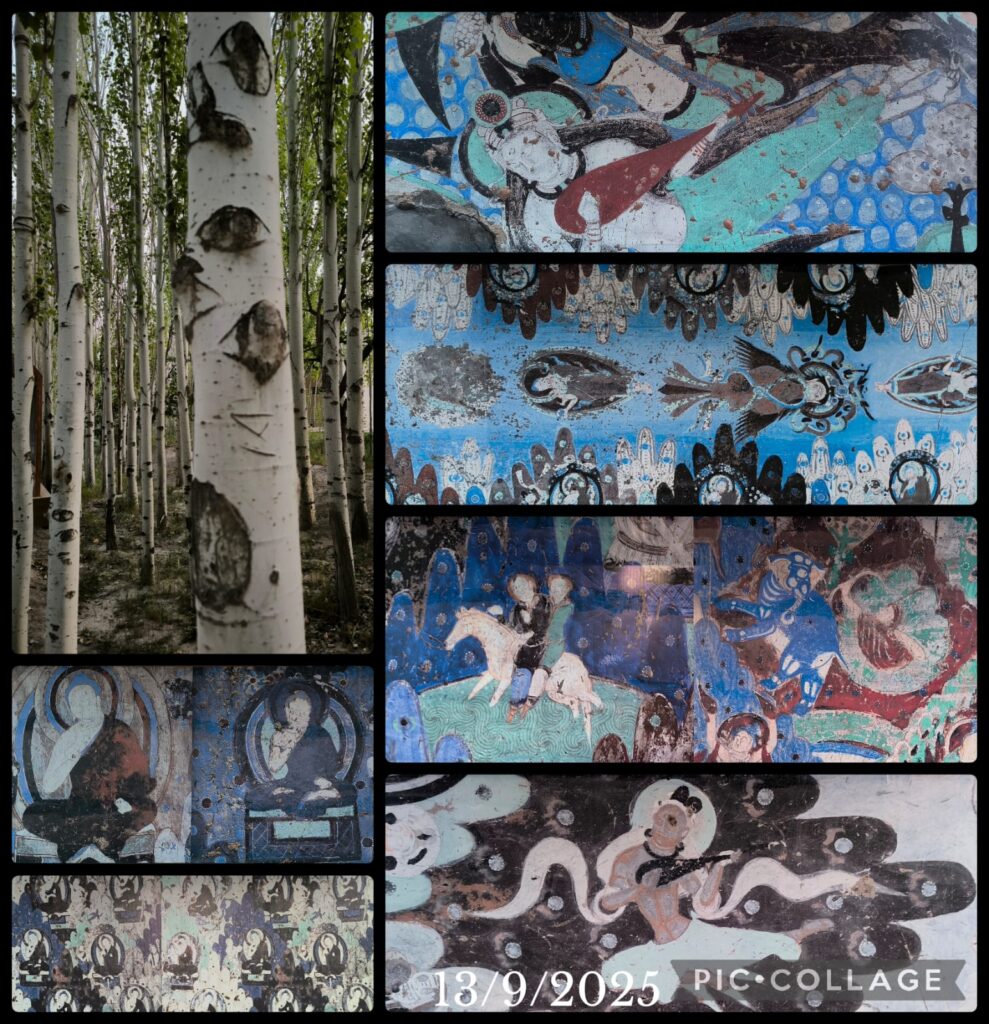
There are 236 cave temples in the Kizil Cave complex. Caves were carved into the cliff stretching from east to west for about 2km. It is said that 135 caves are still relatively intact. Many of the caves have a central pillar design, whereby pilgrims may cir-cum-ambulate around a central column that often have a niche for a statue of the Buddha. Three other types of caves are also present: square caves, caves “with a colossal image”, and monastic cells. A notable feature of the murals in Kizil is the extensive use of blue pigments. In terms of styles of painting, they are mainly grouped under “Indo-Iranian style I” (delicate tone-on-tone paintings using browns, greens and oranges) and Indo-Iranian Style II”s (strongly contrasted colours and strong line strokes with the use of a vivid lapis-lazuli blue). The art of Kizil Caves is thought to have influenced cave art in Mongao Caves in Dunhuang.
We arrived after 6 pm and had to walk some 700 m to reach the bottom of the cliff. We visited six caves (No. 8, 10, 27, 32, 34 and 38). It is sad to see only fragments of mural paintings remaining in these caves which do not seem to be well preserved. I think the caves in Dunhuang are better preserved. It was a long drive to Kucha and we did not arrive at the hotel till 10 pm.
D14 Kucha – Bayinbukuke 巴音布魯克 (220km)
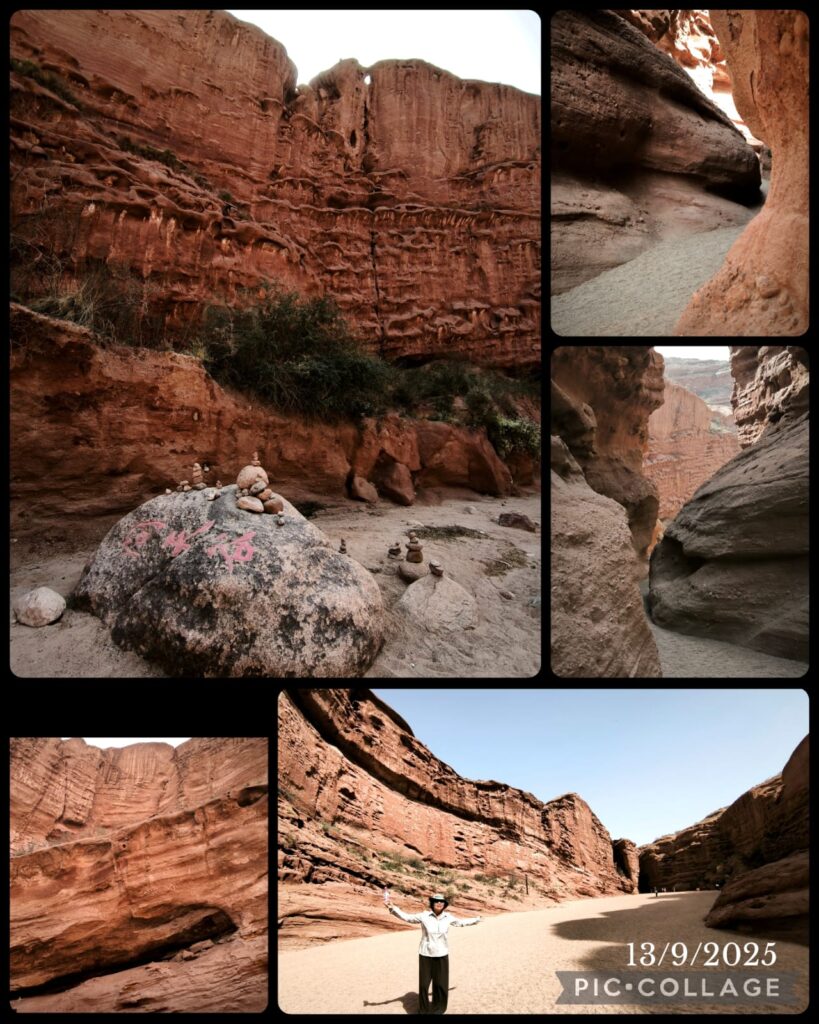
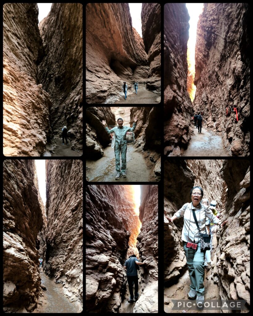
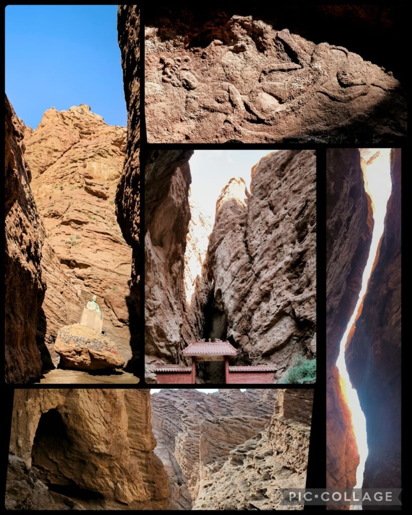
We departed at 9 pm. After a relative short drive, we arrived at the Mysterious Tianshan Grand Canyon (or Keziliya Grand Canyon) which is spectacular with reddish-brown cliffs formed by millions of years of natural erosion, featuring oddly-shaped rocks, craggy pinnacles, and deep ravines. It contains an ancient A-ai Grottoes (or Kizil Thousand-Buddha Grottoes) of historical significance which is closed. We had two hours and I walked slowly on my own soaking in the atmosphere.The natural wonders are awesome and the narrowest section is only 0.4 metre wide. After exploring all possible sites en route (less than 2 km I guess), I took a ride back (20 RMB)
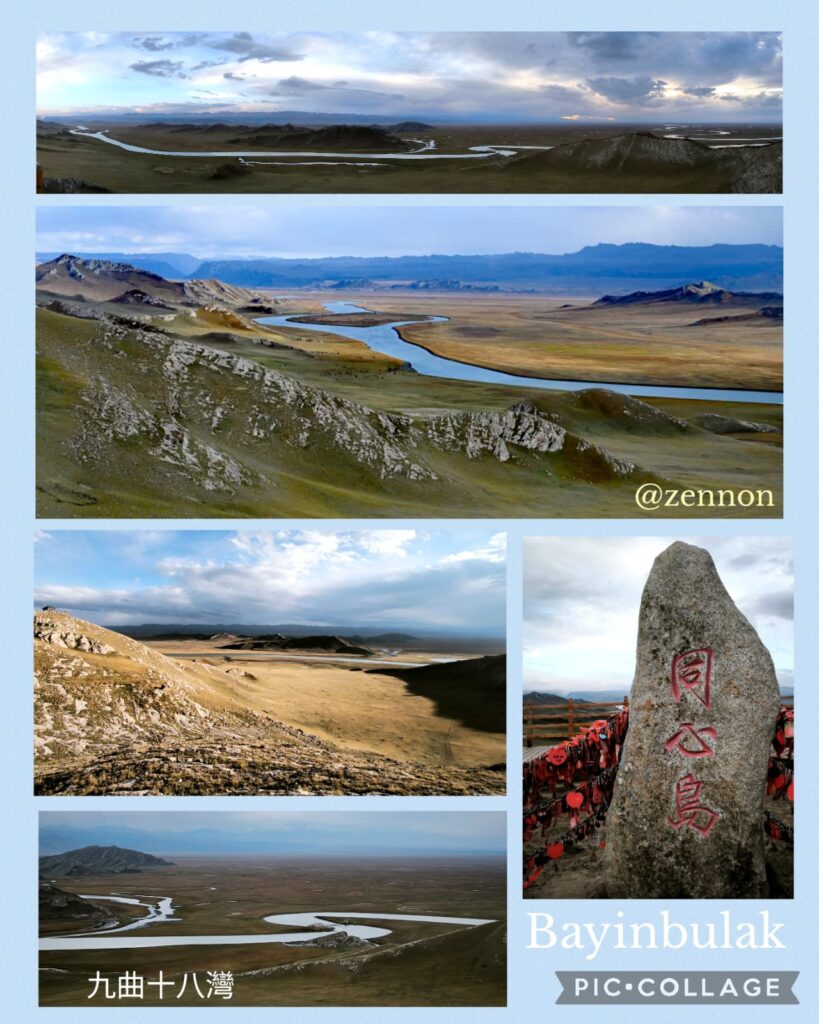
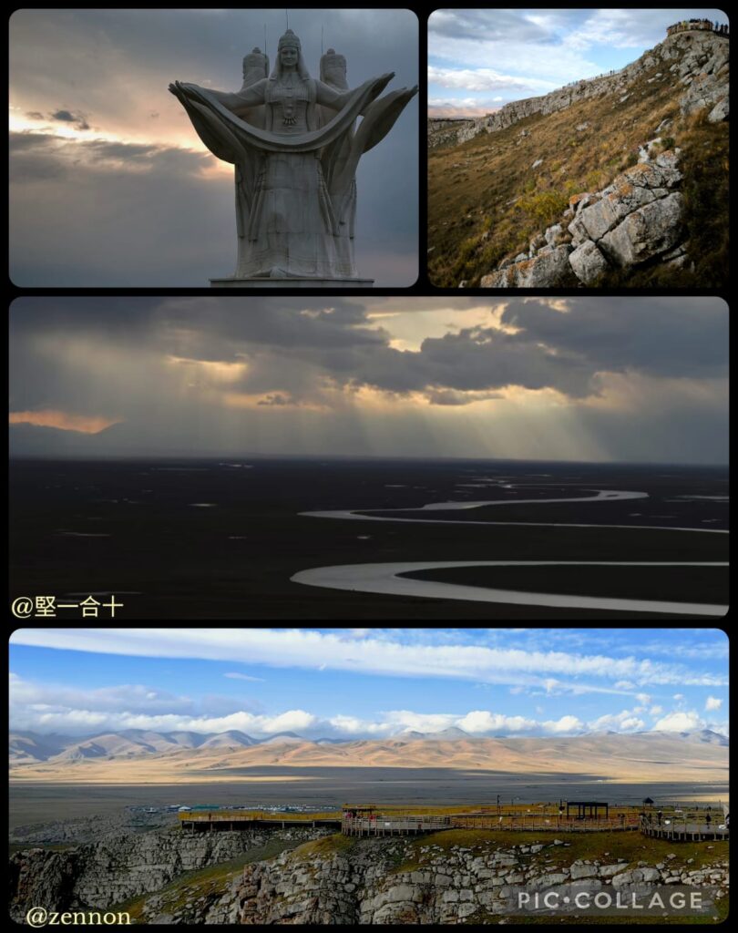
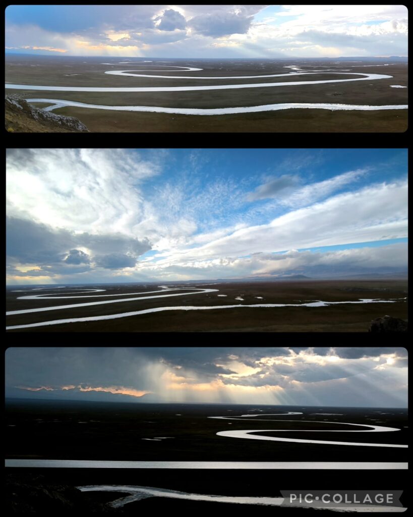
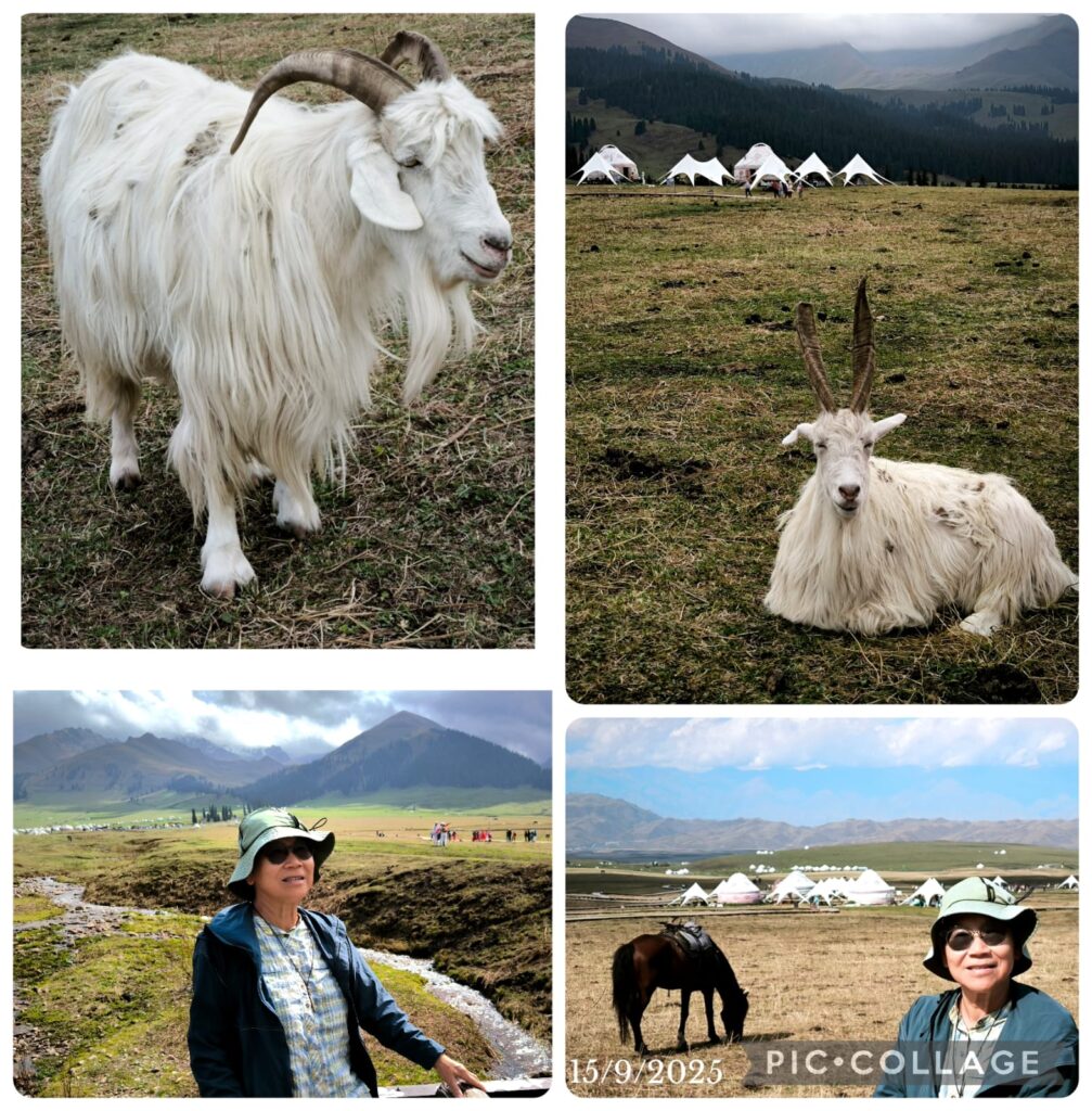
We set off after lunch around 3:30pm for Bayinbukuke (the grassland), a vast scenic area with three main spots: swan homeland, a Tibetan monastery and the famous “nine turns and eighteen bends”. On the way, we had a photo stop at a small beautiful alpine lake.
As we did not have much time, the group decided to go straight to the “nine turns and eighteen bends” where one with good luck, can watch nine suns at sunset. It was cold and windy. When we reached there, things looked promising. Unfortunately it became cloudy and by 8 pm, it was clear there was no chance to watch sunset. We made our own way back to the visitor centre which took one hour on the bus. I was back in the centre after 9:20pm. As a result, we had a late dinner after a long and tiring day.
D15 Bayinbukuke -Nalati (200Km)
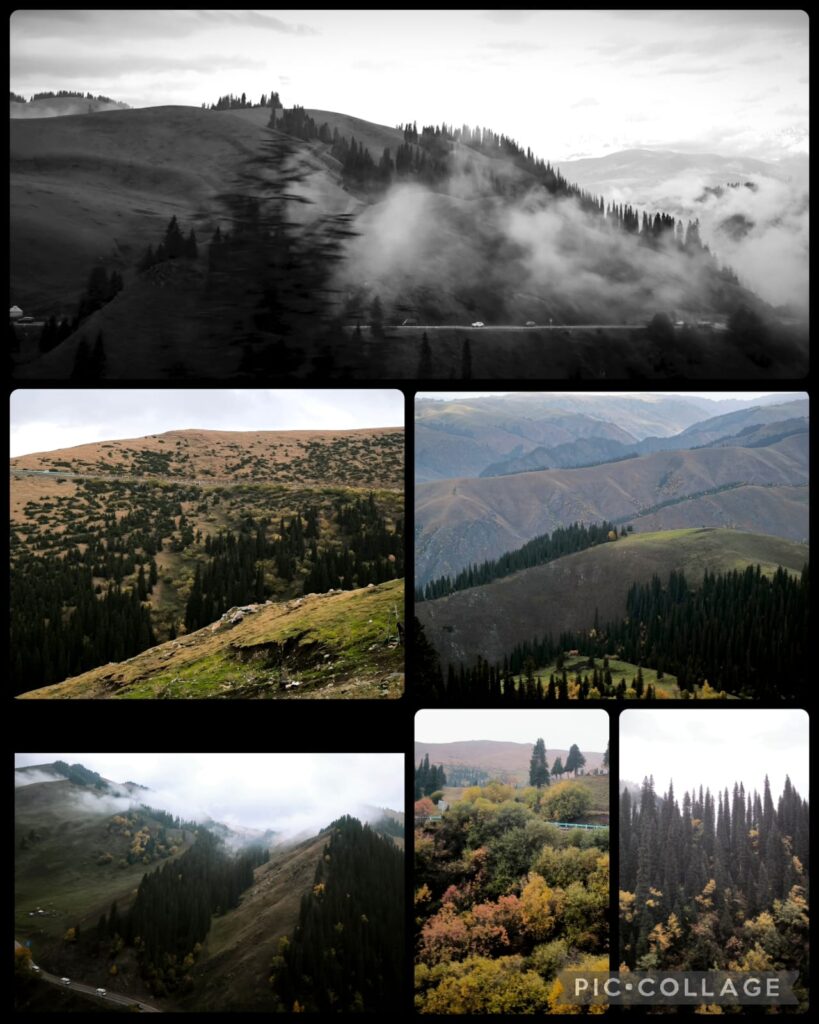
We set off leisurely at 10 am and had a scenic drive with a stop at an alpine lake. After lunch, we set off for Nalati Grassland. We had two stops – half an hour at a viewing platform and a hour and a half in the grassland. I confess I do not find anything special about Nalati which has been spoilt by over-tourism.
D16 Nalati – Zhaosu 昭蘇 (400km)
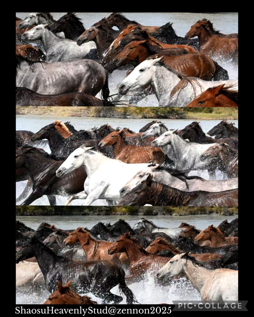
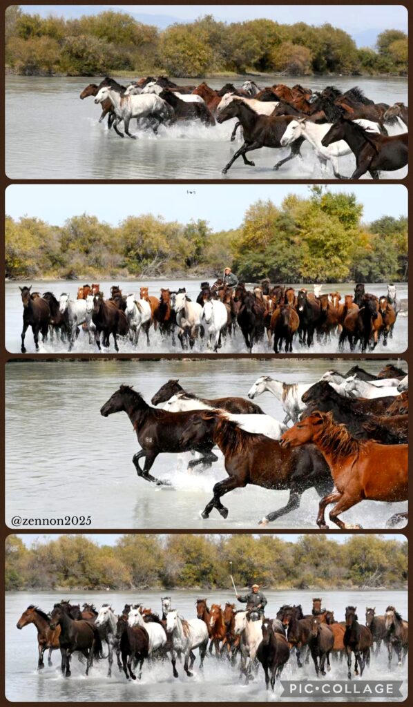
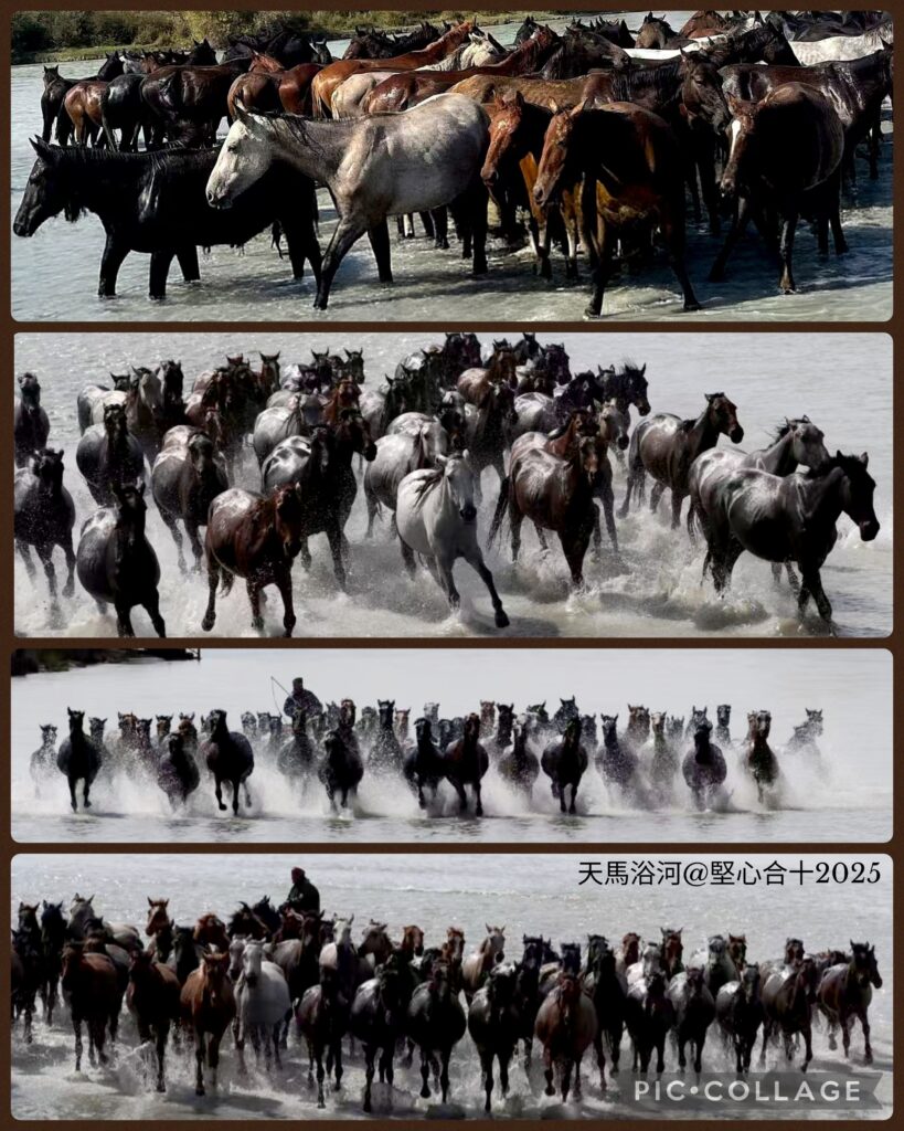
We set off at 8:30 am for the Zhaosu county, which is under the administration of Ili Kazakh Autonomous Prefecture and shares a border with Kazakhstan. Zhaosu region is the home of the famous Heavenly Horse 天馬 that Zhang Qian brought back to Emperor Wu after his mission to Xiyu. I love watching the landscape and topography along the highway. Today, I could see golden wheat along the road side ready for harvest. After lunch, we drove on and arrived at the wetland scenic area around 3pm. There were few birds in the wetland. The show began at 4pm. I took a vantage point watching some 50 majestic Heavenly Horses gathering at the starting point and running in the river. Beautiful animals!
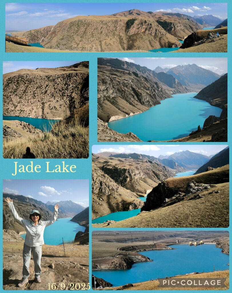
After the show, we drove another half an hour to the Jade Lake, another small alpine lake formed when a dam for a reservoir was built. The lake with an exquisite blue colour, though smaller than Tianchi, is more pleasant with few tourists. We returned to Zhaosu at 6pm. It was a pleasant day without excessively long drive!
D17 Zhaosu – Yining 伊寧市 (110km)
We had a late start at 10am. As it was raining, we could not take the scenic mountain route to Yining. Instead,we had to return via highway which took about two hours to reach Yining. We had a nice lunch in a local restaurant serving delicious baked bun with beef. We also ordered two legs of lamb which was tender and delicious!
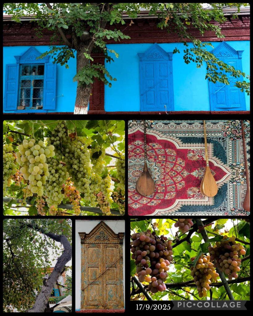
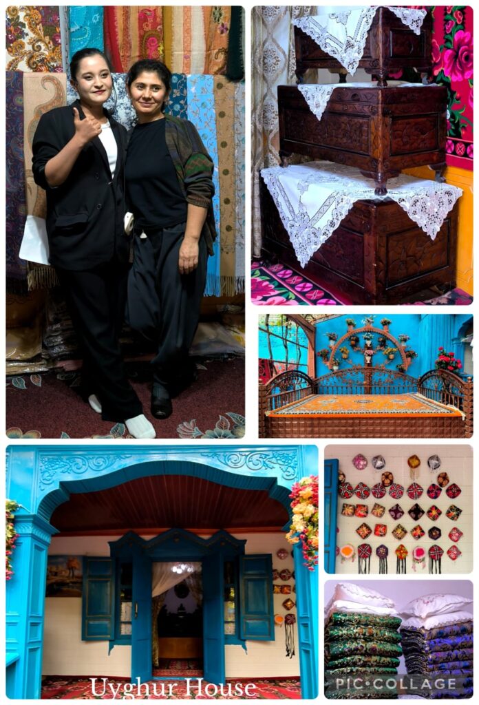
After lunch, we visited old Yining with a guide. We went into two traditional Uyghur houses, strolled along a residential area and had a homemade ice-cream. After a guided tour for an hour, we watched a cultural performance in a big house that used to serve as a caravan. We looked at the elegant and well-preserved house of this rich man.
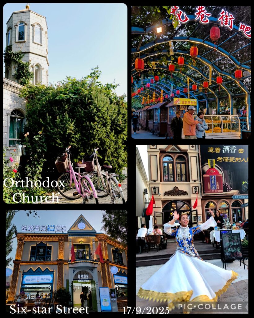

In the evening, we went to a very famous and popular Xinjiang restaurant in the Six Star Street for dinner. The area with Russian and Central Asia atmosphere is lively and full of eateries. We had Russian beer, a roast leg of lamb, ribs of lamb and other special Xinjiang dishes for 480 RMB for six people! It was indeed the best Xinjiang dinner I have had.
D18 Yining – Sayram Lake 賽裡木湖 (150km)
We set off at 10 am and drove along G30 for about two hours. The weather was poor and rained intermittently. We drove on a newly completed and spectacular highway that had taken six years to complete. We had lunch at a fancy modern Xinjiang restaurant with interesting menu and nice presentation. It was wet and cold. Luckily, we were able to have early check in so that we could put on layers of warm clothes.
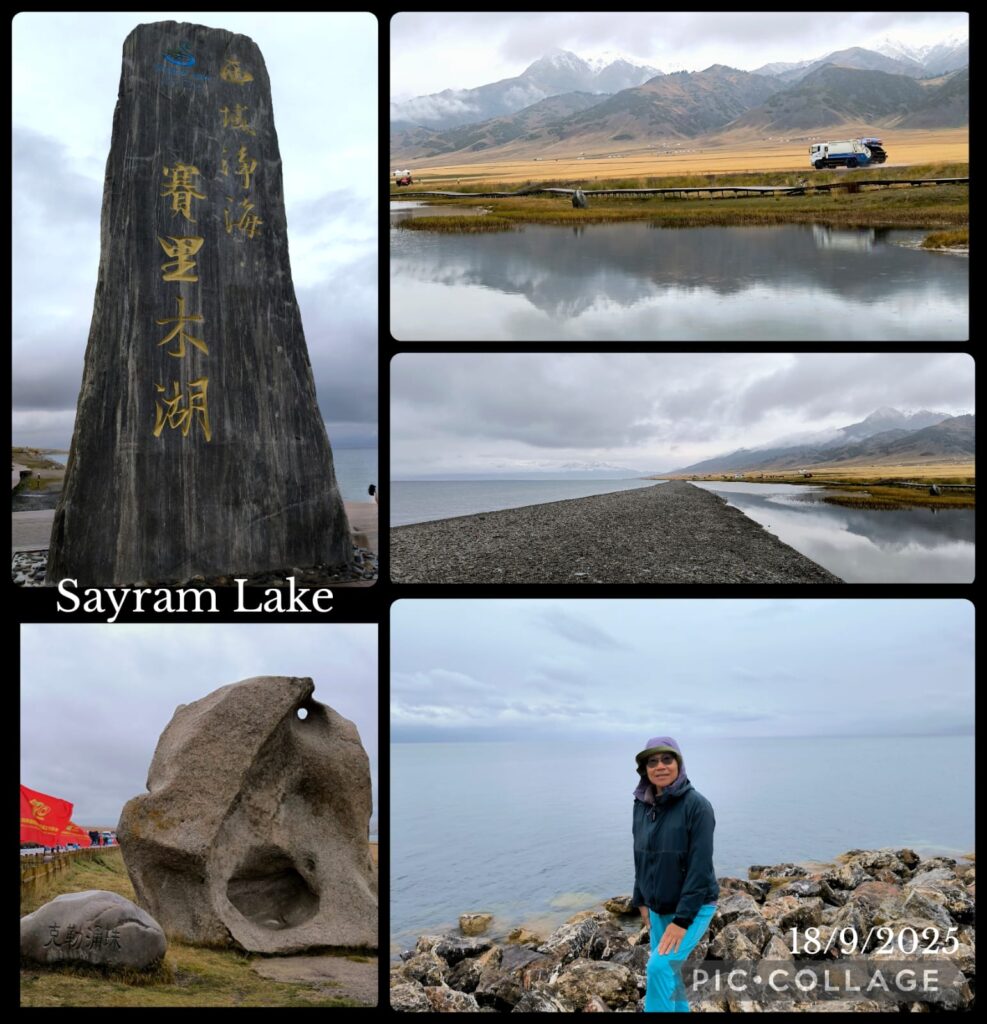
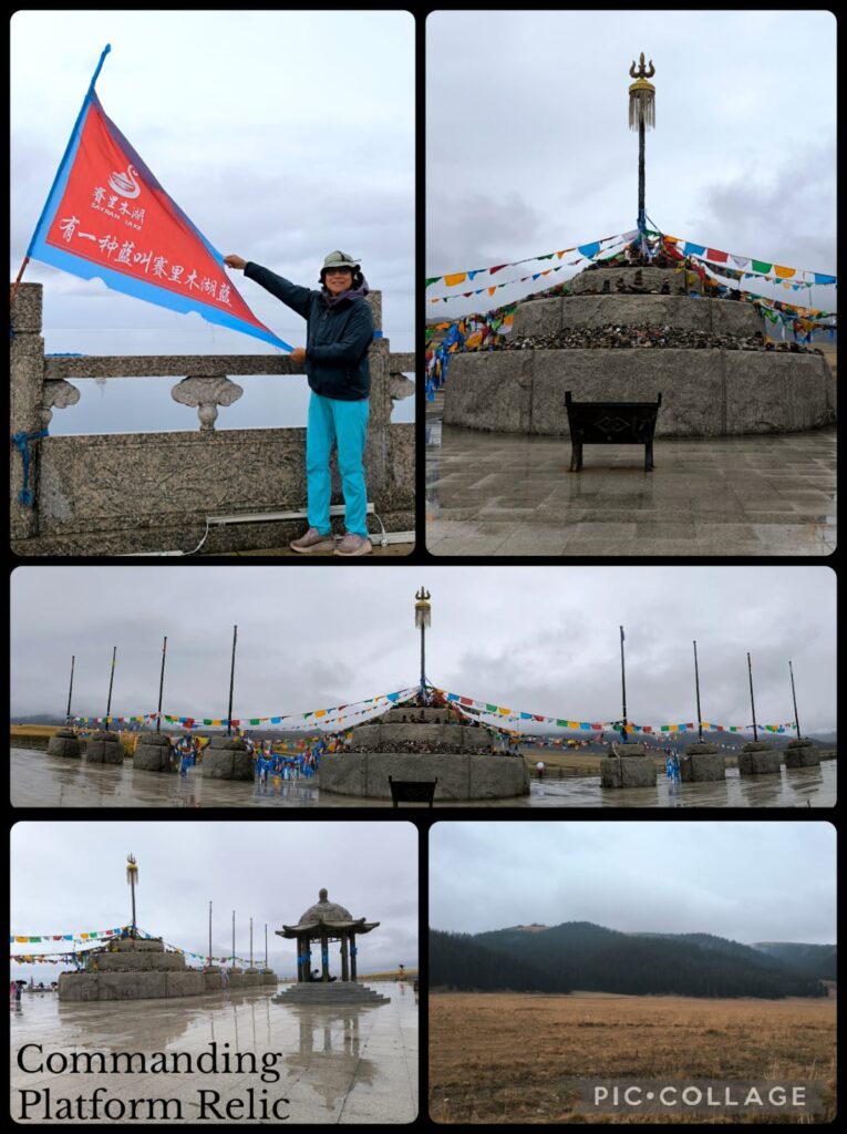
The programme today was a drive around the Sayram Lake (historically known as the “Clean Lake”) which is an endorheic freshwater lake in the northern Tianshan Mountains at Bortala Mongol Autonomous Prefecture less than 50 km from the border with Kazakhstan. At an elevation of 2070m above sea level, the lake has a surface area of 459 km² and a round-the-lake drive of 100km. We would have four stops including the Commanding Platform Relic Park with Eight Banners and the swan area. We saw plenty of gulls but no swan. Luckily the weather improved slightly: at least it was not raining heavily whenever we stepped off the vehicle.
We finished about 7pm when it started to drizzle again. After a simple dinner, we returned to the hotel ready to pack.
Day 19 Sayram Lake – Urumqi (550km)
We set off at 9am and the whole day was spent on the road. Apart from two toilet stops and a lunch stop, we remained in the vehicle till we got back to Urumqi around 5 pm. We returned to the same restaurant in Red Light Hill for our farewell dinner. Our drivers, Li and Wang joined us. We had a nice dinner to end our South Xinjiang trip.
Day 20 Urumqi – Hong Kong
We departed for the airport at 7:30am. The check in was smooth. But it took a long time to go through security. As Bing had left her power bank in the check-in luggage, she had to go to a special area to have her luggage checked. It took almost half an hour. Then we all had our carry-on bags checked when going through security. So, by the time we reached the gate, it was well after 9:15 am! Incredible. The plane took off as schedule around 10:30am and I was back in HK around 4pm.
Remarks
Xinjiang is incredibly diverse, expansive and rich in history, topography, landscape, and natural resources (oil, coal, natural gas, iron, gold, copper, salt, potash, solar and wind energy, cotton, water etc). I first visited Urumqi, Red Flaming Mountain, Tianchi and Jiaohe Ruins in early 1990s. Then I went to north Xinjiang for autumn foliage in 2012. I came to Urumqi again in 2018 to visit Turpan and Gaochang Ancient City after my remarkable journey over the Kunlun Mountains from Pakistan to Tashkurgan via G314 before reaching Tajikstan and the Pamir Plateau. But the travel through the historical deadly vast Taklamakan Desert where Faxian and Xuanzang had risked their life on their way to India in the 4th and 7th centuries, has really introduced me what modern day Xinjiang is all about. The most impressive infrastructural project is the taming of the desert and successful plantation of cash crops in the desert. It is indeed an eye-opening experience with profound implications and significance beyond China!
This journey has taken me to travel along all the main trunk routes/highway including G314, G217, G315, G218, G30 and G312, covering over 5,550 km. I am most impressed by Xinjiang’s geology and landscape, and a few recent developments.
First. The geology, topography and landscape are truly splendid and awesome: the canyons, oasis, grassland, lakes, Tianshan, Kunlun Mountains, Pamir Plateau as well as the desert are stunning and incredibly beautiful. As I was there in September, it was too early to enjoy the golden foliage of the alpine forests and the populus euphratica in the Taklamakan Desert.
Second. The determination, perseverance, long-term views and efforts of the people of China and the government in preventing desertification have stunned the world. As a result of successful application of technology and efficient management of water resources, there are green belts along the highway, and vast areas under cultivation of wheat, corn, cotton, fruits, sunflowers, trees etc.
Third, the infrastructures including highway, Guozigou Bridge and train are impressive. As a result of the “One Belt, One Road” initiative, Xinjiang bordering Pakistan, Tajikstan, Kyrgyzstan, Kazakhstan and Mongolia, is strategically important. No doubt, it is one of the fastest growing regions in China. I was in Tashkurgan in 2018 and can already see rapid developments in this remote part of China.
Fourth. Tourism is one of the key economic forces bringing jobs, trade and people to these parts of China. The number of self-driving mainland tourists in addition to the number of group tourists show both the growing prosperity of the mainland Chinese and the importance of tourism to Xinjiang. I am sad to find “disneyfication” and excessive commercialization of some of the top attractions: there are too many tourists and ugly man-made structures! Also Chinese tourists are making too much noises and they are crazy about photos and selfies. I could hardly fine peace and tranquility despite the heavenly scenery. What a pity!
All in all, there is simply too much to discover in Xinjiang. This trip has brought me to major top tourist attractions including canyons, grasslands and lakes. As I am interested in the history and archaeological sites, I hope to return one day in mid October to visit some of the archaeological sites including ruins and ancient cities, Buddhist temple ruins, tombs, caves etc. Many of these sites are along the Silk Road in the Taklamakan Desert and Lop Desert in south Xinjiang. I also love to see populus euphratica at its best in the Taklamakan Desert. I would spare more time for the Urumqi Museum too.