
Day 12 – 18 August 18 – 24: Umanaq Fjord, Musk Ox and Whales
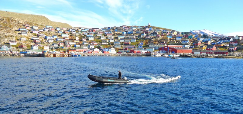
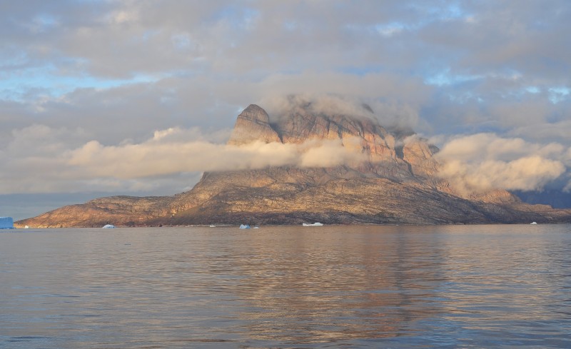
 Uumannaq- iconic mountain behind the town |
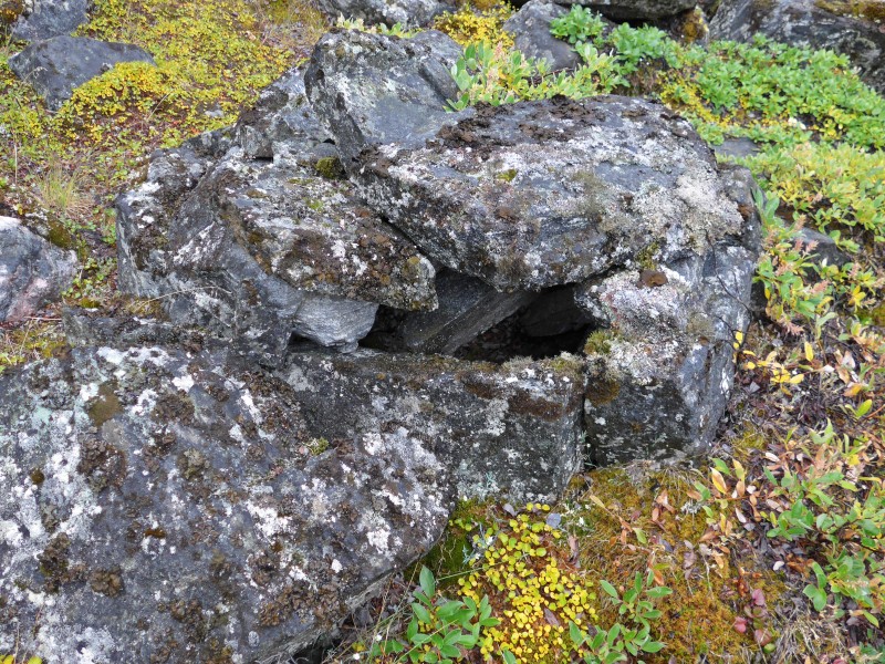
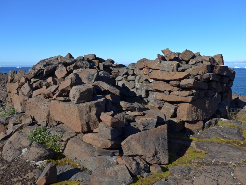 Mysterious stone structure from the Norsemen |
Day 12 August 18 Tuesday: Sailing Southwards through Melville and Baffin Bay; Noon Position 74º 48.9′ N 062º 56.0′ W; Air Temperature Between 7.5º and 8º C; Weather: Cloudy and overcast all day, with occasional blue skies in the afternoon
The sea was choppy during the night. I spent a few hours in the bar writing the epilogue for my last trip while others were sleeping. I tried to sleep for a few hours. I was late for breakfast as DJ was already emptying the trays. Not a big problem anyway as I normally only take cereals and fruits for breakfast.
Today was the bridge day i.e. we could have a session with the Captain at the bridge with him trying to see how things work on a sailing ship. I was in Group B and had a blissful and information session starting at 9:30am at the bridge. The bridge is not roomy but is well-equipped with modern technology. We asked so many questions that we overstayed by 10 minutes. Denis who is our minder, tried to get us out of the bridge twice!
 |
 |
 |
 |
We had a full day at sea, sailing South towards our next destination,-Upernavik. As expected, Jordi made sure we were not idle: we had three lectures.
- Christian talked about “Telecommunications in Greenland” and the problems.
- Allard, the First Officer gave an introductory talk on “Basic and Practical Navigation” explaining several sailing concepts and exposing some scenarios on how to apply them.
- Denis got his masterpiece talk on “Greenland Natural Resources”, starting with general geology of the island and then explaining how the geologists manage to find different minerals of economical interest in Greenland.
The rest of the evening was uneventful. I re-discovered how to use the Photoscape programme for photo editing. Hence I tried to sort out my photos whenever I had free time.
Day 13 August 19 Wednesday: Sailing Southwards in Baffin Bay – Upernavik; Noon Position 72º 55.0‘N 056º 41.2‘ W; Air Temperature 8º – 10ºC; Weather: Partially cloudy in the morning, mostly sunny in the afternoon with some Stratocumulus, and a spectacular passing front
Just after midnight there was enough easterly wind for setting some canvas for motor-sailing during the night towards Upernavik. The Captain called for volunteers to pull the ropes. As I had already settled in bed, I did not want to get up and put on warm clothes again. I knew I missed lots of fun. The Main, Schooner and Staysail were set on Port Tack, giving the boat half a knot more push and speed. I slept from 11pm to 1am, woke up briefly around 2am and fell asleep again. I still felt tired when I got up at 8am. My bones were aching
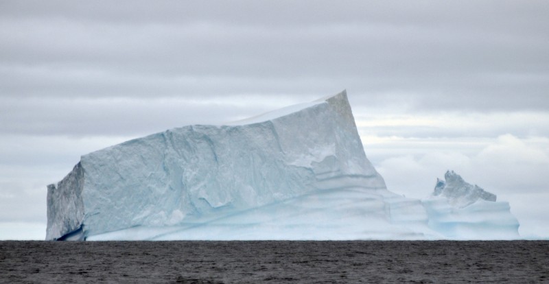
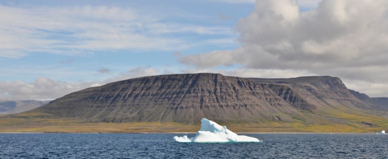
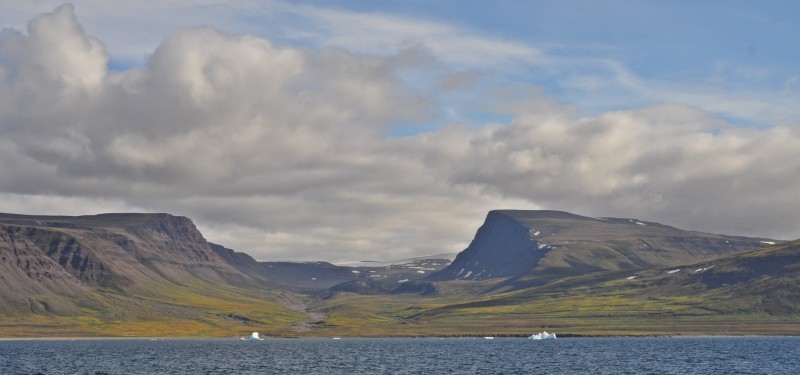
The boat was making good progress doing around 7.2 to 7.6 knots. The weather was fine with blue sky. We were sailing close to the shore dotted with hundreds of icebergs. The low laying hills and islets are welcoming in contrast to the expansive open sea yesterday.
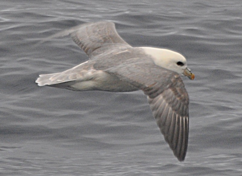
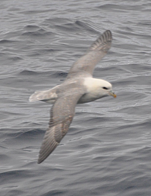
Jordi’s morning lecture on whales and researches done on humpback whales is the most interesting one I have heard so far. He is able to explain in simple terms about the main types of whales (i.e. tooth and toothless), the sub-groups and their features, habitat, migration etc. He has been collaborating for several years with the INACH (Chilean Antarctic Institute) and the Quaternary Research Centre – Punta Arenas on their projects on Humpback whales in Southern Ocean and along west coast of South America mostly based on photo-identification and taking skin samples for genetic studies.
- Colour pattern of the ventral part of the humpback whale flukes is unique. Scientific research is being conducted on the area of the photo-identification, using this individual patterns to catalog the whales, compare with other country fluke catalogs and look for matches.
- There are five general colour patterns and sub-patterns of flukes of humpback whales. Pattern nº1 is a white fluke, nº2 is all white but divided by a black line at the middle, nº3 is 50% white and 50% black, nº4 has more black than white and nº5 is completely black.
- This technique has made it possible to improve our knowledge on how to distinguish different populations, establish the fidelity to particular areas and study migrations patterns.
I have a better understanding about the distributions of various types of whales in the world and know where to go for watching Blue, Bowhead and Sperm whales (the last two types are most endangered with probably less than 1,000 in total for each one).
Around 12:30pm, our boat went alongside the Upernavik pier. We had an early lunch followed by a briefing by Jordi before disembarkation.
Upernavik founded in 1772, is a small town in the Qaasuitsup municipality, located on a small island of the same name. With 1,181 inhabitants (2013), it is the 12th largest town in Greenland and the northern-most town in the country with a population of over 1,000. From the former name of its island, it was sometimes known as Women’s Island.
 |
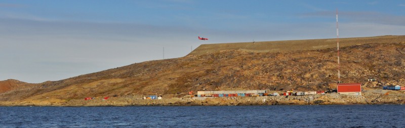 Modern airport on a hill-top above the town |
Upernavik is the furthest north reached by the Vikings. The famous Kingittorsuaq Runestone dating probably from late 13th to early 14th century found outside Upernavik in 1824 bears runic characters listing the names of three Norsemen and mentioning the construction of a rock cairn nearby. The inscription reads: “Erling Sigvartson, Bjarne Thordarson and Enride Oddson Saturday before Rogation Day (25th April) raised these cairns” The question is how this stone ended in a cairn on top of Kingittorsuaq mountain. According to the date, these three Norsemen might have over wintered in the Upernavik district or they might have sailed all the way up here. The stone is now in the National Museum of Copenhagen.
 |
 |
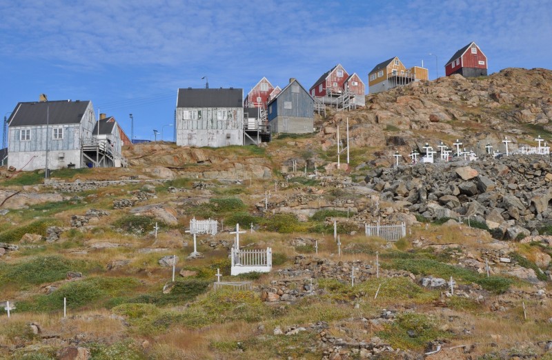
I like small Greenlandic settlements as everything is within walking distance! Denis first took us to the Upernavik Museum, the oldest museum in Greenland, located at the end of the town. Exhibits of the museum are exposed in three buildings – a church, the residence of the former ColonyManager in Upernavik (a building made of hard pine sticks) rebuilt in 1832 and an old shop built in 1864 (a stone-improved “Danish-Greenlandic” house where peat wall is replaced by a pure stone wall). The nearby cooper’s shop (used for manufacturing barrels for storage and transport of oil from seals and whales), has also been restored and used as an artist residence.
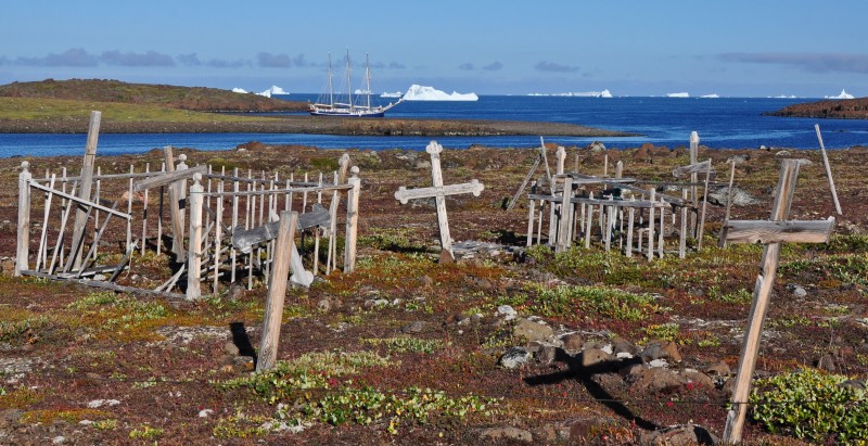
Close to the museum at the bottom of the slope is an old graveyard. I wandered through it before walking uphill to the modern cemetery. I accidentally found a very old grave which looks striking. I looked at the characters but could not figure out the content. Denis later told me that it was the grave of the first wife of Peter Freuchen – the Greenlander Navarana.
 |
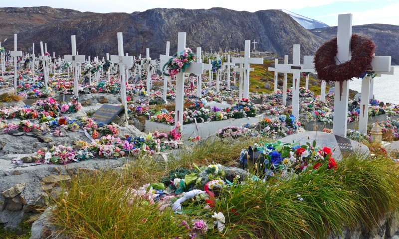 |
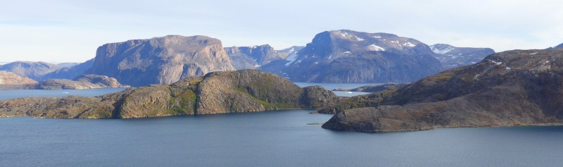
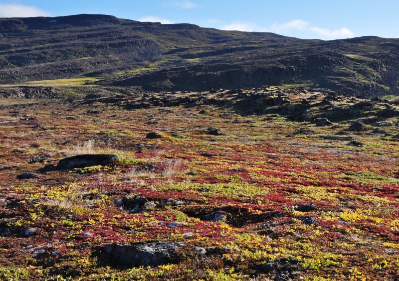
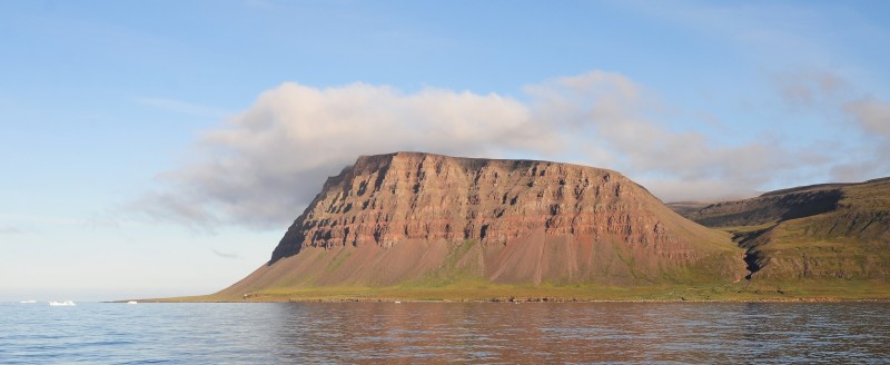
Then I walked uphill and reached the modern graveyard with some 300 graves each marked with a white cross. Most of them are covered in colourful plastic flowers. For the best views of the Upernavik Isfjord, Denis had suggested us walk all the way to the airport which has been constructed by removing the hilltop behind the town. Instead of following the paved road, I took the coastal route above the cemetery and passing by a satellite station. I also went some 200m beyond the airport car park for a better view of the fjord. The geology here is different: instead of the large series of sedimentary rocks in the Thule area, the Upernavik area is dominated by massive charnockite mountains which often expose several hundred meters high cliffs.
 |
 |
 |
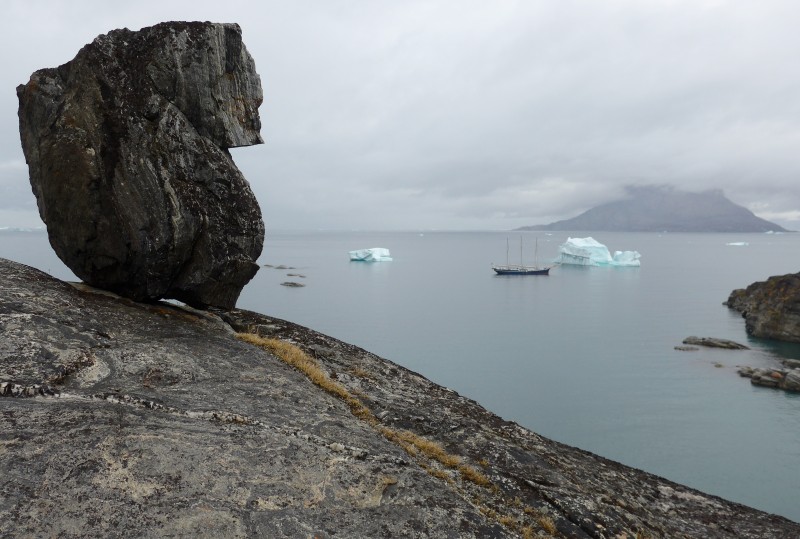
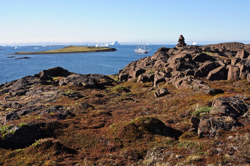
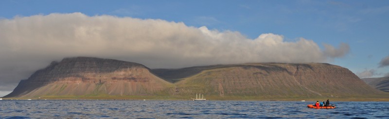
 After strolling in town for three hours, I found my way back to the boat before 5:30pm. I find the town pretty and tidy but a bit boring. The Captain was ready to set sail: he stood behind the wheel on the aft-deck giving command to his crew. Soon, we were heading to Ummanaaq sailing past spectacular cliffs, that can easily dwarf the most famous climbing big walls in the world.
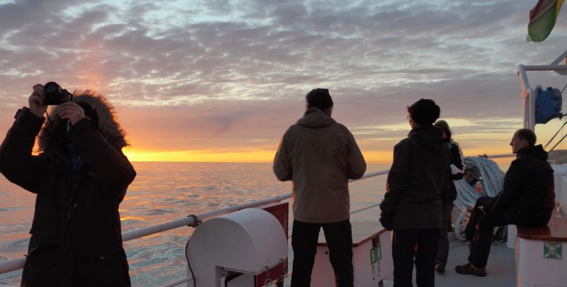
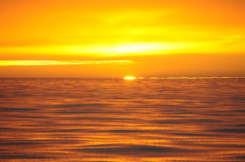
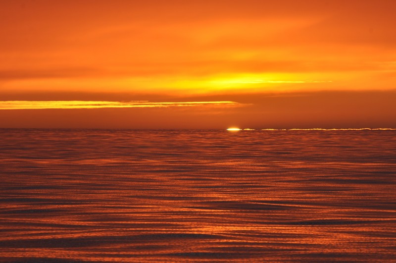
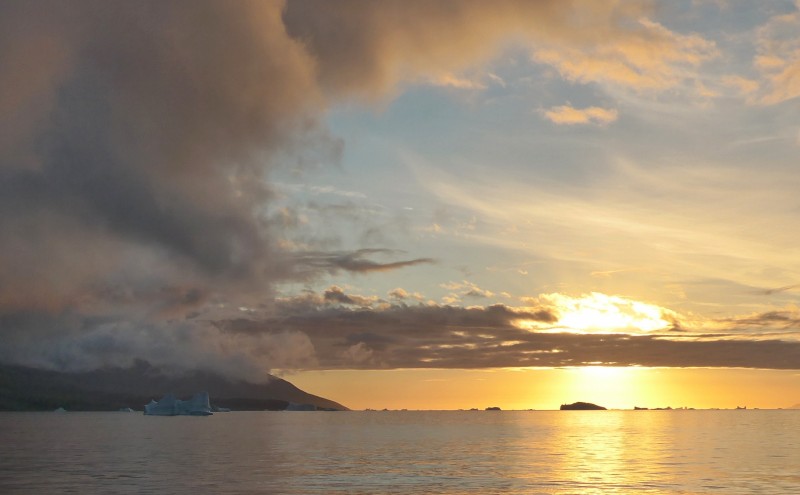
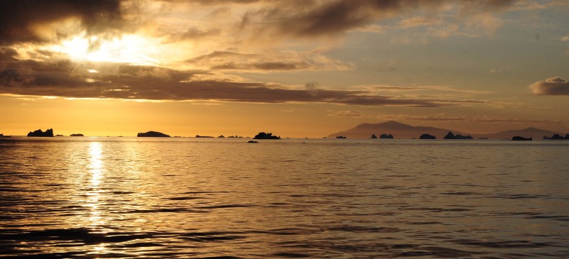
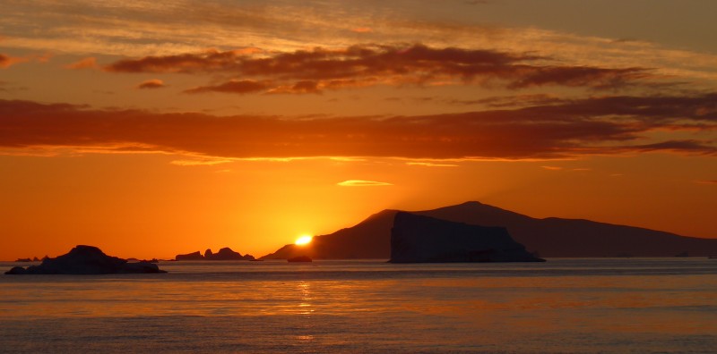
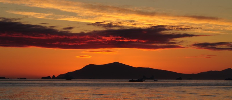
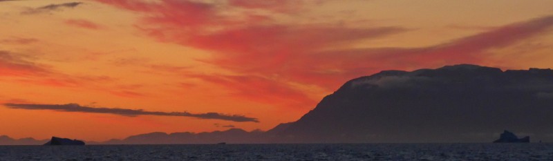
I looked at the clear sky and predicted a gorgeous sunset. I was right. Around 11pm, the golden sun turned reddish orange. Despite thick layers of clouds, the sunset was awesome finishing off with a “blue flash” or “blueish green flash”. Of course, my camera failed to capture this mystical moment and colours in a split second! Anyway, I am thrilled to have seen the flash twice on this voyage.
 |
 |
 |
 |
I stayed on for another half an hour watching clouds that showed hues of gold, pink, orange, red and purple and icebergs. A fantastic setting for an Arctic sunset. I went to bed after 12:30am and had a wonderful sleep till 8am the following day.
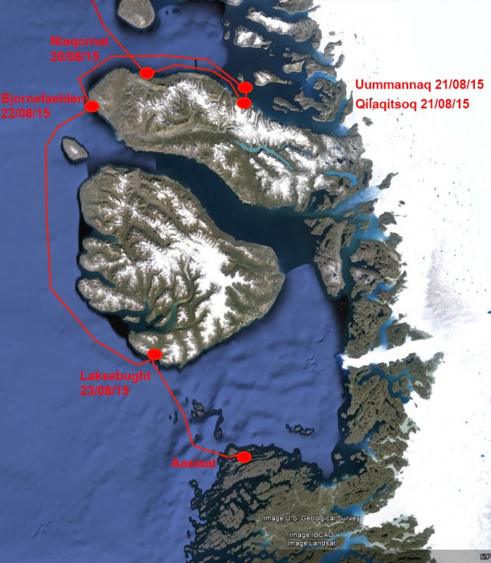
Day 14 August 20 Thursday: Umanak Fjord – Niaqornat settlement; Noon Position 70º 57.1′ N 054º 11.2′ W; Air Temperature: 7º – 8º C; Weather: Cloudy and overcast with some light rain during the day
We woke up at the northern entrance of the Umanak Fjord, where it takes the name of Karrats Fjord. From here, we did a slight change on our course towards the southeast, heading straight to a small settlement in Niaqornat. Today, we were divided into five groups for a 30-minute “Bridge Tour”. During the tour, the Captain explained the navigational instruments and how he and the Mates, used them to sail and navigate Rembrandt in the Greenlandic waters.
I was in Group B and had our tour at 9:30am. Then the Captain discovered more and more icebergs (big and small) appearing in our course. Hence he postponed the tour for the last two groups so that he and his crew could concentrate on navigation. As planned we were approaching Niaqornat by lunch time. The Captain took a while to find a good place to anchor: we landed safely at 2:30pm on the western side of the peninsula.
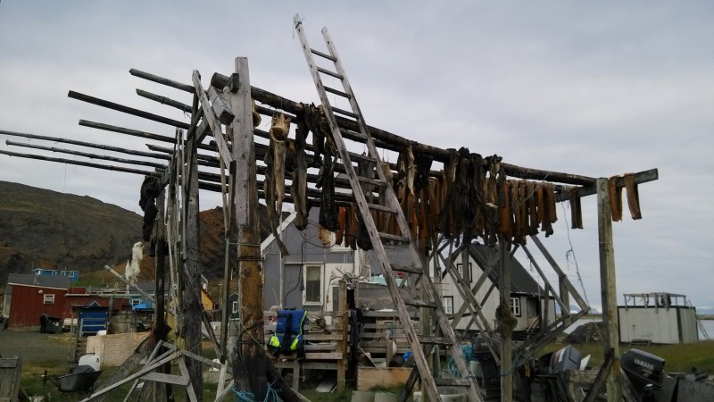
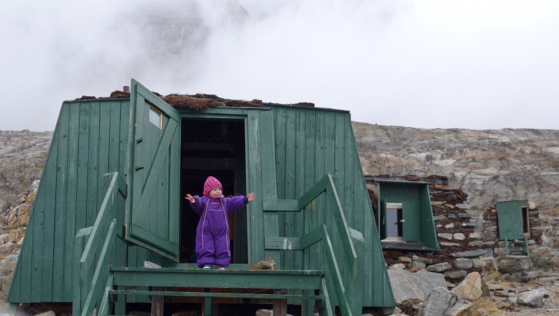
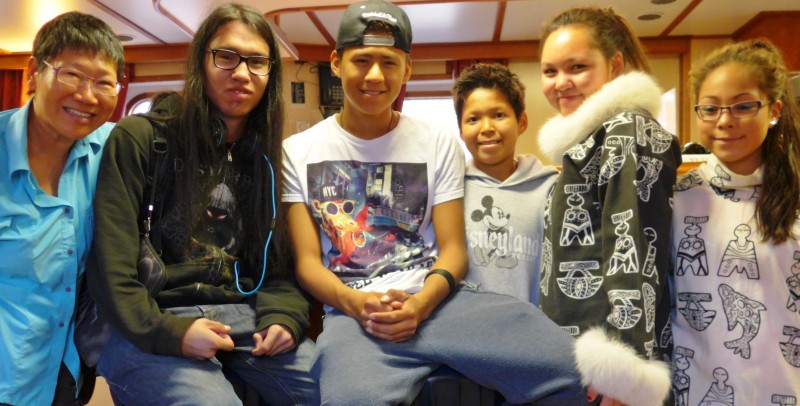
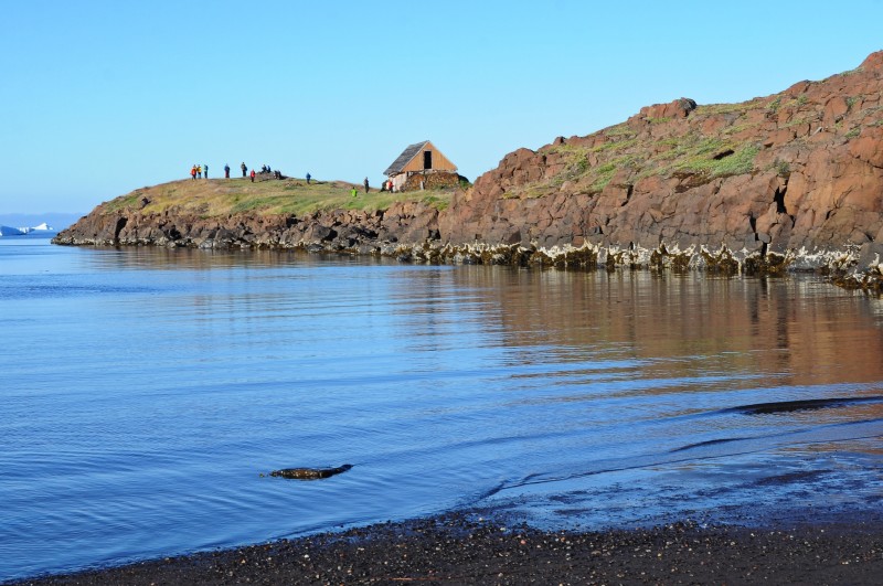
Niaqornat is a picturesque village located on a narrow strip between the Nugssuaq peninsula and a low cape. A hundred years ago it was one of Greenland’s biggest settlements. Now, it is a small settlement with only 49 inhabitants. Today, we found 29 people (including 13 children) while the rest had gone on hunting or fishing mission.
 |
 |
 |
 |
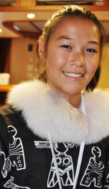
We were welcomed by a Greenlander Ilinnguaq who works at the power plant and can speak English speaking. He arrived here from the south eight years ago after finding a girl from here through internet: they have got married and have now a 7-year-old daughter. He introduced and explained us about the settlement. Few friendly locals were out to welcome and sell us their handicraft. The oldest building is a colonial building from 1760 moved from the abandoned settlement Nûgsuak to Niaqornat.
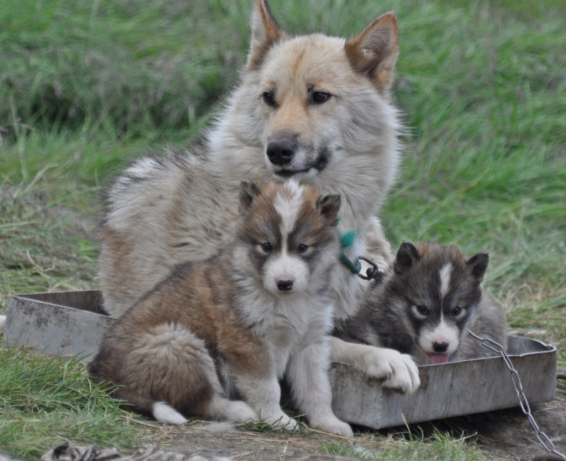
After spending almost an hour strolling in the settlement taking pictures of the landscape, the village, dried fish and animal skins on wooden racks, a fisherman with his catch and Greenlandic dogs and puppies, we were split into two groups. One group followed Denis on a short walk to the cape where they would visit the old and the new cemetery, have a view of the settlement and the surrounding areas. I joined the group led by Jordi and climbed several hills west of Niaqornat. I enjoyed the exercise and beautiful views.
 |
 |
 |
 |
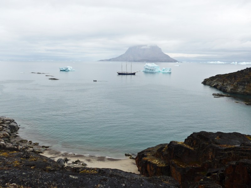
By 5:45pm we were all back on board. The boat began sailing deeper into the Umanak Fjord, towards the Uummannaq settlement. We were greeted first by a Fin whale followed by a Humpack which popped out quite close to the ship breathing heavily several times before starting a deep dive. We saw its fluke. We spent the night at anchor on the western shores of Uummannaq, just under the impressive cliff that dominates the island. The little rocky bay looks great, but difficult and shallow. Fortunately with good and calm condition, our boat anchored without problem: I had a good sleeping without engine noise!
Day 15 August 21 Friday: Qilakitsoq – Uummannaq town; Noon Position 70º 36.9′ N 052º 11.4′ W At anchor in Qilakitsoq; Air Temperature: 6.5º – 7.5º C; Weather: A calm and glassy sea and light winds in the night; rainy and overcast during the day with low clouds over Uummannaq; clear sky and a gorgeous sunset in the evening.
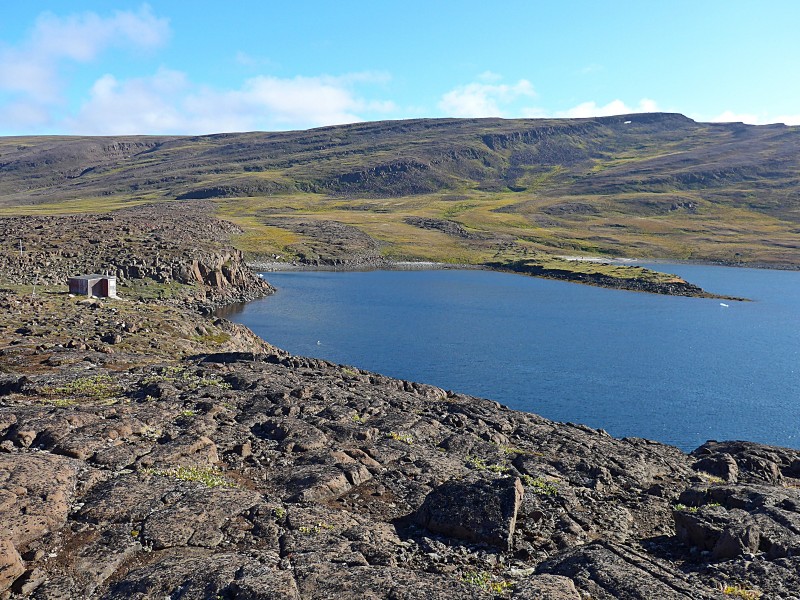
In the early morning, the boat sailed five miles to the south towards Qilakitsoq, the most important archaeological site in Greenland.
The site Qilakitsoq lies idyllically in a flat area protected by stony cliffs and immediately behind a beach and a natural harbour. In the flat area at least seven Thule archeological structures remain, including several stone and turf houses, long houses, tent ring, double houses and round houses ruins. These structures are dated to the 18th and 19th century. There are also numerous graves made out of and covered with stones in the same area. We were told not to step on the structures or disturbed the graves as some still contain bones and skulls.
 The location where the mummies were found |
 |
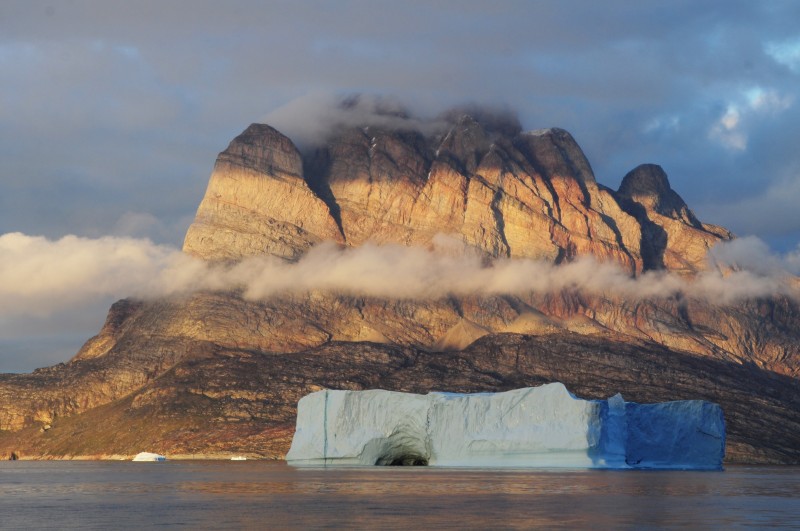
 Uumannaq seen from the archaeological site |
 |
 |
 |
Then we followed Denis to see the original site of the findings of the Greenlandic mummies. In 1972, two brothers Hans and Jokum Grønvold made the discovery by coincidence while hunting ptarmigans on the Nussuaq half island. The path climbs a few hundred of meters in the eastern direction. We located the original site where the eight mummies from 1475 were found in two graves (six females and two children). The mummies have been placed since 1982 in the National Museum of Greenland in Nuuk. The mummies and their clothing are extremely well preserved because of the dry conditions of the grave site. The research of the mummies has revealed many details of the living conditions of the Inuit in the 15th century.
- The mummies were tattooed and the tattoos are very similar to tattoos that were documented from East Greenlanders from 1900.
- The extremely well preserved clothes gave also information about the material used to produce the clothes. For example from one anorak it became clear that five different birds were used to fabricate it.
- The mummies were wearing Kamik which are traditional shoes that are still used today.
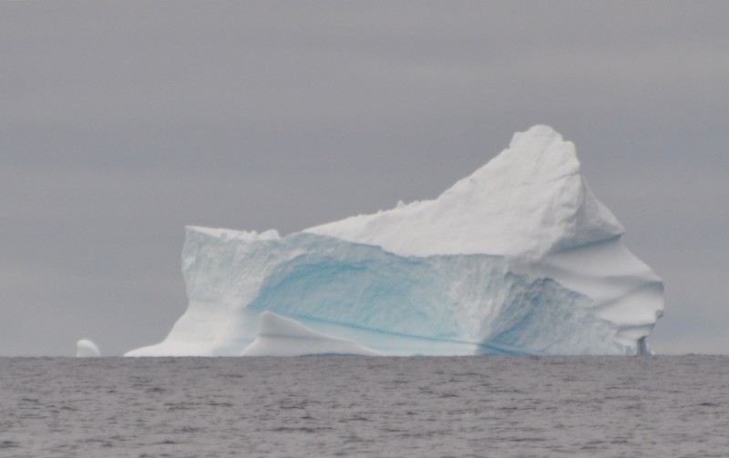
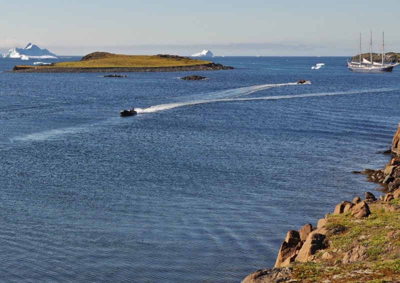
After a most interesting site visit, we also had a zodiac cruise around an impressive iceberg that drifted quite close to Rembrandt.
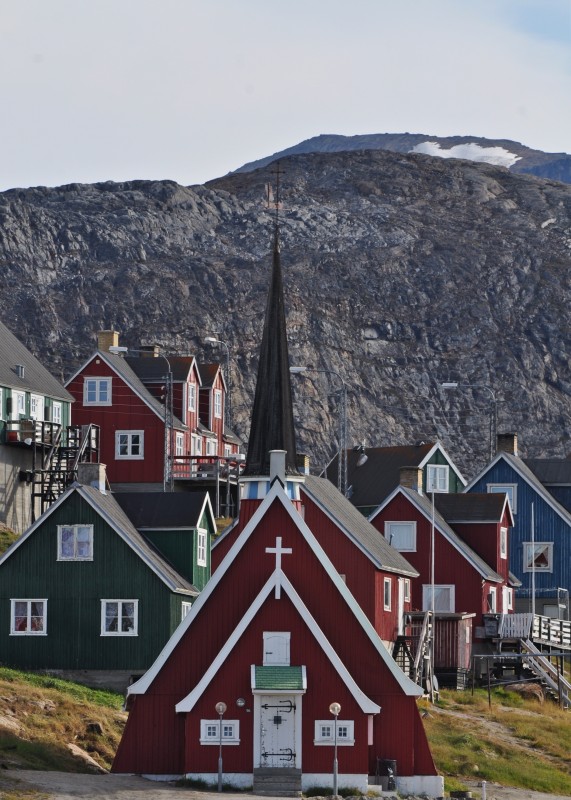
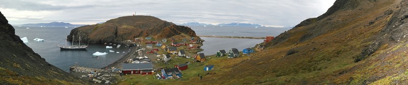
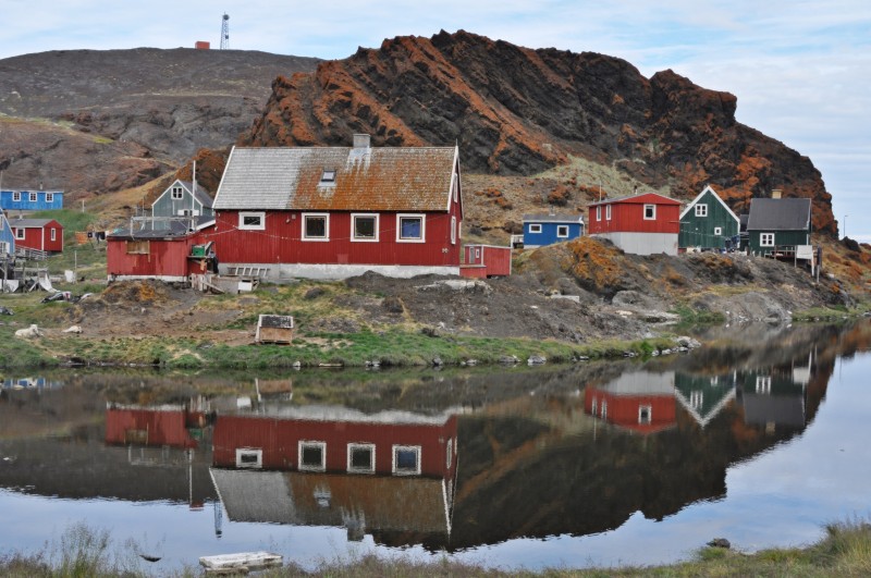
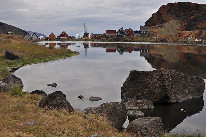
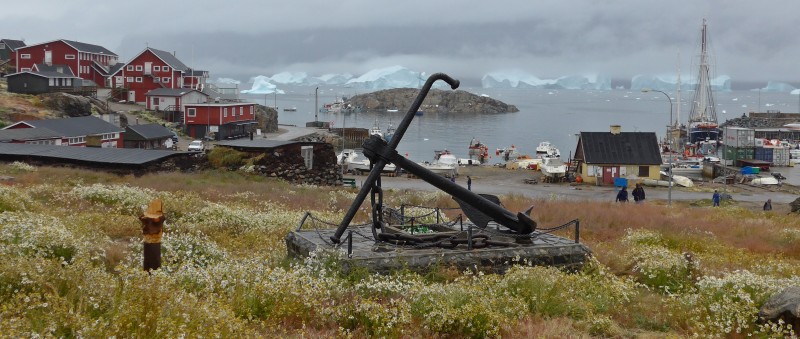
While sailing to the Uummannaq Island, we had lunch and a briefing before landing. Uummannaq is a gorgeous town considered by many as the nicest one in Greenland. It overlooks the fjord of the same name while the Uummannaq Mountain, which rises sharply up to 1170m in height provides a dramatic backdrop. It is the 11th largest town with a population of 1,282 inhabitants (2013). The town is a hunting and fishing base, with a canning factory and a marble quarry.
We came alongside the small pier and were able to stepped off the boat at the heart of the town. The museum and the church are only five minutes’ walk from the pier.
 |
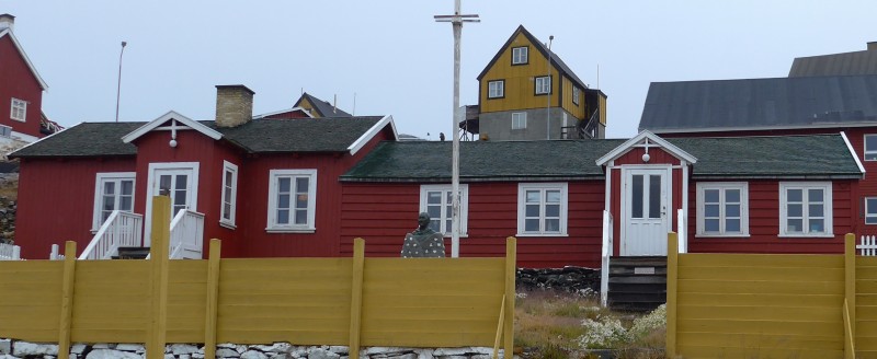 |
I had a busy time ashore. First I spent an hour visiting the museum located in an old hospital and the church. There are three interesting exhibitions in the museum. The first one is on the Qilakitsoq mummies (including the exhibition of an original small anorak dating some 450 years ago which was found in the Qilakitsoq area). There is a section on Alfred Wegener’s exploration including old photos, records and equipments used. The third exhibition is on the Marmoriilik mine. There are also several small exhibitions in a nearby building which is the former house of the doctor: One room shows things belonging to Edvard Kruse (a local teacher and poet) and another room on the career and contribution of a local doctor. Paintings of a local painter Tikkili were on displayed too.
 |
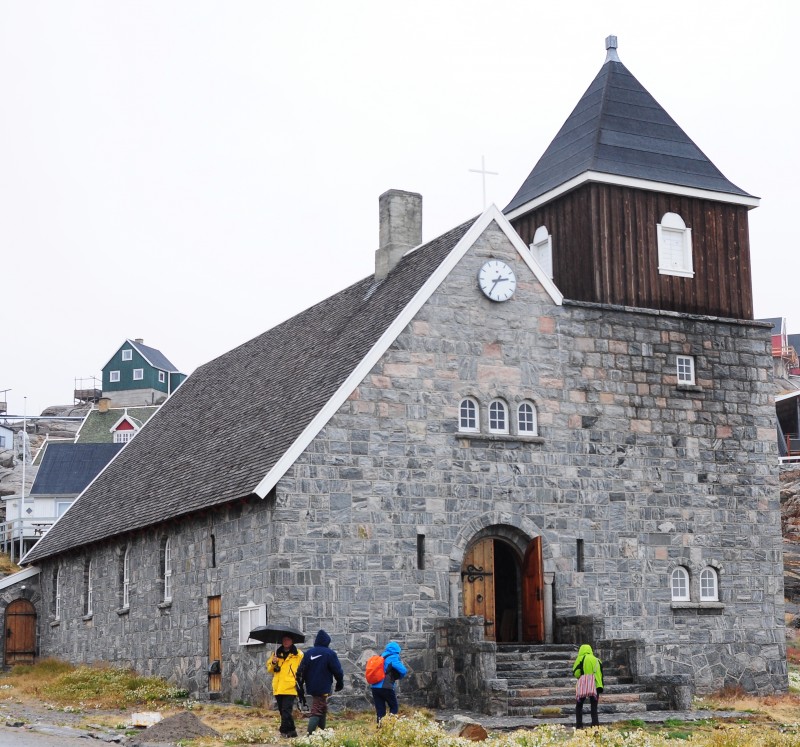 |
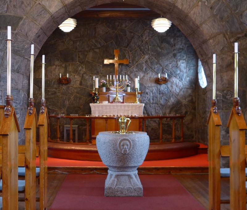
Denis managed to contact the local priest who opened the church for us. This is the only stone church in Greenland. The priest was in a good mood and played the organ for over ten minutes. There are also other things to do in town: to see three peat houses, an exhibition of the Finnish Arctic photographer Tiina Itkonen and a whale installation by a Danish artist and the publisher of Greenland Today Mads Nordlund.
Nivi at Sta Klaus House
At 3:15pm, I joined a walk to Sta Klaus (Santa Claus) house led by Denis. For the Danes, Santa Claus lives in Uummannaq! Despite the cloudy and rainy weather, we all enjoyed the walk. The trail is marked in red. But somehow, as pink dot sometimes overlaps with the pink one, Denis thought they might be the same. Hence on my way back, I started with the red dot but soon followed the pink one which led me to the radio station, well above the red dotted path! Luckily, without vegetation on the rocks, I could easily find my way back and rejoined the group at the bottom of the trail. I was glad to be back on the boat at 6pm. Otherwise, Jordi and Denis might have to organise a search team for me!
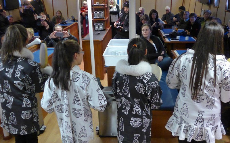
Captain Sven had been busy arranging a surprise concert for us while we were looking for Sta Klaus. He is well acquainted with the place, and during his time off in town, he dropped by and quite spontaneously Ann, the director of the Children’s Home of Uummannaq (an organisation that takes care and gives a place, activities and education to local children coming from families with problems or directly orphans), together with some teachers and youngsters, decided to come on board to give us a performance.A dozen teenagers performed for almost half an hour. They played different kinds of traditional and modern Greenlandic music, sang and dance. A fantastic performance! I talked with Ann before she left and learnt that there were 32 children at the home. She welcomed me to drop by her house for a cup of coffee on my next visit (which would not be long!).
 |
 Ann (R) |
 |
 |
 |
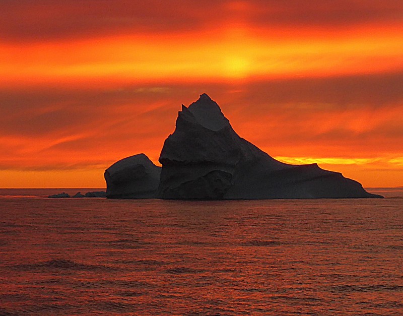
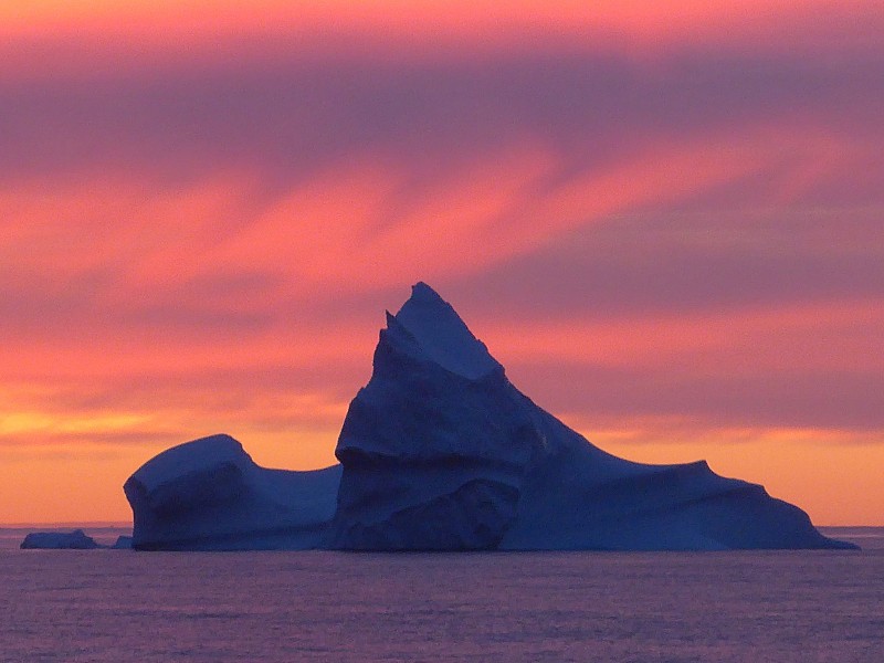
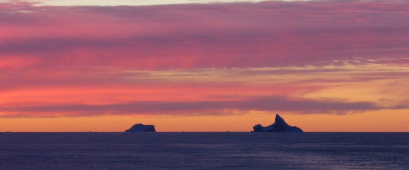
After dinner, we started our way westwards along the Umanak Fjord. Clouds started lifting, offering us a gorgeous sunset: we all stayed on deck watching clouds and warm evening light falling on Uummannaq mountain and beautiful icebergs. There was no wind and the sea was glassy with fabulous reflections.
 |
 |
 |
 |
 |
 |
Day 16 August 22 Saturday: Bjornfaelden and sailing South across the western entrance of Vaigat Strait and the West Coast of Disko Island. Noon Position 70º 41.6‘ N; 054º 35.5‘ W At anchor in Bjornfaelden; Air Temperature: 6º C – 8.5º; Weather: sunny in the morning and afternoon with cloudy intervals
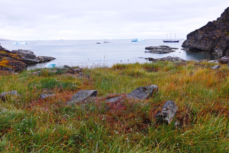
I had a wonderful sleep till 8am. I got up when the boat dropped anchor in Imartuneq Bay on the western tip of Nugssuaq Peninsula. Several icebergs were around the anchorage. Sea conditions were flat and the weather was sunny. After a zodiac ride between icebergs and small bays, we landed on a quiet sandy beach under a flat tundra marsh area. The spot is located south of where we can find the famous and still mysterious Norse ruin named “Bjørnefælden” (Bear Trap).
 |
 |
 |
 |
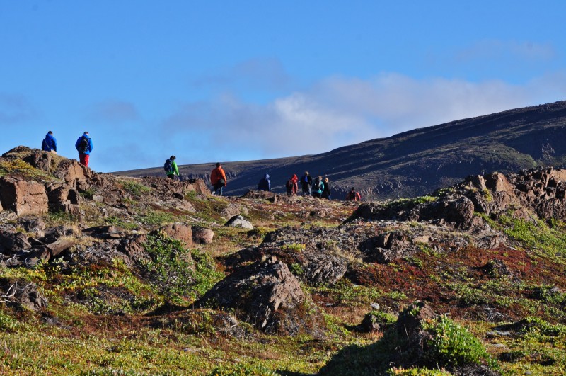
Once we were all ashore, Jordi took us on a 2-km guided walk to see first the Thule remains and a structure of a more modern house. After that, we walked over an extensive area with graves some in traditional Thule style while others marked with a cross. The place has not been under study of archaeological research so far. The only thing that is known is that the area has been used and inhabited all the way from the old times by several different cultures to 1938. Apparently, there is another abandoned settlement of Nûgsuak (old spelling) belonging to this same period, a couple of miles further south.
 |
 |
 |
 |
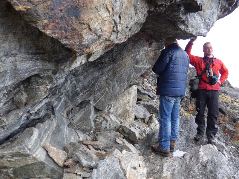
Finally, we arrived in Bjørnefælden where a mystical Norse stone building stands. It is the northernmost Norse remain in Greenland. No one knows when the structure was constructed and its purpose. According to Icelandic written reports it is clear that the Norsemen reached Disko and Nugssuaq areas. Because of the small size, it is impossible that the structure had been a living house. The most probable explanation is that it was used as temporary tomb for people who died during their journey. Here, the bodies could be secured against wild animals until they could be brought home and buried as Catholics.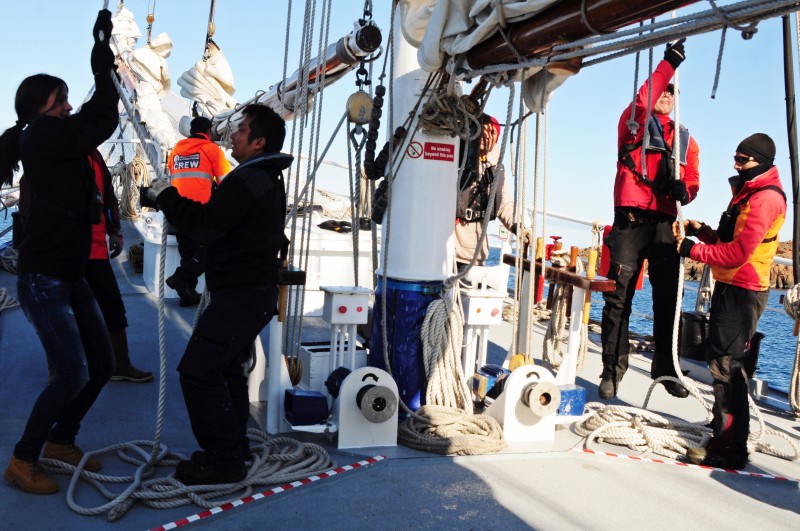
We all enjoyed the fantastic weather and landscape with lushly green tundra with flowers, rushing streams and a mountain range behind us and an expansive blue sea in the front. Denis always stayed at the back to make sure no one strayed away. I usually stayed at the back too so that I could take photos and enjoy the beautiful landscape.
We were back to the boat for lunch. In the afternoon, we were ready to set sail as the wind in the right direction was picking up finally. Many gave a hand in hoisting the Main sail, Schooner, Staysail and Inner Jib in Starboard Tack. Soon, we were motor sailing at around 6.5 knots. Later, the Outer jib was set and the boat was doing around 7 knots, with the engine at low revolutions. At 4pm, the engines were shut down altogether: we were really sail for the first time during this voyage. We sailed for 12 hours!
Taking advantage of the sunny day and the finally good sailing, DJ decided to offer us cake and hot chocolate with rum and whisky on deck!
Day 17 August 23 Sunday: Disko Island (Laksebugt) and arrival in Aasiaat Noon Position 69º 18.5‘ N; 053º 56.0‘ W At anchor at Laksebugt; Air Temperature: 7º to 8º C; Weather: Partially cloudy in the early morning but clearing up later on.
The weather had been improving in the early hours of the morning. By the time we woke up, it was sunny with blue sky. I could see wide valleys and open spaces under the spectacular cliffs that dominate Laksebugt, on the southwestern tip of Disko Island.
Jordi’s original plan was to take us ashore so that we could appreciate the valleys and vast open space in Greenland in addition to narrow fjords, ice caps, glaciers, icebergs and mountains. While Jordi was scouting a suitable landing site, we spotted sprouts from five to six Humpback whales close to the ship and watched them excitedly on deck.
 |
 |
 |
 |
After some discussions, Jordi, Denis and the Captain decided to change programme: we would all go whale-watching in three zodiacs (including the rescue boat). For a couple of hours we were following the group of humpbacks that kept a bit of distance while probably searching for capelin. We were so far from the boat that Jordi decided to turn around. Just then four of the humpbacks popped their heads with open mouths out of the water on a magical feeding display in front of us. Grand finale for our fantastic trip!
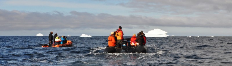 |
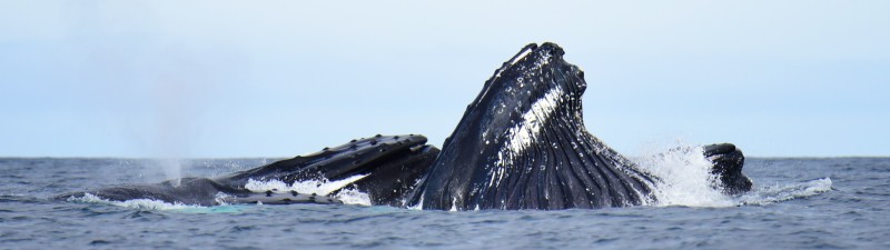 Photo by Manfred Bayer |
We were all thrilled and could not believe in our good luck! Unfortunately, my camera had problem and the memory card was full. Though I saw four heads out of the water from our zodiac, I could not have taken the photo of my lifetime!
We had a sunny afternoon and plain sailing all the way to Aasiaat. In Disko Bay, I saw more Fin whales. We had a farewell drink with Captain Sven and the crew at 6:30pm. Jordi and Denis had been working hard and gave us a perfect digital souvenir with trip log, photos etc. We had a most wonderful time- thanks to Captain Sven and his crew in particular DJ and Khabir. Jordi and Denis are fantastic and professional.
 |
 |
 |
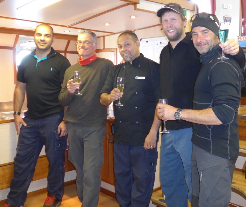 DJ, Denis, Khabir, Captain Sven & Jordi (L-R) |
 |
Day 18 August 24 Monday: Aasiaat
We had a wake-up call at 6:30am, breakfast at 7am and disembarkation at 8am. I said good-bye to my friends who all left for the airport. For me, I hanged around in Aasiaat till 4pm to reboard the boat for my next adventure.