
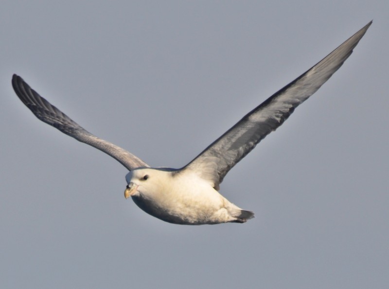
Day 7 – 11 August 13- 17: Thule Area & Upernavik
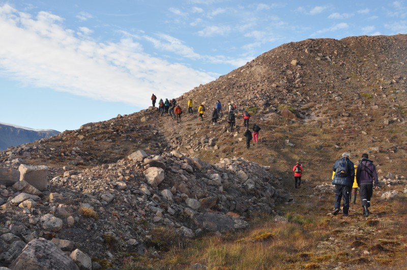
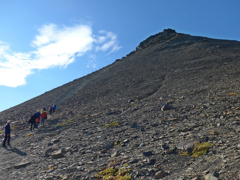 Climbing Mt Dudas – a most strenuous hike |
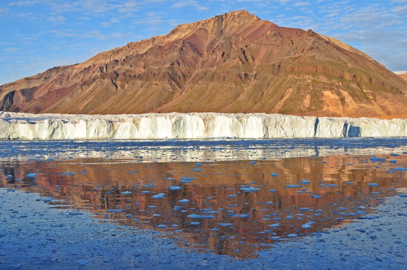
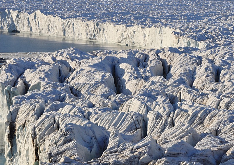
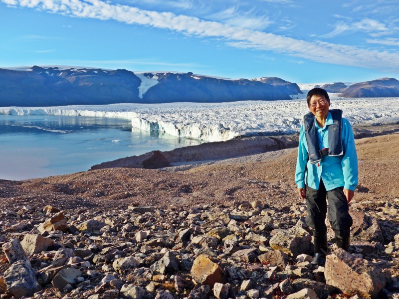 Morris Jesup Glacier |
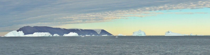
Day 7 August 13 Thursday: Melville Bay – Meteor Island (Savissivik); Noon Position 75º 21.3‘ N; 063º 32.2‘W; Air Temperature:6.5º – 7.5 ºC Weather: Clear sky and sunny almost all day.
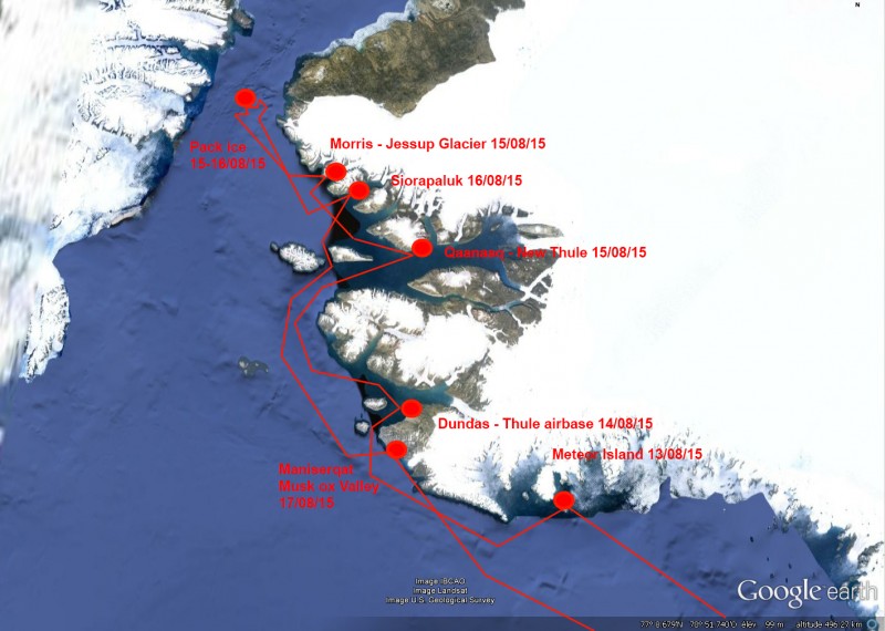
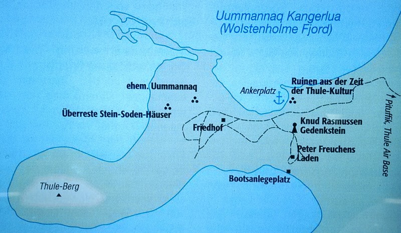
Route map – Thule area
I had a great day today. Khabir, our fantastic chef prepared for us curry chicken and rice for lunch and roast pork for dinner. Most delicious! Jordi continued with his Polar Ecosystem talk, now explaining about some adaptations of the wildlife to the harsh environments, migrations, and comparing diversity on both ecosystems.
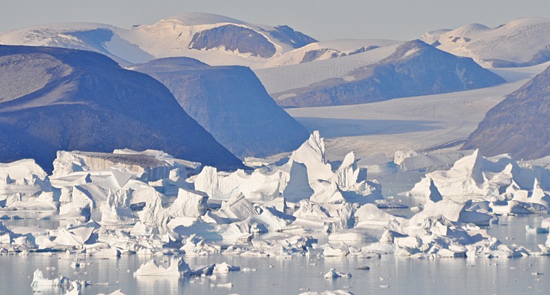
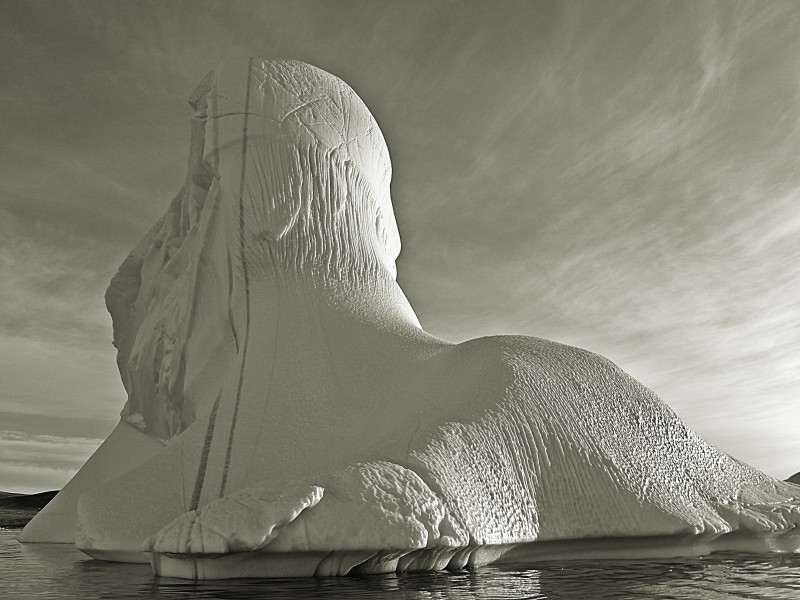
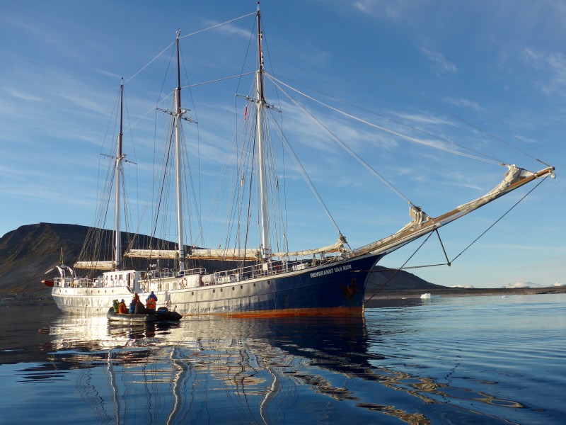
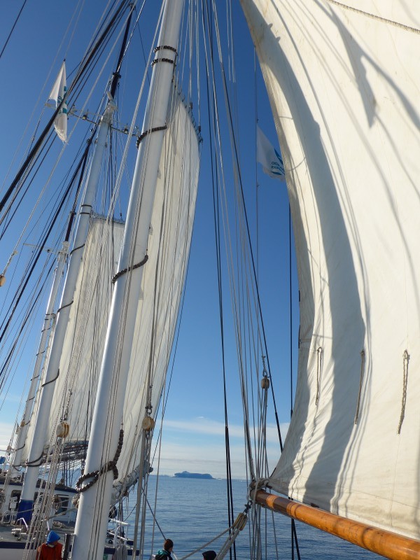
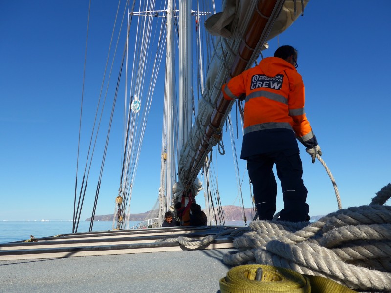
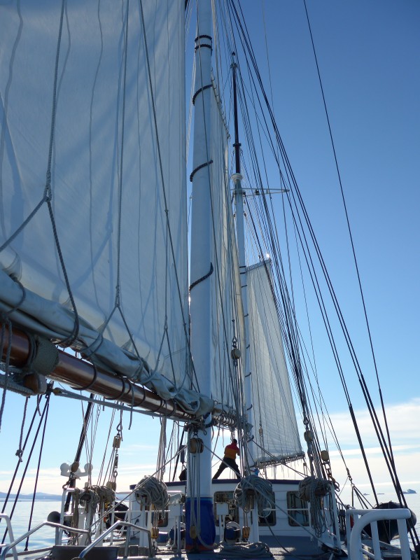
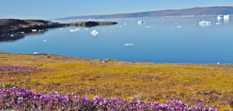
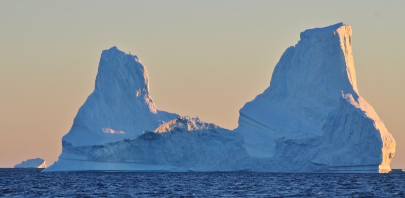
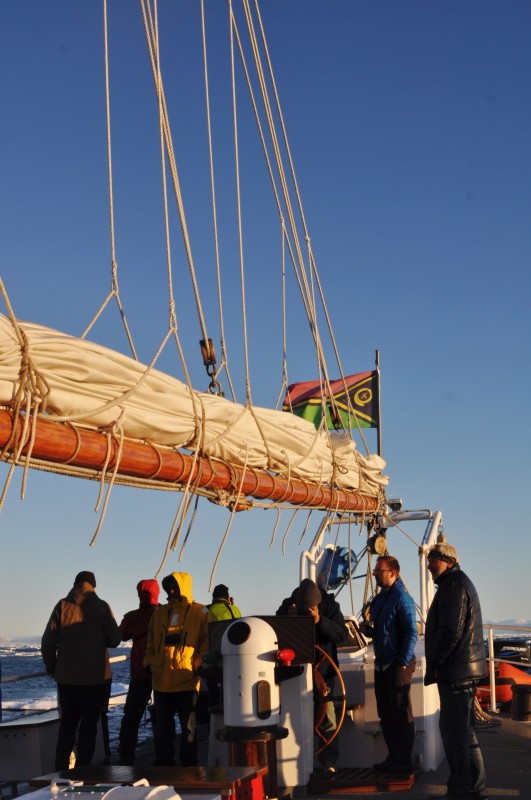
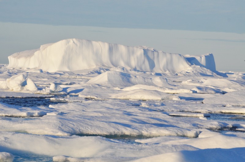
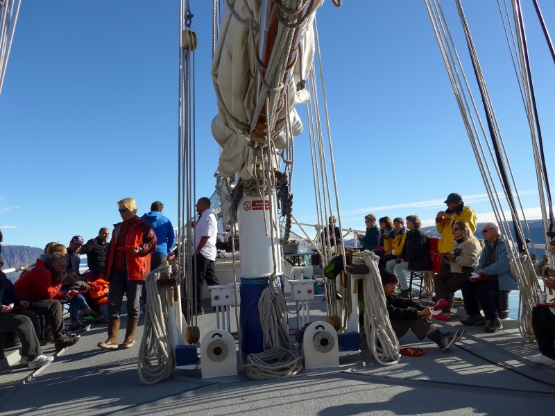
Around midday, we had enough wind from the northwest to set some canvas. Captain decided to set the Inner Jib, Staysail, Schooner and Main Sail in Starboard Tack, and turn off some engines while keeping the speed to about 7 knots. We sailed close to the shore. Most of us stayed on the deck enjoying the sunshine and light breeze while appreciating the picturesque landscape and icebergs of all sizes and shapes.
Sun halo due to Cirrostratus in the afternoon
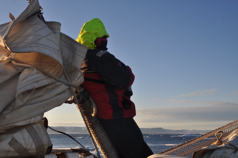
Some of the passengers were interested in climbing the Jibboom to have a good view of the ship and her canvas set. Jordi took some there showing how to do it on a safe way. From there, they saw a full circle around our closest star and a ring of light encircling and extending outward from the sun or moon is called a halo. Such a display is produced when sunlight or moonlight is refracted as it passes through ice crystals. Its presence indicates that ice crystal–type clouds (cirrostratus) are present. The most common type of halo is the 22° halo— a ring of light 22° from the sun or moon. Such a halo forms when tiny suspended column-type ice crystals (with diameters less than 20 micrometers) become randomly oriented as air molecules constantly bump against them.
In the afternoon, the Captain gave a talk on sailing using old-fashioned writing board instead of a power-point. In simple terms, he explained the word’s weather systems and how they affect the evolution of the different riggings depending on the oceanic crossings, prevailing winds and ship’s activities.
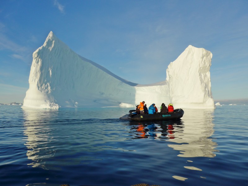
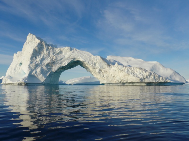
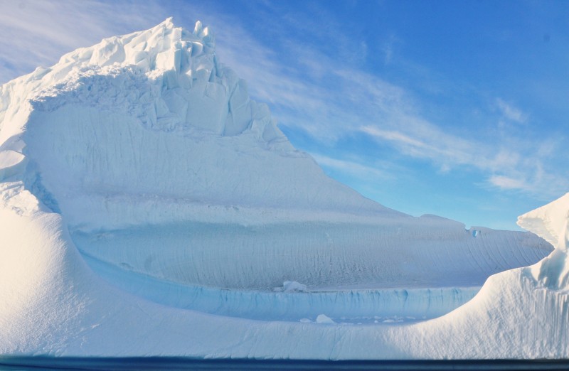
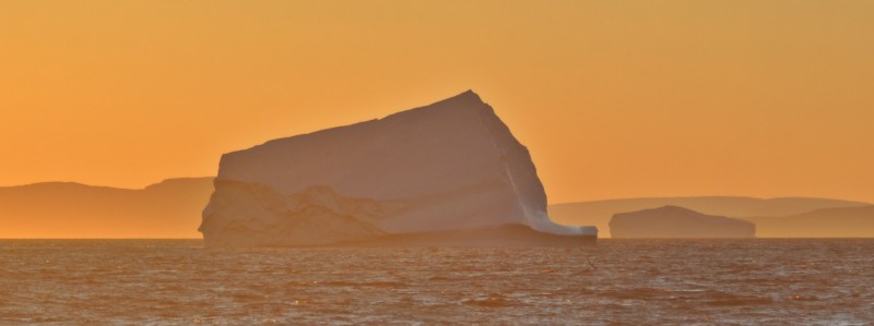
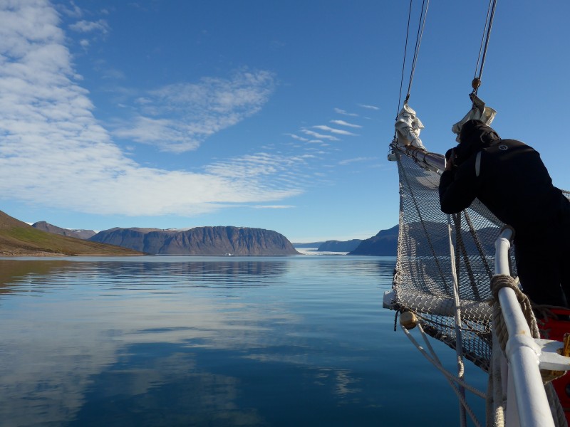
In the late afternoon, we had full sight of Savissivik (or commonly the Metero Island), our first landing in the Thule area. Jordi’ plan was to take us ashore after an early dinner. As thousands of icebergs had been stranded in the Melville Bay, Jordi decided to divide us into two groups: one group would go ashore while the other group would take a zodiac cruise. It worked well!
 |
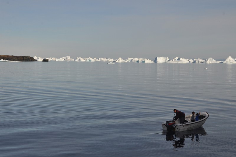 |
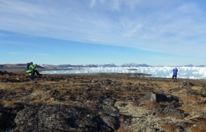
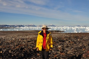
I joined the first group to go ashore with Denis. As a rule, guides have to carry guns in a polar bear area and we had to walk together as a group. The landscape and views of the icebergs were fabulous. We kept silent for half an hour, listening contemplating, becoming saturated of the Arctic.
 |
 |
 |
 |
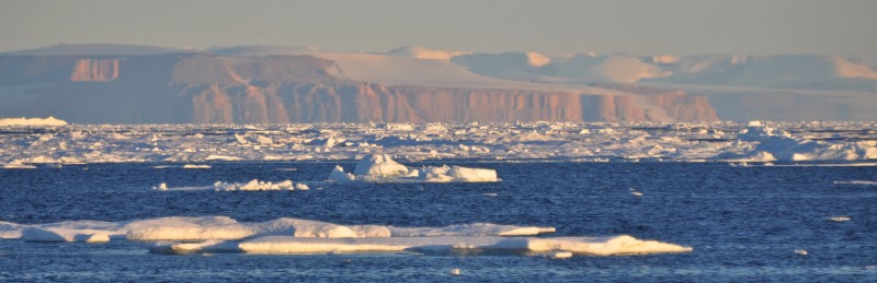
During the zodiac cruise, we got very close to many sculptured icebergs. I must say this iceberg cruise is better than the one at Ilusiaat.
 |
 |
 |
 |
At 10:45pm, I was back on the boat and joined the drinking party in the bar. I had my first Tuborg (a Danish beer) in this trip. Most passengers were in a jubilant mood drinking, laughing and chatting. The sun was like a golden ball hanging above the horizon. The scenery was pretty but I was tired and went to bed at 12:30am.
 |
 |
Day 8 August 14 Friday: Old Thule – Dundas, and sailing North; Noon Position 76º 22.5′ N 069º 42.4′ W; Air Temperature 6º – 8º C; Weather: Clear sky during the day with a short interval of partially cloudy around midday
I did not sleep well and woke up late. At 9:30am we had some light winds from the northwest allowing us to set some sails. It’s exciting to see the Schooner, Main, Inner Jib, Stay sail and Mizzen in position and set on Starboard Tack.
 |
 |
 |
As we had some spare time before arriving in Dundas – the Old Thule in the afternoon, the Captain ordered the engines be turned off allowing proper sailing for 45 minutes at around 3 knots. It’s wonderful without the engine noises. Sadly, all the sails had to be taken at 11:30am when the engines were turned on again before approach Dundas. An enormous military base came into sight when entering the North Star Bay. In 1951, America set up this secret base and sent 12,000 soldiers over. In 1968, an American B-52 bomber carrying nuclear weapons crashed near Thule.
 |
 |
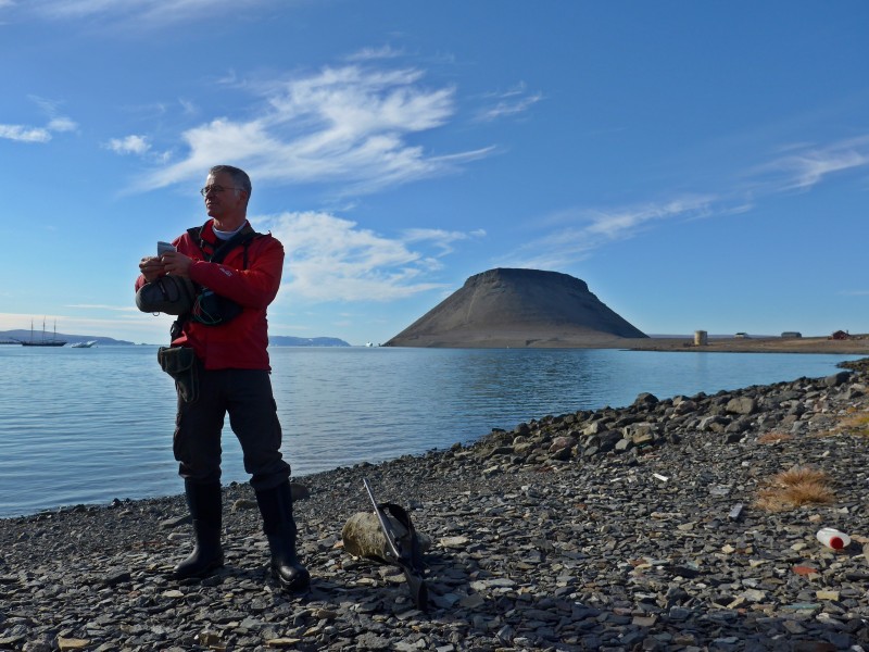
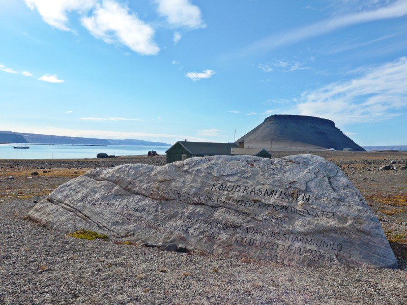
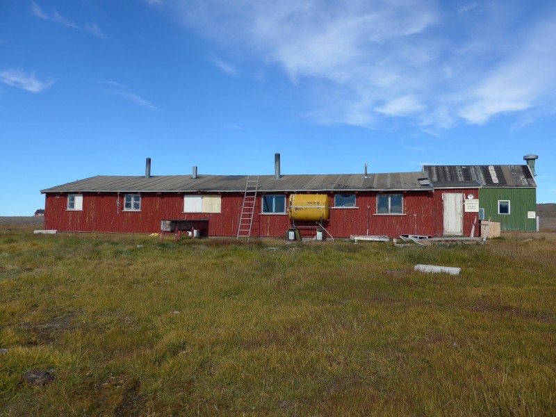
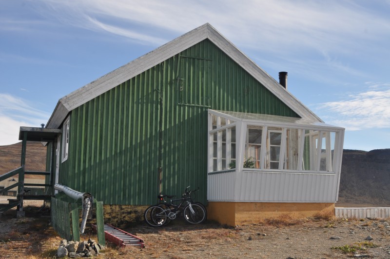
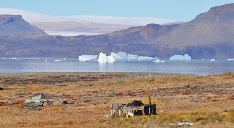
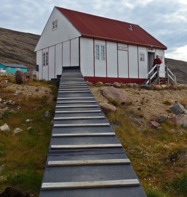
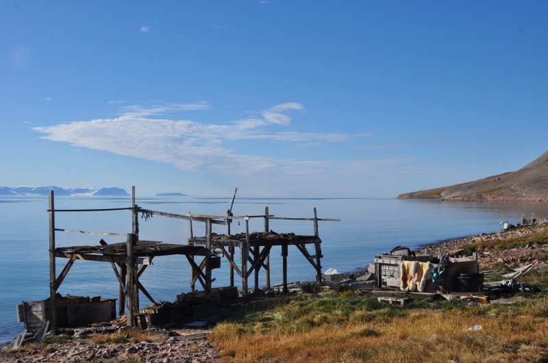
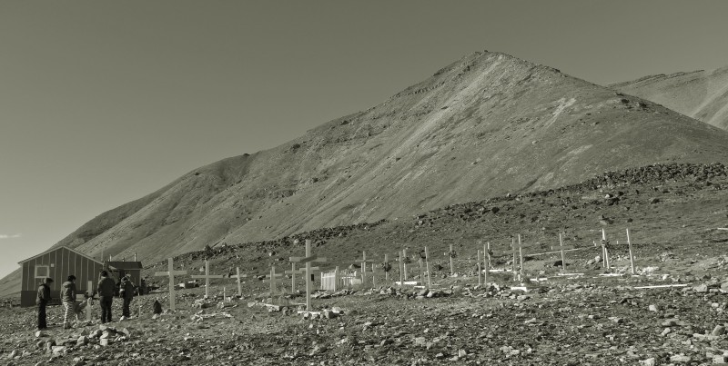
We were eager to go ashore to see old Thule. I was on the last zodiac and landed at 3:30pm in a small cove by the former settlement of Dundas. There are lots to see. The whole group first followed Jordi to see the former trading post built in 1910 by Knud Rasmussen (1879-1933), a national hero of both Inuit and Danish descent. Several building are still in very good state and well maintained, even not inhabited since 1953.
 |
 |
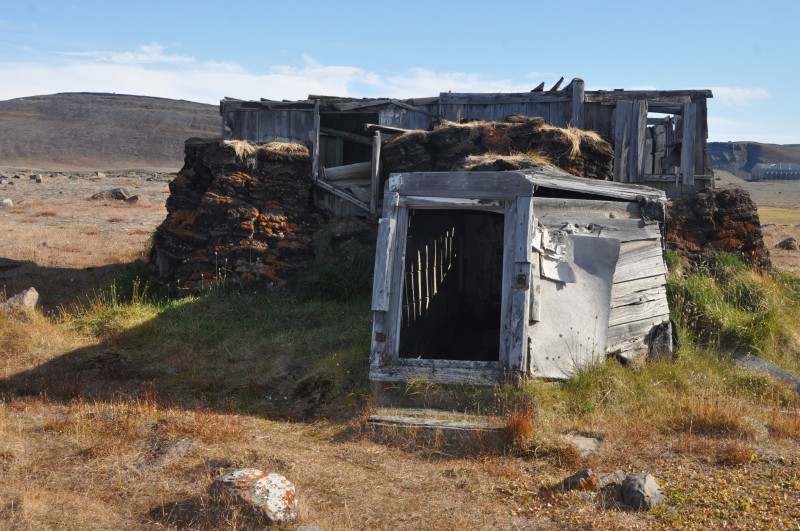
There is a weather station built by the Americans in 1946. It was in use till 1951 when the American built the large airport and military base at the present site. There are two cemeteries.Then we saw at a number of small peat houses from the old times until 20th century. Part of the house was built below ground with a kind of tunnel entrance.
 |
 |
 |
 |
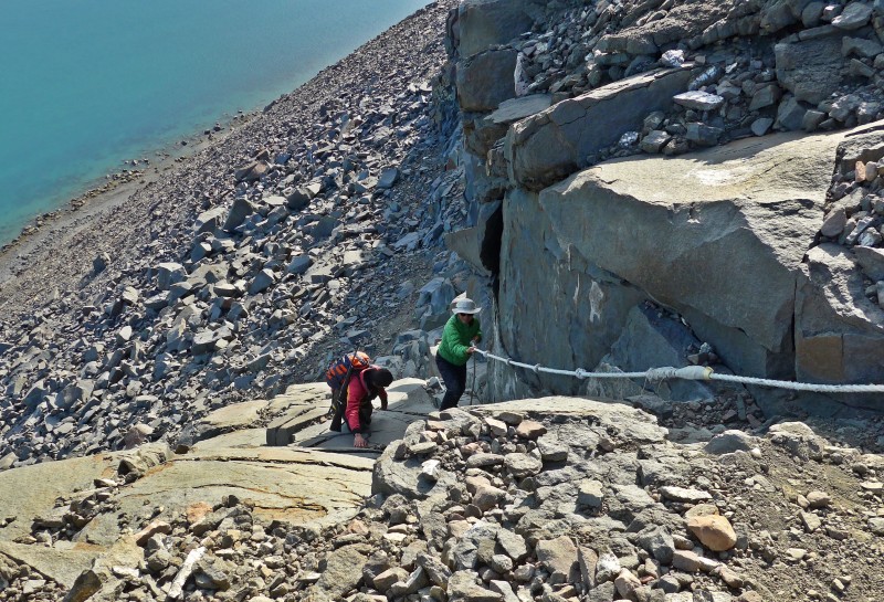
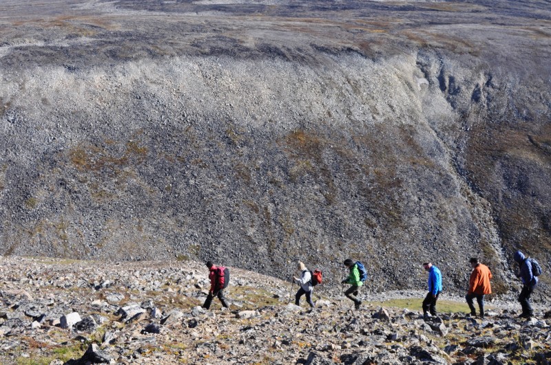
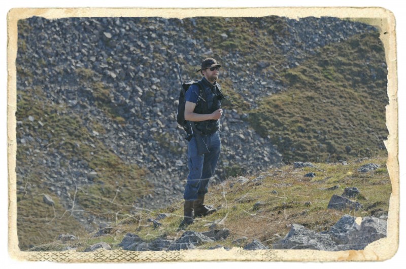
Then we were split into two groups. I joined Jordi’s group to climb Mt. Dundas (600m). The path is very steep: dangerous and slippery with falling stones. The last 50m is reached by a rope for safety reasons. Sixteen of us set off and seven (including me!) made to the top. Captain Sven was already standing at the top with a rifle protecting us from bears! I was exhausted after the climb and was glad that the zodiac picked us up close at the bottom of the hill.
 |
 |
In the meantime Denis’s group walked around the lower part of the hill, exploring all the old Thule settlement, with remains from different ages from the Thule culture, that first started colonising Greenland around this area. I was back in the boat shortly after 7pm. After a good dinner, I went straight to bed and had an excellent sleep.
Day 9 August 15 Saturday: Inglefjeld Bredning fjord – Thule (Qaanaaq) – Morris Jesup Glacier; Noon Position At anchor in Qaanaaq 77º 27.6‘ N 068º 13.9‘W; Air Temperature 5.5º – 9.5º C; Weather: Clear in the early morning, partially cloudy during the day, clearing up when sailing North.
I got up at midnight as I could not sleep. The usual bar-goers had an early night and I had the dining room and bar by myself! It was too cold to stay on deck. I went out to take a quick look from time to time before retiring to the bar for a hot drink. I went back to my cabin at 2:30am but could not sleep till 5am.
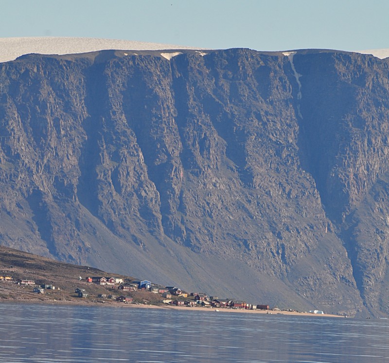
Early in the morning, we arrived in the New Thule settlement, Qaanaaq and were ready to land after breakfast. In the low tide it is difficult to land in the shallow waters surrounding the settlement. We were lucky and landed without problem.
 |
 |
 |
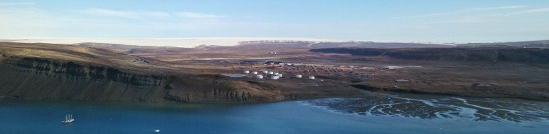
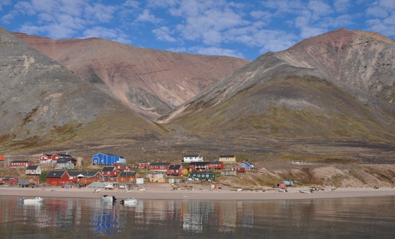
 Qaanaaq with a population of over 600 inhabitants, is the main town in the northern part of the Qaasuitsup municipality in northwestern Greenland and is said to be the northernmost town in the world. But the Qaanaaq area was first settled around 2000 BC by the Paleo-Eskimo migrating from the Canadian Arctic. Today, inhabitants of Pituffk and Dundas, relocated from old Thule to Qaanaaq in 1953, are living in modern housing with an almost industrial appearance. Locals speak Kalaallisut and Danish and many also speak the Inuktun language.
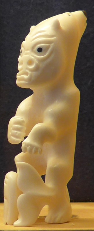
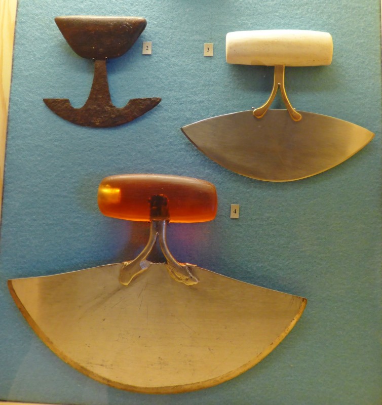
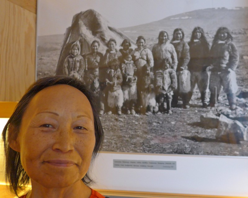
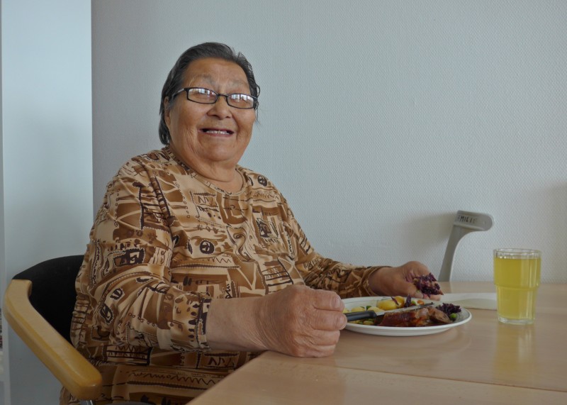
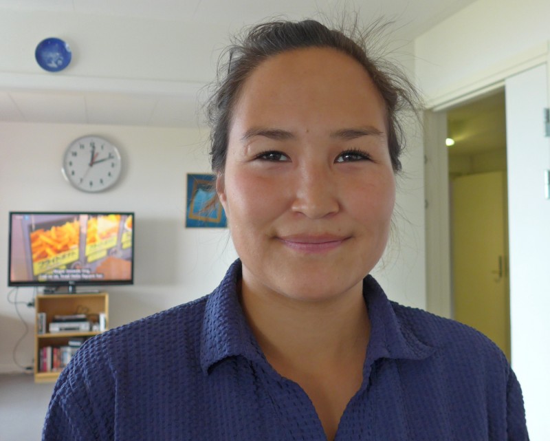
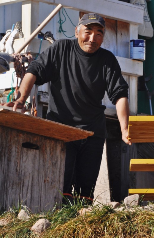
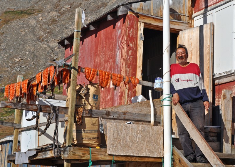
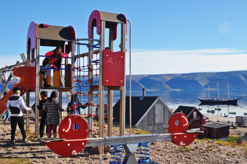
Like all settlements in Greenland it has a post office, museum, medical facilities, schools, church, a home for the elderly, and a large supermarket. I noticed there were many large dinghies with powerful engines used for both hunting trips and ordinary journeys. Some traditional kayaks were lying around too. The settlement stretches for over a kilometre along the beach. First, I visited the museum which is a former trading post in old Thule. There are many artifacts of the Inuits including their tools used for hunting and daily life. A meteroite is on display too. The lady in charge of the museum speaks good English and looks Chinese. She is 68 years old but looks happy and young. She took me around showing me a picture of his father and grandmother.
Next to the museum is a clinic. I went in but no one was around. Then I walked across the road and visited a modern and comfortably home for the elderly. A young lady who speaks English showed me around. There are 24 residents and each has his/her own room with private facilities. They were having lunch with roast lamb, potatoes and green vegetables.
 |
 |
 |
 |
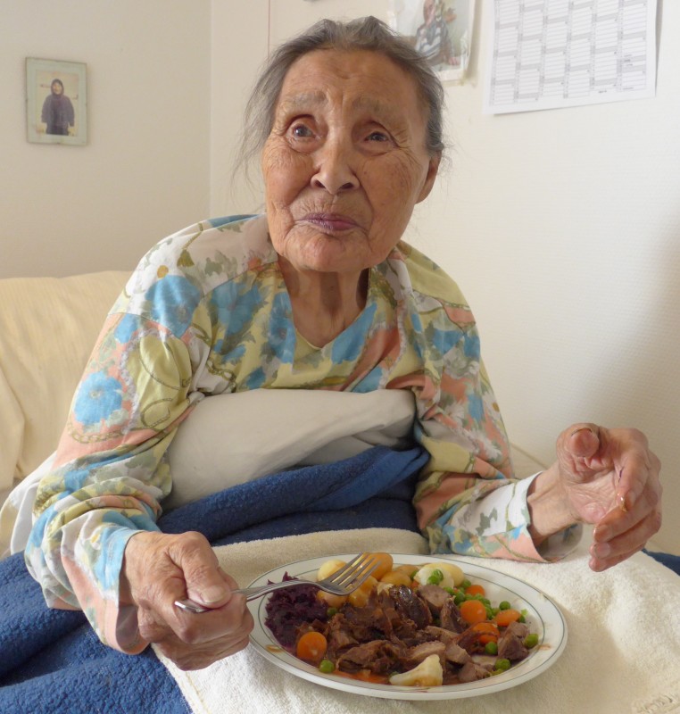
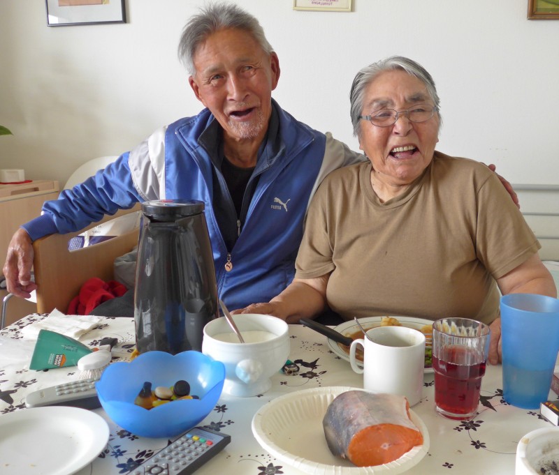
I met the oldest person of the home who was born on February 2, 1925. She looks healthy with good teeth! Then I passed by a room with a couple. I recognised the man who was sitting outside his house opposite the home. Apparently, his wife cannot walk and lives in the home while he joins her at meal time. I saw a large piece of fresh trout/ Arctic char on the table. They invited me to taste the fish. I did and found it delicious!
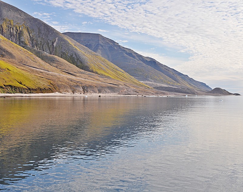
At 12:30pm, I returned to the boat for lunch and had an afternoon nap. The weather was good and I spent most of the afternoon on deck. While the Antarctic scenery is splendid and imposing, the Greenlandic scenery with low table-top mountains and smaller glaciers reaching the sea or hanging high up in the valley looks tame and cute. Without wind, I was able to stay on deck with my light green down jacket.
 |
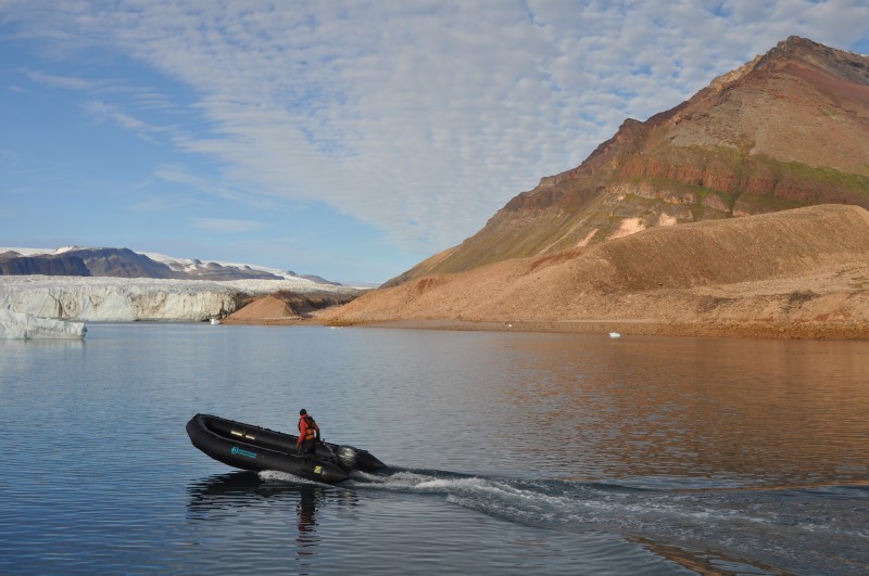
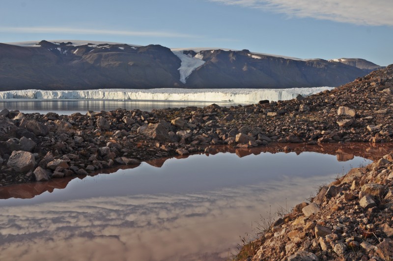
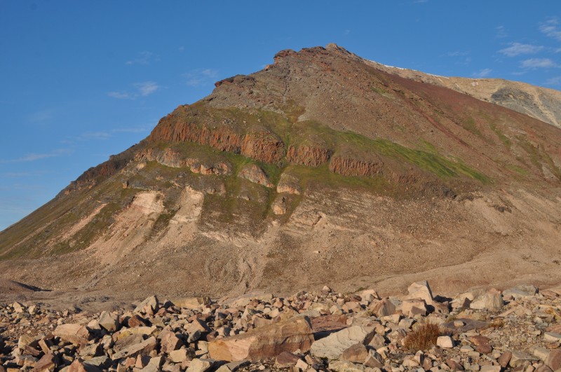
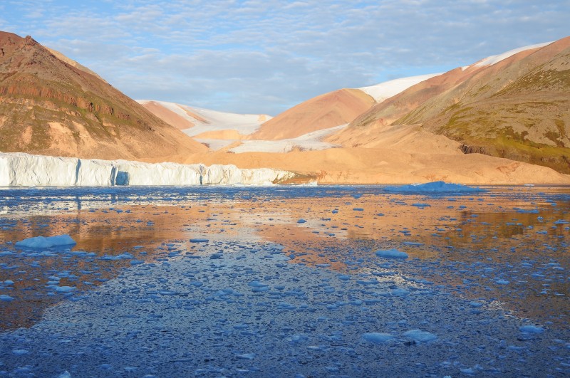
Given the nice weather, the Captain and Jordi decided to explore further north. They were busy revising and checking maps, nautical charts, satellite images and ice charts with a view to searching a perfect candidate for a great landscape and huge glacier front calving in the sea from the Greenlandic Ice Cap. They managed to take Rembrandt safely to an uncharted fjord and reach the impressive Morris Jesup glacier.
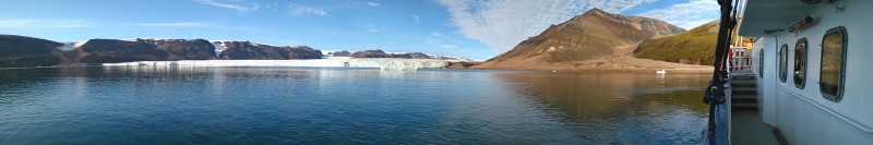
After dinner, we disembarked and were again divided into two groups. I joined the hiking group led by Jordi and we walked up to a lateral moraine for a view from above while Denis took another group walking along the beach for a close-up view in front of the glacier. The slope was steep at some places- but not as bad as the climb to Mt Dundas the day before. The mountain slopes are colourful- red, brown, golden, copper green etc. Birds were hovering above us making loud noises – quak, quak, quak. Their guano has fertilised the soil and there are lovely green patches on some of the slopes.

 |
 |
 |
 |
 |
 |
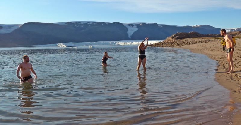
The glacier looks eerier and fearful: powerful uproars and splashes from avalanche pierced through the sound of silence. We also saw a lateral subsidiary glacier that in the old times was joined with the huge Morris Jesup glacier.
 |
 |
 |
 |
 |
At 10pm, the sun was still shining and high on the sky. I was so hot that I had to remove my down jacket and parker. Some young people took the chance for a polar swim!
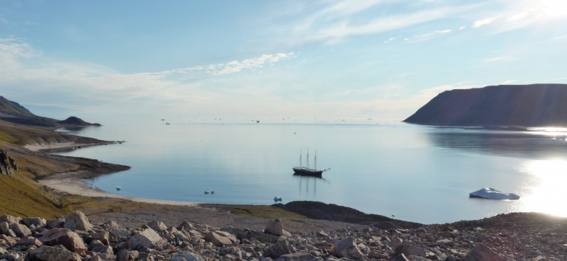
We were back on the boat before 11pm and had a ship cruise along the glacier front. The golden sun rays lift up our spirit. We were now almost 78 degree latitude north and had clear views of Ellesmere Island on the Canadian coast. We jokingly asked the Captain to take us to Canada! When I left the bar to return to my cabin after midnight, I noticed our boat was still heading north. I asked the Captain whether he was taking us to Canada!
 |
 |
 |
 |
Day 10 August 16 Sunday: Pack ice (Smith Sound) – Northernmost position 78º 05‘ –Heading South – Siorapaluk; Noon Position 77º 44.1‘ N 071º 415.1‘ W; At anchor Siorapaluk; Air Temperature: 3.8º – 10ºC Weather: Variable in the morning and partially overcast in the afternoon but improving quickly to sunny weather again
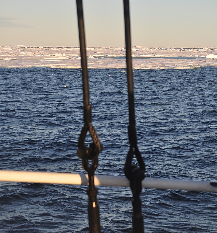
I was waken by 5:15am by Jordi’s exciting voice telling us to come on deck as our boat was surrounded by pack ice. I immediately put on my leather pants, thick woolen socks, gloves and shoes and rushed to the deck. The sun was shining and I could see the low-lying mountain range on the left side of the strait is Ellesmere Island while the one on the right is Greenland.
 |
 |
 |
 |
 |
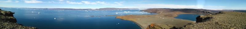
Ellesmere Island behind pack ice
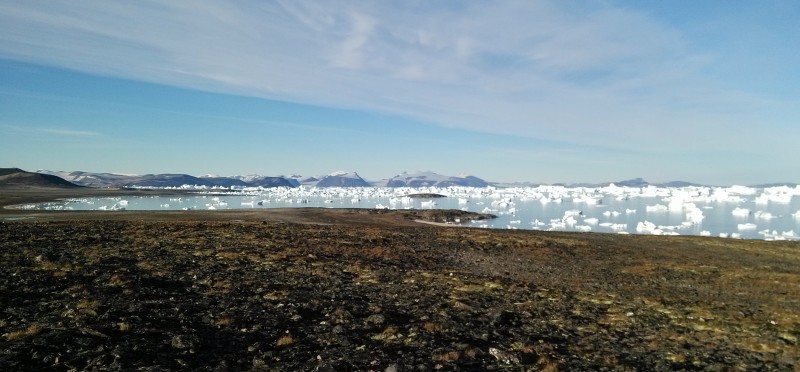
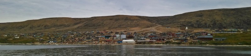
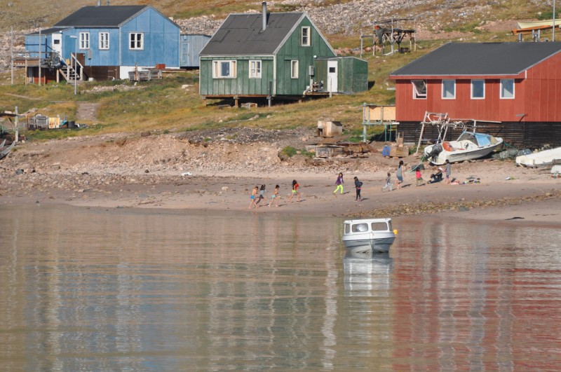
Jordi and the Captain had worked hard to give us a big surprise! After checking satellite images, they realised the pack ice drifting for the North Pole would be in the area. They also hoped to find wildlife such as narwhal, whale and seal in the pack ice. I had seen plenty of beautiful pack ice on my journey to North Pole last year and the Antarctica a few months ago. Anyway, I fully appreciate their efforts and initiatives. What a nice surprise!I can imagine the path the Inuit had taken when making their way to the north-western part of Greenland some 4,500 years ago!I went back to sleep and got up late for breakfast. We had a most beautiful and warm morning with a calm sea (virtually no wind). I was on deck enjoying the gentle breeze, sun and landscape.Around noon, the boat anchored just off Siorapaluk, the northernmost settlement with some 30-40 inhabitants. I could see more than a dozen children running and playing on the beach. Two young boy took off their clothes and got into the water!
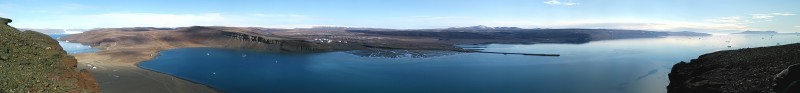
 Sirorapaluk – Greenland’s northernmost settlement |
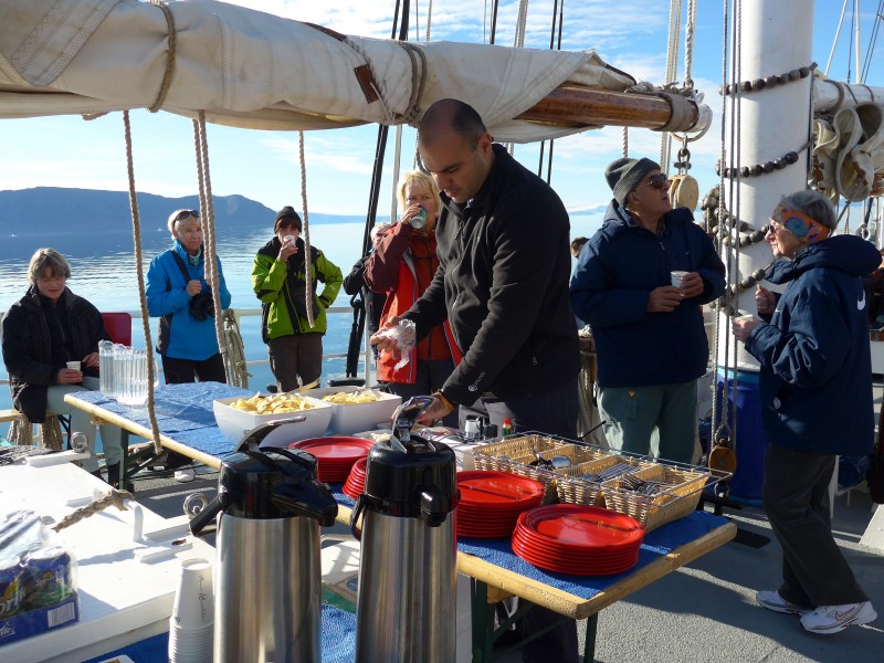 DJ arranging a lunch on deck |
 |
 |
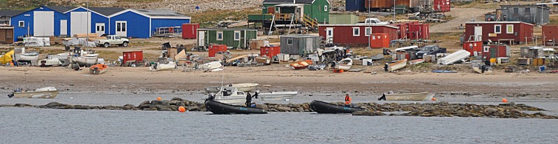
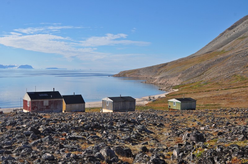
Khabir, DJ and the crew had prepared a special lunch with hot dog, chicken skewer, chips on deck. After lunch, we went ashore for two hours. The settlement is fairly small spreading over a 500m-long stretch of land behind the beach.
 |
 |
 |
 |
 |
 |
 |
 |
 |
I walked from one end of the settlement to the other end beginning to feel the isolation, harsh environment and subsistence living of the people. Most of the houses are not modern: they are smaller and older than the ones I have seen so far. Many appear to be in need of care as the paint is coming off, stuff are lying outside. I saw greasy blubbers, skin, seal head and bones still lying on some of the rack near the houses or on the beach. Smells of blubbers, fish and dead animals filled the air. The local inhabitants litter and the place is not too clean tidy. Nonetheless, I find the children looking healthy and jolly: this is most important. As it was Sunday, I saw a few large dinghies with powerful engines shooting off probably for fishing.
 |
 |
 |
 |
 |
 |
 |
We all spent sometime in the ‘White House’ talking with a Japanese man who has spent 40 years here. Born in Tokyo, he prefers to live as a hunter and fisherman in one of the last places on earth with his Inuit wife. The place is a paradise with stress. He told us about wildlife here: a pod of narwhals was seen in the fjord the week before. There are plenty of fin whales, seals and fish. He could catch 200 fishes from net a night and he loves beluga. He finds this place a paradise without stress.
At the far end of the settlement is the cemetery with some 30 graves each with a white cross. Some have plastic flowers and a simple plague while many have no names. A family was laying flowers on a new grave and a young lady was still crying in mourning. Who had passed away? I did not want to disturb the bereaved family and walked quietly away. Nearby I saw a family partying outside their house celebrating the baptism of a child born here. A trip in West Greenland is not truly complete until one comes to and experience a traditional isolated and small settlement like Siorapaluk.
Our next destination would be the Maniserqat Valley. During the night sail, we had no wind at all, flat mirroring seas and sunshine. Denis was on whale-watch out on deck and suddenly he spotted two narwhals at the distance! Of course, I had missed this rare chance. Well, I had an excellent sleep instead! As the sun goes down in a never ending sunset, the cliffs, mountains, glaciers and icebergs are embedded in a wonderful warm light.
Day 11 August 17 Monday: Maniserqat Valley – Pitugffik Glacier – heading south; Noon position 76º 18.1′ N 069º 50.7′ W; Weather: Clear and sunny almost all day, becoming a bit foggy and low clouds in the late afternoon-evening, together with a wind increase
I got up fresh and energetic after a 7-hour sleep. The weather was fantastic: sunny, nice and warm without too much wind. The place to explore right after lunch was an area north of Cape York, where Jordi had some exclusive information about a couple of little valleys with “interesting wildlife” potential. Talea gave an interesting lecture on sea ice and snow coverage on it, and how its variations can affect the charismatic Arctic wildlife. Global warming is threatening the ecosystem in particular this fragile corner of the world.
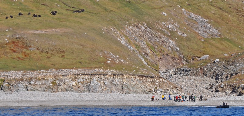
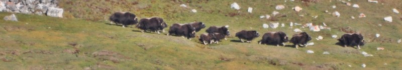
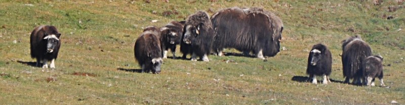
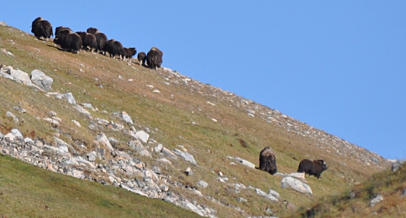
By 11am, we came into full view of the Maniserqat Valley and I saw some 20 muskoxen including several calves grazing on green grassy slopes (14 on the NW shores and 6 on the SE side of the valley). Instead of dropping anchor the crew winched it down slowly not to scare the animals away. We succeeded!
 |
 |
It’s the first time I see this funny looking creature with big horns and eyes, four short and white sticky legs and long hairs almost touching the ground. I gazed at them through binoculars for an hour. Musk oxen are large heavily built goat-antelopes, native to the tundra of North America and Greenland. Main population here inhabits Northeast Greenland, and it has been introduced in several spots in West Greenland, but much further South of Thule. Jordi thought this group is originally from the big NE Greenland population, extending their range through the North, and now spreading a bit further South in Thule area, or even coming from Ellesmere Island.
Everyone got excited, finished lunch within half an hour and got ready for a landing by 1pm. The animals began to notice our arrival after two zodiacs had landed on the beach. They started to run away: I saw them racing on the slope while waiting for the zodiac from the boat.
 |
 |
 |
 |
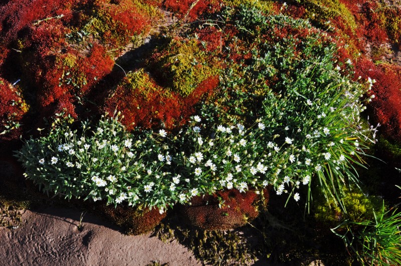
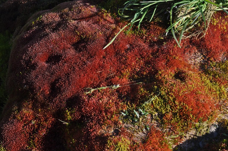
The sides of the river valley are all covered by vegetation very close to the sea: this area has been heavily fertilised by the huge Little auk colony that use the rocky scree slopes for nesting during their breeding season. The birds are now sea beginning their migration South.
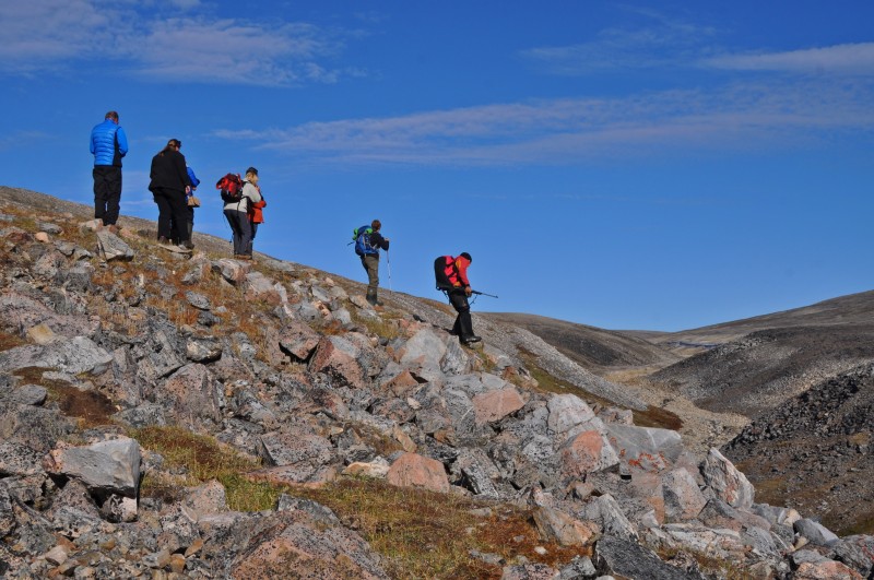
Once ashore, we all followed Jordi who held a gun in his hand. Denis stayed at the back. Even the Captain joined us with a gun in hand. Christian and Talea had a difficult time to keep baby Nivi quiet.
We followed the footsteps of musk ox into the river valley. Suddenly, Jordi stopped when he spotted a group of musk ox snoozing and grazing in the grass close to the river. Checking the topography and wind direction, he decided to go uphill for a lookout point. We watched them in silence for a short time. After noticing our presence, the animals started moving uphill, always keeping some distance from us.
We also walked further up the slope and found another nice lookout point over the whole river valley and the sea. We watched a dozen of musk ox grazing on the NE slope and a few on the SE side. The NE group moved on and soon disappeared over a ridge.
 |
 |
Anyway, we sat in silence enjoying the magnificent landscape, the sunshine and the sea dotted with icebergs. we started day musk oxen day watching from 11 am to 4pm, saw two dozens, walking along the valley. Sunny and warm day.
By 4pm, we set sail heading South. The large glacier front of Pituffk glacier came into view after sailing for an hour or so. Unfortunately, the boat cruise was spoilt by the weather which was getting cold and clouds and fog started to appear. The wind increased to 15 to 20 knots on southeasterly direction. What a wonderful musk ox day! I went to bed at 8:30pm and got up at 1am. I spent a couple of hours writing the epilogue of my last trip.