Xinjiang China September 1-20, 2025
Xinjiang 新疆 (full name: Xinjiang Uyghur Autonomous Region) with an area of approximately 1.66 million km² and a population of 25.85 million (2020), is China’s largest administrative division, covering about one-sixth of the country’s total landmass. It consists of two main regions geographically separated by the Tianshan Mountains天山: Dzungaria to the north and the Tarim Basin to the south. Its indigenous population is principally Uyghurs 維吾爾族 who are agriculturalists and pastoralists.
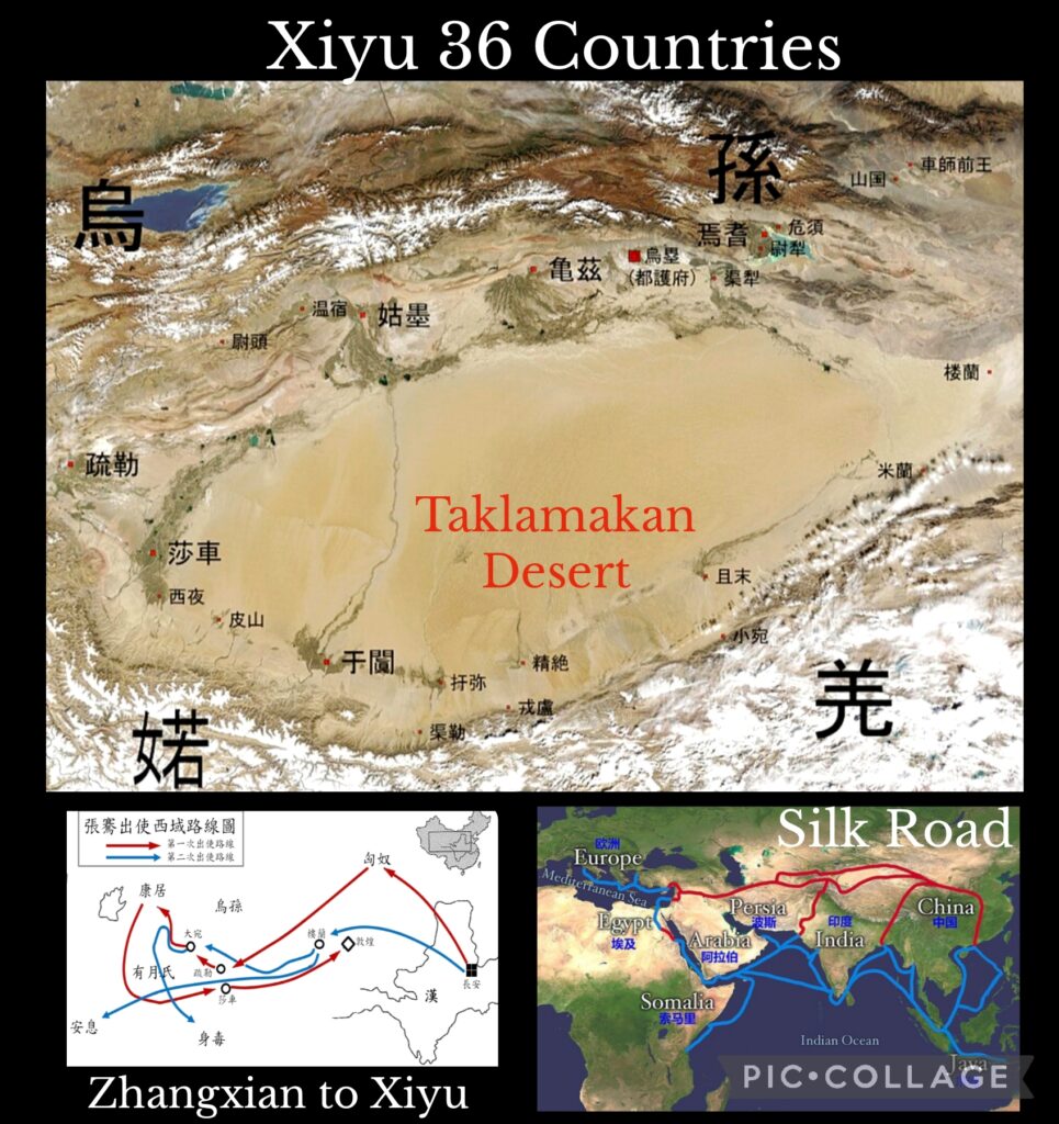
Xiyu 西域 (Western Regions), a historic name specified in Ancient chronicles between the 3rd BCE to 8th CE, refers to the vast land mass west of Yumen Pass (land of the Tarim Basin in present day southern Xinjiang) and Central Asia. During the Han dynasty (206 BCE -220 CE), Emperor Wu 漢武帝established a Protectorate over “Xiyu 36 countries” 西域三十六國 which had risen, fallen and eventually vanished during a millennium.
Xiyu is also an emotive term closely associated with Chinese history and territory. Zhang Qian 張騫 (195 -114 BCE), the first Chinese diplomat, was dispatched by Emperor Wu in 138 BC to make contact and build an alliance with Yuezhi 月氏 (modern Tajikistan) against the Xiongnu 匈奴. He was captured by the Xiongnu twice and did not return to report to Emperor Wu till 125 BC. During his extended stay in Central Asia, he was able to learn and bring back first-hand and invaluable information on countries in Central Asia and beyond including Dayuan (the Ferghana Valley in present day Tajikistan), Daxia (Bactria – present day Afghanistan) and Anxi (Parthia). Zhang Qian played an important role in bringing the vast territory in present day Xinjiang under the rule of the Han dynasty and in facilitating the development of the Silk Road. Also Buddhism was brought to China by merchants and missionaries through the Silk Road. Chinese monks including Faxian 法顯 (337-422 CE) and Xuanzang 玄奘 (602 – 664 CE) had travelled to India through Xiyu.
Our 20-day journey designed by Roger (leader) and Zennon (deputy leader) with six members (Bing, Cynthia, Ellen, Masy, Sam and I) would take us through South Xinjiang passing through the Taklamakan Desert, driving along the north side of the Kunlun Mountains, skirting the Pamir Plateau and transversing Tianshan with stops at archaeological sites of some of the legendary nations, ancient towns and major attractions.
Day 1 Hong Kong – Urumqi烏魯木齊市
I departed Hong Kong with Bing, Cynthia, Ellen and Sam on Cathay Pacific at 1:30 am and had a smooth flight. I watched three films and arrived in Urumqi at 7 am. I was surprised to find an enormous new airport on arrival. I later learned that it has a designed capacity for 90 million passengers a year and had a soft opening since May. We waited a long time for our luggage and were met by our guide Li after 8:30 am. Though the hotel is not too far away, we spent well over an hour because of horrific traffic jam. On arrival, we met our group leader Roger who had led a group of eight to visit North Xinjiang from 20 to 30 August. Since the hotel kindly arranged early checked in for us, we were able to freshen up. I even had a nap before the afternoon trip to Tianshan.
I travelled with friends along the Silk Road in early 1990s. This was my fourth visit to Urumqi: the city has changed remarkably with better infrastructure, numerous high-rise buildings, more modern shopping malls and hotels since my last visit in 2018. At 1:30pm, we set off for Tianshan which is about 150km from Urumqi. Located north and west of the Taklamakan Desert and directly north of Tarim Basin, the mountain range extends eastwards for about 2,900km from Tashkent Uzbekistan to Kazakhstan, Kyrgyzstan and Xinjiang. Its highest peak Jengish Chokusu (Victory Peak) at 7,439m which I saw while in Kyrgyzstan, is shared by Kyrgyzstan and China.
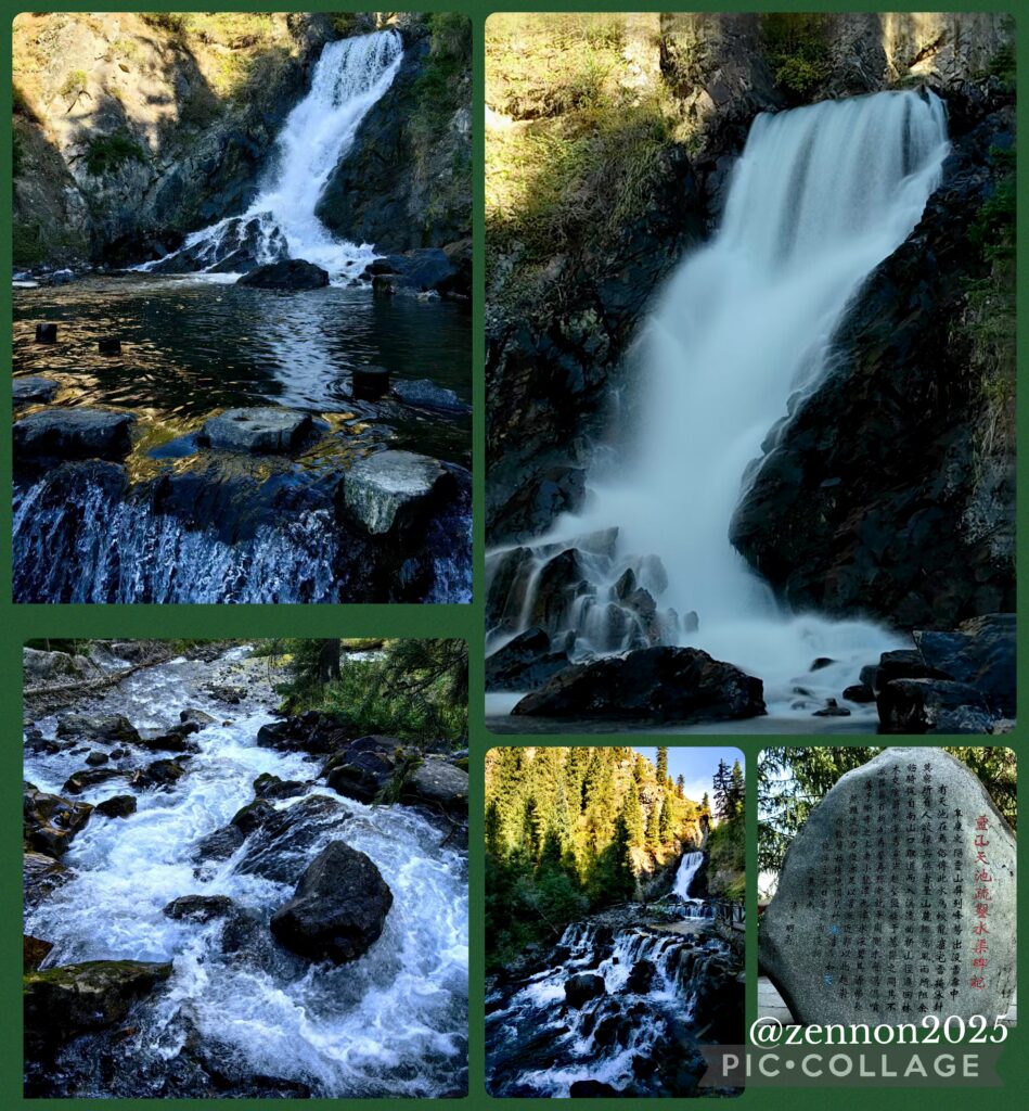
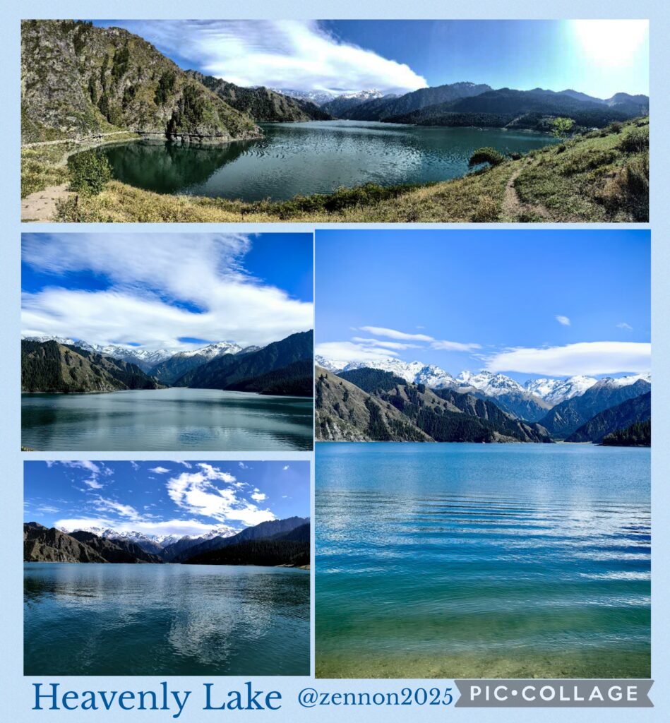
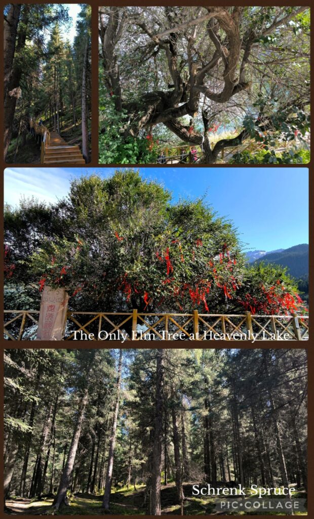
I was glad to meet up with Masy and Jenny whom I met on the Shikoku Pilgrimage in 2012 and 2023 respectively. I also met a monastic whose name I have heard before. Good karma! I visited Tianshan during my first visit to Urumqi when we rode a horse to reach Tianchi 天池 (Heavenly Lake), an alpine lake with an area of 4.9 km² located at 1,907m above sea level. Today, Tianchi is a top attraction with a fleet of buses taking visitors from the visitor centre for a 30-min ride up the mountain. Then we walked for another 10 -15 minutes to reach the lakeside. Li arranged us to take a boat ride followed by an hour’s free time to explore on our own. I walked along the lake and saw the thousand-year old elm tree (the only elm tree in the lake area). I was amazed by the beautiful coniferous forests comprising primarily the Schrenk’s spruce, and the geology of the area. We departed at 6 pm and had a simple dinner next to the hotel.
Day 2 Urumqi
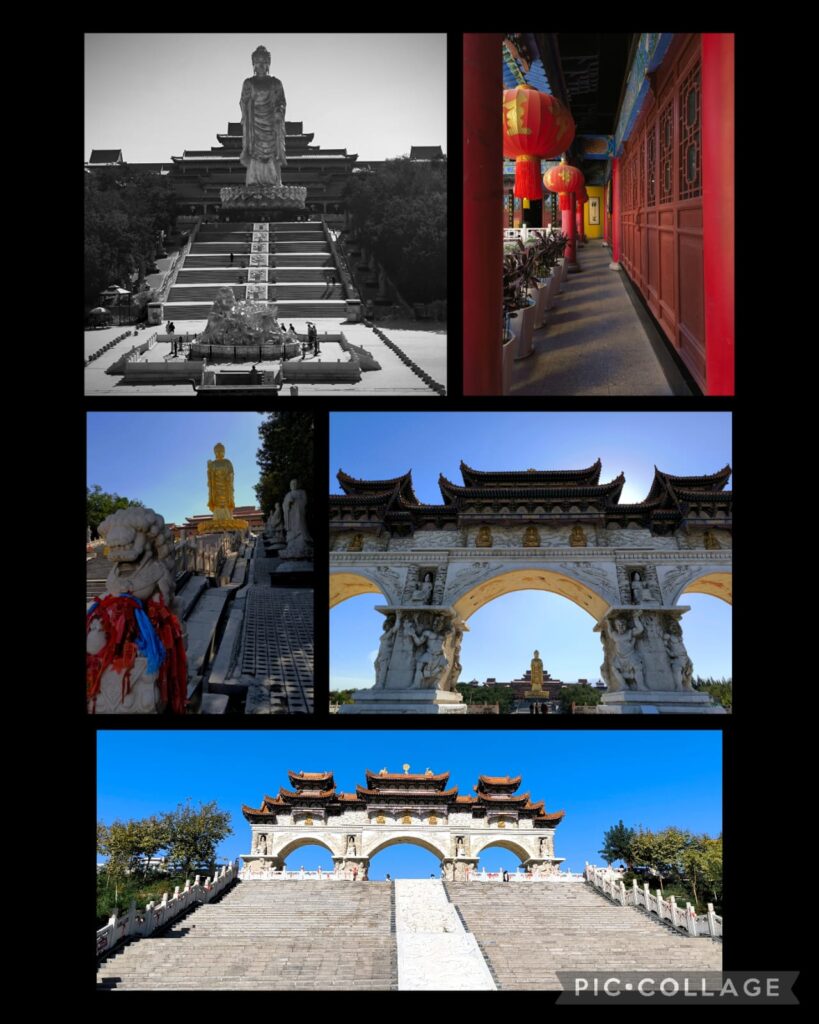
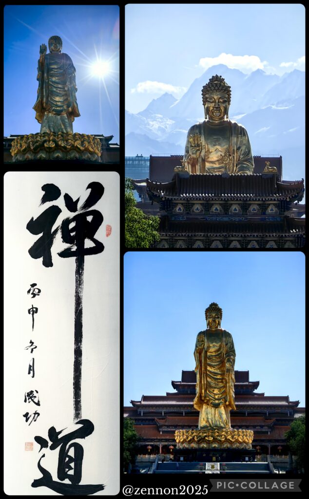
We had a leisure day and visited a temple in the Red Light Hill 紅光山. The temple was constructed during the Qing dynasty but destroyed in 1933. Reconstruction began in 1989, and the temple was completed in 2010. A standing golden Buddha at a height of 40.8m is a landmark. After a tour, we went to an excellent Xinjiang restaurant 吉尔花园生态餐厅 for lunch.
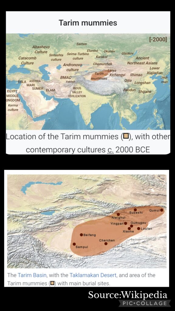
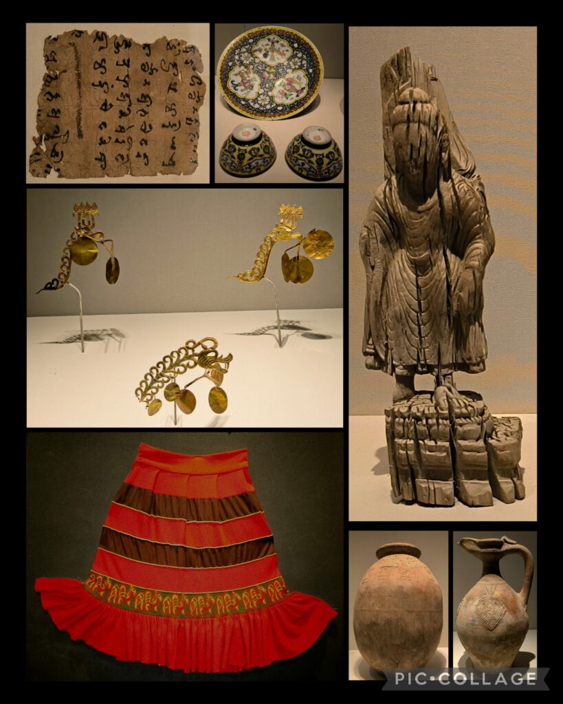
In the afternoon we spent two hours in the enormous Xinjiang Museum that boosts 381 national first-grade cultural relics. We had a guided tour to see the ancient mummies of Xinjiang. I find the illustrations and interactive presentations impressive! But it was too crowded as there was much room for visitors to move around.
These days, I find it tiring to stand and walk in a museum. After the mummies, I only had time to take a glimpse of Hall 7 and 8 that showcase historical relics in Xinjiang. I now have a better idea where the mummies were discovered and the locations of the legendary Xiyu 36 Countries. The exhibits are well-preserved and presented.
We then visited the Grand Bazaar. I bought camel milk power which is supposed to be nutritious (though expensive), several kilos of dried fruits and four cute Labubu!
D3– Urumqi – Korla 庫爾勒 (550km)
This was our first long travel day. We travelled in two 7-seater vehicles, and I was with Ellen, Zennon and Sam. Normally we stopped every two hours so that the driver could take a break and we could go to the toilet. Toilet facility along the highway has improved a lot: as I cannot swat, I have to look for toilet for families and disabled. Most of the time, I had no problem in finding one in large service areas along the highway.
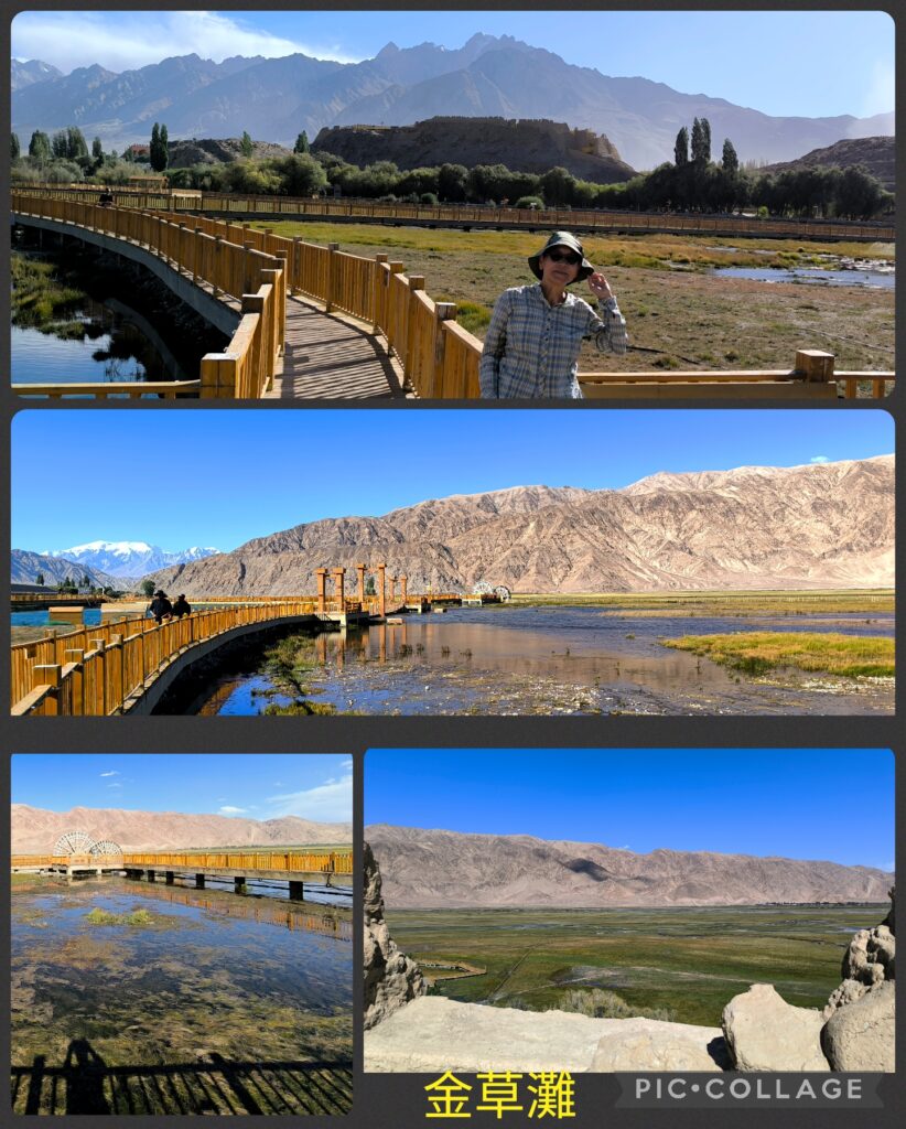
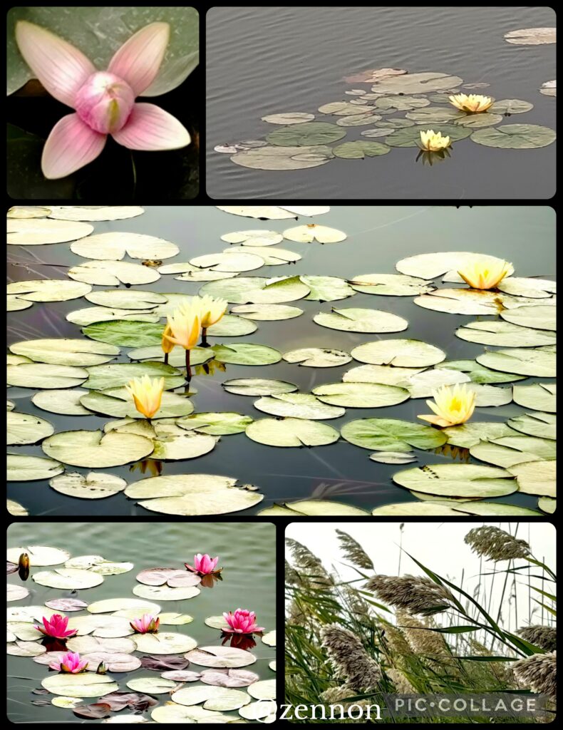
After a late lunch, we drove to Bosten Lake 博斯腾湖. It is China’s largest inland freshwater lake with an area of 1,019km² and an important wetland supporting some 300 species of birds. We saw lots of lotus though the season had gone. We then drove half an hour to another scenic area with weeds. The weather was not good and there were few birds. We did not stop and drove to Korla, the second largest city by population in Xinjiang and is the seat of Bayingolin Mongol Autonomous Prefecture (the largest prefecture of China).
Our hotel was close to the famous Kongque River (Peacock River). Bing, Ellen, Cynthia, Sam and I went out for dinner. Afterwards, we walked to the river and found a small night market with a dozen of food stalls. We could have come here for dinner. It was a pity that we had no time to visit any of the attractions in the area including ruins, mosque, and ancient city. It wound be wonderful to visit the Minlan Ruins 米蘭遺址with the world famous mural painting of winged angel of the 3rd century, eight stupas, three monasteries and ancient city ruins.
D4 Korla – Kuqa 庫車市 (540 km)
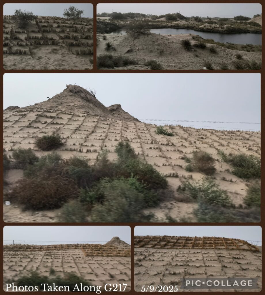
We had a smooth drive and arrived in Kuqa a county-level city in the Aksu Prefecture for lunch. It was the homeland of Kucha (Quici龜茲 ), an important ancient country on the Silk Road and an ancient Buddhist Kingdom where Xuanzang had visited in the 7th century. Though it is one of the historically significant places, it is often overlooked. Kuqu is also the end of the famous Duku Highway 獨庫公路 (G217) running through the Tianshan range with a length 561 km.
After lunch and a rest, we visited Kuqa Palace to learn more about naan (a traditional flatbread). In Xinjiang, naan is not just food, it is a link connecting daily life and cultural heritage. Among the more than 200 types of naans in Xinjiang, Kuqa naan is regarded as the “king” with an average diameter of over half a meter.
I am interested in history and archaeology. When I caught sight of the Kuqa Wei Jin Ancient Tomb Museum on a notice board at the exit of the naan palace, I asked Li to take us to the museum. The Wei Jin dynasties 魏晉朝 ran from 220 to 420 CE . This archaeological site with some 2,000 tombs was discovered in 2007 and the museum was formally opened in July 2024. Our driver Huang found his way to the Kuqa Museum instead. This museum was formally opened in May this year. We paid for a guide for 100 RMB and had a good tour for an hour visiting two exhibition halls. I learned more about Quici, the motherland of Kumarajiva鳩摩羅什 (344 – 413CE), a Buddhist monk, scholar, missionary and one of the four greatest translators of Chinese Buddhism.
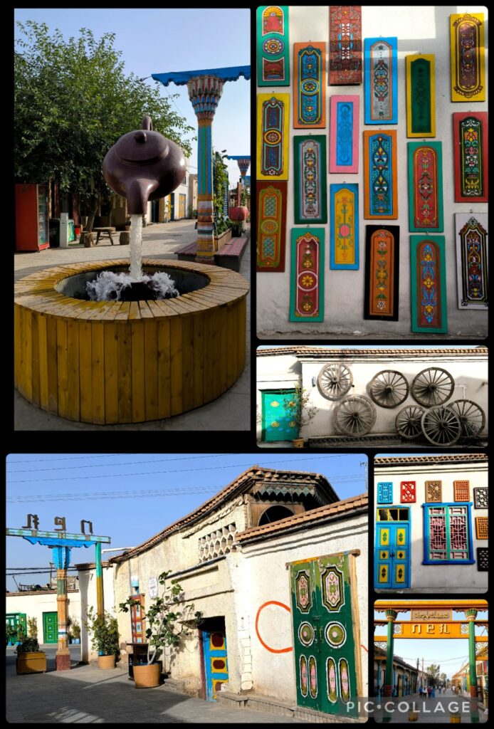
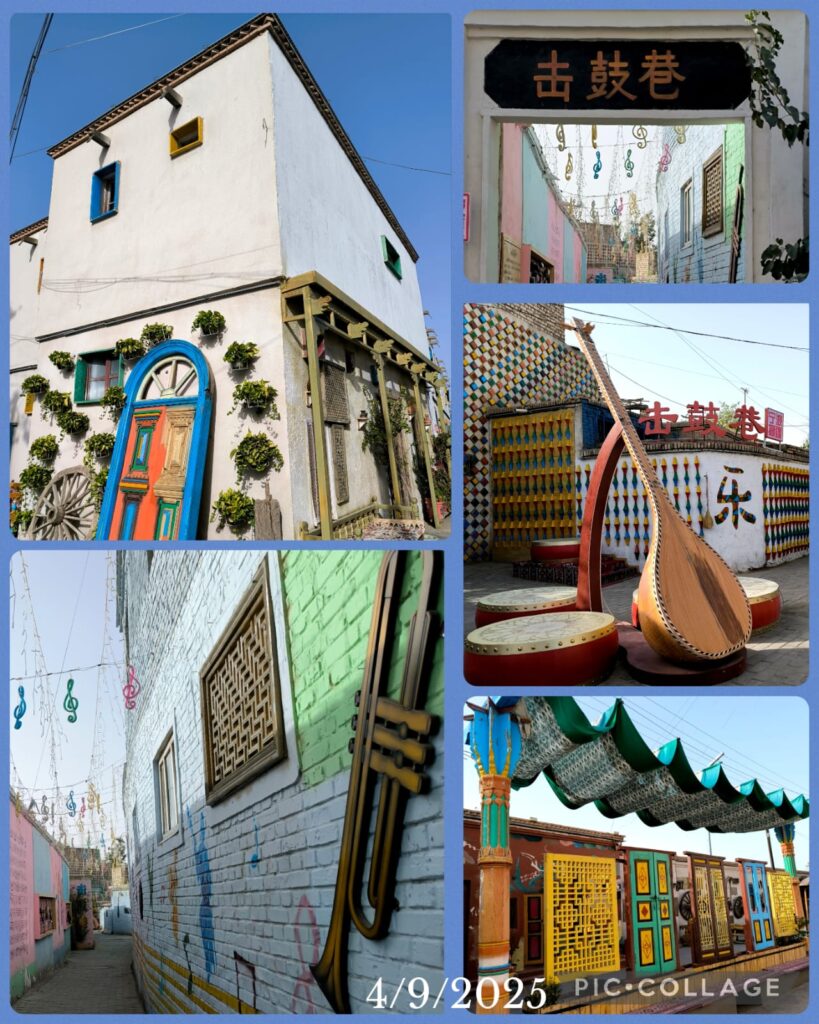
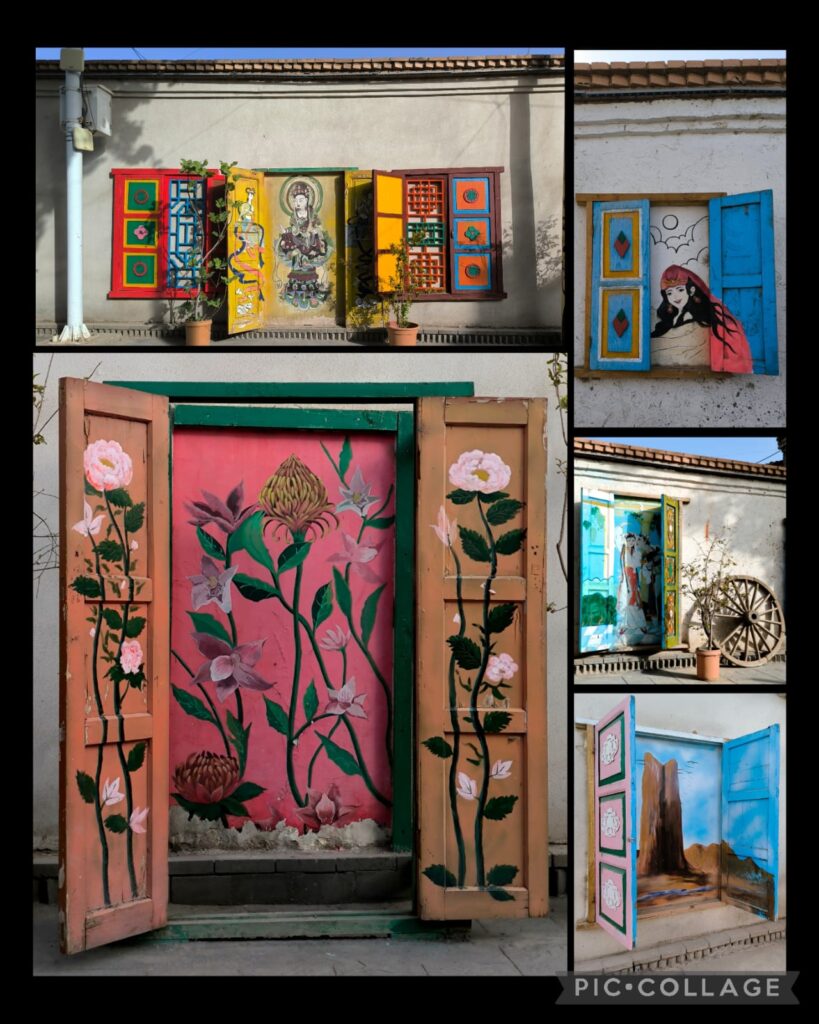
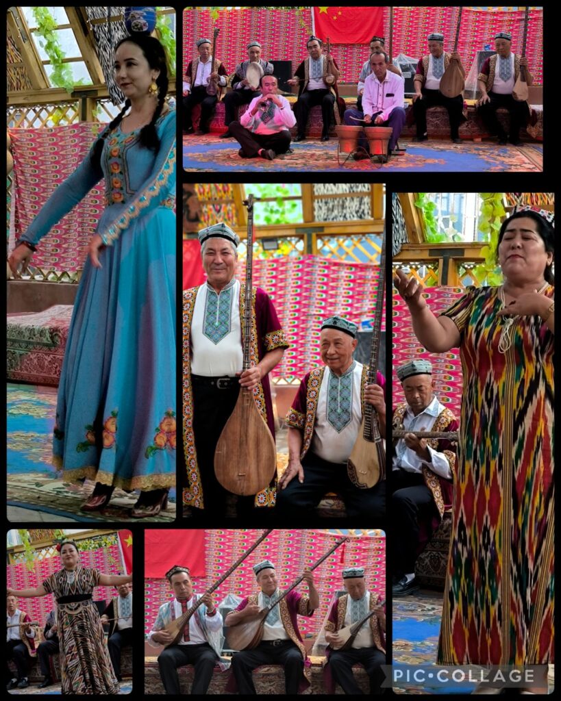
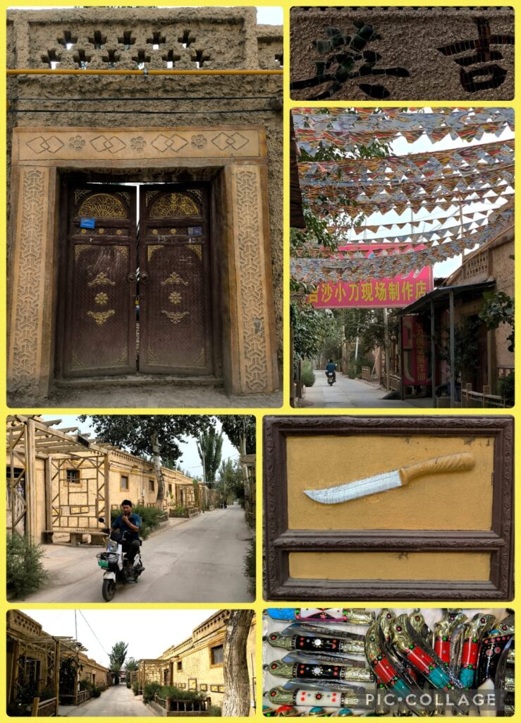
We then spent over an hour in the famous Restan Street filled with local eateries and shops, a mosque, royal palace and many old houses. I did not join the group to go shopping. Instead I strolled aimlessly around the colourful side streets decorated with street art and musical instruments. The old houses with colourful doors and windows are beautiful. I planned to visit the mosque. But it was too far to walk. Instead, I went to an old house where a dozen of elderly artists performed for a small group of tourists. I paid 20 RMB for a cup of tea and set down to enjoy the performance. I find this a wonderful way to soak in the relaxing atmosphere and enjoy the local culture. I met up with the group in the car park at 7:30 pm. Ellen and I found a Cantonese restaurant near the hotel where we shared a hot-pot rice (30RMB for two!).
I left Kuqa feeling a bit lost. I have been been fascinated by Quici as a result of my Buddhist studies and reading about Kumarajiva. But I was not been able to visit the notable cultural and archaeological sites such as the Haradun site, and Subashi Buddhist Temple Relics.
D5 Kuqa – Alar 阿拉爾市 (430km)
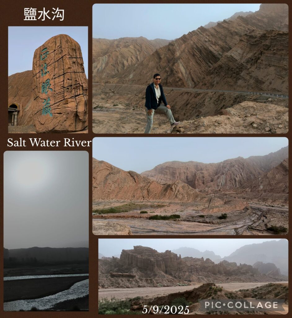
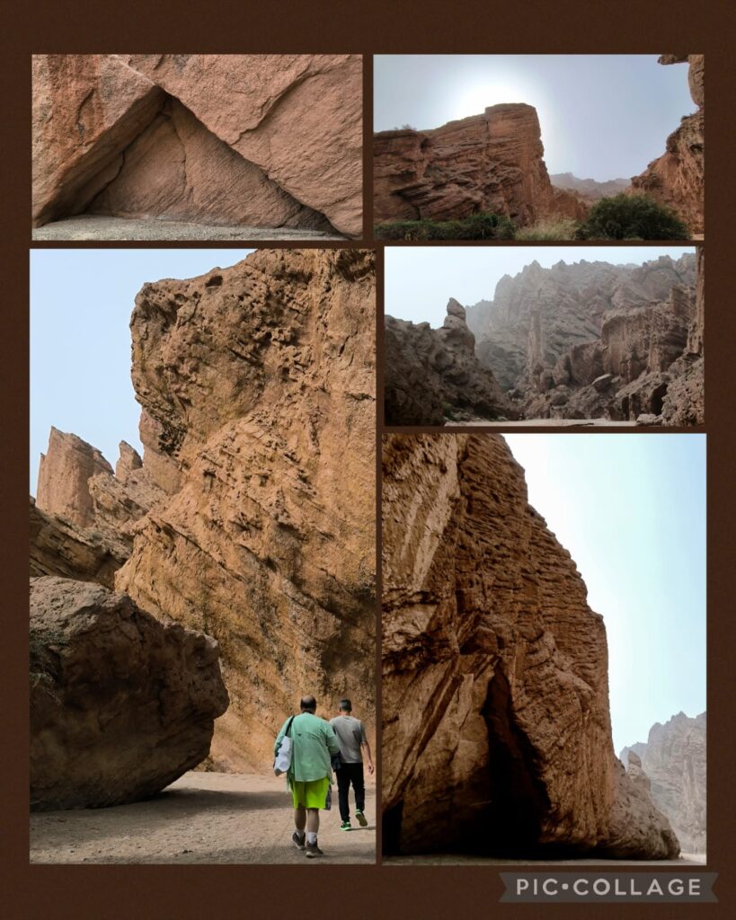
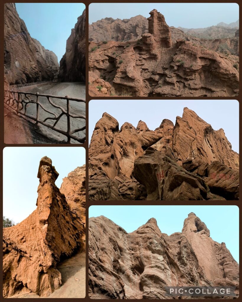
We spent two hours in the Kizilya Scenic Spot located in a salt water river canyon area with unique landscape: distinctive Danxia landform featuring colourful, layered rock formations and dramatic canyon terrain. We had three stops. At the first stop, Li, Roger and I even explored a newly developed path and got lost. At the end of a small canyon, we arrived at an open air temple! At the second stop, we climbed up a sandy slope to reach a flat top named Harry Potter Fortress! We had a nice lunch in a new restaurant nearby where we had delicious steamed fish and fish soup. A nice surprise!
We were back on the road at 3 pm driving 300km to reach Alar. On the way, we began to see the desert populus euphratica 胡楊 which had not turned yellow yet. We reached the hotel after 8 pm.
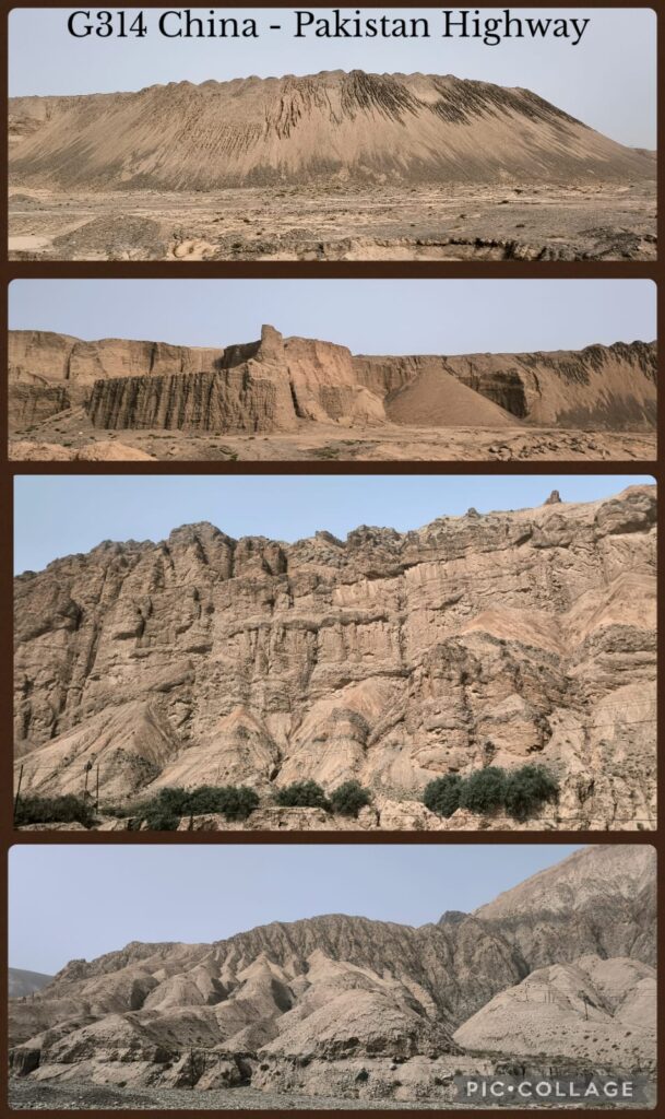
D6 Alar – Hotian 和田 (450km) The Taklamakan Desert Road
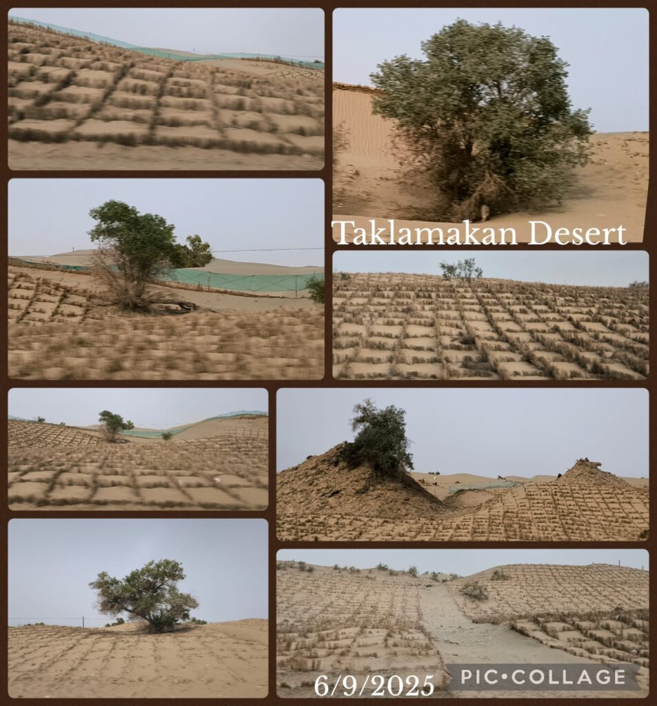
Alar marks the beginning of the desert road through the Taklamakan Desert to Hotian. Today, we set off at 9 am with a couple of toilet stops on the way. I watched the desert with fascination. Through China’s determination and successful efforts to fight desertification since 1978, the Taklamakan Desert, the world’s second largest shifting sand desert with an area of 330,000 km², has been tamed with grasses, shrubs and trees. Crops, cotton and sunflowers are grown wherever possible.
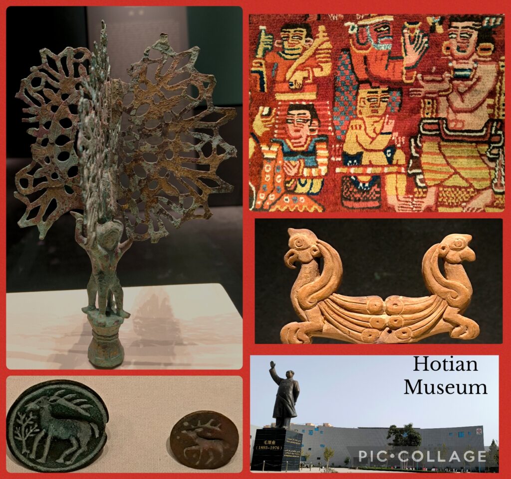
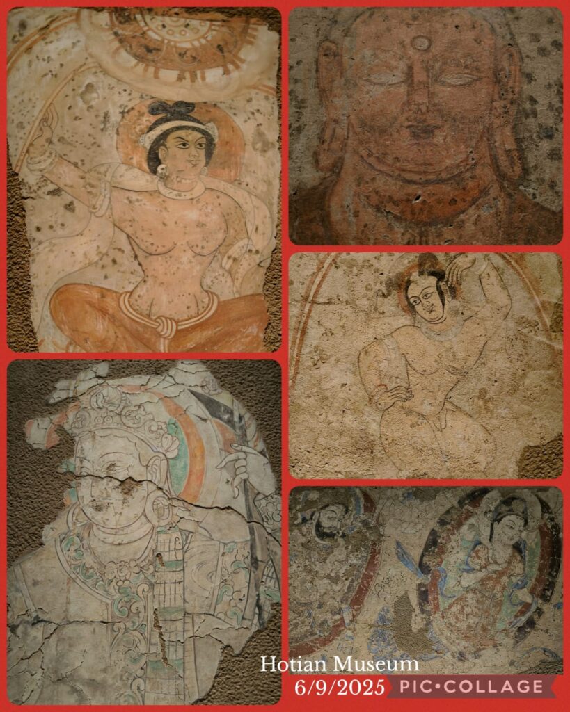
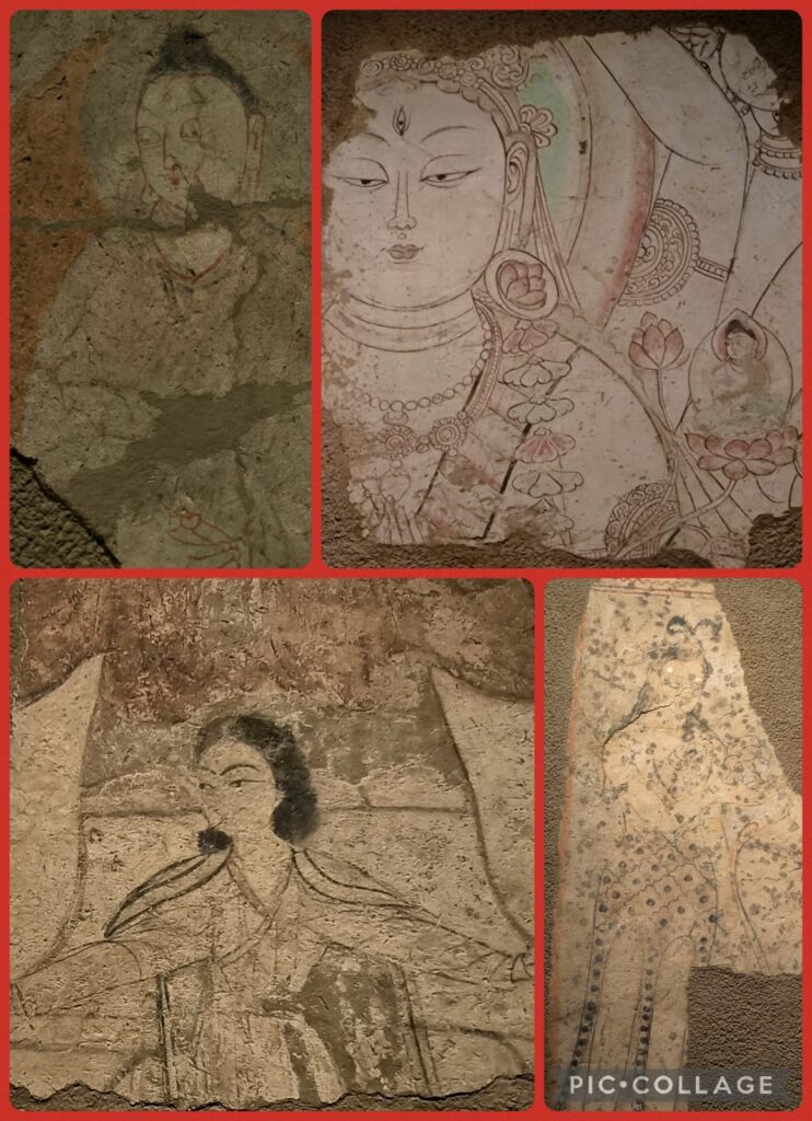
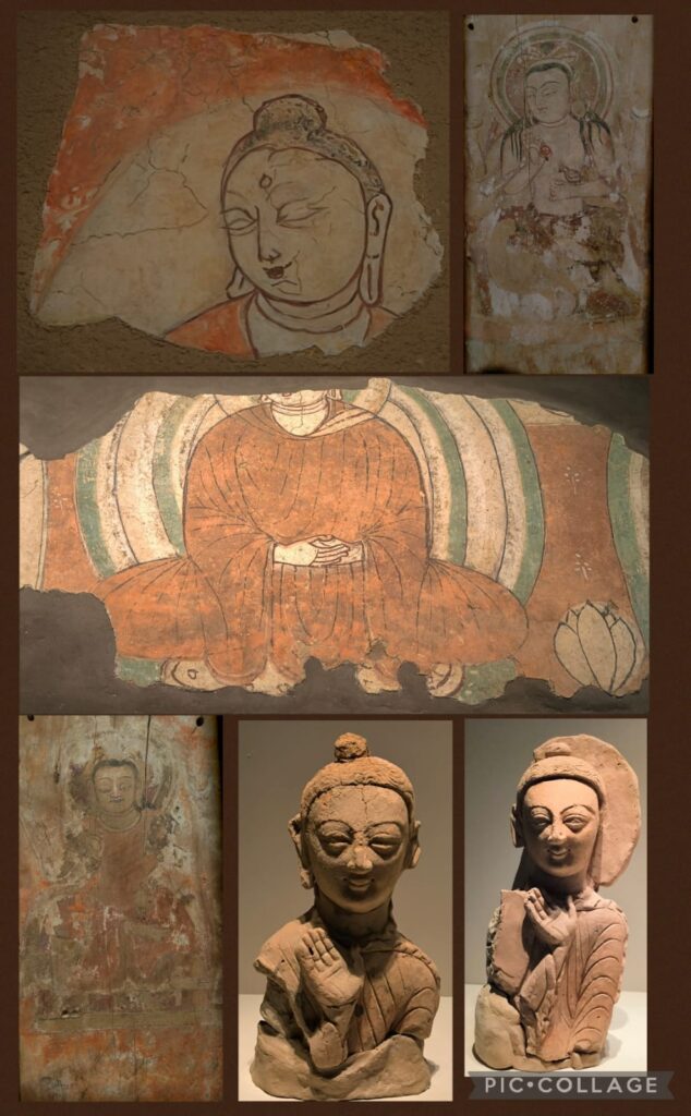
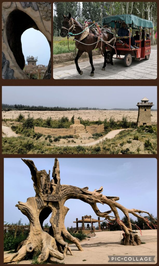
Hotian was the centre of the ancient Iranian Saka Buddhist Kingdom of Khotan 于闐 (56-1006CE). It has been famous for its jade, silk and carpets. We checked in the Mecure Hotel before 4pm. As we had no programme till 7:45pm, I decided to visit the Hotian Museum. Bing, Ellen, Cynthia and Sam went with me but left after an hour. I spent almost two hours at this relatively small museum where I found some interesting mural paintings and exhibits displaying Gandhara, Persian, and Central Asia influences. I took a taxi back to the hotel (8 RMB).
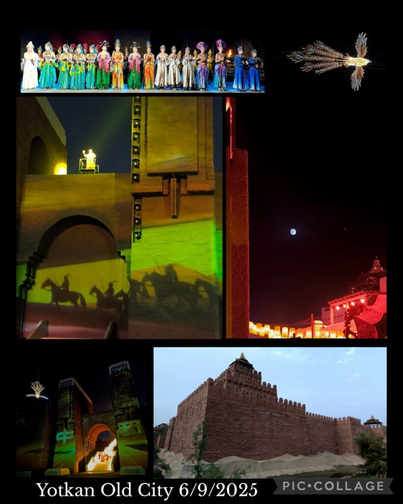
At 7:45 pm, Li took us to the Yotkan 約特干Old City built on the site of ruins about 11 km west of Hotian. The buildings were modeled on descriptions of the palace, architectures of the palace, streets and city walls of the Khotan Kingdom. Li said 500 millions RMB were spent in constructing this attraction. There is a daily show from 9:30 to 11 pm that showcases the history of Khotan with reference to its royal family, Zhang Qian and Ban Chao 班迢 (32-102 CE) both were closely associated with the expansion of the Han Dynasty territory to Xiyu and eventual development of the so-called “Silk Road”. Tourists would follow the performers walking through the entire site. Unfortunately with my hip problem, I can’t walk for hours. Instead, I found a comfortable place, sat down and watched a full blue moon rising. Cool! Sam was tired and joined me. We watched the finale in front of where we sat before joining others to return to the hotel. The show actually finished at 11:15pm and we were back to hotel around midnight! Once again, it is a pity I had no chance to visit some famous Buddhist temple ruins including the Andir Ancient City, Niya, Balawaste, and Rawak.
D7 Hotian – Kashi 喀什 (250km)
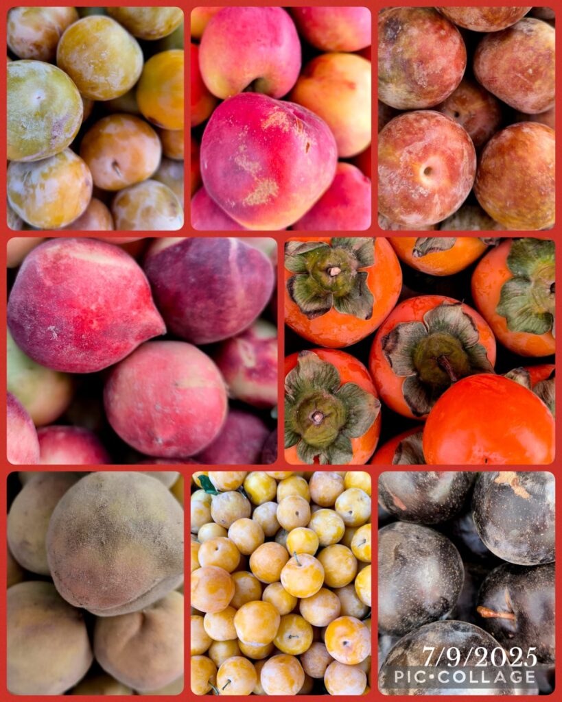
Fresh Fruits at Toilet Stops 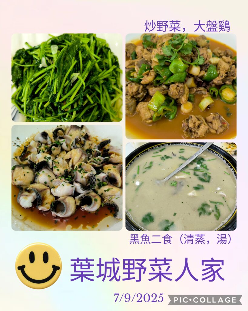
Highlight of the Day: A Delicious Lunch
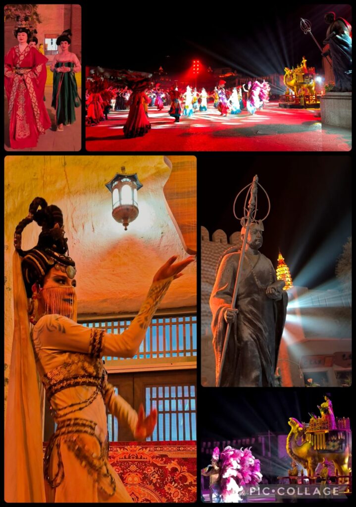
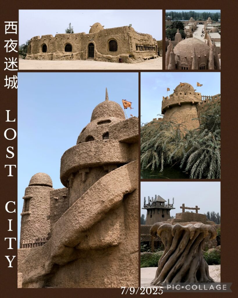
We departed at 9 am and had lunch before heading to the Xiyu Lost City 西域迷城 at Ye Cheng 葉城. It is a new tourist attraction built next to an expansive archaeological site. We took a horse ride and spent an hour and a half looking at rustic mud houses, a palace and city walls. I climbed up the walls and saw a desolate desert with expansive ruins close by. I think the archaeologists are still trying to unearth the secrets below. I like this place much more than the tourist Disney-like Yotkan Old City. It was so hot that I did not attempt to walk along a trail with the names of the legendary Xiyu 36 Countries.
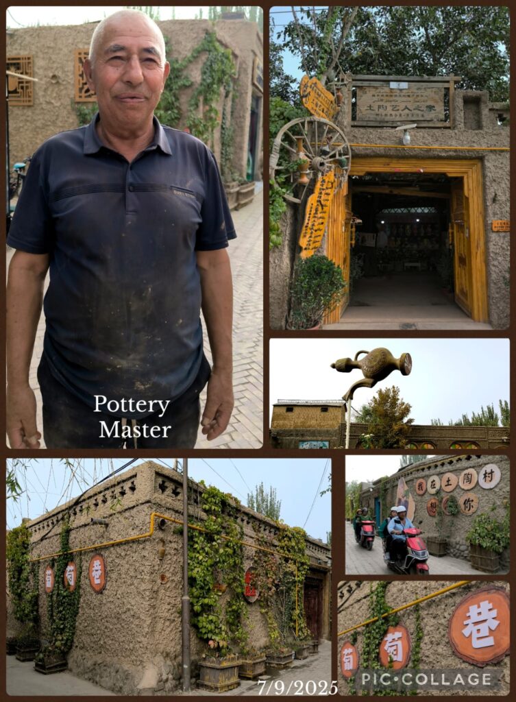
On our way to Kashi, we visited two villages. One is specialized in knife-making and the other in pottery. I like the pottery village and we met a pottery master. We arrived in the hotel after 8:30pm. Tonight a total lunar eclipse could be visible provided we had a clear sky from about 1 to 3 am. I started watching the beginning of the lunar eclipse till 1 am. Then I could not see anymore as it became cloudy. I got out of the bed from time to time to look up the sky but failed to see anything. At the end, I had a sleepless night.
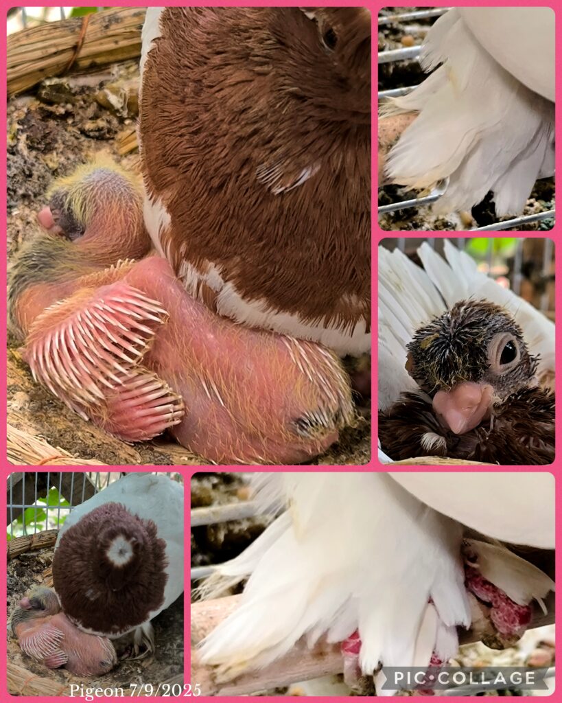
Pet Pigeon
D8 Kashi – Tashkurgan 塔縣 (300km)
We set off at 9:20 am and had to go to the border control office to get a permit. Poor Li had to get here to queue up at 7:10am. The office opened at 10am. It was chaotic with probably about 100 people applying for permits. When the office opened, Li got ticket No 1. Today, there was only one officer handling the issuance of permits. Each of us had to present oneself in front of the officer to take a photo. Luckily we were done by 10:20am and could set off.
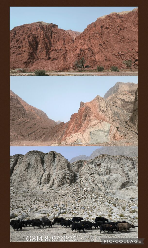
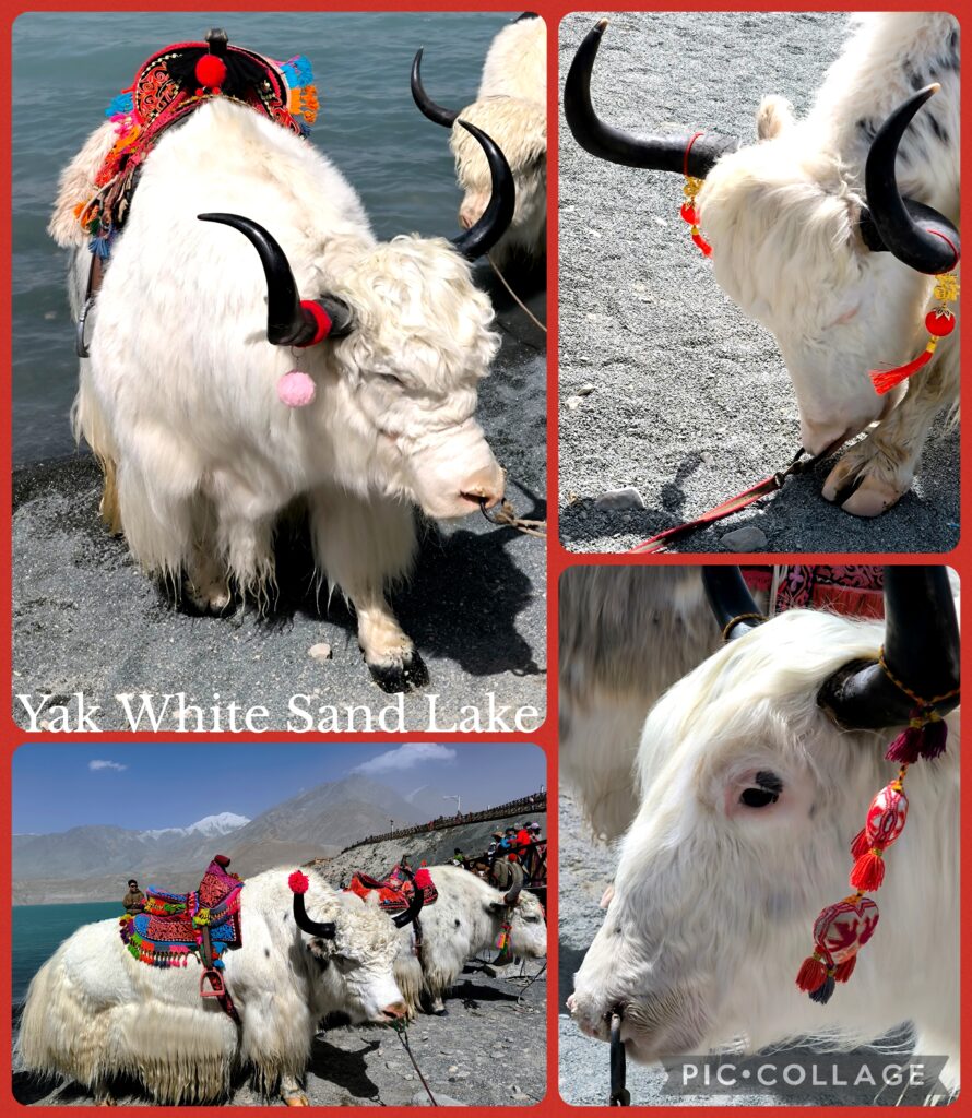
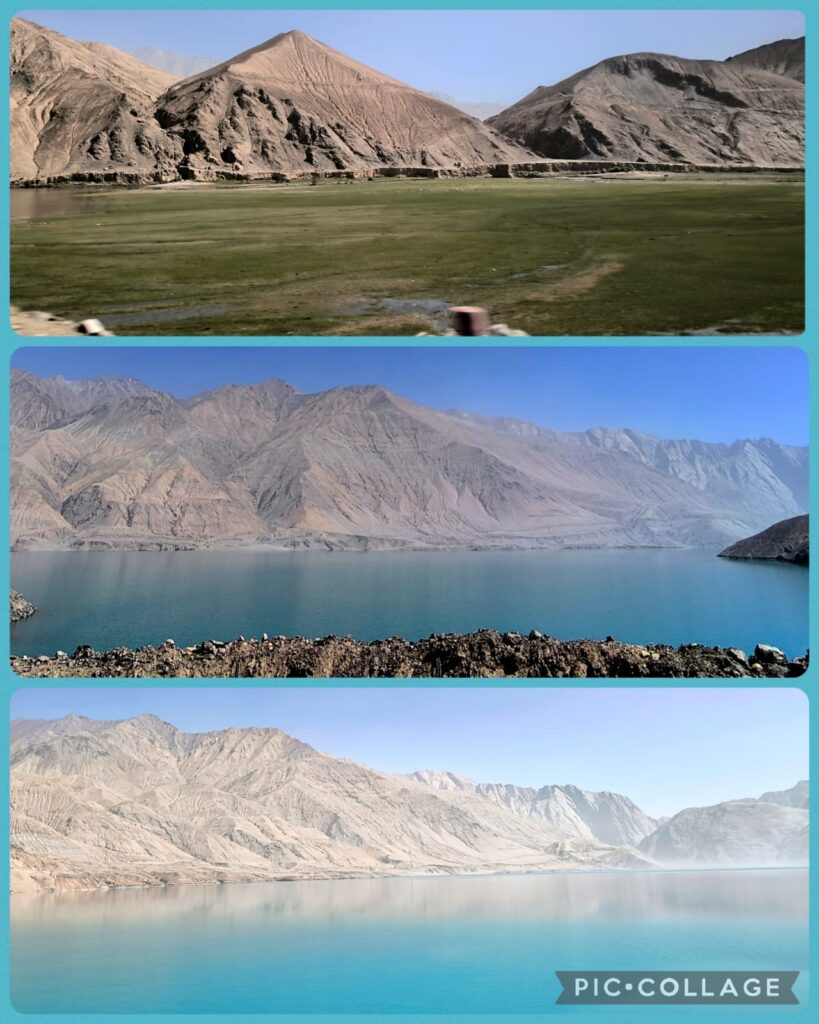
We drove along G314 (the China-Pakistan Highway). Our first stop was the White Sand Lake 白沙湖 (elevation:3100m). Unfortunately, we were stuck for almost an hour before we could pass through the check-point for Tashkurgan. It was almost 3 pm when we had a quick lunch by the lake. The weather was not good with poor visibility: we could hardly see the snow-cladded mountain range surrounding the lake and the White Sand Mountain. Anyway, we had an hour free time. I strolled along the lake and watched the Mainland Chinese taking photos with white yaks. ,
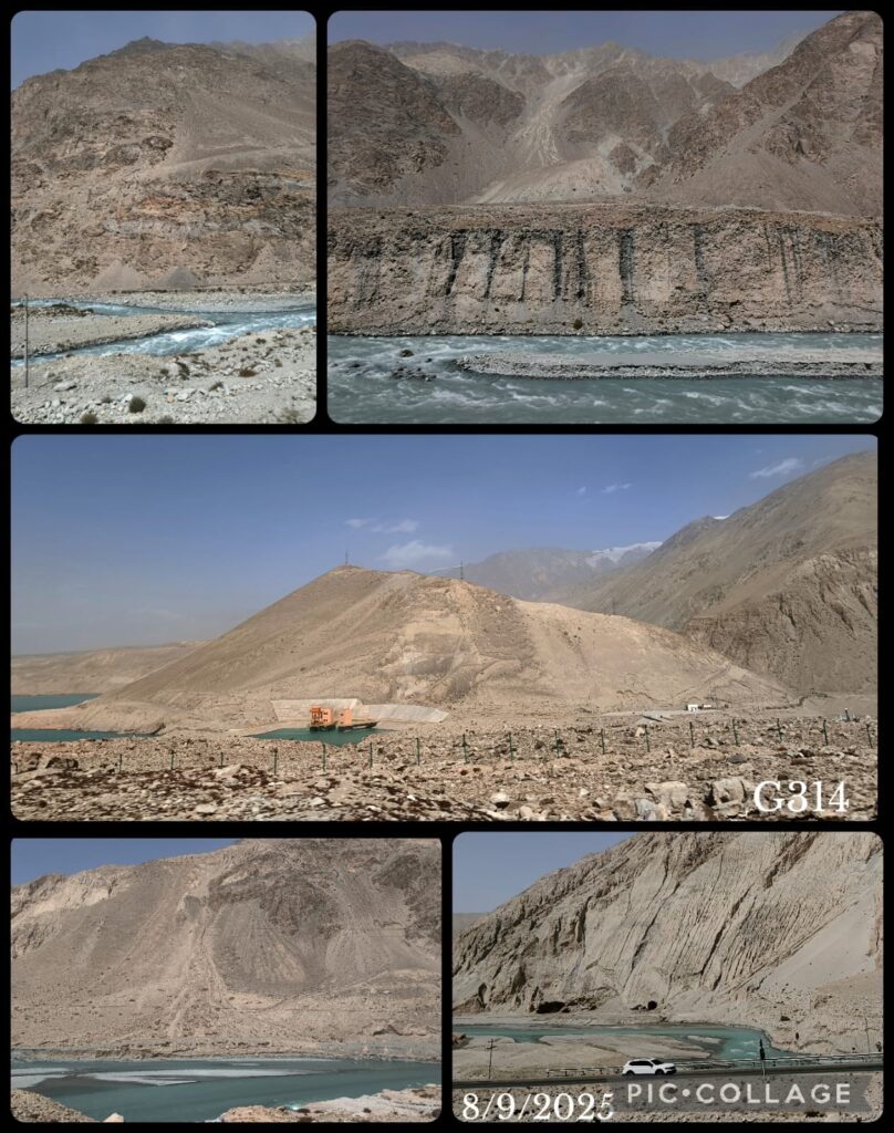
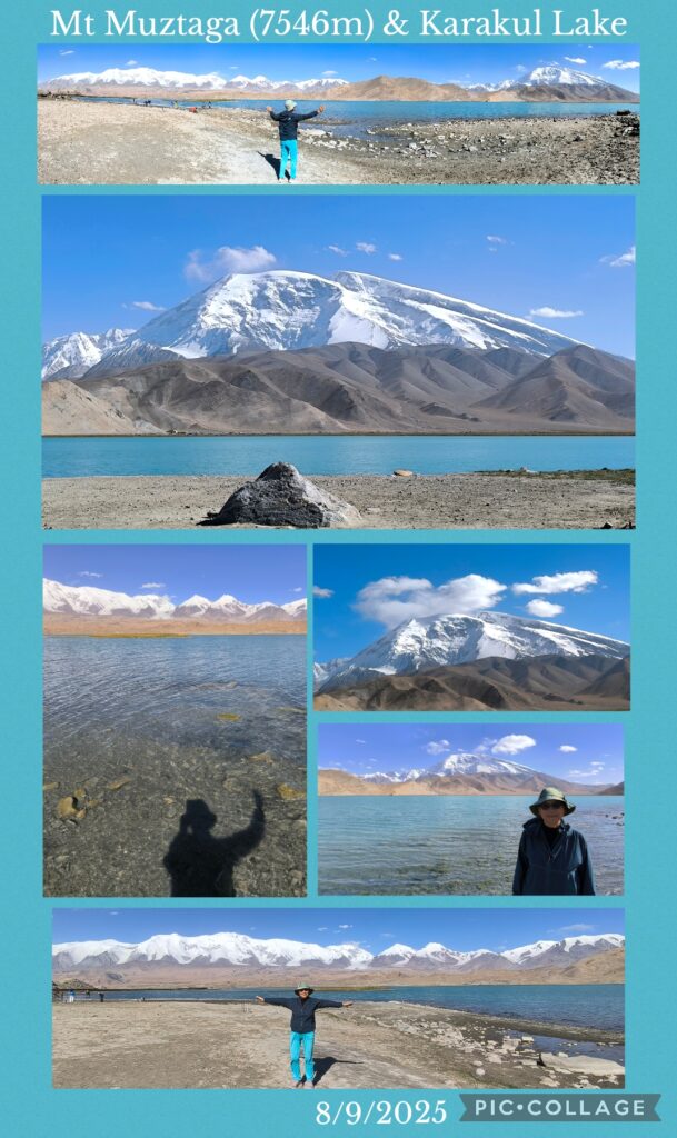
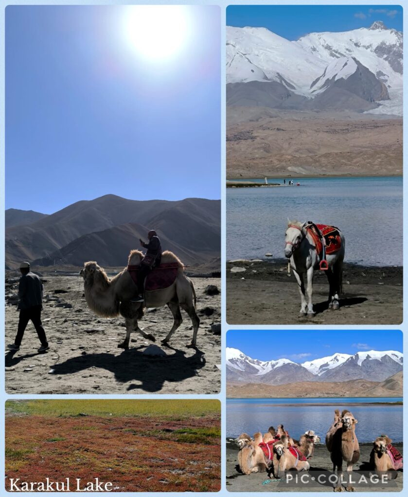
The stop at the Karakul Lake 卞拉庫勒湖 (elevation 3600m) with a surface area of 4.8 km², was much more enjoyable. The weather had improved with blue sky and reflections of the snow-capped Mt Muztaga 慕士塔格峰 (7546m), Kongur Tagh 公格尔峰 (7649m) and Kongur Tiube 公格尔九别峰 (7530m).
We arrived in Tashkurgan around 8pm for a hot-pot dinner. This was my second visit to Tashkurgan: I was here after visiting Pakistan in 2018. The town has grown a lot with more hotels and eateries! We had hot-pot for dinner.
D9 Tashkurgan (100km)
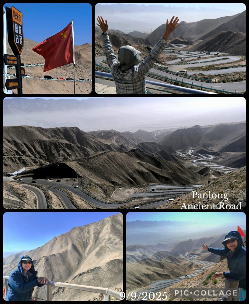
We had a leisure day with a scenic ride along the 36-km winding Dragon Old Road 盤龍古道. Li thought given our age and my hip problem, we should not walk uphill to reach the highest lookout platform at 4216m. I assured him I would be fine: I walked slowly and had no problem to reach the lookout point. Great views! We had two more photo stops on the way down.
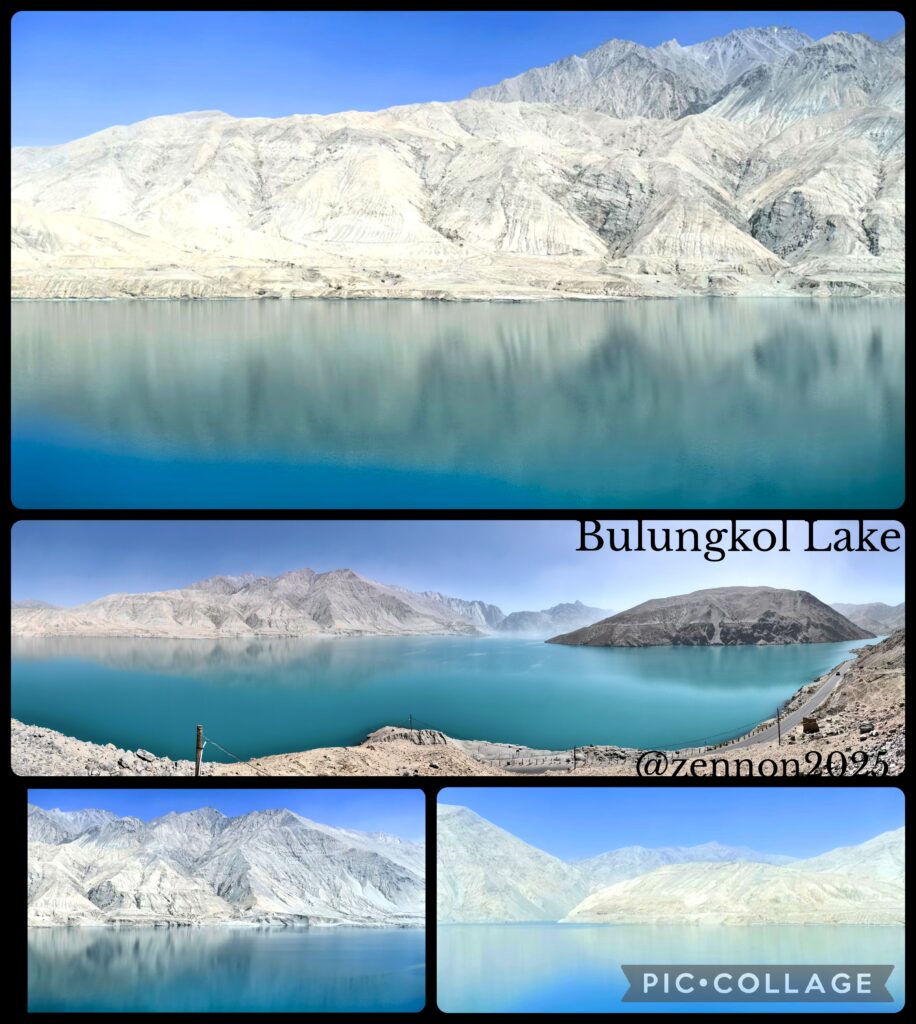
We continued the scenic drive back to Tashkurgan for lunch with a stop at the Bandir Blue Lake 班迪爾藍湖 which is described as the bluest lake in the Pamir Plateau. The lake was formed as a result of the construction of a reservoir.
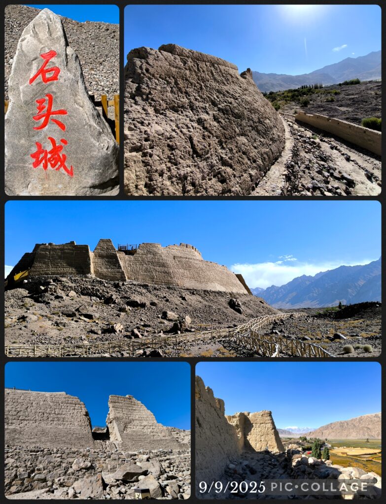
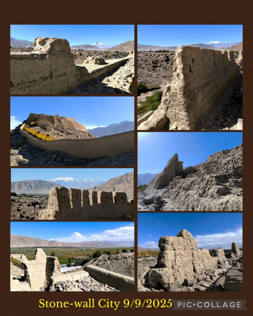
After lunch we visited the historic Stone City石頭城 which I did not have time to visit in 2018. This ancient stone castle located in the north of the city, is a famous heritage along the ancient Silk Road which dates back to the Jin Dynasty. Archaeologists believe the city was the site of the ancient Heptanese Kingdom in the Tang Dynasty. We spent over an hour wandering through the stone city walls, gates, watch towers, etc. There is a temple ruin in the Outer City while the Inner City mainly comprised the royal palace, government offices, official residences and temples. There is a platform which is supposed where Xuanzang had preached during his stay in the city on his way back to China. After a quick tour of the Inner City of the Stone City, I spent half an hour enjoying the grassland nearby. I still remembered my time in the grassland in an early September morning in 2018.