
 Greenland is the world’s largest island, over three-quarters of which is covered by the only contemporary ice sheet outside Antarctica. I was on a trip from Spitsbergen, Norway to Iceland and had a chance to visit the eastern coast of Greenland. I long to see more. During my journey with OceanWide Expeditions earlier this year, I learn about its sailing trips in the Arctic in the summer. Hence, I come on board s/v Rembrandt van Rijn spending 26 days in the northwestern part of Greenland this summer.
Background
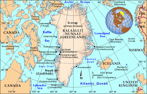
Greenland is the world’s largest non-continental island with a total land area of 2,165,000 km2 (12th largest nation in area). Lying between latitudes 59º and 83ºN, and longitudes 11º and 74ºW, Greenland is located between the Arctic and Atlantic Oceans and east of the Canadian Arctic Archipelago.
Greenland is geographically part of North America but has been ethnically, politically and culturally associated with Europe for more than a millennium. The nearest countries are Canada and Iceland. It is an autonomous country within the Kingdom of Denmark.
Brief history
Greenland has been inhabited for at least 4,500 years by Arctic peoples whose forebears migrated from what is now Canada. There have been several waves of people and cultures–
- Around 2500 B.C., Independence I people, the first people to arrive in Greenland, lived near Independent Bay. The Saqqaq culture was found in the southern and western Greenland but disappeared around 800B.C.
- Later, the Independence II culture emerged in northern Greenland while the Dorset culture in western Greenland. The Dorset culture spread throughout the Greenlandic coastal areas but disappeared around 1500A.D.
- The Thule culture migrated from Alaska around 1000 A.D. reaching Greenland around 1300A.D. The Thule culture people are the ancestors of the current Greenlandic population.
- Gunnbjørn Ulfsson, a Viking discovered Greenland in A.D.930. Erik the Red arrived from Iceland in the western coast of Greenland in 982A.D. and returned six years later with 350 people and their livestock. Vikings settled in the southern part of the island but disappeared in the late 15th century.
16th Century to Early 20th Century
In 1500, King Manuel I of Portugal sent Gaspar Corte-Real to Greenland in search of a Northwest Passage to Asia which according to the Treaty of Tordesillas, was part of Portugal’s influence. Corte-Real found the sea frozen and headed south and arrived in Labrador and Newfoundland the following year. A map made in 1502 in Lisbon based on information provided by him already depicted accurately the southern coastline of Greenland.
The Danish government never relinquished the claims to Greenland that it had inherited from the Norwegians. In 1605–1607, King Christian IV of Denmark sent three expeditions to Greenland and Arctic waterways to locate the lost eastern Norse settlement and assert Danish sovereignty over Greenland. The expeditions were mostly unsuccessful.
In 1721, a joint mercantile and clerical expedition led by Danish-Norwegian missionary Hans Egede was sent to Greenland, not knowing whether a Norse civilization remained there. After 15 years in Greenland, Hans Egede left his son Paul Egede in charge of the mission and returned to Denmark where he established a Greenland Seminary. This new colony was centred at Godthåb (“Good Hope”) on the southwest coast. Gradually, Greenland was opened up to Danish merchants, and closed to those from other countries. When the union between the crowns of Denmark and Norway was dissolved in 1814, the Treaty of Kiel severed Norway’s former colonies and left them under the control of the Danish monarch.
From Second World War to Present
American plane crash
Greenland had been a protected and very isolated society until 1940. The Danish Government had maintained a strict monopoly of Greenlandic trade, allowing only small scale trading with Scottish whalers. Nevertheless, wartime Greenland developed a sense of self-reliance through self-government and independent communication with the outside world. Despite this change, in 1946 a commission including the highest Greenlandic council recommended patience and no radical reform of the system. In 1948, the first step towards a change of government was initiated with the establishment of a grand commission which presented a final report in 1950 recommending a modern welfare state with Denmark as sponsor and example. In 1953 Greenland was made an equal part of the Danish Kingdom. Greenland’s connection to Denmark was severed on 9 April 1940 when Denmark was occupied by Nazi Germany. On 8 April 1941, the United States occupied Greenland to defend it against a possible invasion by Germany. The Americans remained until 1945. Bluie (B) was the military code name for Greenland and the American major air bases were B West-1 at Narsarsuaq and B West-8 at Søndre Strømfiord (Kangerlussuaq today).
In 1973, Greenland joined the European Economic Community with Denmark but withdrew in 1985. In 1979, Denmark granted home rule to Greenland and in 2008, the people voted in favour of the Self-Government Act. The Greenlanders also passed a referendum supporting greater autonomy while leaving the Danish government in control of foreign affairs, defence and monetary policy and providing it with an initial annual subsidy of DKK3.4 billion. It was planned that the sum would gradually be diminished as Greenland’s economy strengthened by income from the extraction of natural resources.
Geology & Climate
Greenland is of exceptional interests to geologists. The Earth’s earliest rocks formed 4,500 to 570 million years ago are found in the southern part of Greenland which consists almost entirely of bedrock. About 81% of the area of Greenland is covered by an ice sheet (1,755,000 km²). This ice cap is a unique and immense sea of ice that would cause the sea level to increase by approximate seven metres should it melt. The weight of the ice sheet has depressed the central land area to form a basin lying more than 300m below sea level while the elevations rise suddenly and steeply near the coast. The highest point on Greenland is Gunnbjørn Fjeld at 3,700m. The majority of Greenland is less than 1,500m. The ice flows generally to the coast from the centre of the island. The northeastern part of Greenland has been designated as a national park, the largest one in the world.
Greenland has many types of minerals (ruby, aluminum, gold, rare-earth, lead, zinc etc), which might generate revenue. About half the government revenues come from grants from the Danish government. The estimated GDP(PPP) total and per capita in 2011 was 11.59 billion DKK and US$37,009 respectively. The shrimp and fish industry is the largest income earner.
Greenland has a population of 56,370 (January 2013 estimate), of whom 88% are Greenland Inuit (including mixed people). The remaining 12% are of white European descent, mainly Greenland Danes. The majority of the population is Lutheran. Nearly all Greenlanders live along the fjords in the south-west of the main island, which has a relatively mild climate. Over 16,000 people live in Nuuk, the capital. Greenlandic culture today is a blending of traditional Inuit and Scandinavian culture. Inuit culture has a strong artistic tradition, dating back thousands of years. Greenland faces a few serious social problems including a very high rate of suicide, unemployment and alcoholism.
July 31 Thursday: Hong Kong (GMT+8)– Finland – Denmark (GMT+1)
My sailing Northwest Greenland trip would begin on August 7 in Kangerlussuaq where Greenland’s largest and most important international airport is located. A chartered flight would fly all participants to Aasiaat to go on board s/v Rembrandt van Rijn. Unfortunately when I booked my flights in end June, the earliest flight from Copenhagen to Kangerlussuaq I could take was the one departing on August 1. I had no choice but to spend six days in Kangerlussuaq.
I left Hong Kong on Finnair at 0025 and arrived in Helsinki after 7am local time. I waited for over an hour for a connecting flight and arrived in Copenhagen around 8:30am local time. As the flight from Copenhagen to Kangerlussuaq would be leaving at 9am, I again had no choice but spend a night in Copenhagen.
My first visit to Copenhagen was in 1980. I was back on short business trips lasting a day or two a dozen times from 2006 to 2010. I like Copenhagen which is a vibrant business capital city with history and culture. It has also become a centre for design and food.
The weather was fine but windy. I had to put on my down jacket as soon as I came out of the airport. I took the train to the Central Station (DKK36) which is close to Urban House, a well-run large hostel with over 900 beds.
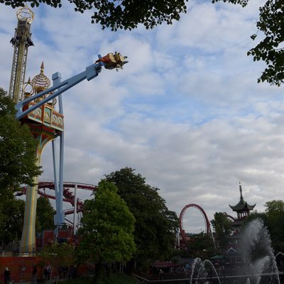
As I would spend five more days in Denmark after my sailing trip, I had plenty of time to explore the place. Hence, I first collected information and maps from the Tourist Office before strolling around the old town and harbour. I walked past Tivoli, the world’s second oldest amusement park founded in 1843 and reached the City Hall Square, where a dozen groups of tourists gathered around their guides.
Like all tourists, I began my walking tour from this square, then followed the main street Strøget which is filled with shops and cafes and stopped at St Nikolaj Church (Copenhagen’s third oldest church) which is now a contemporary art centre exhibiting paintings and artworks. I find the side streets quieter and more attractive with fewer tourists. Finally I reached the famous Nyhavn lined with colourful townhouses and spent sometime in the new modern theatre building by the harbour. From here, I saw the Opera House and the North Atlantic House on Christianshavn. It would be nice to cross the bridge and walk around this old part. But something was wrong with my legs and hips: I was tired and walked with discomfort and pains occasionally. I got worried: if something happened, it would ruin my sailing and hiking trip!
By 3pm, I was ready to return to the hostel to rest and eat. I am no fan for hamburger, open sandwich or salad: I prefer a simple hot meal with cooked vegetables. So I brought chicken and vegetables from a supermarket and prepared a nutritious and delicious chicken broth. While I was cooking, I met Pearl and Peter, a nice young couple from Hong Kong. What a small world! They told me where they had been with the Copenhagen Visitor Card in the past few days. Anyway, I plan to get one on return to Copenhagen on September 2.
 |
 |
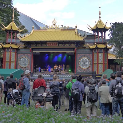
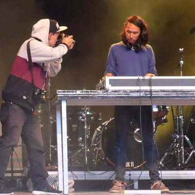
Hostel is often a great place to meet people and collect useful travel information. Today I met four interesting room-mates: Alice from Taiwan, Diane from Korea and two Greenlanders who had come specifically for the 2-day Greenland Festival in Tivoli (July 31 and August 1), an annual event attended where thousands of Greenlanders living and working in Denmark. At their recommendation, I brought a ticket (DKK99) and spent almost two hours in Tivoli which remains as popular attractions for the Danes and tourists. I watched the musical performance by two popular Greenlandic bands and left at 8:30pm. By 9pm, I was already in bed as I had to get up at 6am to catch my flight.
 |
 |
6 Days in Kangerlussuaq
Kangerlussuaq, located at the head of the 190km-long Kangerlussuaq Fjord and at the confluence of two major regional rivers, the Qinnquata Kuussua and Akuliarusiarsuup Kuua, both of which originate from the Russell Glacier. Founded on October 7, 1941, Kangerlussuaq was a base for the American air force till 1992. It has the largest road network outside any settlement in Greenland (about 57km from the port to Isuugua next to the ice sheet). The area is home to Greenland’s most diverse terrestrial fauna, including musk oxen. Today, the town (a population of 512 in 2013) is almost entirely reliant on the airport and tourist industry.
August 1 Saturday: Copenhagen (GMT+1) – Kangerlussuaq (GMT-3)
I took the 7am train to the airport and my plane departed on time at 9am. It was an Airbus 320-220 and the plane was full! There is a four hours’ difference between Copenhagen and Greenland. I arrived in Kangerlussuaq at 9:40am.
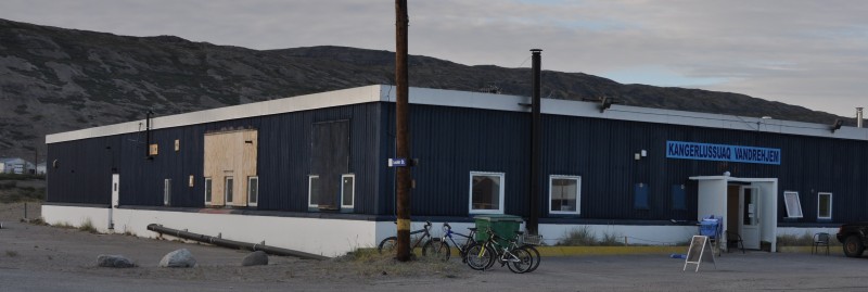
The weather was gorgeous and the temperature was over 20°C in the sun. As accommodation is fairly expensive in Greenland, I decided to stay in a hostel. I took a bus (DKK10) to the hostel which only opens in the summer. It is run by two Danes, Henrik and Noma. I had no plan or idea about how I would spend while waiting for the chartered flight. At the end, I found myself pretty occupied.
 I stayed at this nice hostel |
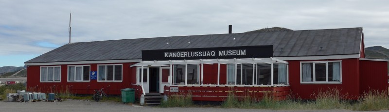 Kangerlussuaq Museum |
First, I purchased three shanks of musk oxen (2 kg for DKK50). The meat was supplied by local hunters. Musk oxen belong to the goat/sheep family. I therefore spent a couple of hours in the kitchen preparing a broth with onions and vegetables. I tasted musk ox meat for the first time in my life. I find the meat lean, tender and delicious without strong ‘meat/flesh’ flavour. The meat lasted me four days!
Second, the hostel which is clean and cozy, makes me feel at home. It provides 42 beds (DKK200-250 a night a person). There are two well-equipped kitchen and plenty of sitting areas. I enjoy sitting in the small sitting room cum kitchen. The hostel was full most of the time during my stay and I have made a few new friends from Germany.
Third, the place is peaceful and quiet. I had a wonderful rest sleeping nine to 11 hours a day!
Point 660 (highest point on the ridge)
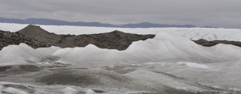
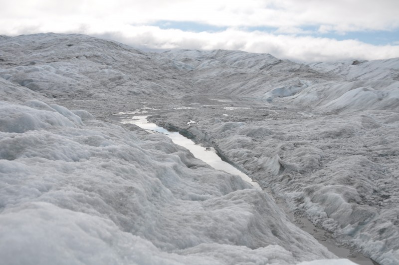
Fourth, I joined a two-day tour to Point 660 (660m above sea level)– the Gate to the Ice Cap which affords amazing views of the ice cap and terminal moraines formed with rocks, stones, gravel, sand, clay and stone dust. It is possible to walk directly onto the Ice Cap and go all the way (600km) to the east coast. Kim our guide did the journey in 1994 in 43 days while a record holder did it in 8 days. I was joined by a German couple (Patricia and Daniel).
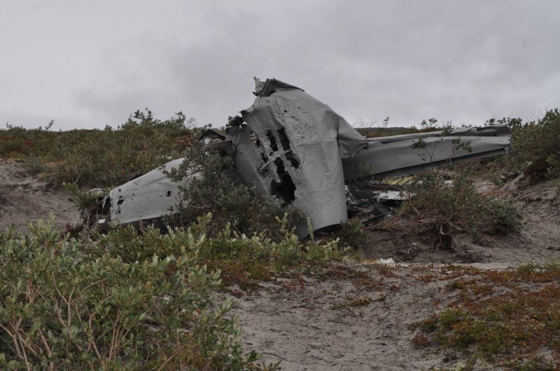
We had a briefing in the morning before setting off at 1pm. Point 660 is about 37km from the airport. The gravel road is fairly uneven and we had a bumpy ride for an hour and a half. It was gray, wet and cold. We had a couple of photo stops to see a plane crash and the Long Lake.
The ice-cap looks dark, gloomy and uninviting in a gray rainy afternoon. A main tent and a small tent were already at the camp ground. We set up one more tent for Patricia and Daniel. Kim has made a special toilet tent which works wonderfully: it faces away from the wind and is not cold at all.
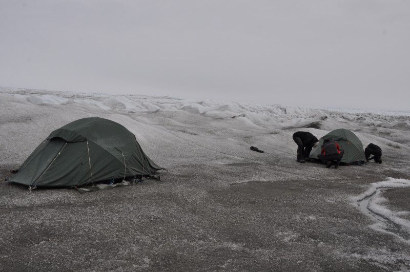 My tent (left)- a night on the glacier |
 Daniel digging ice for water |
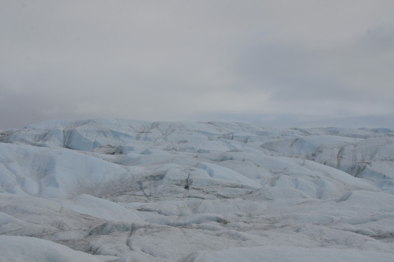
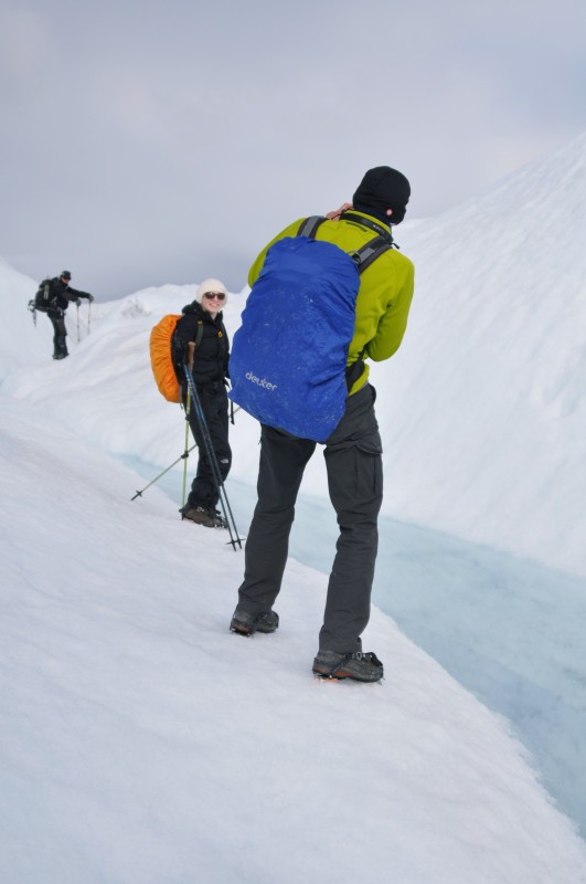
Our next task was to get clean ice which could be used to be boiled to get hot water. Then Kim took us on a 2-hour walk where we learnt to walk with crampons. We walked for about a kilometre towards the Russell Glacier for a closer look. The weather had improved slightly: it stopped raining. The sun now emerged occasionally behind the thick dark clouds. We could see Sugar Loaf.
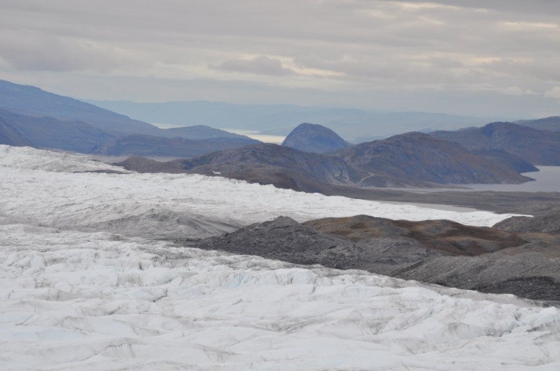 Sugar Loaf (round hill top) beyond Russel Glacier |
 A stream |
 |
 |
I was expecting Greenlandic dinner. I was wrong: each of us had a goulash meal pack. Kim poured boiling hot water in the pack and we had our dinner 15 minutes later. The taste was filling and not bad. But it was deadly salty!
There was nothing to do and I went to my tent shortly after 8pm. I was given a warm sleeping bag and a fleece lining. I also had a silk lining with me. I put everything on as it could be freezing during the night. I did not feel cold but could not sleep: the ground was wet, damp and sloping. The mattress is too narrow. I tossed around the whole night.
Around 5am, I decided to get up. Kim was preparing our breakfast (coffee, tea, chocolate, muesli, musk ox milk, oatmeal, rye bread, cheese and butter). Then we packed a sandwich for lunch.
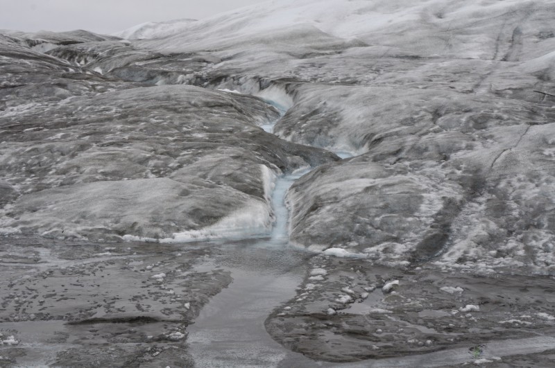
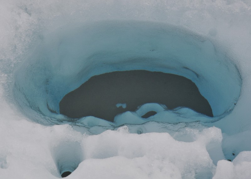
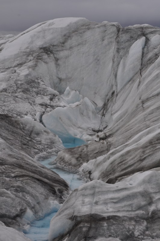
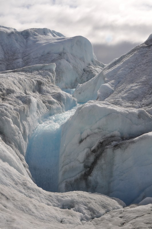
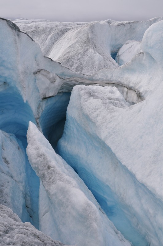
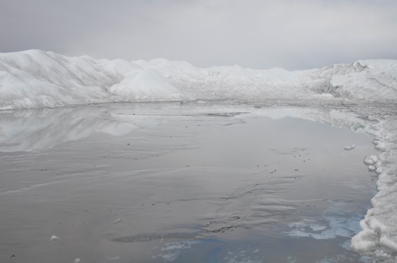
At 7:45am, we set off for a 5-hour glacier walk. The weather though cloudy had improved. The ice landscape is eerie and surreal. We climbed up and down crossing many melting streams, looking at waterfalls, crevasses and three lakes.
 |
 |
 |
 |
 |
 |
At 1pm, we were back at the camp site and spent 45 minutes in pulling down and packing all the tents and washed the used cups and plates. Then we walked back to the bus and set off. Kim dropped us off at the hostel at 4:30pm.
Did I enjoy the trip which cost DKK2250? As I normally do not sleep well in a tent, I should not have gone on this camping tour. An 8-hour day trip for DKK995 would be better for me! I am also disappointed at the quality of food. Perhaps I have been spoilt by my hiking experience in Nepal and recently in New Zealand which cost less than this trip per day. Also if this trip were taken in winter, I might have enjoyed it as I could watch aurora borealis and the surreal icy white landscape.
Fifth, the area is great for hiking. On Sunday (August 2), the weather was hot and sunny. After an excellent Sunday lunch with musk oxen soup, I walked to Lake Fergueson which is three kilometres away. Then I walked uphill and saw a reindeer! I finally reached the weather observatory at Taco before walking back to the hostel. I walked for over four hours and must have covered about 12 km. My legs were tired but the pain was bearable.
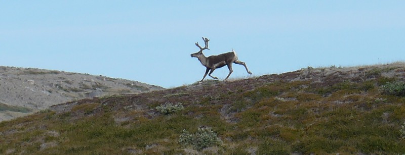 My first reindeer on this trip (above); Lake Fergueson (R) |
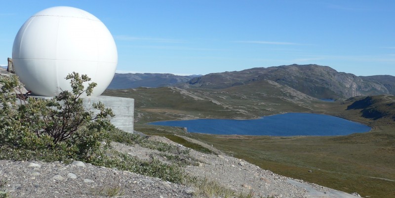 |
On my last day in Kangerlussuaq (August 6), I went to Sugar Loaf (400m) for panoramic views of Kangerlussuaq Fjord and Russel Glacier. I followed the main road which I had already passed twice on my trip to Point 660. I set off around 8:30am and reached the top at noon. The distance is about 7.5km from the hostel. The views are impressive especially in clear days. I could see Russel Glacier and the fjords.
 |
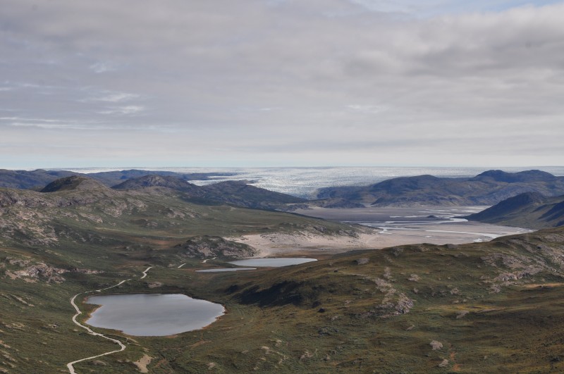 |
I took the same route back and found the walk boring. I normally have no problem with a 15 km-long hike. But I was exhausted when I arrived at the hostel at 2:30pm. Something must be wrong with my legs or my health? I hope not.
17-day Northwest Greenland Expedition aboard S/V Rembrandt van Rijn (to continue)