
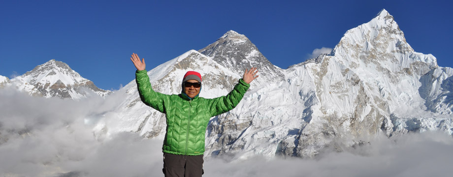
7-day Machame Route Trek, November 19-25, 2016
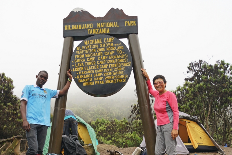
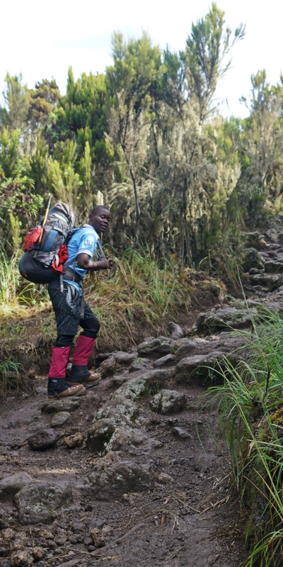
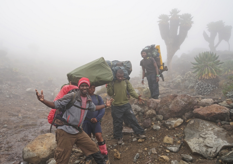
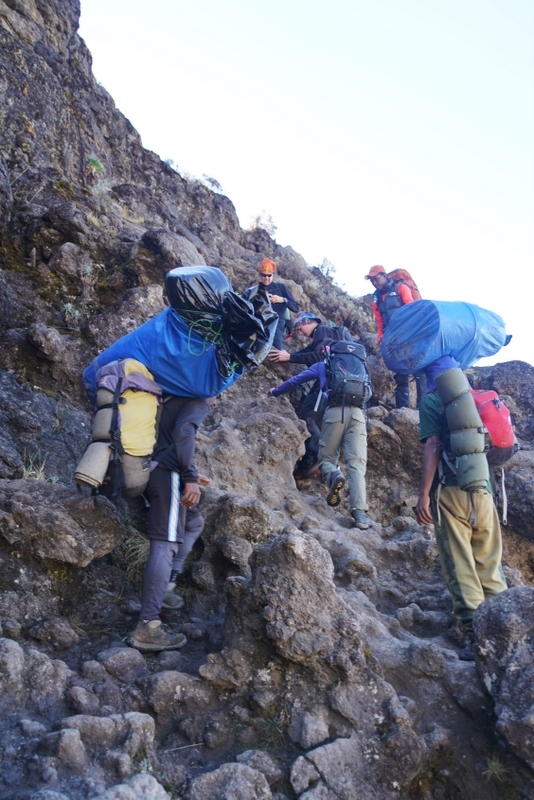
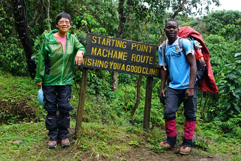 Sanke, my guide at the starting point of the 7-day Machame Route Trek, November 19, 2016 |
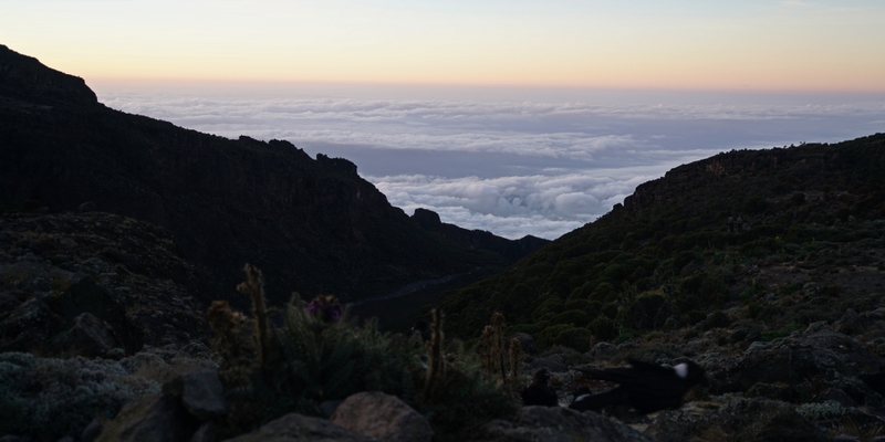
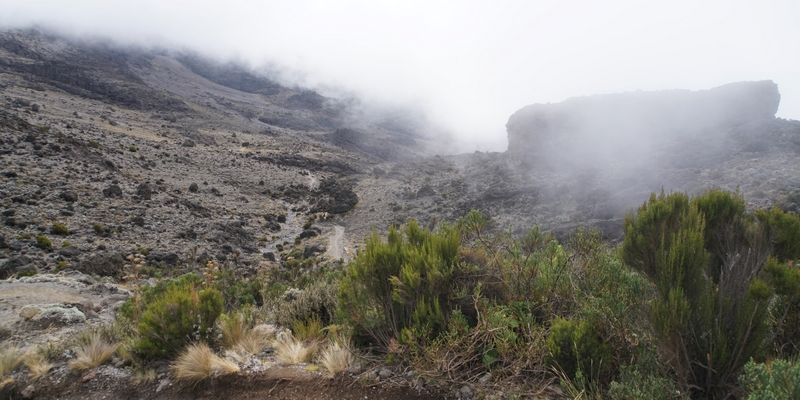
 I had sunshine, fog, mist, rain, snow and frost during the 7-day trek |
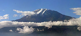
Photo from Wikipedia
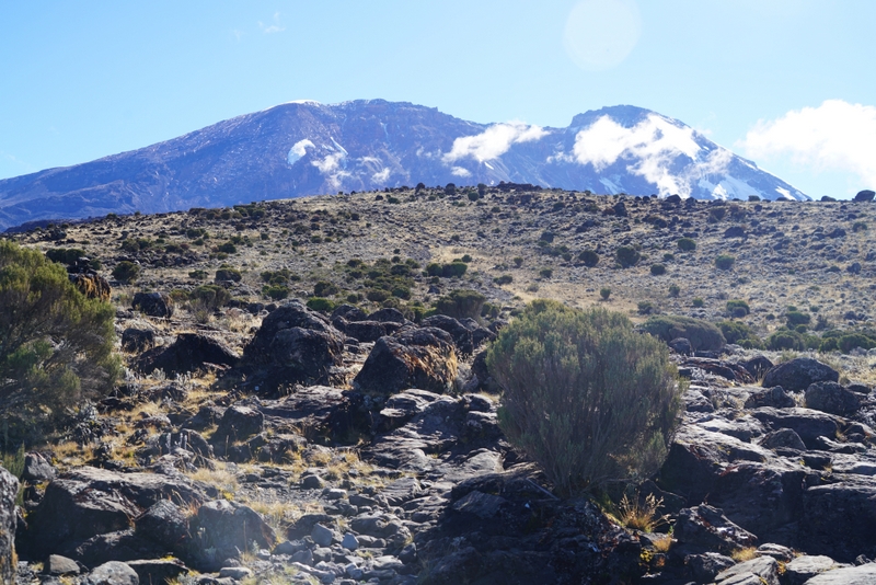
Mount Kilimanjaro
Kilimanjaro standing at 5895m above sea level is the highest mountain in Africa, hence the title “Roof of Africa”. A dormant volcano with three volcanic cones, “Kibo”, “Mawenzi”(5149m) and “Shira”(4005m), it is the world’s tallest free-standing mountain measuring up to 40km across with a base covering an area of about 388,500ha. In recent years, it has been a subject of many scientific studies because of its fast shrinking glaciers: almost 85 percent of the ice cover disappeared from October 1912 to June 2011. It is estimated that most of the ice would disappear by 2040 and be gone by 2060.
The first recorded ascent to the summit, Kibo Peak/Uhuru Peak was by Hans Meyer and Ludwig Purtscheller in 1889. Kilimanjaro is a World Heritage Site with a capacity for 28,470 climbers a year as specified in the park’s General Management Plan. There are seven official trekking routes by which to ascend and descend the mountain namely Lemosho, Machame, Marangu, Mweka, Rongai, Shira and Umbwe. Of all these routes, the Machame Route (also known as the Whisky Route) though long and steep, is considered most scenic and popular. Kilimanjaro, one of the world’s seven summits, has become a top destination for keen hikers of all ages as it is not a technical climb. The trek takes 5 to 8 days depending on the route. Acute mountain sickness (AMS)/altitude sickness which symptoms include headache, nausea, diarrhea,vomiting or loss of appetite, can be a problem. All climbers must be accompanied by licensed guides who keep reminding their clients to go slowly – ‘pole, pole’ and drink 4-5 litres of water a day. The number of climbers has increased steadily over the years.
 |
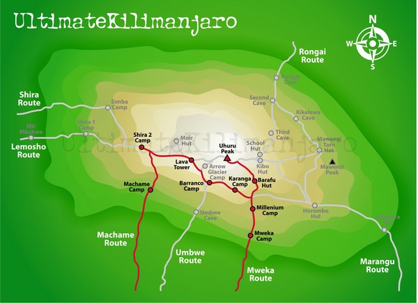 Trekking routes in Kilimanjaro |
Why I want to climb Kilimanjaro?
Passion for hiking? Romanticism? Influence by Ernest Hemingway who had written about the mountain? Vanity? Obsession? A dream? Proof of stamina? I cannot remember when this idea first got into my head. Anyway, it has been on my bucket-list for over a decade. In 2009, I made an abortive attempt taking on the Rongai Route. I reached the base camp at Kibo but affected by AMS, I did not go beyond 5300m. I have been yearning to complete this mission.
My Second Attempt
Since retirement, I have done more hiking and find myself in better shape. Hence, I have been looking for the right time to make a second attempt. After having booked an overland Cairo-Khartoum journey from October 22 to November 17 and then a pilgrimage tour to Sri Lanka from December 1 to 6, I found a two-week gap in-between. It would work well in terms of logistics: I could fly easily and cheaply from Khartoum to Kilimanjaro via Nairobi. Perfect!
Preparation
I am not young, have a knee problem and sleep badly while camping. Hence, climbing Kilimanjaro will be a big challenge for me. After some research, I made a tentative booking with an agent in September. But I would not take a decision after the GR20 trek in Corsica.
After having reached Piton des Neiges (3000m) in La Réunion in June and Mt Fuji (3776m) in August and covered 170kms in Corsica in September, I believe I am ready to take up the challenge and to fulfill my dream. I finally paid a deposit to Safari Heroes in early November i.e. two weeks before the climb.
Why the Machame Route?
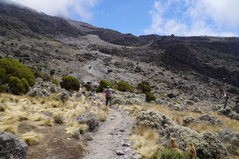
 I took the Rongai Route in 2009 but did not enjoy it. Since then, I have read flavourable reviews on the Machame Route in terms of landscape, scenery, vegetation, hiking distance and time, and above all altitude acclimatisation. This route begins in the southern base of the mountain, goes through part of the Shira Plateau before circling along the southern circuit halfway around the mountain. The approach to the summit is made from the east with the descent following the Mweka trail. Hikers can therefore have views of the mountain from all angles along the way (weather permits!). Hikers can also appreciate the landscape and flora of all the vegetation zones, namely the cultivation zone and forest between 800m and 2800m, heath and moorland between 2800m and 4000m and Alpine desert between 4000m and 5000m.
Given my age and average physical condition, the agent suggested me take a small group 7-day trek from November 22 to 28. If so I would depart for Sri Lanka on November 29. Perfect!
November 18 Friday: Khartoum, Sudan – Nairobi, Kenya – Kilimanjaro International Airport – Moshi
I flied out of Khartoum after 3am on November 18, waiting two hours in the Nairobi airport for a connecting flight and arrived in the Kilimanjaro International Airport around 9:30am (an hour late). Safari Heroes had confirmed that I would be met on arrival. Hence I had not bothered to ask for the name and phone number of the contact person and the name of the hotel. But no one was in sight. All I could remember was the name ‘Richard’, ‘Safari Heroes’ and ‘Keys Hotel’ from some of the correspondence.
A young man at the airport reception desk kindly called the Keys Hotel which confirmed that it did not have a reservation under my name. The hotel suggested me go there by taxi and could help me sort things out. The smart taxi driver called his friend who eventually reached Richard of Safari Heroes. Richard told the driver to bring me to the Panama Hotel in downtown Moshi.
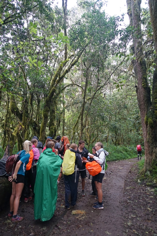
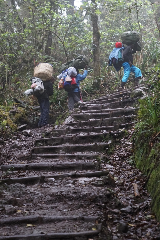
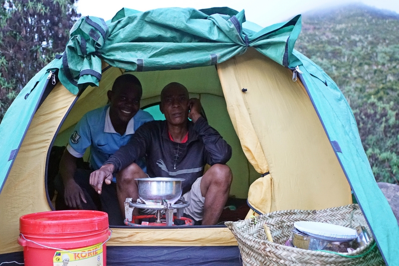
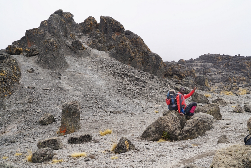
I was relieved when I finally met Richard around 11:30am in the Panama Hotel. He is a big guy with an assuring and cheerful broad smile. After leaving my bags in my room, I met Richard again in his office to discuss the detailed arrangements. Richard introduced me to Sanke, a 29-year-old guy, who would be my guide. Richard explained that the group departure on November 22 had been cancelled as the other hikers preferred to take a shorter and cheaper trek. But I could trek on my own with Sanke, a cook and three porters for the same price. I could also set off the next day. Perfect!
I ended up having a busy day preparing for the trek. I like Sanke who is quiet with a boyish and honest look. He briefed me on the itinerary and I told him about my preference for simple food without much oil and salt. After checking the gears that I had brought with me including my Gore-Tex and down jackets, thermal wear, woolen socks, rain jacket and pants, a down sleeping bag, hiking and walking boots, warm headgear, gloves, walking poles, headlamp etc, he told me to rent a duffel bag, a warmer sleeping bag, a pair of gaiters and waterproof mittens and three 1-litre water bottles. At the end, I paid US$65 rental for these items.
It was after 2pm when I came back from the rental shop. I was exhausted as I had not slept for over 30 hours. After having a bowl of stewed beef soup in a local eatery, I spent the rest of the day in my room uploading photos of my Italian trip to my website before going to bed shortly after sunset.
7-day Machame Trek: November 19 – 25, 2016
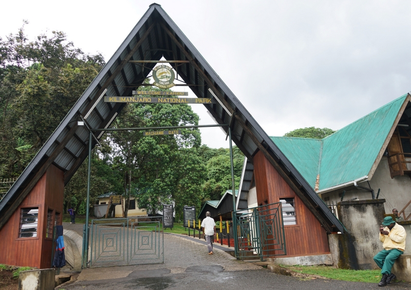
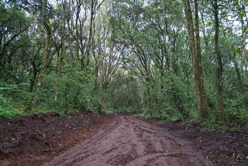
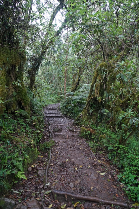
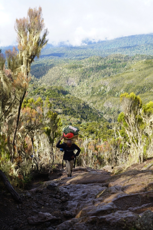
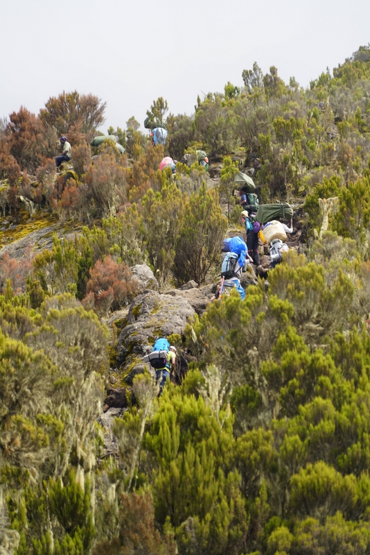
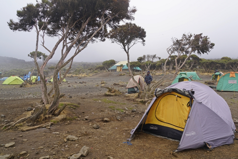
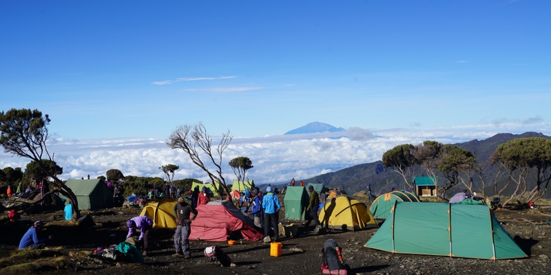
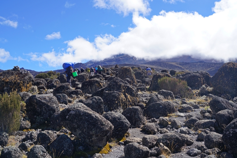
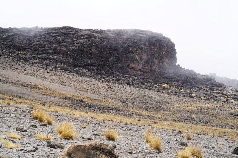
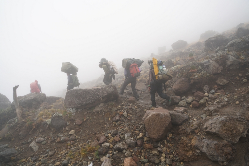
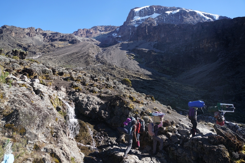
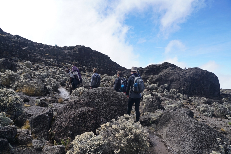
Day 1: Machame Gate (1490m) to Machame Camp (2835m) 11km; Weather: rain &foggy; Vegetation: rain forest
Sanke arrived at 9am while I was still busy uploading photos to my website. We set off in a mini-bus packed with stuff and porters at 9:30am. On the way, Sanke took me a mini-store where I bought four snickers chocolate bars, four packs of biscuits (one for me and three for them), a pack of baby-wipe, a hand sanitiser and two bottles of water. I was shocked when the girl asked me for US$30! A rip-off!
By 11:30am, we were at the Machame Gate park office where I had to sign in. Soon heavy rain poured down forcing hikers to take refuge in a rain shelter. Alarge group of high school students, an American group of five and a couple of individual hikers were hanging around there. I had my picnic lunch. The rain was over by 12:30pm.
 |
 |
After taking a photo with Sanke to mark the beginning of the trek, I began a 4-hour walk to the first campsite. The air was fresh and cool especially after the rain and I had a pleasant and easy walk. By the time I reached the campsite at 5pm, it was foggy and grey. My purple yellow and orange tent was just behind the signpost.
 |
 |
 |
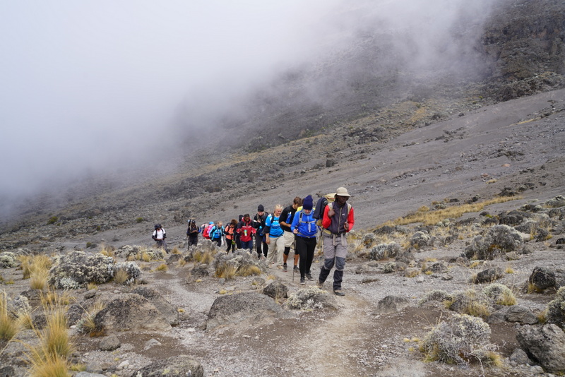
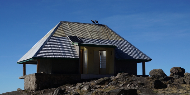
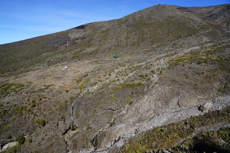
I guessed some 30- 40 hikers were at the site that evening. Sanke said the site might hold as many as 300 hikers during the peak season. This means the site accommodates some 1000 persons including the guides and supporting staff a day! It must be very noisy and crowded.
 |
 |
Tea time. I had pop corn and Milo. Around 6:30pm, the sky suddenly cleared up: I had my first sight of Mt Kili. Good omen! I had soup and fried fish for dinner. Being tired, I managed to sleep without problem.
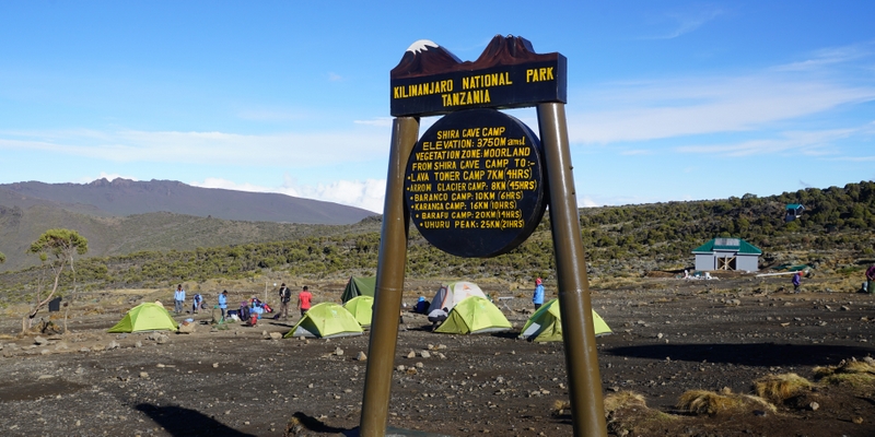
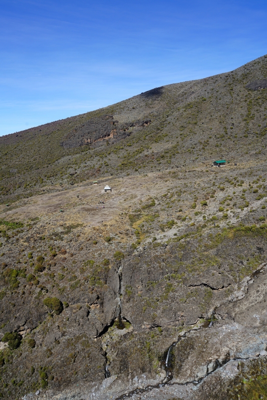
Day 2: Machame Camp (2835m) to Shira Cave Camp (3840m) 5km; Weather: clear cloudy & foggy; Vegetation: moorland
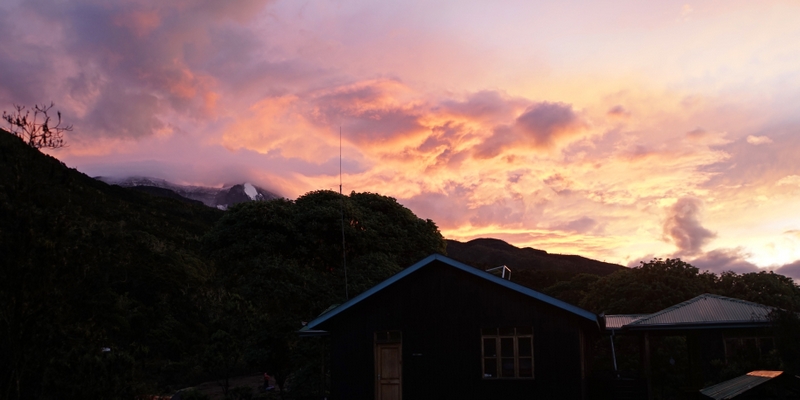
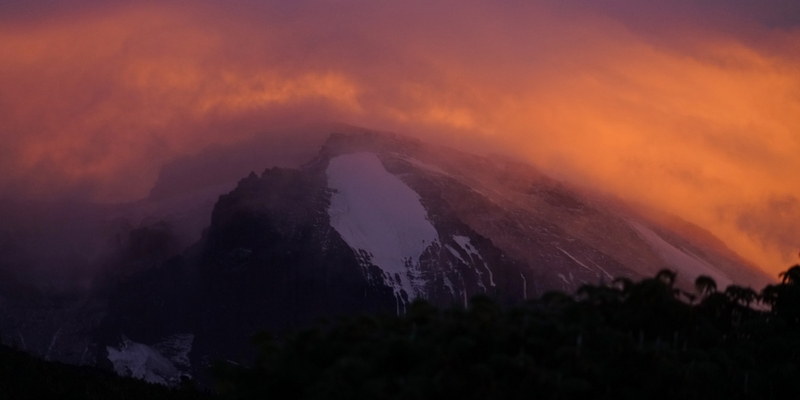
Though I woke up very early, I did not get out of the tent till 5:30am, just in time to catch the best moments of sunrise. It was amazing to watch the changing colours: the summit was glowing in a surreal yellowish orange hue. By 6am, the awesome hues had all gone. But the views of the lush vegetation covering the Shira range were good.
 |
 |
Samson, one of the three porters, acted as my caretaker. He would bring me a flask of ginger drink first thing in the morning (usually around 6am), then a basin of warm water to wash my face followed by my breakfast. Today, I had good appetite and finished an omelet, two sausages, two pieces of toast and some fresh fruit. By 8am, we were ready to set off. Today’s hike was relatively easy and short. Sanke kept reminding me ‘pole, pole’as I was making a 1000m-ascent and reaching almost 4000m in altitude without stop. On the way up, I had full views of the Shira Plateau and the farm land below.
 |
 |
 |
 |
 |
 |
 |
 |
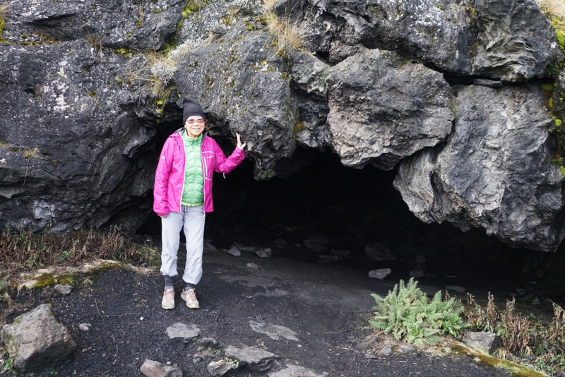
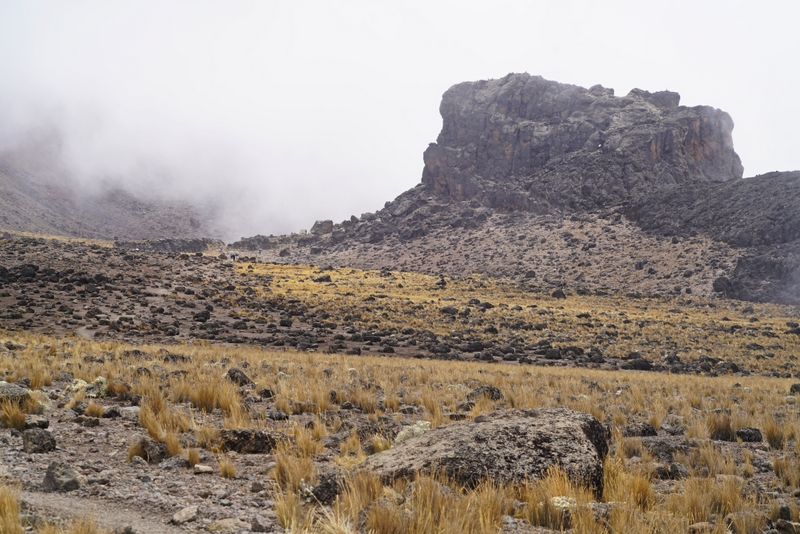
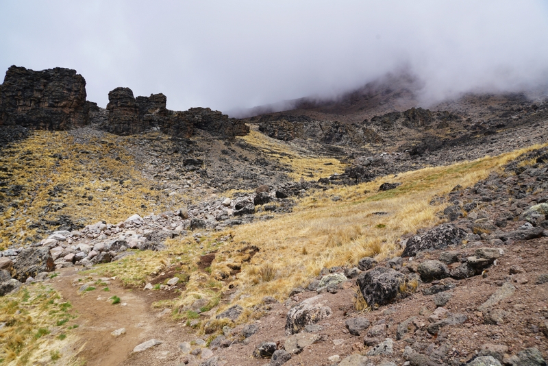
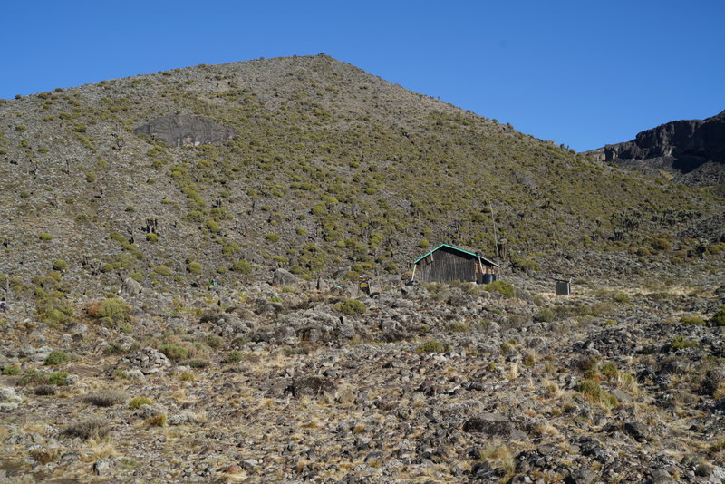
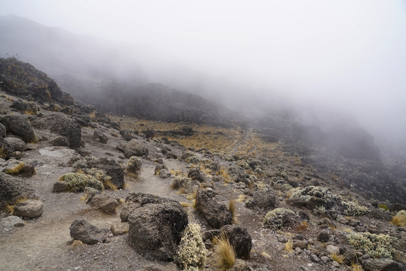
Weather in the mountain is changeable and unpredictable. Around 11am, the fog arrived. Around 12:30pm, I arrived at the second campsite which is flatter and much larger. I had spaghetti in a creamy tomato sauce. Despite my passion for pasta, I could not stand the smell of the sauce and began to have problems with my stomach. These are symptoms of AMS. I tried to slow down and stayed in my tent drinking plenty of water. Sanke came to my tent around 4:30pm and got me out to see lava caves which had once been used by porters for cooking and sleeping. But such practice has stopped.
 |
 |
It’s foggy and the whole world looked grey. When Samson brought me pop corn again, I told him to take it away. The cook prepared four small pieces of fried beef and rice for me. I do not like fried food. But to prepare myself for the climb, I forced the meat through my throat. Before going to bed, I vomited for the first time on this trek. I did not sleep well. When I got out of the tent to go to the toilet, I saw a clear starry sky.
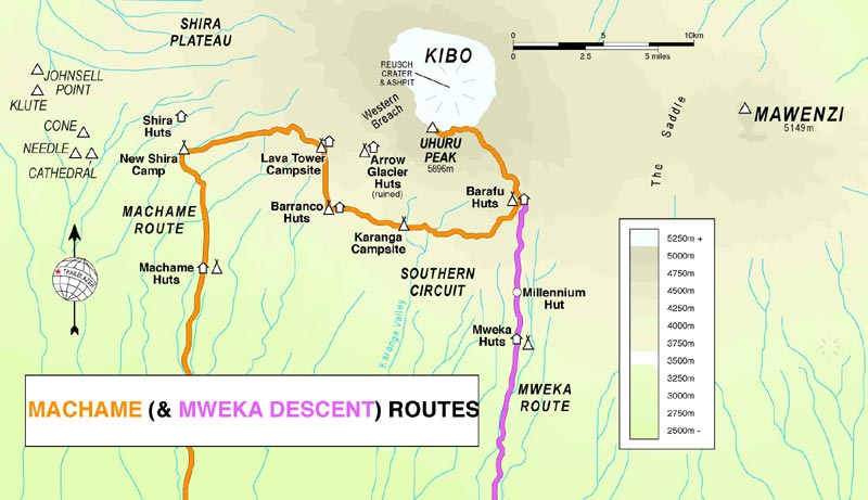
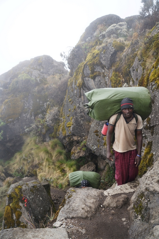
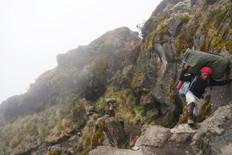
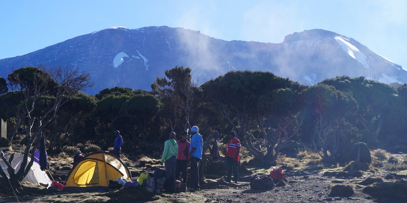
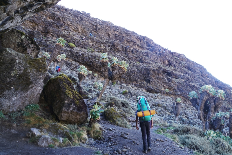
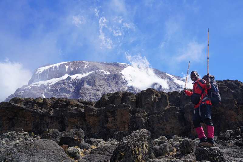
Day 3 – Shira Cave Camp (3840m) to Lava Tower (4600m) 7km to Baranco Camp (3950m) 3km; Weather: good till 10:30am & foggy for the rest of the day; Vegetation: moorland & semi desert
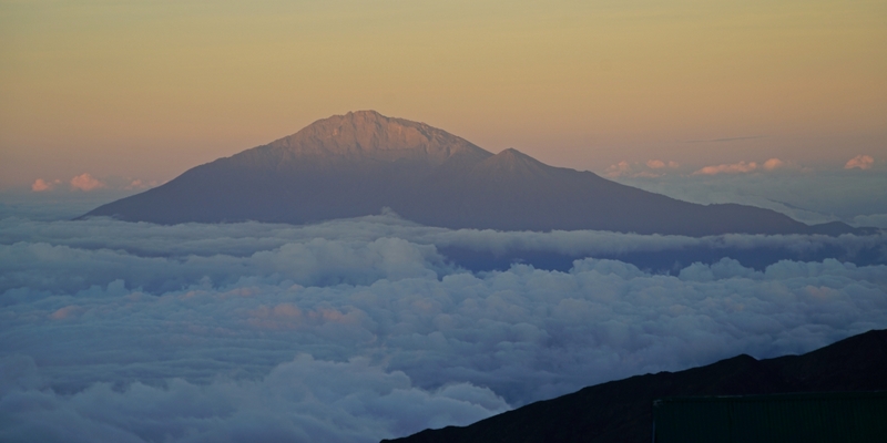
I got up around 5am and poked my head out of the tent. Wow, Mt Meru was floating above clouds with the Shira ridge in the foreground. Located 70km west of Mt Kili and standing at 4562m above sea level, Mt Meru is the fifth highest mountain in Africa. Though I reached its summit in February 2011, I had no photo with it as my camera had gone dead.
 |
 |
 |
 |
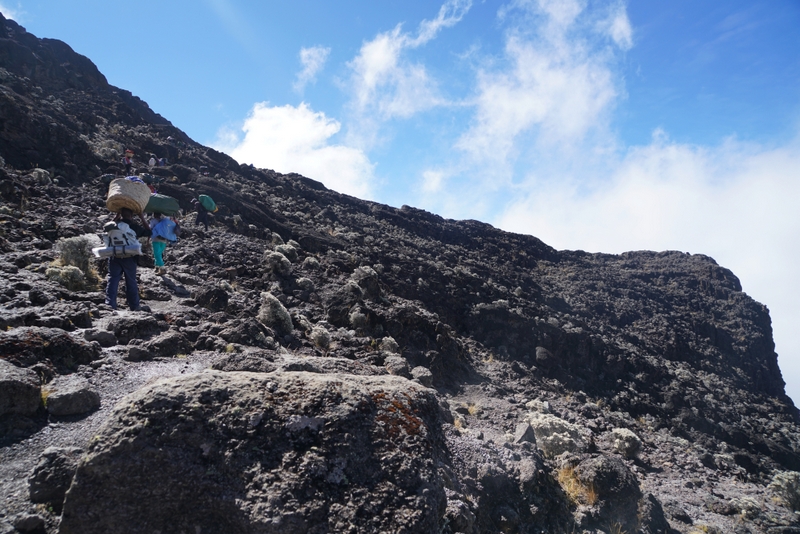
More symptoms of AMS showed up. By the time we set off at 8am, I had already vomited several times throwing up the ginger drink I had that morning. I had a tough day with an ascent of 800m and a descent of 700m. This’s however good for acclimatisation. Sanke carried my water bottle and told me to drink whenever we stopped.
 |
 |
 |
 |
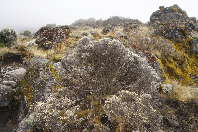
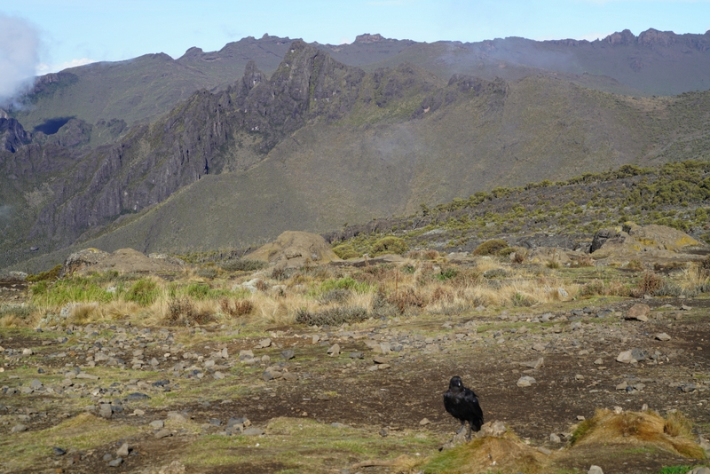
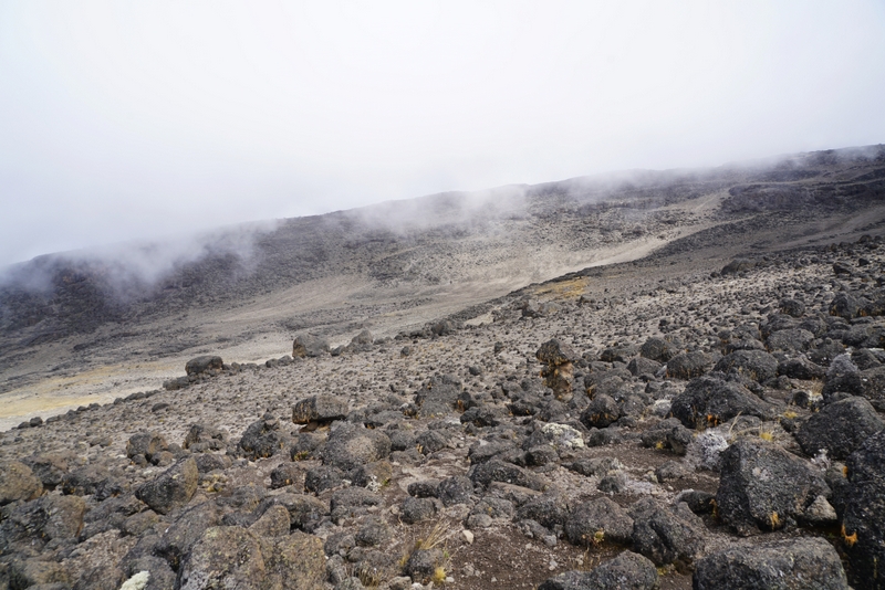
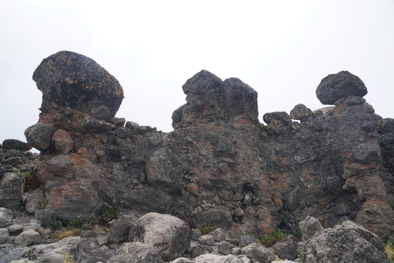
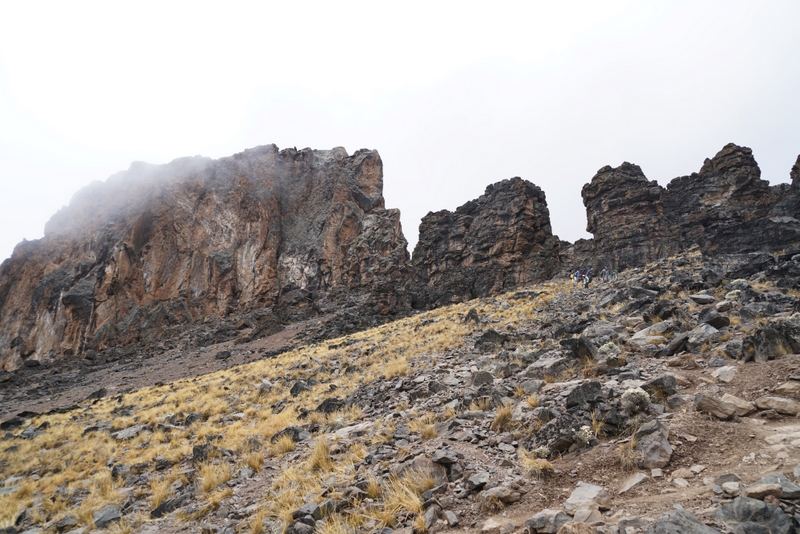
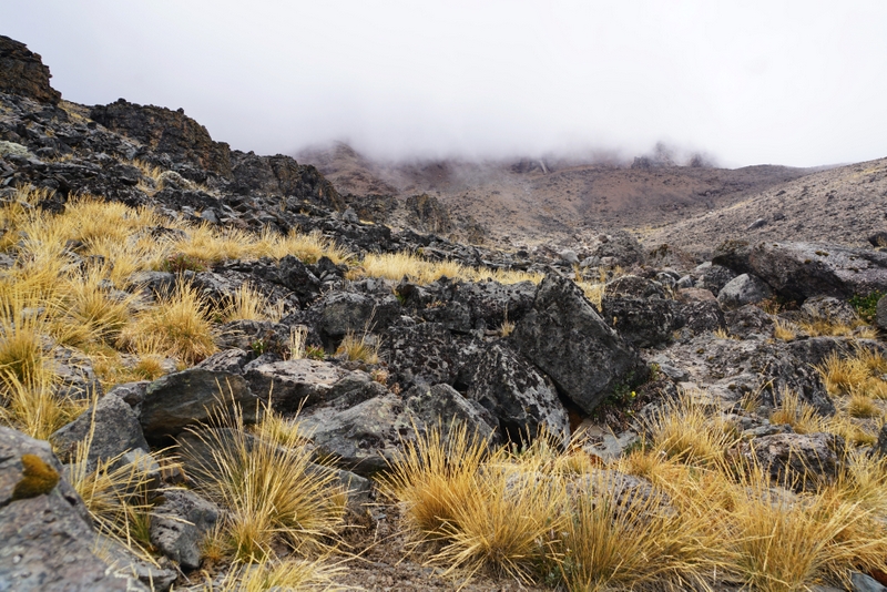
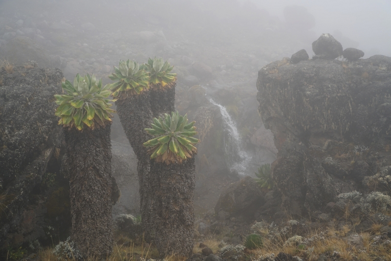
We had fog again most of the time today. Hence, I could not see the massive Lava Tower (also known as ‘Shark’s Tooth’) till I almost reached it. Nonetheless, the landscape with golden tussock grass carpeting the Alpine desert still looked magnificent.
 |
 |
 |
 |
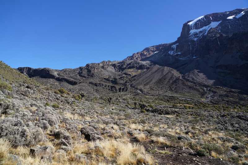
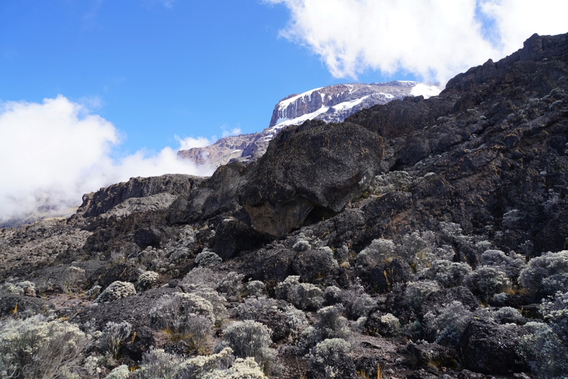
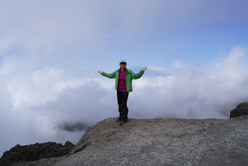
I arrived at the Lava Tower around noon time. For 10 minutes, the blue sky suddenly appeared lighting up the dramatic landscape and surreal Alpine desert which is intersected by vertical lava cliffs/towers and covered by boulders of all sizes. I jumped with joy.
 |
 |
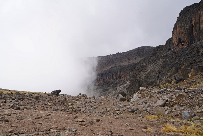
We all had our lunch break here. Some groups had lunch in their own tent. After lunch, I began a steady descent. The weather was fine at the start. But soon fog came: I could only see the outline of the dramatic cliffs on the right side, steep ravines on the left, dried streams, waterfalls and iconic giant groundsels.
 |
 |
 |
 |
 |
 |
 |
 |
By 3pm, I was already in my tent. It was foggy and cold outside. I took an afternoon nap, had beef with vegetable soup for dinner and slept thereafter. This was the last day when I could eat and sleep without problem.
Day 4: Baranco Camp (3950m) to Karanca Camp (3995m) 5km; Weather: changeable, sunshine, fog and rain; Vegetation: Alpine desert
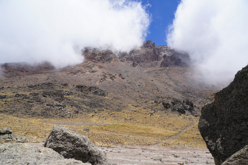
I started a great day with gorgeous views of the summit and the Rebmann Glacier at sunrise. After breakfast, I set off at 8am and had a wonderful and most enjoyable hike to the next campsite. First I descended a well-trodden path and crossed a stream before walking uphill again. I looked back at the Baranco camp ground and was able to trace the path I had taken the day.
 |
 |
 |
 |
 |
 |
 |
 |
 |
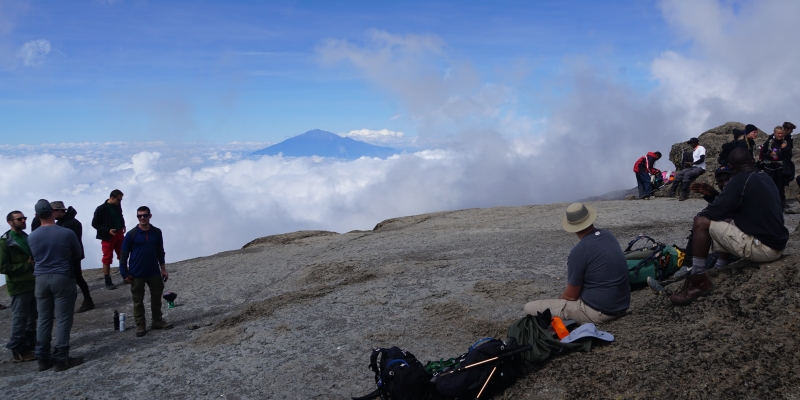
The weather was generally fine in the morning. At 10am, I arrived at the top of the Baranco Wall which affords fantastic views in all directions including Mt Meru. I managed to have a photo with the mountain before the fog rolled in. Luckily the blue sky reappeared lighting up my heart and the landscape for another hour. I could not stop taking photos of Kilimanjaro and the Alpine desert that I had just crossed.
 Path taken to the Baranco Camp and down below |
 Heading to the Baranco Wall |
 View of Kilimanjaro from below |
 Pushing on to Baranco Wall |
 |
 |
 |
 |
 |
 |
Nonetheless, by the time I settled in my tent around midday, it started to rain. I was not tired but felt unsettled. My stomach kept bothering me. I slept a couple of hours after a light dinner with chicken. Then I heard one of the porters coughing badly. I also had to get up a couple of times to go to the toilet near my tent. This toilet is the cleanest one with the best view of the mountain. As a result, I had a restless and sleepless night.