
Day 1 – 6 August 7-12: Disko Island, Disko Bay & Sailing to Thule
 Ilulissat Ice Fjord, August 10, 2015 |
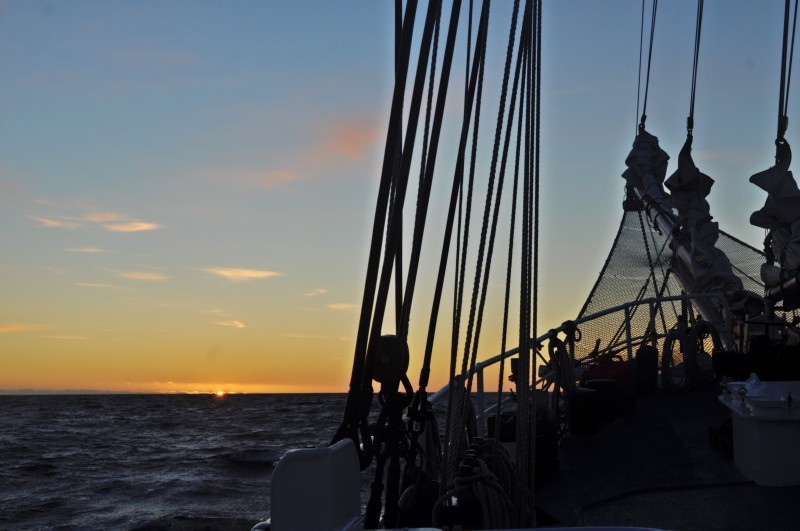 Green Flash at Sunset August 11, 2015 |
Day 1 August 7 Friday: Kangerlussuaq – Aasiaat (68º 44.9‘ N; 052º 38.8‘ W)
The chartered flight to Aasiaat took off at 11:30am and I arrived in Aasiaat around noon. Our expedition leaders Jordi (a Spanish marine biologist) and Denis (a Swiss geologist) met us in the arrival hall. It was grey, wet and foggy. As the boat was not ready for boarding till 4pm, I spent a few hours strolling round the city with a population of 4,000.
 First sight of Rembrandt in Aasiaat |
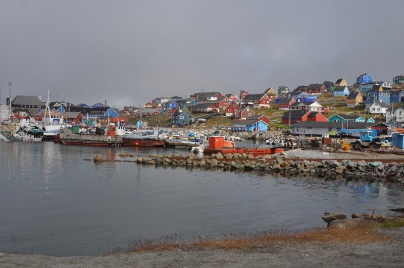 |
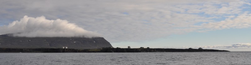
Aasiaat founded in 1759 by Niels Egede and moved to its present location in 1763, is located on an island in the southern part of Disko Bay at the edge of a very beautiful archipelago often referred to as “The land of a thousand islands”. Many of the islands in Disko Bay are conservation areas and provide good opportunities to study the unique birdlime or the whales. The area around Aasiaat has been inhabited by several different waves of Inuit peoples from the Saqqaq, Dorset, and Thule cultures (as far back as 2000 B.C).
After spending almost a week in Kangerlussuaq, I found Aasiaat lively and busy with hundreds of colourful houses scattering along the coast, half a dozen of shops, several eateries, a shipyard, a fish factory and numerous vehicles on the road. I am surprised to find boutiques selling all sorts of merchandise goods including sportswear, candles, furniture, clothes etc. The supermarket is large with everything on the shelf.
I paid 150DKK for the use of Wi-Fi for five hours in a hotel near the pier i.e. 30DKK per hour. I spent an hour to clear emails and messages on Whats App. The remaining four hours of Wi-Fi could be used on August 24 when I would be back in Aasiaat. The weather here is unpredictable. Within a few hours, I had sunshine, mist and rain. By the time I embarked at 5pm, it was sunny – a good omen for the voyage. I am back at sea again!
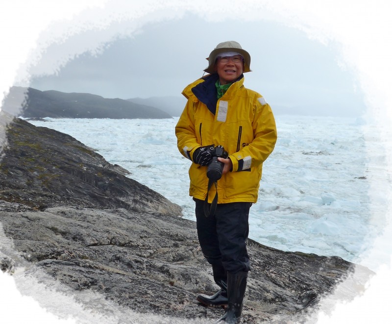
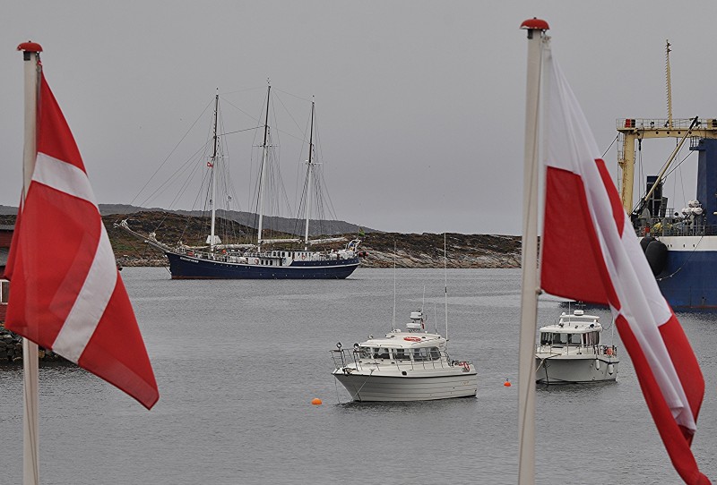
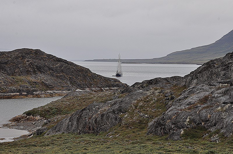
 Returning to my floating home Rembrandt |
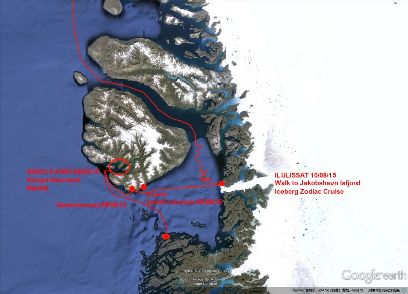 Route map – Disko Bay |
Day 2 August 8 Saturday: Disko Island – Disko Fjord; Noon Position At anchor at Kangerdluarssuk 69º 30.8′ N; 053º 44.8′ W; Air Temperature: 6.5º -8.5º C; Weather: Overcast and rain showers in the morning, becoming partially overcast in the afternoon
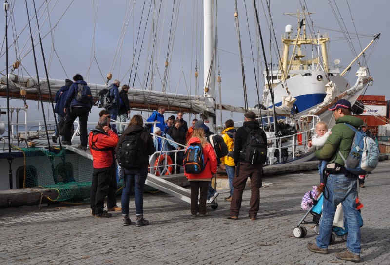
I shared Cabin 15 with Sabina from Germany and Francine from Belgium. The cabin on split level, though small, is good with a pothole. I was the last to enter the cabin and took the bottom berth. I am a bit claustrophobic – luckily I survive as I could see light from the pothole. Of the 30 passengers on board, 16 are German. The youngest passenger is Nivi, a 17-month baby coming with her parents, Christian and Talea who are guest speakers. Everything takes place in the dining room and the bar.At 6pm, we had our first assembly in the dining hall when we met Captain Sven and his crew of nine including Hotel Manager Dejan (whom I met on Ortelius) and the expedition team – Jordi and Denis. Then we had a compulsory briefing on ‘Safety at Sea‘ followed by an ‘Abandon Ship Drill‘. I had my first dinner on the boat at 7pm. Passengers suffered from seasickness and missed dinner. I was hungry and enjoyed my first fish dish with halibut.
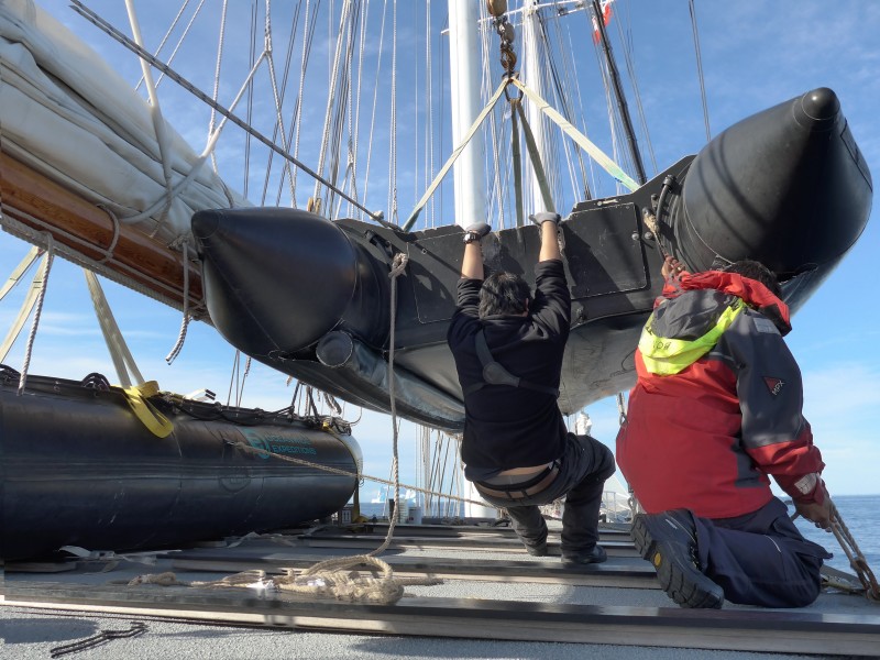
Weather was grey and rainy. As usual, we had to attend several mandatory briefings including one compiled by the AECO (Association of Expedition Cruise Operators) on code of conduct ashore, safety in polar bear areas and another one on zodiac operations on the Rembrandt.
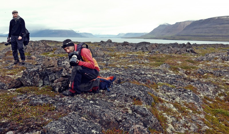
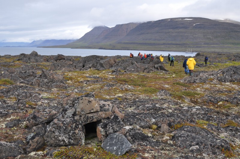
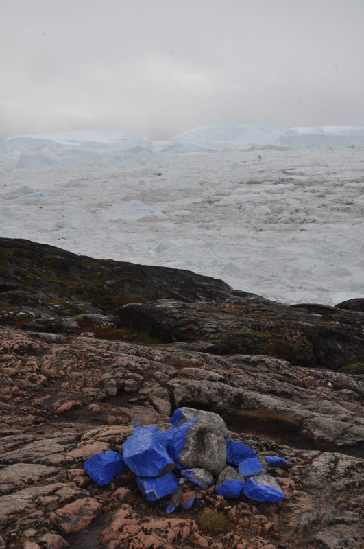
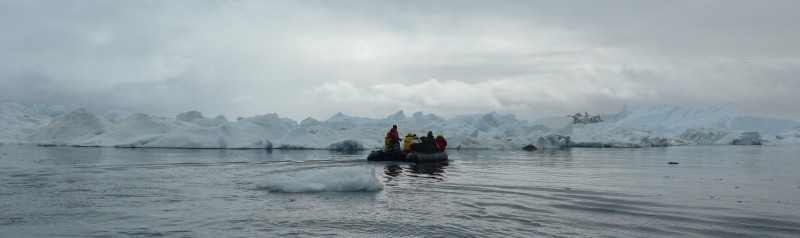
Around 9am, the Captain ordered the anchor be dropped and we had our first landing in a shallow bay in Kangerdluarssuk. Jordi’s zodiac got stuck in mud and he had to jump into the water to pull it out. We split into two walking groups and I joined the hiking group led by Denis. We walked 2km inland in the Arctic tundra and climbed a few hundred metres for a commanding view of the fjord. The area is pretty with two small lakes at several levels separated by ridges of rounded rocky hills and scattered “erratic rocks” which were the results of glaciation.
 |
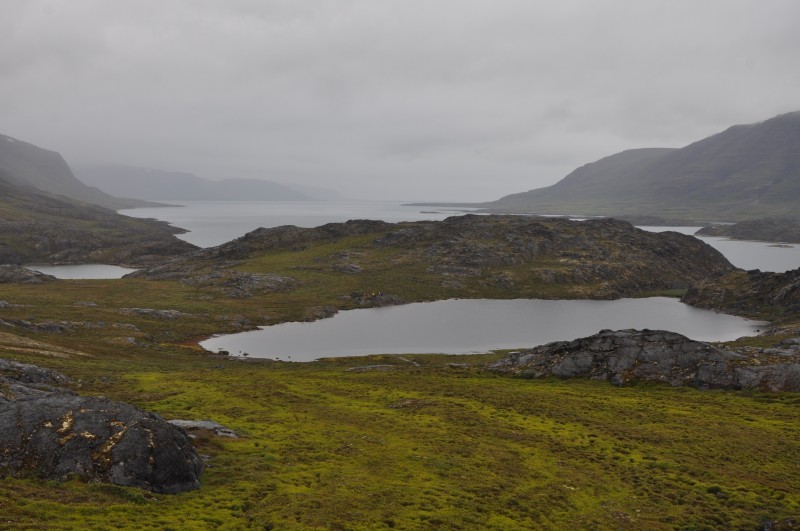 |
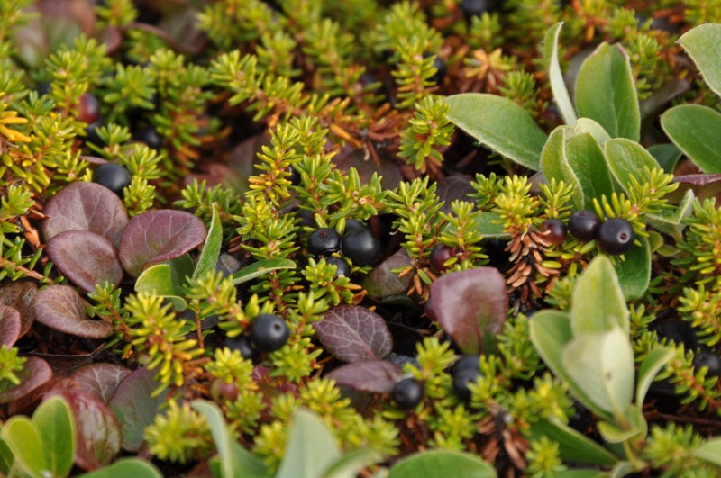
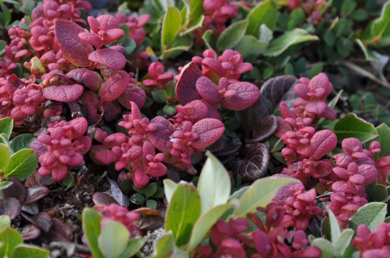
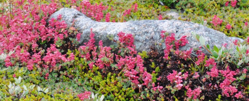
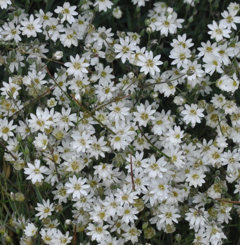
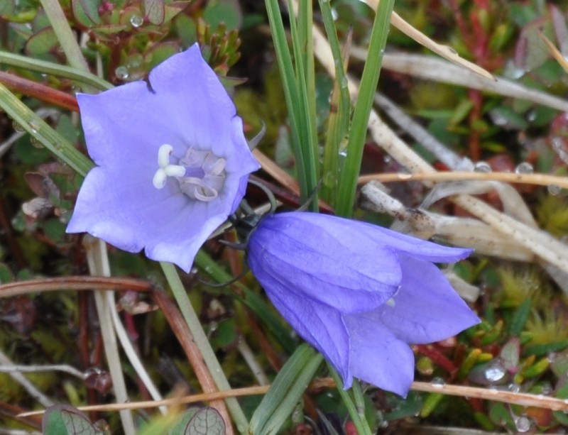
Denis, a passionate geologist, explained in details about the landscape and rock formations. Geologically the terrain is characterised by older basement rock of Archean age. These polished rocks show signs of recent epochs of glaciation and erratic blocks are abundant. The rocks are gneisses and are the basement of the large volcanic basaltic rocks. We also saw Canadian gooses and red-throated divers. The tundra is green this time of the year covered with lovely flora. There were swarms of mosquitoes. Fortunately, I had my net veil and put it over my head. The 4 km-walk was a good start.
 |
 |
 |
 |
At 12:30pm we were all on board again and had our first lunch on board. We sailed westwards towards the entrance of the fjord.
 |
 |
At the landing spot at Nipisat on a small beach, Denis showed us evidence of raised beaches which are the result of the raising of the land, due to the isostatic rebound of the land mass after molting of overlaying ice of the ice cap. These raised beaches represent old beaches, whereas the modern beach is forming at the present time. Geologically this area is made up entirely of volcanic basaltic rocks.
 |
 |
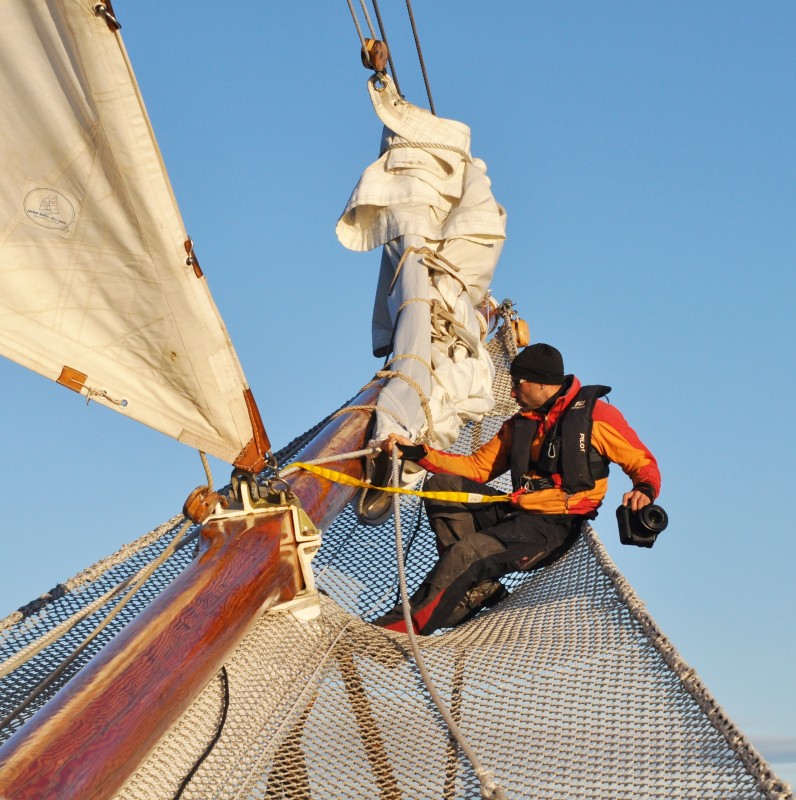
Jordi, a most energetic expedition leader
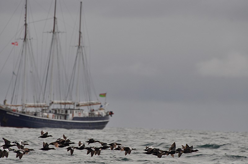
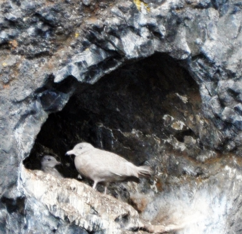
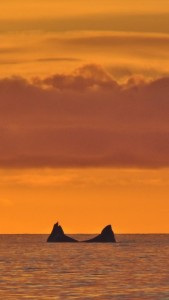
This time, I joined Jordi’s group for a longer hike. We walked up to the top of a small cliff that has been colonised by cormorants and black guillemots. Jordi showed us several fox traps in the shape of a small cage surrounded by rocks and the entrance is closed by a falling rock. Fur from foxes caught in this way would fetch a higher price as it would have no bullet hole. I saw many geese and two Humpback whales swimming from the fjord towards the open water to the East.
I settled easily in my new routine on the boat. Buffet breakfast was served normally at 7:30am, lunch at 12:30 to 1pm and dinner at 7 to 7:30pm. Jordi would debrief us after dinner on highlights of the day and brief us on activities for the following day. Some would drink at the bar, a few were busy with journal writing and others might go to bed.
As the wind charts for the next few days indicated strong winds coming from the north, it would not be desirable to go to Thule against the wind. Instead the Captain and Jordi decided to change the route plan: we would visit the Disko Bay area first before embarking on the 460nm (800km) journey to Thule.
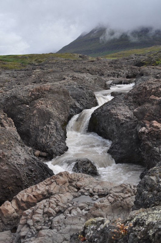
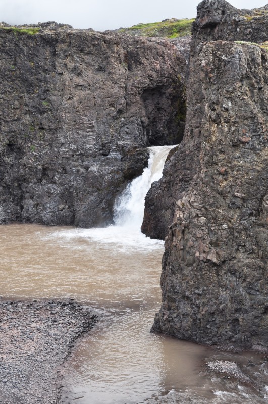
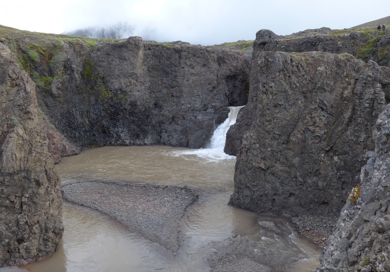
Day 3 August 9 Sunday: Disko Island; Noon Position At anchor at Qeqertarsuaq 69º 15.2′ N 53º 33.2′; Air Temperature: 6.5º – 7.5ºC; Weather: Overcast all day
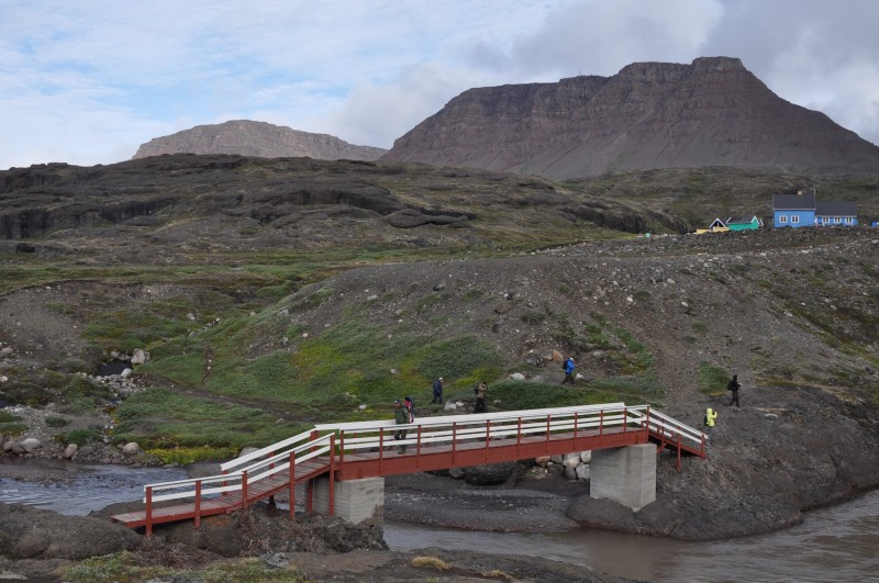
I got up before 6am and found the boat approaching Qeqetarsuaq. After breakfast, we had a dry landing at the jetty at 9am. The group walked together through the town, passed the Danish Arctic Station before crossing a bridge at the eastern outskirt of the town.
 |
 |
I joined the hiking group to the waterfall led by Denis. The walk through the tundra is beautiful and relatively easy without steep or slippery climb. The landscape is pretty with a range of high mountains behind the settlement. There are several visible green patches on the hillside. According to Denis, there are still volcanic activities at some spots. As a result, the temperature around these spots never fall below zero in winter. Amazing!
 |
 |
 |
 |
 |
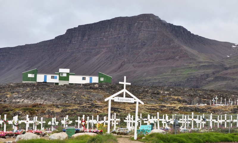
This town has less than 1,000 inhabitants. There are hundreds of colourful Greenlandic houses, a cemetery, a museum and a decent supermarket. After the walk, I slipped into the supermarket and find a full range of food items is available at reasonable cost.
 |
 |
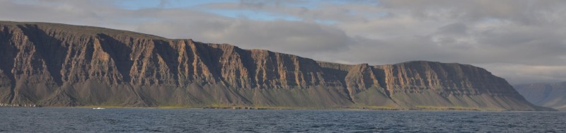
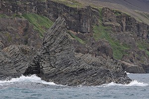
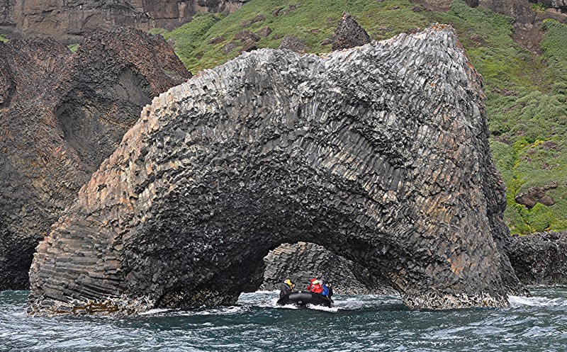
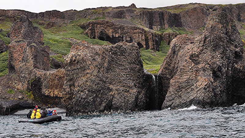
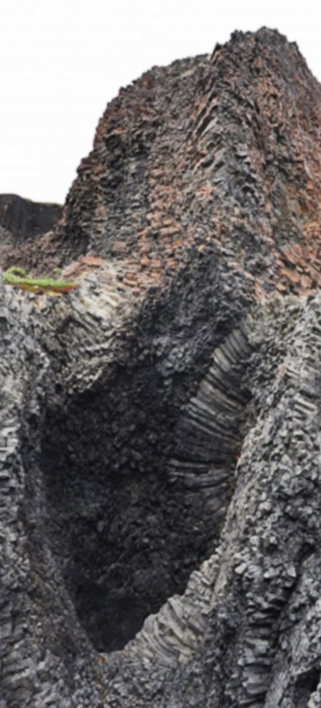
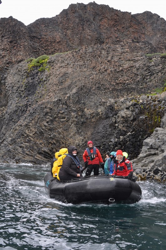
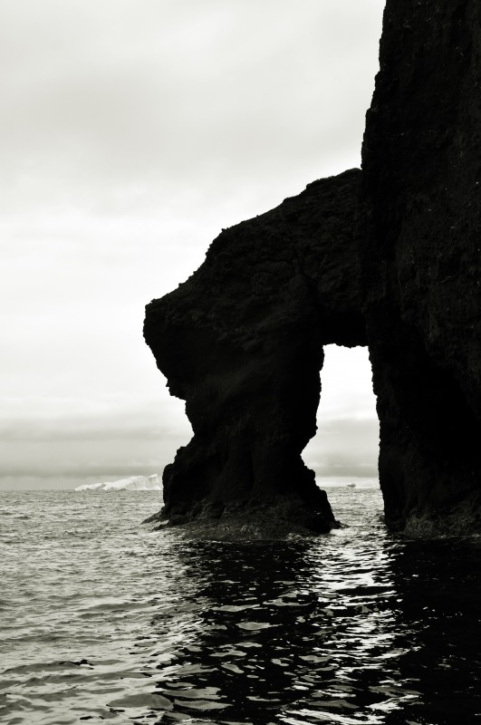
In the afternoon, we were divided into two groups to see the basaltic columns in the Kuanit area. Jordi is an excellent expedition leader as well as zodiac driver. I had a most enjoyable cruise along the coastline which is spectacular and beautiful with basaltic columns, caves, arches and waterfalls. All the cliff, reaching heights of more than 600m in total is related with the geological period of Paleogene vulcanism. We also had a fun drive through the arch rock!
  |
 |
 |
 |
 |
 |
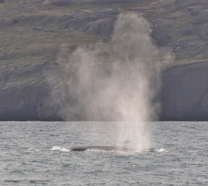
I returned to the boat around 4pm. While Jordi was out with the second group, we spotted a couple of Fin whales swimming close to the boat. I spent the next half an hour on deck tracing the second largest whale in the world. I even managed to take a couple of photos which show their nose and short fin. Fantastic!
 |
 |
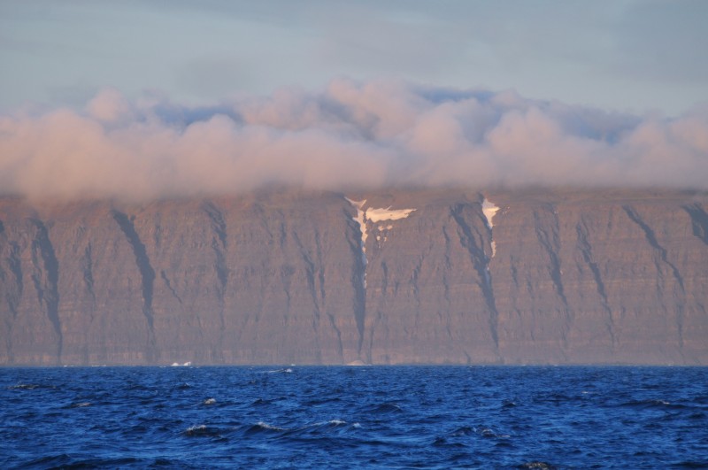
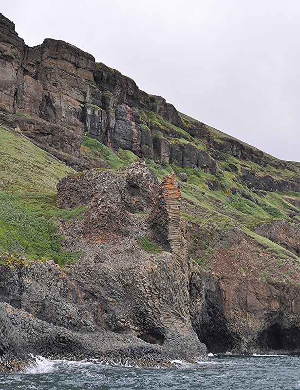 Denis explained in great detail about the formations of basaltic rocks during the debriefing session. The splendid landscape was formed about 62 millions of years ago (Ma). The enormous lava pile that conforms the huge cliffs in the zone was built between 62 and 54 Ma ago. This vulcanism is related with the onset of Paleocene sea floor spreading. It began at West Greenland with the opening of the Labrador Sea between Greenland and Canada. The plateau basalts reach a thickness of 10 km and cover thousands of square kilometres onshore and extends onto the shelf. The volumes of magmatic material erupted during this period were enormous with intervals of 3,000 years between major lava flow units. The shortest periods between other minor eruptions are approximately of 300 years. Different chemical compositions of the lava have resulted, in rusty brown or yellowish colours.
In the periods of volcanic inactivity the piled up sections of lavas suffer weathering, depositing layers of these eroded materials, that can oxidate, giving us nowadays the appearance of non structured layers between the different layers of basaltic rocks.
The columnar basalt formations were formed in the solidifying magma perpendicular to the top and bottom surfaces. As cooling progressed shrinkage caused the polygonal columns to contract and separate from each other. I am proud to say that the basaltic columns in Hong Kong compare well with those found in Kuanit (perhaps even better!)
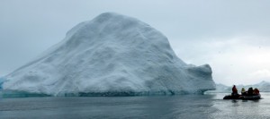
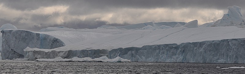
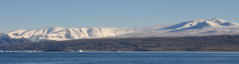
Day 4 August 10 Monday: Ilulissat & Jakobshavn Isfjord; Noon Position At anchor in Ilulissat 69º 13.7‘ N; 051º 06.2‘ W; Air Temperature: 6.5º -9.5º C; Weather: Overcast during the morning and partially overcast later on
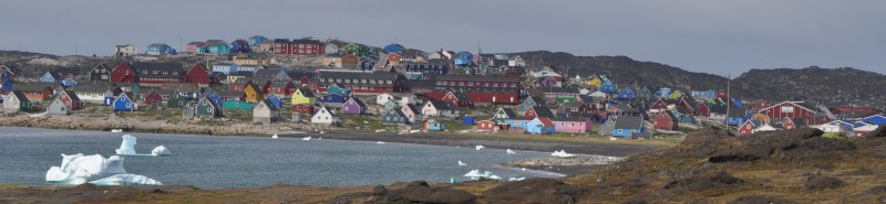
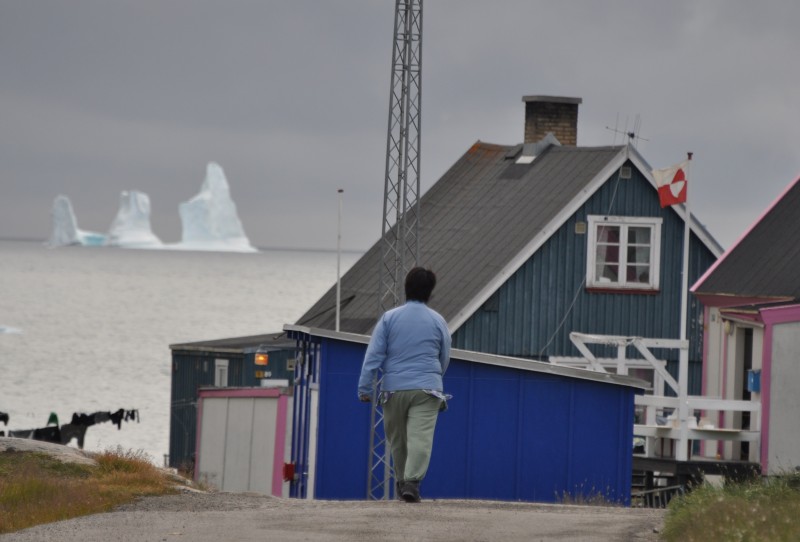
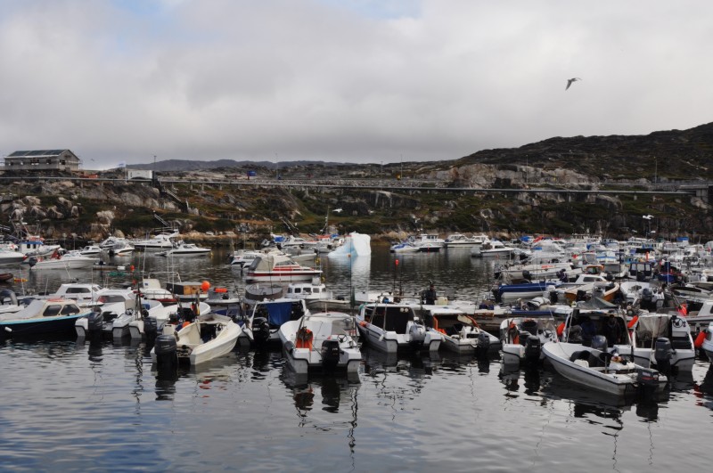
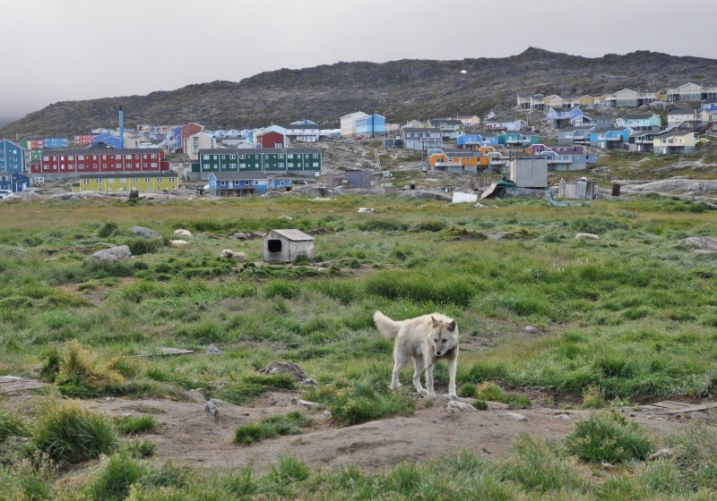
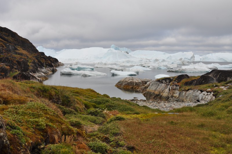
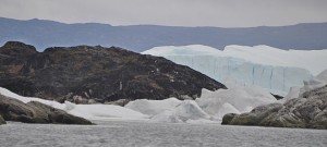
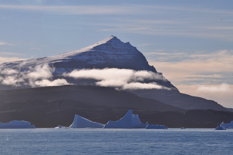
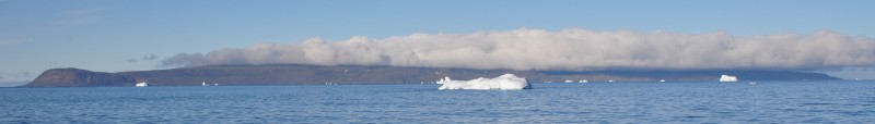
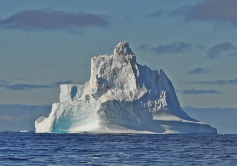
When I woke up in the morning, I was delighted to find our boat surrounded by icebergs and berg bits. I could also see the most visited town by tourists in Greenland, Ilulissat. The economy here is based on fishing of fish and crab and two fish factories are also present, whereas tourism becomes increasingly important. There are some 4,500 inhabitants and over 2,500 dogs.
 |
 |
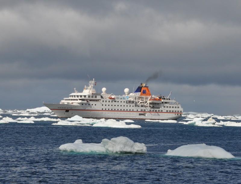
It was raining and grey. Amongst the bergs was a big cruise ship that turned out to be Hanseatic on its Northwest Passage. The weather improved around 10am: I could see the blue sky occasionally.
 |
 |
I joined Denis and walked to the hills that frame the northern side of Jakobshavn Isfjord. The walk to the fjord starts at the old harbor in southern direction, crossing the town and passing the old heliport. After a few hundred meters following the board walk path we arrived at the entrance to the World Heritage Site of Ilulissat ice fjord (Sermermiut). After another 1,000m, we reached the lookout point offering magnificent views over the Kangia ice fjord which is fed by the Kangia glacier (Jakobshavns glacier), the most productive glacier in the northern hemisphere.
 |
 |
 |
 |
 |
 |
 |
 |
 |
It’s a small world: I could not believe when I saw Tao taking photos at the viewpoint! We embraced and chatted non-stop for almost an hour. After spending 68 days on Ortelius, he had travelled for two months in Russia and was now doing the Northwest Passage. It was noon when I said farewell to Tao. Will we meet again? God knows!
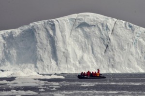
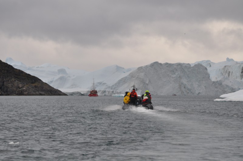
I strolled leisurely through the town and reached the pier at 12:30pm for the last zodiac back to the boat. I moved so slowly that I had no time to visit the birth place of a famous Arctic explorer Knud Rasmussen (now a museum) who was a Greenlander and the colonial houses at the harbor. After lunch, Jordi arranged us to see icebergs at the Jakobshavns Glacier. I set off on the first group with Denis as the zodiac driver. It was raining and cold. The light was not good. The sights were impressive and atmospheric though I was not in a photo-taking mood.
 |
 |
  |
 |
 |
By the time I was back on the boat at 4pm, the sky started to clear up. I felt tired, went to bed before 9pm and had a sound sleep till 1am.
Day 5 August 11 Tuesday: Vaigat Strait & Baffin Bay sailing along the West Coast of Greenland; Noon position 70º 49.6‘ N 054º 55.1‘ W; Air temperature 4.5º – 6.5º C; Weather: Clear and sunny skies during all day, until becoming partly overcast in the evening
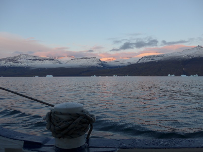
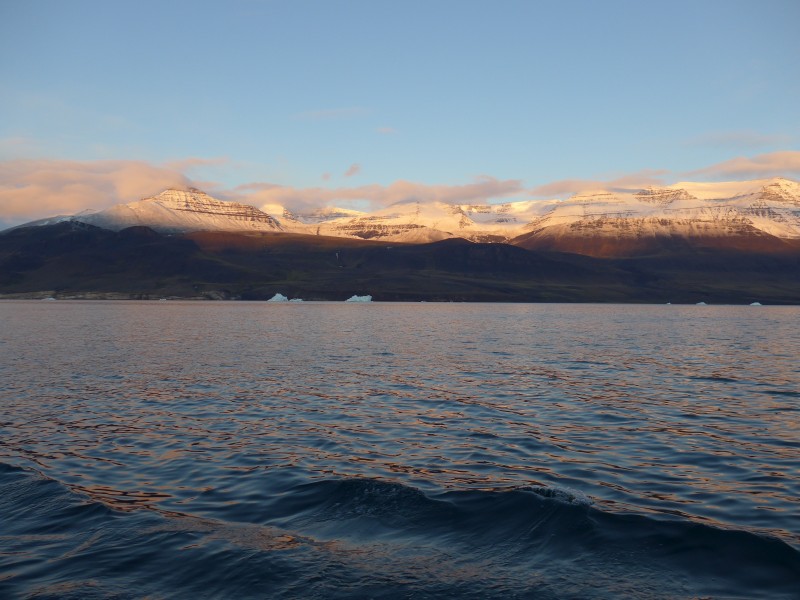
After Ilulissat, we sailed through Vaigat Strait heading north to Thule. As the wind had pushed the majority of the ice and icebergs towards the northern coast, along the shores of Nugssuaq Peninsula and northeast corner of Disko Bay, we had plain sailing making good progress. As I was fully awake by 2am, I got up and watched the boat sailing through the strait. The sunrise was beautiful with pinkish hues covering the mountain tops on both sides of the strait.
 |
 |
 |
 |
As the wind was picking up a bit, the Captain decided to motor-sail putting two engines on full power assisted by a few sails. The boat managed to make 5 to 6 knots an hour – not bad! The expedition team made use of sailing days for lectures. Denis talked about “The volcanic and sedimentary rocks of Disko Island” in the morning. This is a useful introduction and overview of the geology of Greenland.
Somehow, I had problems with my stomach and vomited after lunch. I was not feeling good possibly owing to lack of sleep. I took an afternoon nap and felt much better afterwards.
At 4pm, I attended Jordi’s lecture on “Polar Ecosystems- Part 1” highlighting the similarities and differences in the ecosystem of the Arctic and Antarctica.
After dinner, Talea talked about ‘Living in Greenland‘. She speaks English, Danish, German, Italian and Spanish and has been studying in Italy and Germany. She has been working in the Managing of Greenland Resources Department dealing with the environment and issue of permits for visits to national parks and reserve. Based on her descriptions, I can imagine living for a foreigner in Greenland is not easy especially during the dark winter months. Isolation, inability to speak the local language and difficulties to make good friends can make life miserable.
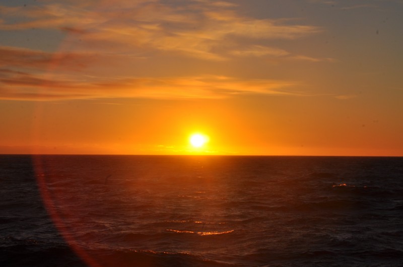
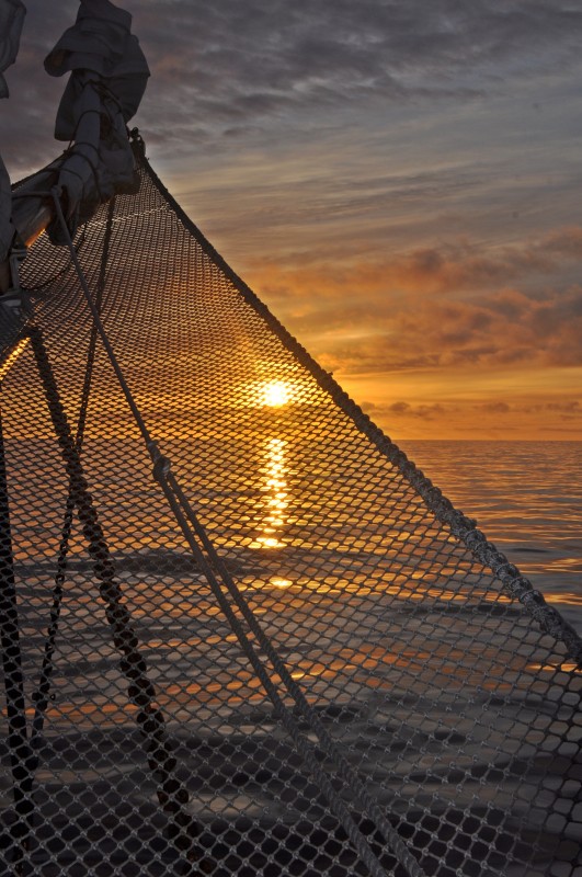
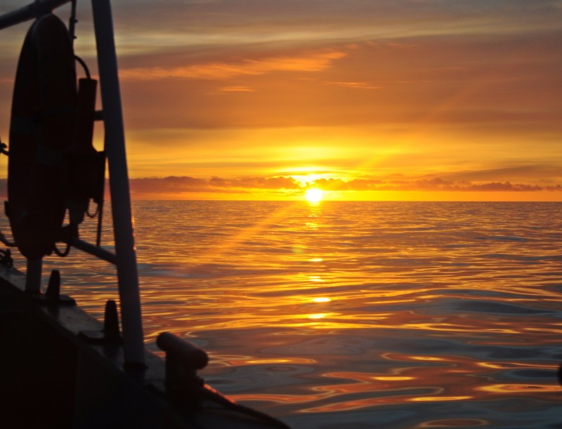
Tonight I stayed up in order to watch sunset. The sky was clear and I asked the Captain whether we could see the ‘green flash’. He guessed we had a good chance. Hence I sat patiently and was thrilled when ‘green flash’ appeared and vanished in no time.
 |
 |
 |
 |
Day 6 August 12 Wednesday: Baffin Bay & Melville Bay sailing along the West Coast of Greenland; Noon Position 73º 01.7‘ N; 057º 58.6‘ W; Air Temperature: 6.5º – 9ºC; Weather: Clear skies all day, becoming partially cloudy in the evening and night
Another sailing day. I felt much better after an excellent sleep. It was the first time I woke up by Jordi’s wake-up call at 7:30am. I did not want to get up and was late for breakfast. Sunshine, virtually no wind and glassy seas welcomed us this morning. As we were out of the area with northerly winds, having calm conditions that lasted the whole day, we sailed between 7 and 8 knots.
 |
 |
Denis gave an informative talk on “Alfred Wegener – Greenlandic and Polar Explorer and the Father of Plate Tectonics”. Wegener (1880-1930) a German meteorologist and a keen observer, had been on three expeditions to Greenland from 1910 to 1930. He died on November 15, 1930 while leading his third expedition in Greenland. During our trip we might visit some of the areas where he had centred his adventures.
In the afternoon, Talea talked about “Ecosystem Based Management. Case Study of Greenland-Disko Bay”. Based on her working experience, she spoke about conservation of natural resources in Greenland, and how the Government deals with nature in the country, through different working groups working on the frame of the Arctic Council comprising the Arctic Eight countries (Russia, Canada, USA, Norway, Greenland & Denmark, Finland, Sweden and Iceland). This approach to Management and Conservation is not entered on a single species biology, stocks and human uses upon it, but abrogate for an integrated approach to management that consider the entire ecosystem, with the interrelations between its biodiversity including humans and their impact as a fundamental part of it. Talea used Disko Bay as an important ecosystem, with many Arctic species using the area, and with men for thousands of years have also been using the resources for survival, science, exploration and recently tourism.
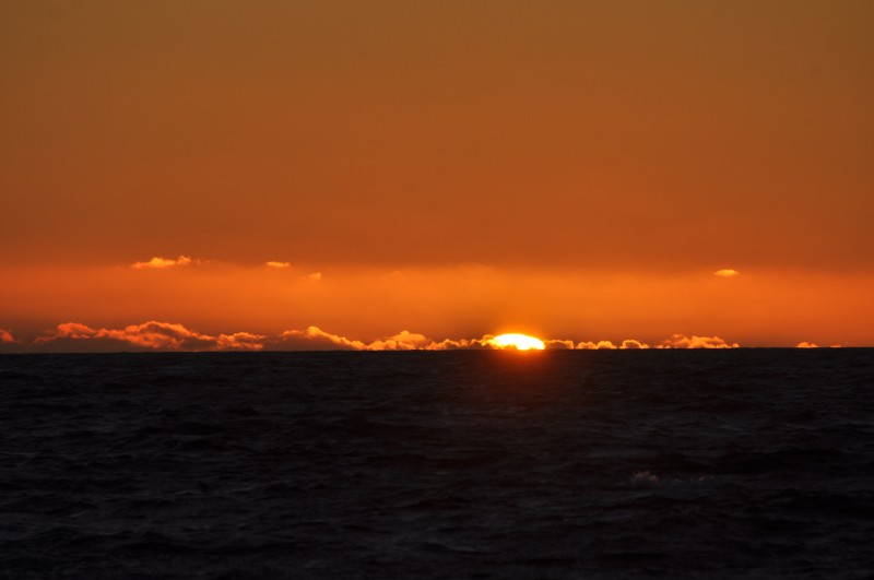
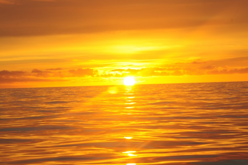
Today I had good appetite. Khabir had brought fresh cod from Ilusiaat: the fish was so tasty and fresh! The sunset was gorgeous with red and deep orange hues. After having seen an awesome green flash the night before, I decided to look for the second one. By 1:15am, the sun was still above the horizon. Peter who was also waiting for the miraculous moment and I gave up and left the fore deck. (Sandra, the Second Officer told me later that the sun rose half an hour after my departure. What a pity!)
 |
 |
 |
 |
 |