
32-day from Bluff, New Zealand to Ushuaia, Argentina
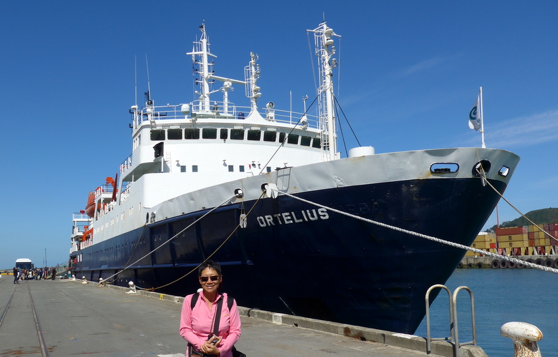
MV Ortelius at Bluff Port, February 11, 2015
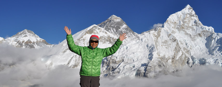
My trip to Falkland, the Antarctica Peninsula, South Oakley Islands and South Georgia in early 1999 marks the beginning of my love affairs with the polar regions. I am totally captivated by the pristine nature, wildlife and unearthly beauty of the polar region. After three Arctic journeys, I am ready for the Antarctica odyssey from Bluff, New Zealand to Ushuaia, Argentina via the Southern Ocean before travelling to Cape Verde on board the ship MV Ortelius.
Antarctica – the White and Frozen Continent
Antarctica with an area of 14 million km² is the 5th largest continent in area after Asia, Africa, North America and South America. About 98% of the continent is covered by ice which average thickness is 1.9km. It is the coldest, driest and windiest continent with the highest elevation. Owing to the extremely low precipitation (about 20mm in the interior), it is considered a cold desert. The continent has been governed since 1959 by the Antarctic Treaty with some 50 signatory countries.
Geography
More than 170 million years ago, Antarctica was part of the super continent Gondwana which gradually broke apart. The present day Antarctica was formed around 25 million years ago. At a number of points in history, the continent was located farther north with a tropical or temperate climate and was covered in forests and inhabited by various ancient life forms.
About 98% of the continent is covered by ice sheet average at least 1.6km thick. Antarctica has about 90% of the world’s ice (about 70% of the world’s fresh water). Surrounded by the Southern Ocean, itis divided into two by the Transantarctic Mountains close to the neck between the Ross Sea and the Weddell Sea.
The continent is the windiest place on earth. Katabatic wind carrying high density air from a higher elevation down a slope under the force of gravity can rush down elevated slopes at hurricane speeds. In a few regions of the continent, snow is scoured away by such winds resulting in dramatic ‘dry valleys’ such as the McMurdo Dry Valleys.
 |
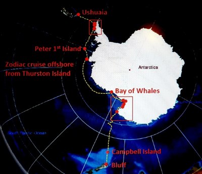 The route map |
Biodiversity
Phytoplankton and Antarctic krill are critical components in the ecosystem of the Southern Ocean. Krill which feeds on phytoplankton, is an important food source for whales, seals, squid, icefish, penguins and albatrosses and many other birds.
Owing to the extremely cold environment, few terrestrial vertebrates live in Antarctica. The snow petrel is one of the only three birds that breed exclusively in the continent. Antarctic sea life is more vibrant where marine animals including penguins, blue whales, orcas, colossal squids and fur seals survive. The Emperor Penguin is the only penguin that breeds during the winter in Antarctica.
The harsh climate of Antarctica inhibits plant growth. Hence the diversity of plant life is very low and limited in distribution. Nonetheless, some 1150 species of fungi have been recorded of which 400 are lichen-forming. Seven hundred species algae also exist.
Discovery and Exploration
Since the times of Ptolemy (1st century AD), people believe in the existence of a Terra Australis, a vast continent in the far south of the globe. The Antarctic Continent is the last continent to be discovered though it is not clear who first discovered it. Zealous navigators and explorers have contributed to the discovery and exploration of the continent. The Heroic Age of Exploration in the early 20th century epitomized by the epic voyages and life stories of Robert Falcon Scott, Ernest Shackleton and Roald Amundsen is legendary.
Captain James Cookwas the first person to circumnavigate the continent. His ships, HMS Resolution and Adventure, crossed the Antarctic Circleon 17 January 1773 coming within 121km of the Antarctic coast (71º10’S, 109º30’W) before driven back by ice and again in January 1774. He dispelled the myth that a fertile and populous continent surrounded the South Pole.
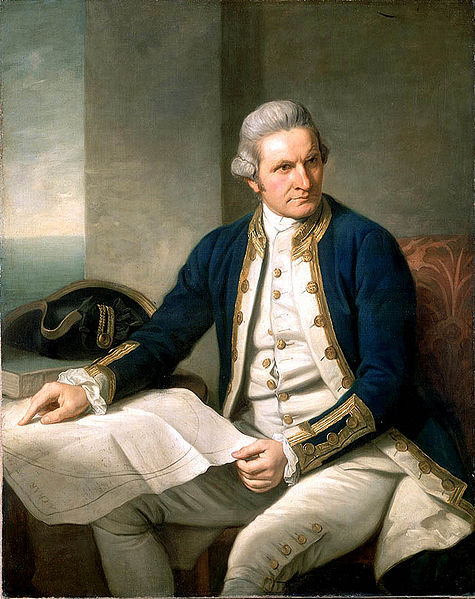 Captain James Cook |
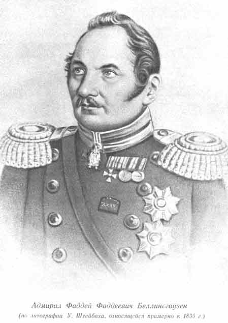 Admiral von Bellingshausen |
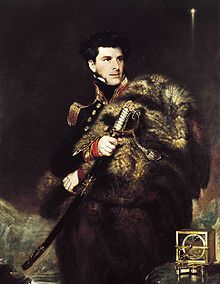 Portrait of Sir James Clark Ross by John R. Wildman |
The first sighting of the continent can be narrowed down to the crews of ships by three explorers in 1820. Fabian Gottieb Thaddeus von Bellingshausen (1778-1852)reached on 28 January 1820 a point within 32km from Queen Maud’s Land and recorded the sighting of an ice shelf (i.e. the Fimbul ice shelf). Edward Bransfield(1785-1852) of the Royal Navy Bransfield sighted Trinity Peninsula, the northernmost point of the Antarctic mainland on 30 January 1820. Nathaniel B. Palmer a sealer from Connecticut.Palmer did so later in November. The first documented landing on Antarctica was by John Davis, an American sealer who landed at Hughes Bay on the Peninsula on 7 February 1821.
James Weddell (1787-1834), a British navigator and seal hunter sailed in February 1823 to 74°15′ S and into a region now named after him – the Weddell Sea.
Sir James Clark Ross (1800-1862) led the British Royal Navy’s Antarctic Expedition (1839-43) with two ships, Erebus and Terror. He discovered an open sea beyond the ice pack that had stopped every boat from approaching the continent and was the first person to reach the ‘farthest south’ at 78º10’S. Today his name is found all over this area including the Ross Sea, Ross Island and Ross Ice Shelf.Charles Wilkes (1798-1877), an American explorer led an expedition (1838-1842),reached 70ºS and 102ºW and reported the discovery of the continent west of the Balleny Islands in January 1840.
Adrien Victor Joseph de Gerlache (1866 – 1934) led a Belgian Antarctic expedition (1897-99) in Belgica and explored what is now the Antarctic Peninsula. In January 1898 he discovered a strait which is now named after him and crossed the Antarctic Circle in February 1898. His ship trapped in the ice of the Bellinghausen Sea till mid April 1899 became the first vessel wintering in Antarctica.
The first recorded and confirmed landing was at in 1895 by Carsten Borchgrevink (1864-1934) a Norwegian and his team on the ship Southern Cross. His party was the first one ever to winter on the continent at Cape Adare in 1899. His hut is still standing today.
Jean-Baptiste August Étienne Charcot (1867 – 1936), a French scientist andmedical doctor, led two expeditions to Antarctic. First his ship Francaissailed around the west coast of Graham Land from 1904 to 1907. In his second expedition from 1908 to 1910, his ship Pourquoi-Pas explored the Bellingshausen Sea and the Amundsen Sea and discovered Loubet Land, Marguerite Bay and Charcot Island.
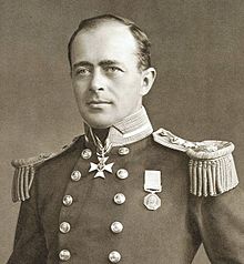
Robert Falcon Scott
Robert Falcon Scott (1868-1912) led the British National Antarctic Expedition in Discoveryin 1901-04 and another expedition in Terra Nova in 1910. Accompanied by Edward Wilson, L.E.G. Oates, Birdie Bowers and Edgar Evans, he reached the South Pole on 18 January 1912 but died of hunger, exhaustion and failing health with a broken heart on their return journey leaving the most moving accounts of their final struggle during the heroic age of exploration of the continent. Their bodies were found on 12 November 1912.
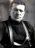
Sir Ernest Shackleton
Sir Ernest Shackleton (1874-1922), a member of Scott’s 1901-04 expedition, led the British AntarcticNimrod Expedition in 1907-09. On 9 January 1909, Shackleton and party reached 88º23′ S (156km from the geographic South Pole) but decided to return owing to dwindling supplies and bad weather.
Shackleton’s third expedition (1914-17) is the most dramatic Antarctic adventure in history! His original plan was to cross the continent and he set sail in his ship Endurance with a crew of 28 on 5 December 1914 from South Georgia. Soon they were caught in ice and Shackleton and his crew spent 497 days on ice floe with the ship eventually sank in Weddell Sea (69º5’S, 51º30’W) in November 1915. The stranded men finally landed in Elephant Island in three lifeboats in mid April 1916, 557km from where their ship had sunk. In order to seek help, Shackleton accompanied by Frank Worsley, Tom Crean, John Vicent, Timothy McCarthy and McNish (a carpenter) set sail on 24 April 1916 in James Caird, a 20-foot lifeboat for a whaling station in South Georgia (720 nm away). On 9 May 1916, they landed on the unoccupied southern shore and Shackleton, Worsley and Crean then walked 51km over mountainous terrain for 36 hours to reach the whaling station at Stromness on 20 May. Shackleton with the assistance of the Chilean government and a British whaler finally reached Elephant Island on the fourth attempt on 30 August 1916 and reunited with all 22 men! Without his leadership, prowess, endurance and luck (!), it is inconceivable to return without a single loss of life in such an epic journey in the toughest conditions. In 1921, Shackleton led another expedition but died in South Georgia on 5 January 1922. I visited his grave in South Georgia in 1999.
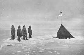
First men at South Pole, 14 December 1911
Roald Amundsen (1872-1928), a Norwegian polar explorer,began his first expedition to the Antarctic on Belgicain 1897 which was the first boat to winter over on the continent. He had the first expedition to traverse the Northwest Passage (1903-06) in the Arctic. His expedition on Fram of 1910-12, originally intended as a North Pole voyage switched course as he wanted to beat Scott to reach the geographic South Pole. Accompanied by Hanssen, Wisting and Bjaaland, Amundsen left the Bay of Whales on 20 October 1910 with four sledges and 52 dogs, went over the Axel Heiberg Glacier and reached the Pole on 14 December 1911. He was the first expedition leader to be recognised without dispute as having reached the North Pole in 1926 together with Umberto Nobile, an Italian explorer. He went missing over the Arctic seas in 1928 during a rescue search for Nobile whose airship Italia wrecked after flying over the North Pole.
The Heroic Age of Exploration finally came to an end with the advent of modern and sophisticated technology.
Conservation
Antarctica is the least spoilt land on earth. The Protocol on Environmental Protection to the Antarctic Treaty (also known as the Environmental Protocol or Madrid Protocol) which came into force in 1998, is now the main instrument concerned with conservation and management of biodiversity in Antarctica.
Today, Antarctica is a top tourist destination. Expedition tourism existed since 1957 is currently subject to Antarctic Treaty and Environmental Protocol provisions and self-regulation by the International Association of Antarctica Tour Operators. Travel is largely by small or medium ship focusing on specific scenic locations with accessible concentrations of iconic wildlife. The maximum number of tourists ashore is kept at 100.
About 35,000 tourists visit Antarctica a year with over 70% travelling to the Antarctica Peninsula with ships with fewer than 501 passengers. Ships with more than 500 passengers can cruise without landing: about 27% of Antarctic tourism is ‘cruise only‘. Only about 1% of the visitors who can pay over US$50,000 can make their way to the Pole or climb Mt Vincent, Vinson Massif (78°35’S, 85°25’W), the highest mountain in the continent (4897m).
Day 1(February 11, Wednesday): Departure from Bluff Harbour 46º 36’S 168º 20’E, Air 19ºC; On board MV Ortelius
My travel agent has told me to arrive at Kelvin Hotel at 2pm. The first person I meet is Alan Burger, one of the expedition team members. At 3pm, two coaches set off for Bluff. After a quick tour of this sleepy town which I visited in 2004 on my way to Stewart Island, we arrive at the port where I have my first sight of MV Ortelius- my floating home for the next one month.
MV Ortelius
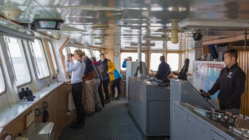
The ship owned by a Dutch company is named after Abraham Ortelius (1527-98), a Flemish cartographer and geographer who produced the first world atlas in 1570. The ship with a maximum passenger capacity of 125, is 91 m long, 17,6 m wide and has a maximum draft of 5,8 m, with an ice strength rating of UL1/1A, top speed of 13 knots. It is basic but functional fitted out for polar expeditions. It has three helicopters, a lecture room on Level 3 (right next to my cabin), one restaurant on Level 4 (next to the reception) and a bar/lounge on Level 6. All passengers have access to the bridge on Level 7.
 |
 |
Around 4pm, the NZ immigration and customs staff arrive. Half an hour later, I step into Cabin 337 and meet my cabin mates: Laurie, a writer from New York who is writing a book on William Grawonski, a stowaway on Byrd Expedition in 1928 and Katherine, a French meteorologist. I decide to take a 3-person cabin as I pay US$5000 less. Our cabin is simple, small but liveable with two potholes, two bunk beds (for 4 persons), a writing table and a toilet with shower. I take a lower bunk while Katherine (the third person to arrive in the cabin) has the top bunk one. Laurie has the other lower bunk bed. We are well-organised and manage to keep the cabin fairly tidy.
|
|
Before the ship sets sail, we attend a mandatory lifeboat and safety drills. At 7 pm, the lines are cast off and our ship moves out into the bay and then the open sea. We see our first albatrosses glide by minutes later.
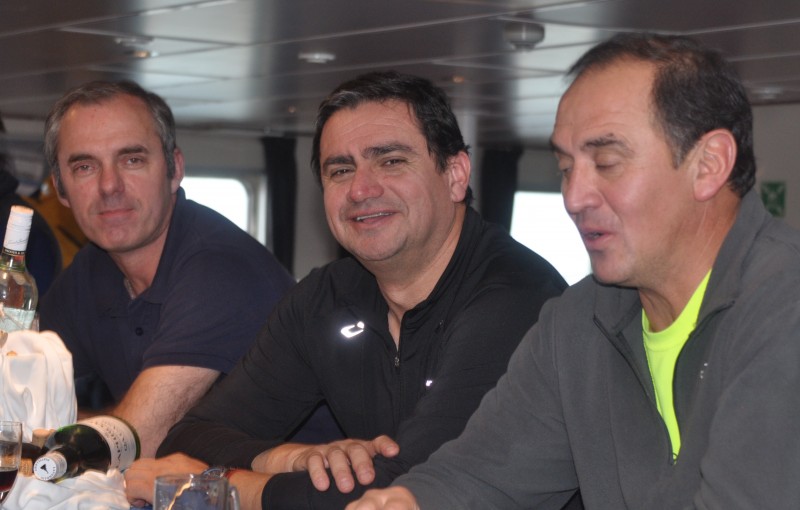
Tonight we have a welcoming party before dinner and met Captain Tuomo Leskinen supported by an international crew of 45. Robert McGillvray is our hotel manager, Don McFadzien, the expedition leader and Jim Mayer, the deputy leader. We also have Carol Knot (historian), James Cresswell (geologist), Alan Burger, Dmitri Banin and Gary Miller (all naturalists). John Gumbley, NZ government representative of the Department of Conservation, is on board to show us the historic huts. The 6-member helicopter team comes from Chile and our three pilots are Marcelo Yanez, Andres Silva and Guillermo Müller.
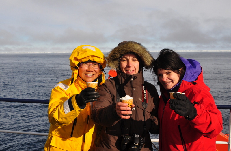
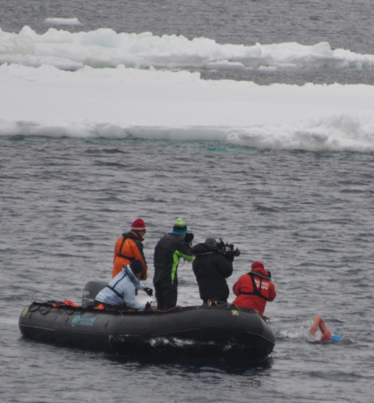
Of the 84 passengers from 14 countries, two have come on mission. Louis Pugh, an ambassador of the UN Environment Programme and swimmer of extreme cold waters, plans to swim in the Southern Ocean to raise world attention to the need to preserve Ross Sea and ban commercial fishing in the area. Michael Martin, a renowned top desert photographer who has won numerous awards for “Deserts of the Earth” comes to photograph the Dry Valleys for inclusion in his 31st book named ‘Planet Desert’ to be released this September.
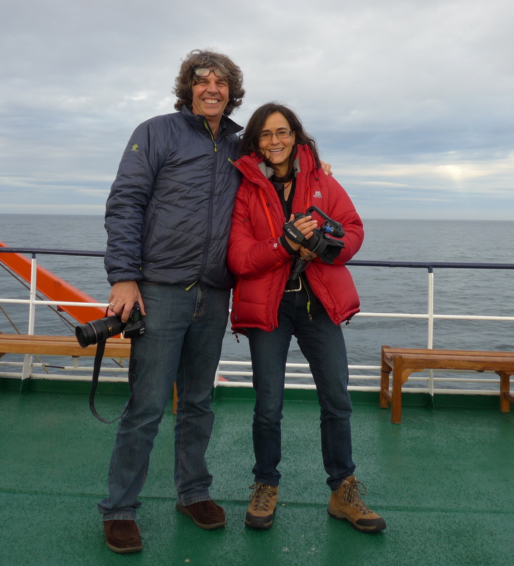 Elly & Martin |
 Steve and his filming team |
The sea was calm and I had a good sleep on my first night on the ship. (D-turkey)
Day 2 (February 12 Thursday): At Sea- Noon position: 49º 38’S 168º 48’E; Wind NNW Force 7; Sea state 4; Air 19ºC; 2 lectures
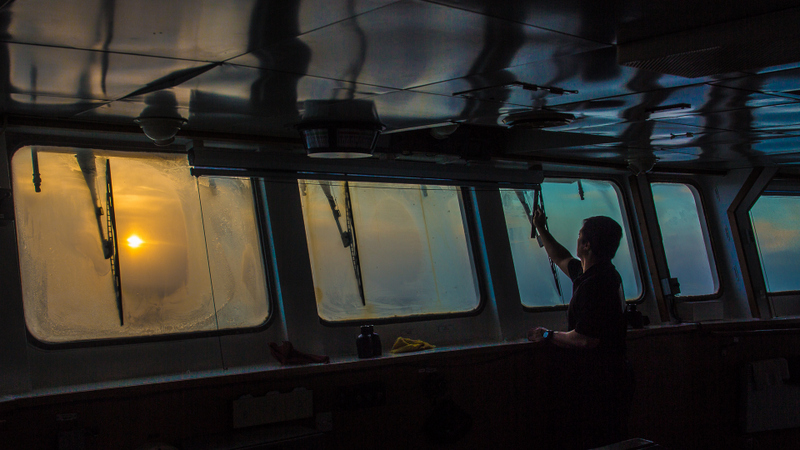
Photo by Ingo
Life in a ship is strangely simple and hassle free. I have no burden or responsibility: no need for passport and money; no need to take any decision on where to go, what to do and eat. But there is nowhere to escape. There is no gym and the only exercise is to walk from my cabin in Level 3 to the bridge at Level 7. I can also get fresh air on Deck 5 and 6 provided I am warmly dressed.
I settle down in a new routine with ease (as I am a lazy person). On a sea-day, I get a wake-up call – ‘”Good Morning, Good People” through the public address system from Don half an hour (7:30am) before breakfast (8-9am); attend a morning lecture; have lunch around 12noon; sit in an afternoon lecture; join a recap/ briefing at the bar at 6pm; have dinner around 7pm and watch a film/documentary at 8:45pm. If I am tired or the sea is calm, I have a good sleep. If not, I have a sleepless night. I put on weight owing to overeating and lack of exercise.
For excursions, we land by zodiac or helicopter depending on the distance, weather and ice conditions. Sometimes, we have a zodiac cruise to appreciate the white wonderland with icebergs and wildlife on ice floes.
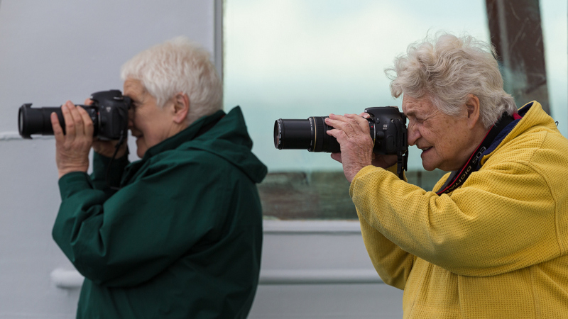
As we spend almost all the time at sea, wildlife and iceberg watching from the bridge or open deck on Level 7 or at the bow on Level 4 is a flavourite past-time.
 Ann and Lise taken by Ingo |
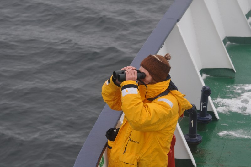 Picard whale watching |
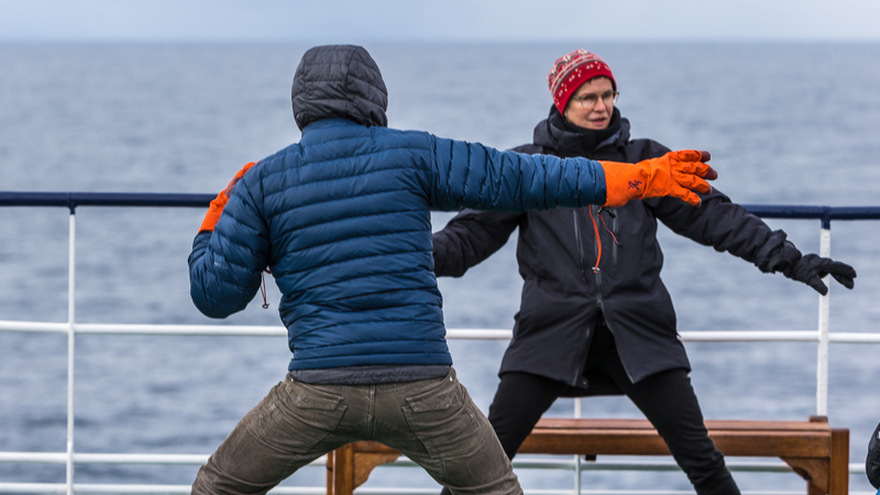 Exercise (photo by Ingo) |
 Bridge scene (Photo by Ingo) |
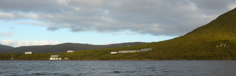
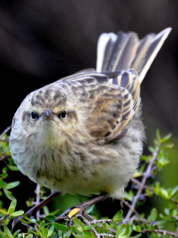
Today, we have a compulsory lecture on Antarctica and responsible tourism. We have to learn about getting on and off the gangway and in and out of zodiacs safely. We also collect life-vests and insulated gumboots. In the afternoon, we line up to vacuum all our outer clothes and backpacks to prevent the dispersal of alien seeds, insects or microbes to Campbell Island and the Antarctic. To prepare us for our first landing, Dmitri gives an evening lecture on flora, fauna, birds and animals on Campbell Island. This island group is NZ’s southernmost sub-antarctic territory, lying some 660km from Bluff.
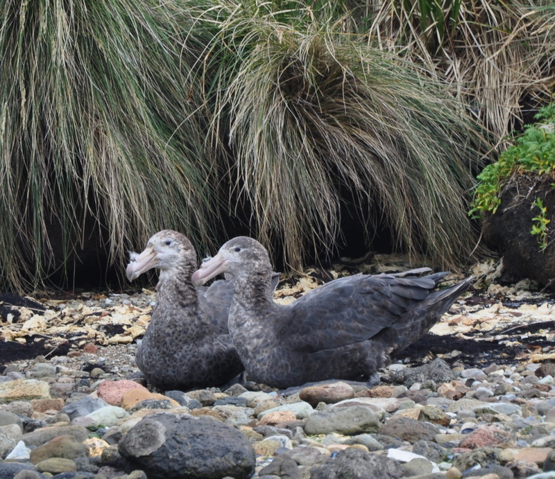
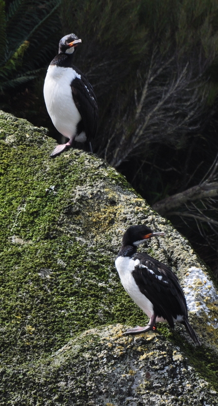
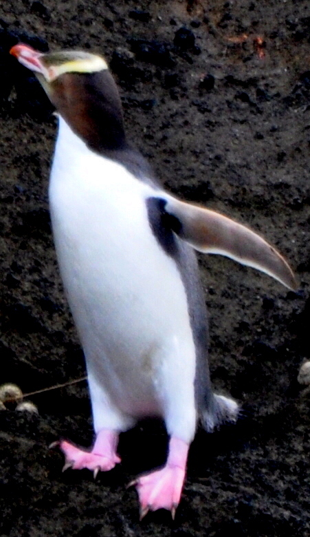
Campbell Island (11,268 ha in area), eroded remains of a shield volcano and teeming with rich flora and fauna and wildlife, is now a World Heritage Site. The successful eradication of rats and domesticated animals from the island has helped the growth of bird population. The island is home for six species of albatross including the Southern Royal, Antipodean, Light-mantled sooty and Yellow-eyed albatross (one of the rarest penguins on earth with only about 2,000 individuals known to exist.), Campbell Mollymawk and Black-browed Mollymawk. One can also find Campbell Island teals, petrels, sooty shearwaters, Antarctic terns, snipes, pipits and red-billed gulls here. (L- beef goulash and rice; D- pan-fried hake and quinoa which is labelled at the world’s healthiest food!)
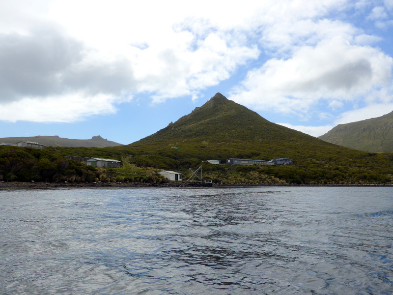
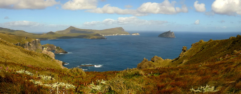
Day 3 (February 13 Friday): Campbell Island, NZ- Noon position: 52º 33’S 169º 12’E; Wind W Force 6; Sea state 2; Air 13ºC; First landing & First Cruise –A fantastic day with activities
I watch the ship entering the Perseverance Harbour on the north side of the island at sunrise. It’s wonderful to find plenty of sooty shearwaters and light-mantled albatrosses in the harbour.
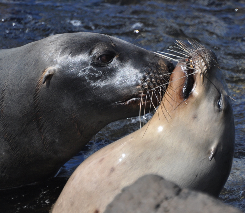
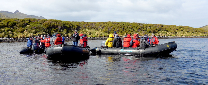
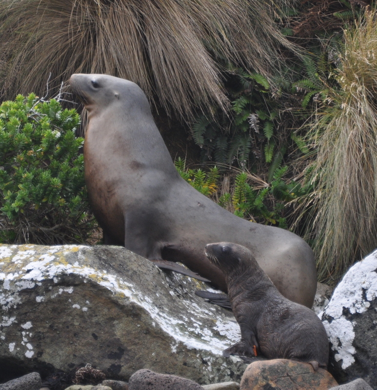
Zodiac operation begins at 8am and we are greeted by an exciting welcoming party of rambunctious young NZ sea lions. All visitors are required to walk on the boardwalk into the island interior. The boardwalk is well-maintained showing NZ authority’s determination and efforts to maintain its pristine nature while accommodating the demands of ecotourism.
 |
 |
 |
 |
 |
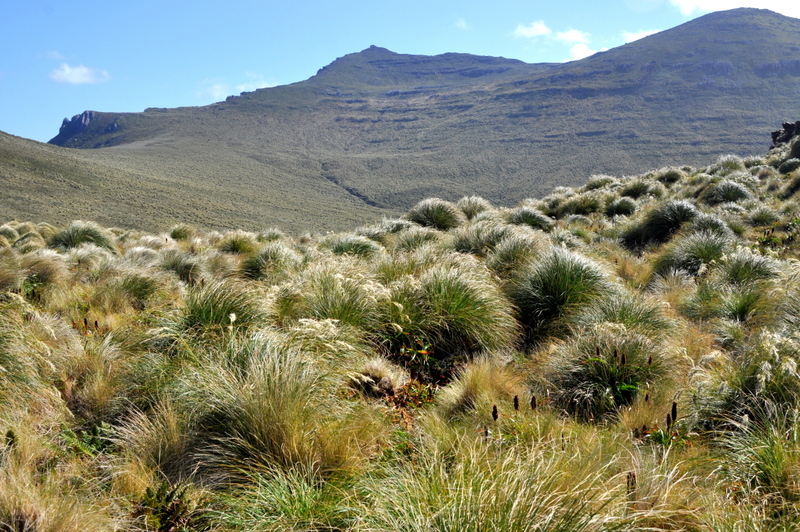 |
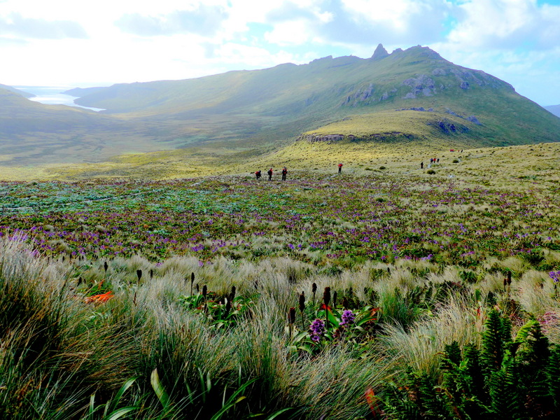
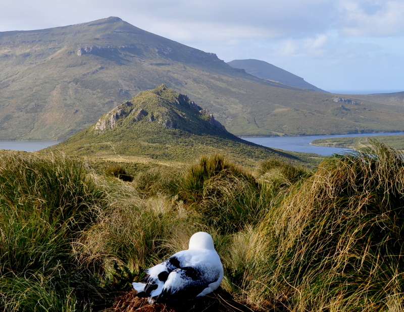
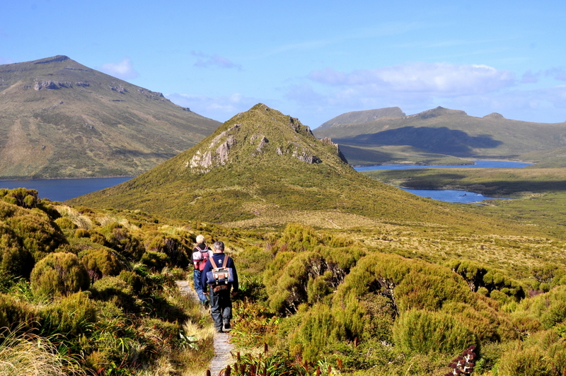
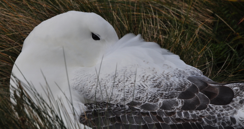
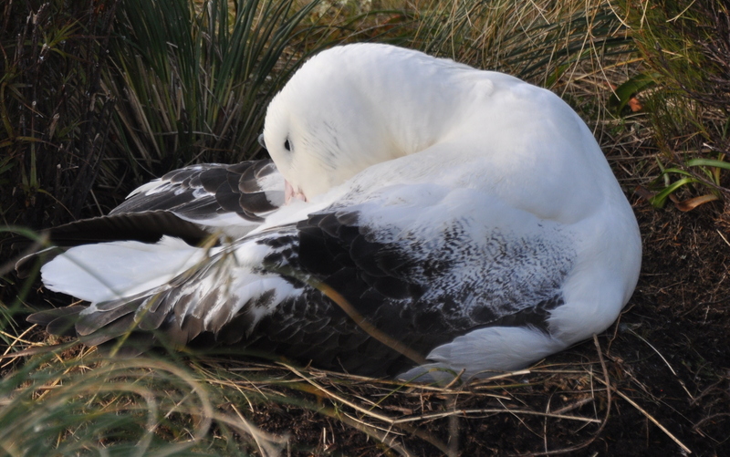
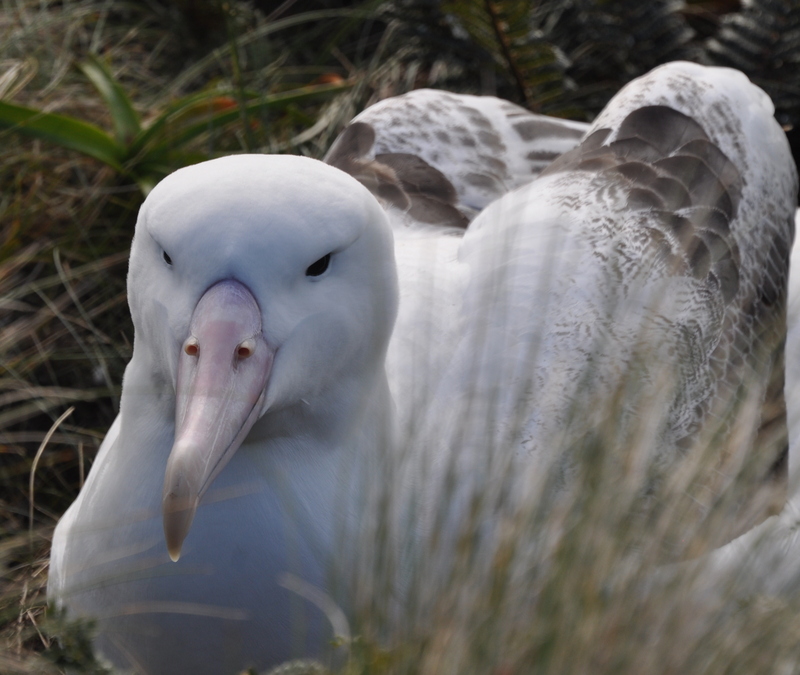
The 8-km return hike to a lookout point on a ridge is most enjoyable. In the higher stretches where the wind is strongest and the vegetation lowest, we come into close encounter with the Royal Royal Albatrosses sitting on raised nests. One is sitting right by the boardwalk and we have to detour in order not to disturb it. Most appear to have eggs or small chicks and are sitting tight on the nests, occasionally preening themselves but mostly snoozing or watching us without concern.
 |
 |
 |
 |
 |
 |
 |
 |
 |
 |
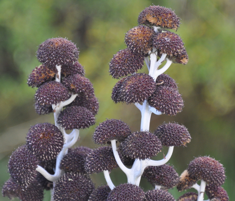 |
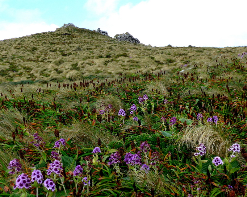
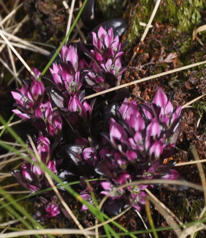
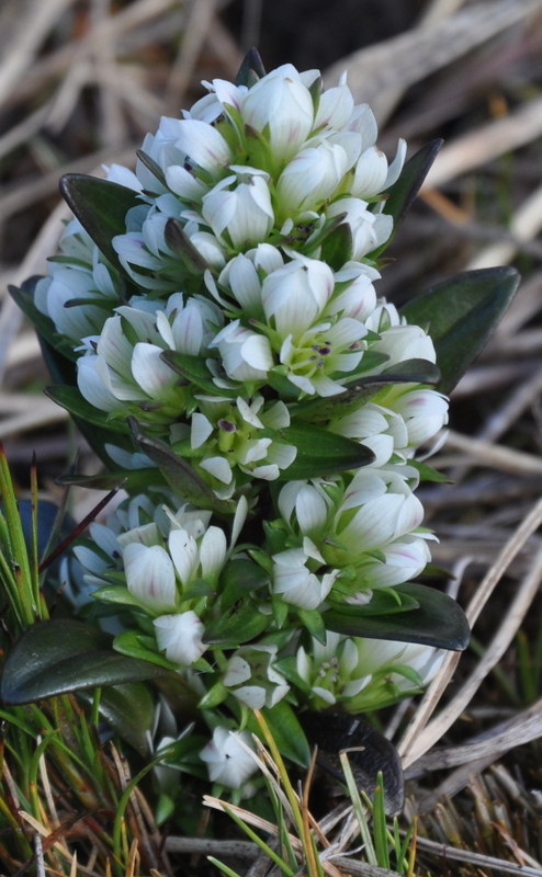
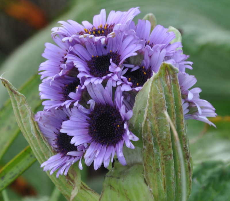
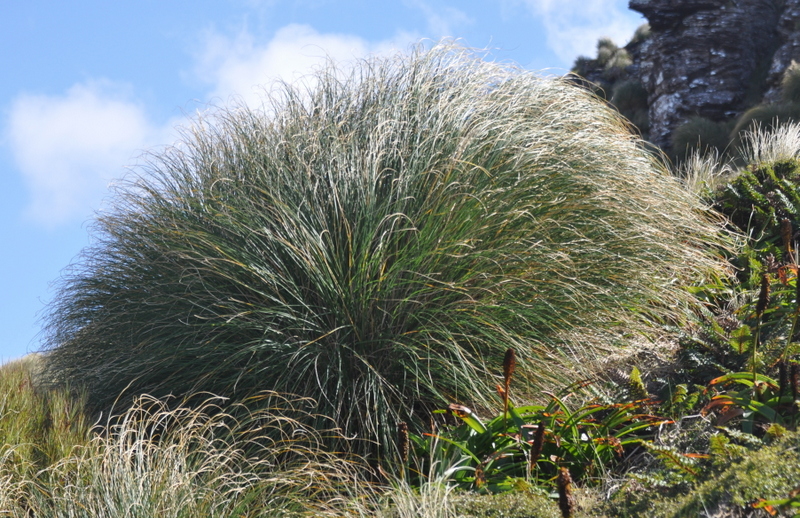
The scenery, wilderness, wildlife and fauna is unearthly beautiful. The island, a paradise for the Southern Royal Albatrosses, is teemed with life. I am fascinated by the mystical albatross and wish to reincarnate to a wandering albatross enjoying total freedom of the sky! The island is green covered with mega-herbs, colourful daisy and other summer flowers. Campbell Island Pipits and sea lions are plentiful. I stretch my legs for four hours before returning to the ship at 12:20pm.
 At 3pm, we have a zodiac cruise to watch petrels, shearwaters, Antarctic Terns, Campbell Shags, Albatrosses, Kelp Gulls and Red-billed Gulls flying around or feeding in water. But I miss the ‘World’s Loneliest Tree’, an aged Sitka Spruce grown stout and bushy in this windy environment. Planted as a memorial to those who perished here during the days in the early 1900s when attempts were made to farm and settle Campbell Island, it is the only tree grown on the island.
We spot a lonely baby elephant seal ashore – it seems disturbed and turns its back on us. According to Don, the chance of spotting Yellow-eyed penguins that nest among the dense shrubs at the top of the coastal cliffs, is slim. His advice does not deter Rob (the hotel manager and our zodiac driver) and my keen zodiac mates from checking them out. We cruise along the rocky shore of the harbour entrance and in a split second, I spot a small black object with yellow spots in the water! Wow, it is indeed a Yellow-eyed Penguin. Soon, I see four more on the rocks and a bush on a the slope nearby. I feel happy to return to the ship at 5:45pm.
 |
 |
 |
 |
 |
 |
 |
Campbell Island gets less than 600 hours of sunshine all year and has rain on 325 days a year and gales on 280 days. The mean temperature is just 6°C. We are extremely lucky as we have no rain and a mix of cloud and sun all day. But as the Ortelius moves out of the bay, the usual sub-antarctic weather returns, with cold rain driven by strong winds.
I celebrate my perfect day on Campbell Island with a glass of red wine (half price today). After dinner, I watched a fantastic 6-part BBC documentary ‘Frozen Planet‘. Modern technology has made it possible to capture amazing footage of wildlife and nature. While sitting comfortably in a sofa, I can see all corners of the world! But there is no more adventure (in its true sense!). I must be tired and have a sound sleep. (L- pasta; D- mushroom risotto)