
6-day Grand Traverse Hike: Greenstone Valley and Routeburn
 |
 |
NZ is a paradise for nature lovers and hikers. After looking at a few guided trips, I pick a 6-day ‘Grand Traverse Hike‘ with the Ultimate Hikes. This track combines the easy Greenstone Track through forests and the Routeburn Track lying in the Fiordland and Mt Aspiring National Parks (both of which are inside the South West NZ World Heritage Area) traversing wild and scenic mountain landscape between the Hollyford and Dart Valleys at the base of NZ’s Southern Alps.
February 3, Tuesday: Auckland, North Island – Queenstown, South Island
I had a short flight from Queenstown from Auckland. The temperature dropped so much that I had to put on my down jacket while waiting for the shuttle bus. I stayed at the Absolute Value Hostel right by the lakefront on Beach Street. The rooms are nice with a well-equipped and clean kitchen and a comfortable common room. The staff are most helpful.
At 3pm, I attended a briefing at Ultimate Hikes and picked up a backpack and rain coat. After the briefing, I had a blissful afternoon strolling in the park and along the lakefront and had an early-bird dinner with salad and a tasty and juicy steak for less than $20. Queenstown remains pretty but has lost its charm owing to mass tourism and over-development.
Amazing 6-day Grand Traverse Hike February 4-9
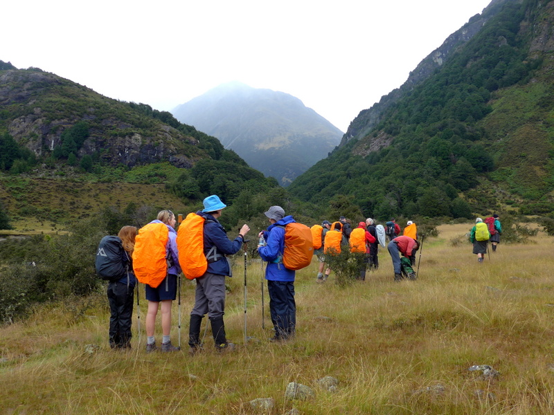
Day 1: Greenstone car park to Steele Creek (18km)- Sunshine & shower (9:45am-4pm)
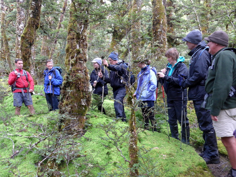
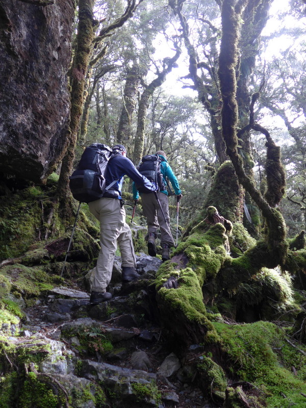
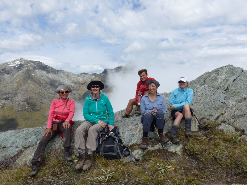
The bus departed at 7:45am from Queenstown for the Greenstone car park. This group had 15 hikers (Mick & Vic, & Trevor from NZ, Anthony, Jo & John from the UK, Amanda, Briony, Jean, Paul, Sue, Anna-Grace & Sophie from Australia and myself) and three guides (Tom, Fraser and Charlotte).
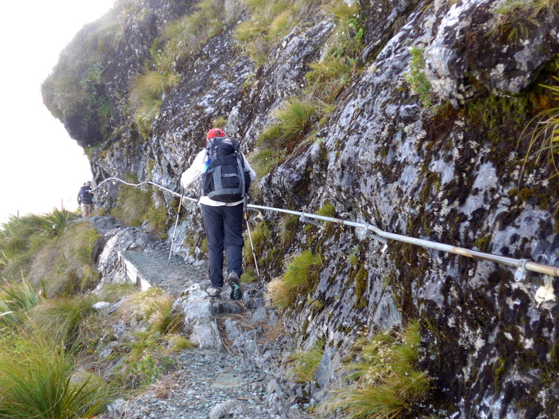
After a short briefing, we set off at 9:45am. As the weather did not look promising, I put on the full rain gear (rain jacket and trousers). I got hot and had to take off the rain trousers later.
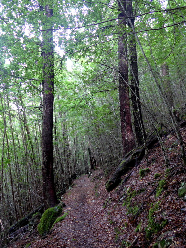
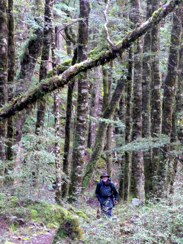
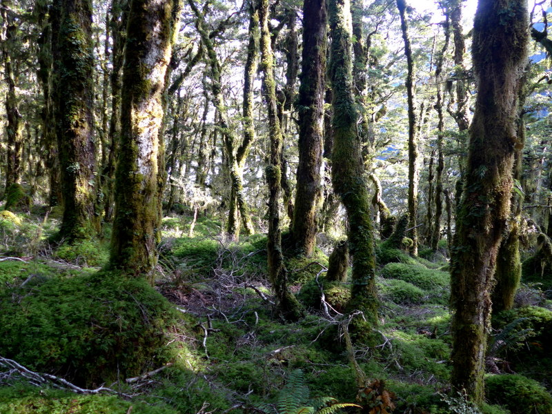
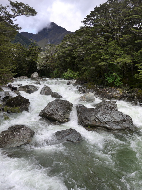
Today, we had an easy day spending most of the time in beech forests on the left side of the valley. We had lunch in a private hut with water pipe and cooking stoves. I had hot chocolate with my sandwich.
 |
 |
 |
 |
 |
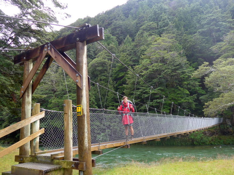
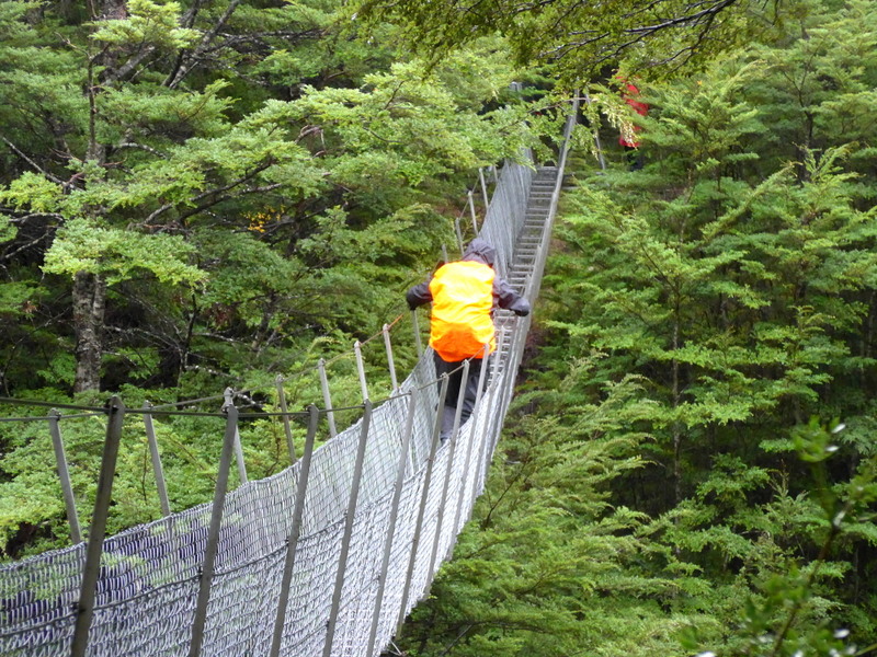
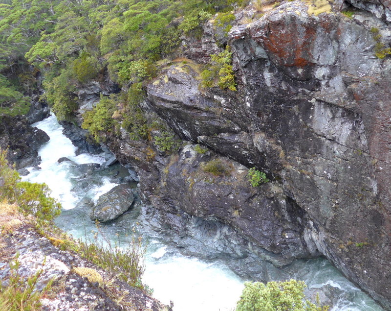
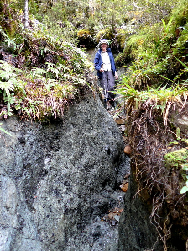
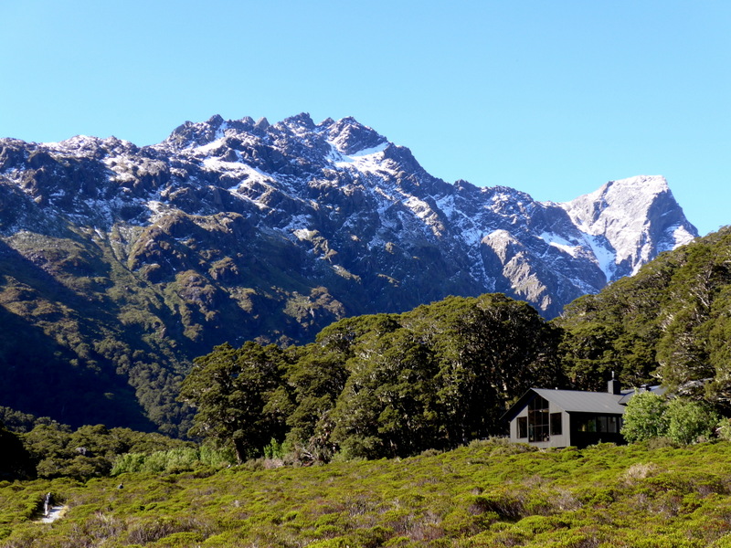
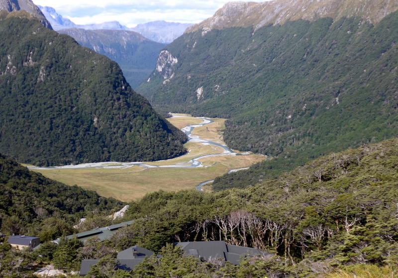
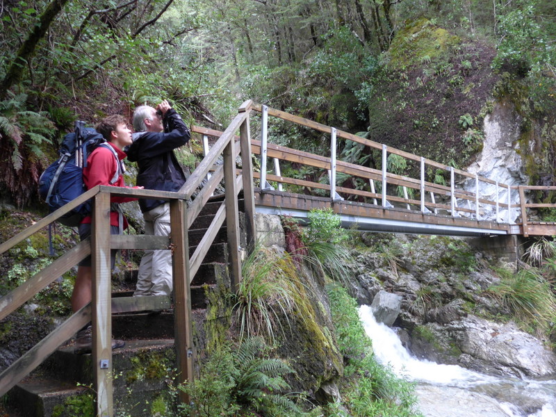
I enjoy walking at my own pace. A short distance from the Sly Burn turnoff is a bridge over the Greenstone River running through a deep chasm. As usual, I was the slowest in the group and the last person to arrive at the Steele Creek Lodge, a comfortable simple lodge located close to the Greenstone River Flats.
 |
 |
I am surprised to find comfortable bunk beds, hot shower, a modern and well-equipped kitchen and cozy sitting room with a fire. Everything is delivered by helicopter to the lodge. Charlotte had already got the fire going and made tea for us. I was cold and wet: I had a hot shower before enjoying my afternoon tea. Soon heavy rain fell upon the roof and lasted for the next 24 hours. I had a good dinner with red wine and went to bed before 9pm.
Day 2: Steele Creek to Lake McKellar (16km)- Wet (9:30am-3:30pm)
I had a good sleep. Breakfast was served after 8am. I started with cereal, fruit and yogurt followed by poached egg and bacon. The weather did not look promising: gray, wet and cold. I had my rain gear on the whole day.
 |
 |
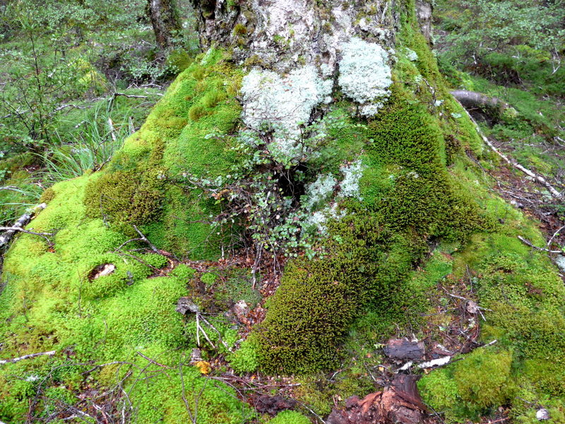
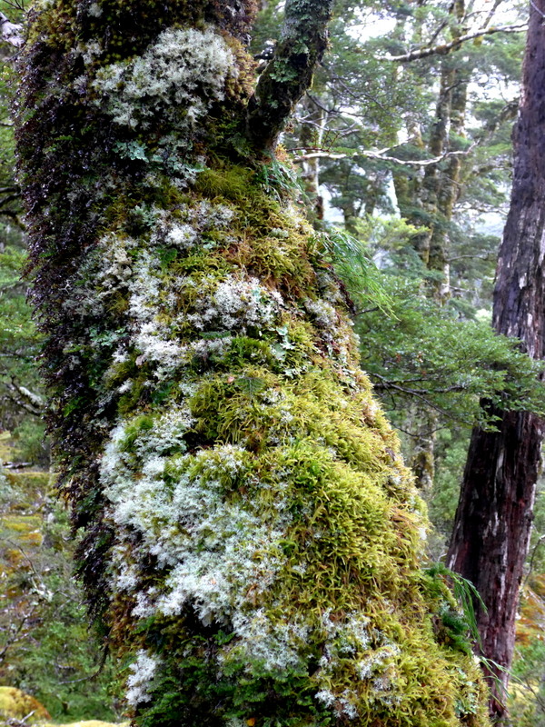
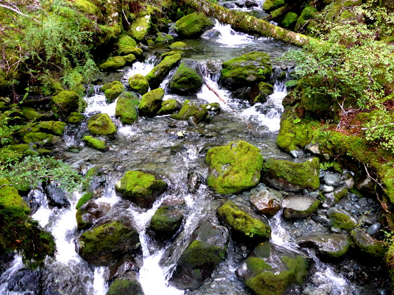
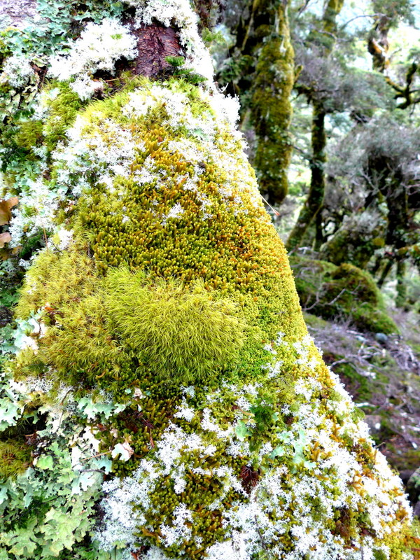
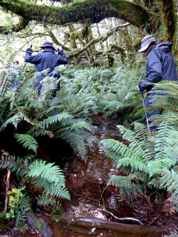
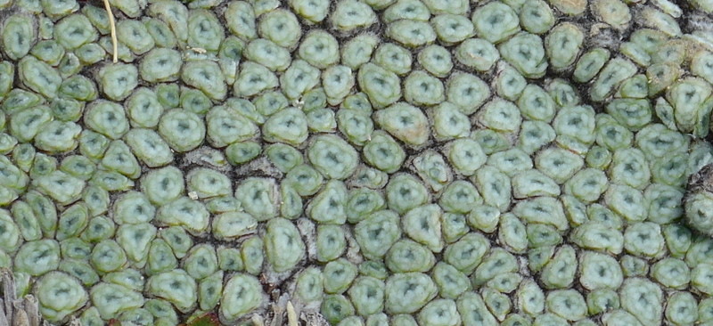
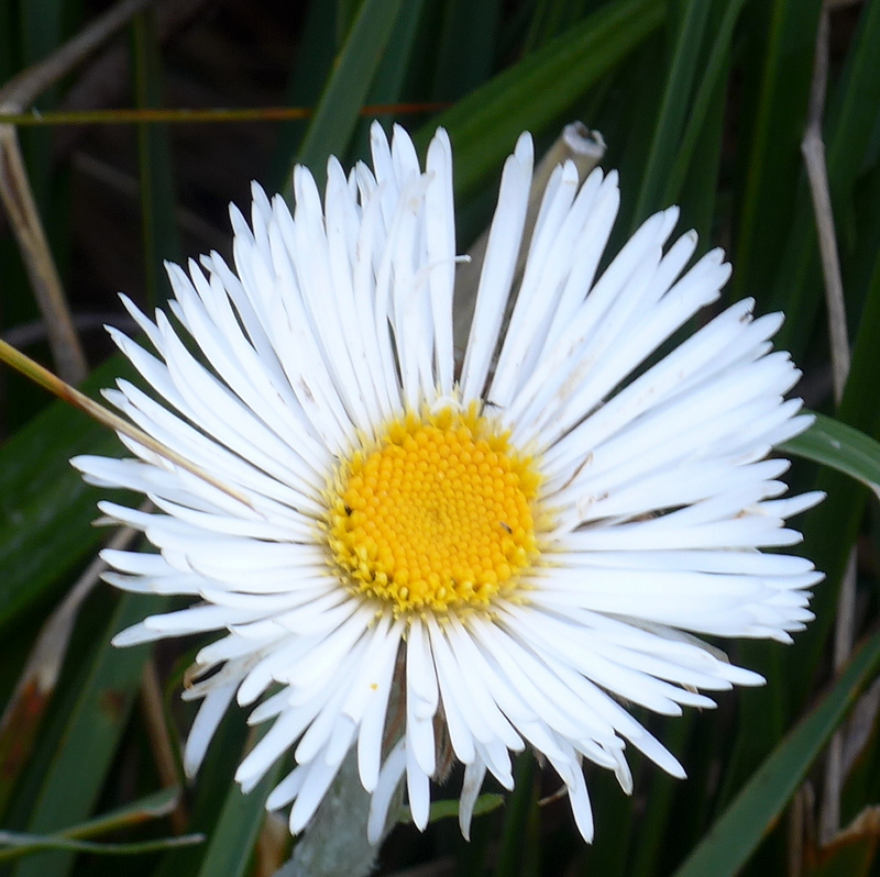
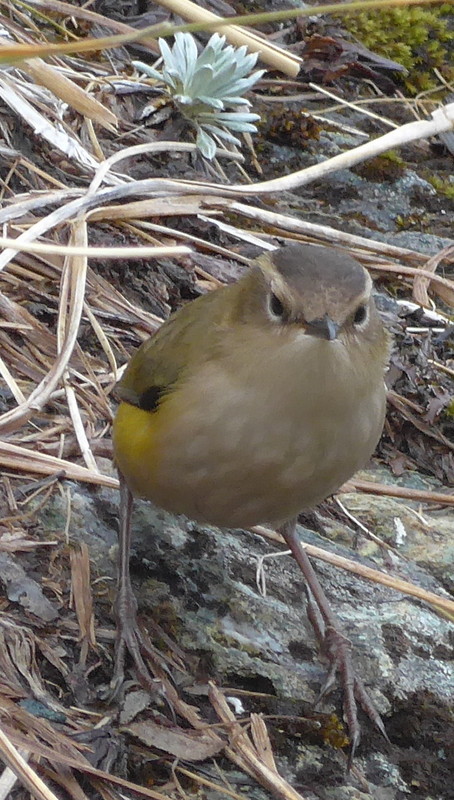
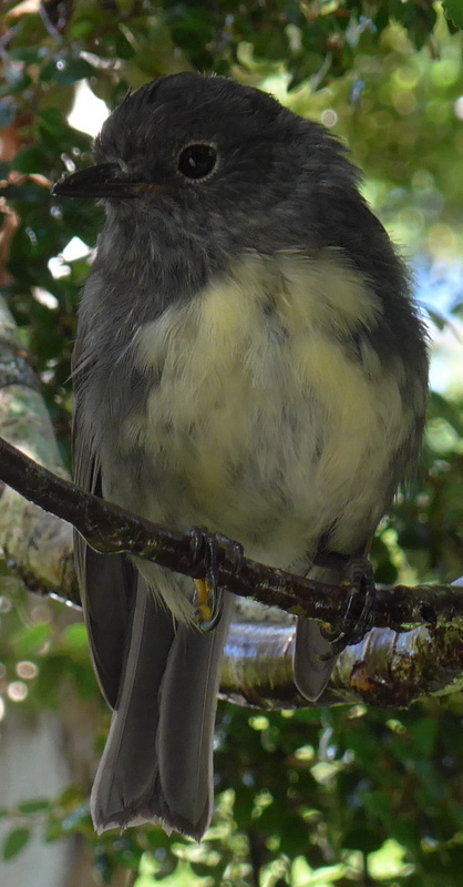
Today’s track runs through beech forests with most impressive and colourful mosses, lichens and ferns. I saw fantails for the first time.
  |
 |
 |
 |
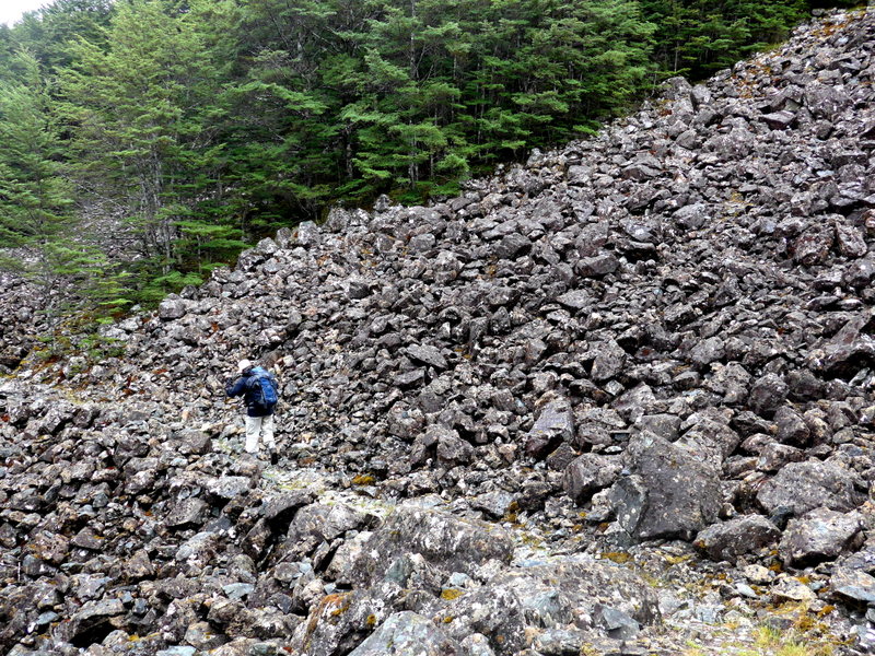
We crossed countless streams and my hiking boots were wet. Despite the slippery rocks and muddy path, I was lucky to fall only once (after lunch) and managed to arrive at the McKeller Lodge without serious mishap.
 |
 |
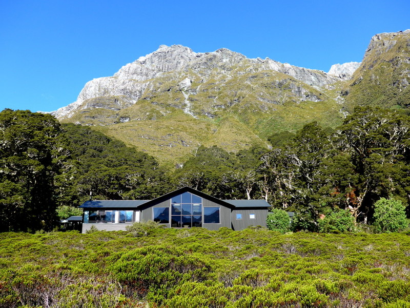
We spent two nights at this lodge which is bigger and more comfortable than the first lodge. There are several rooms each fitted with a heater. I shared a room with Sophie.
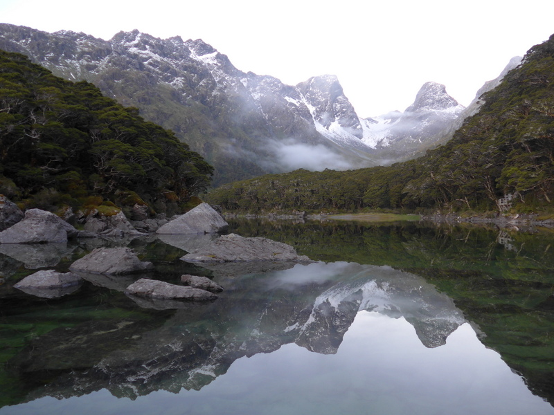
Day 3: Rest Day at McKellar with side trips to the Lookout (4km) and waterfall (4km)- Sunshine and snow
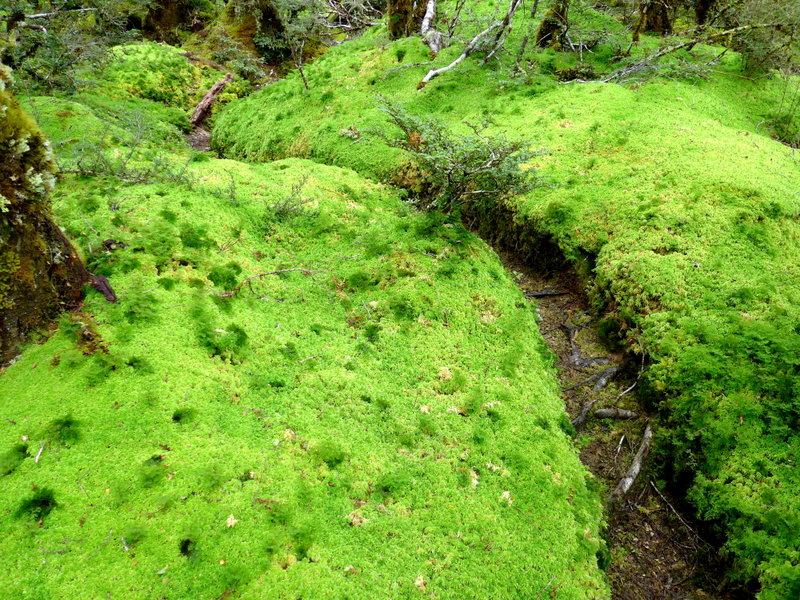
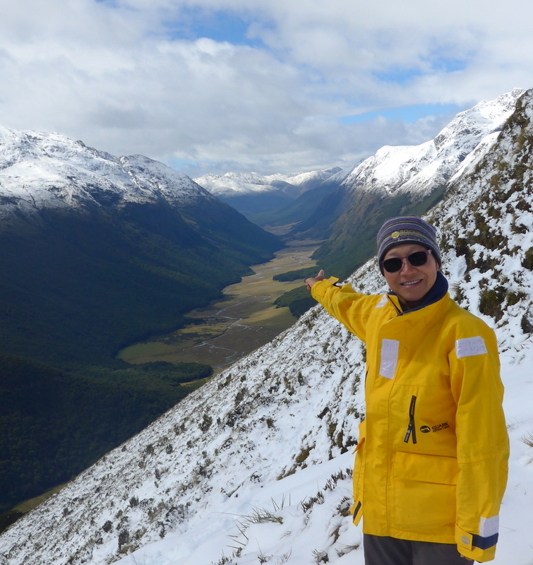
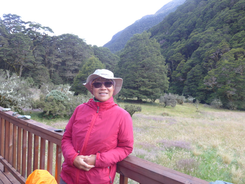
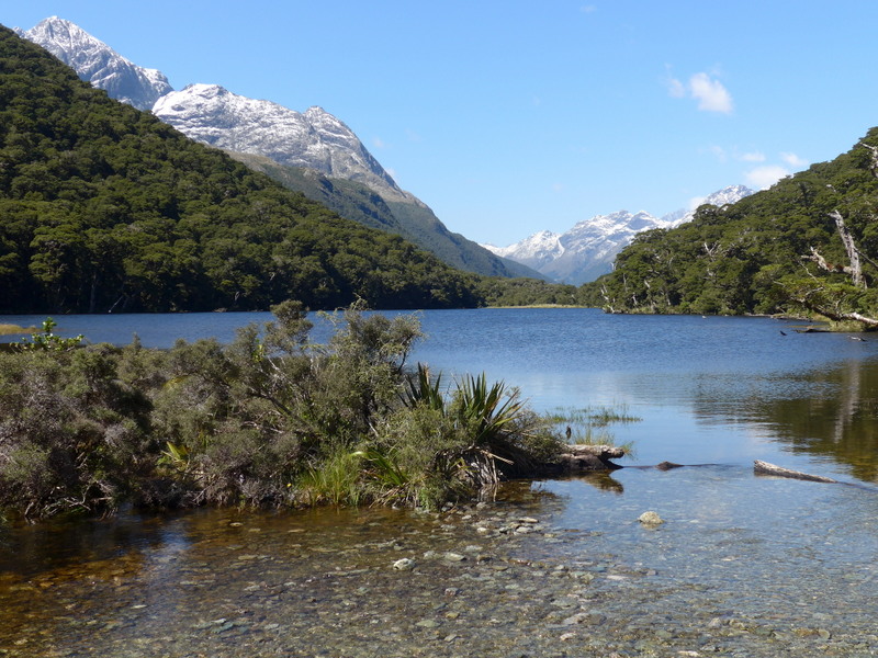
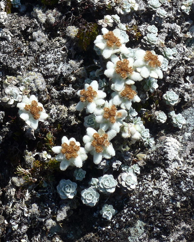
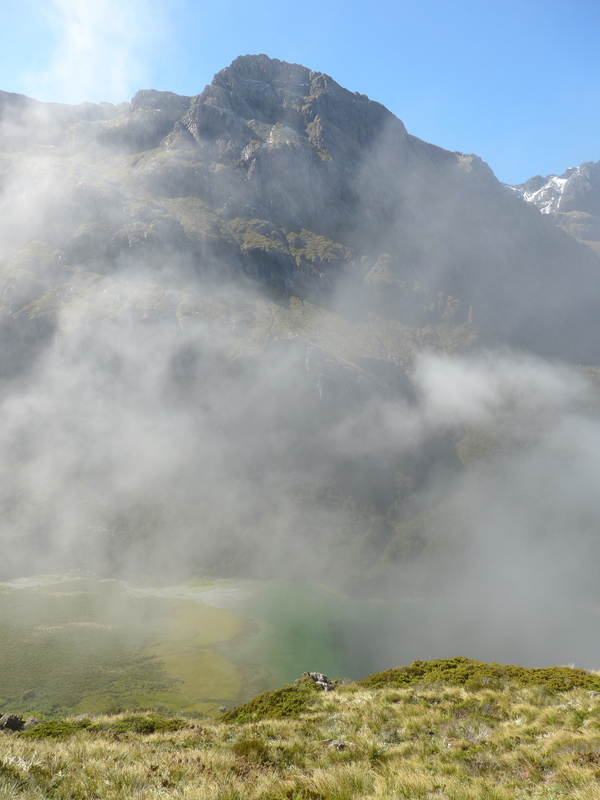
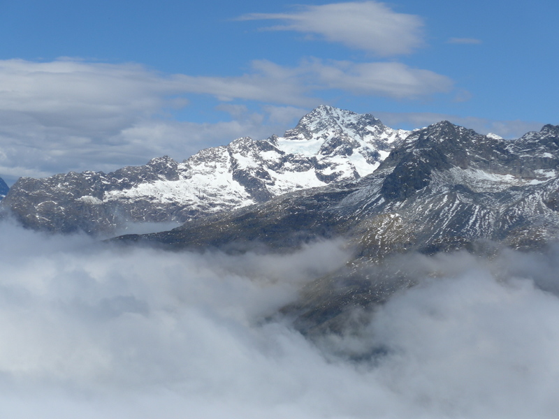
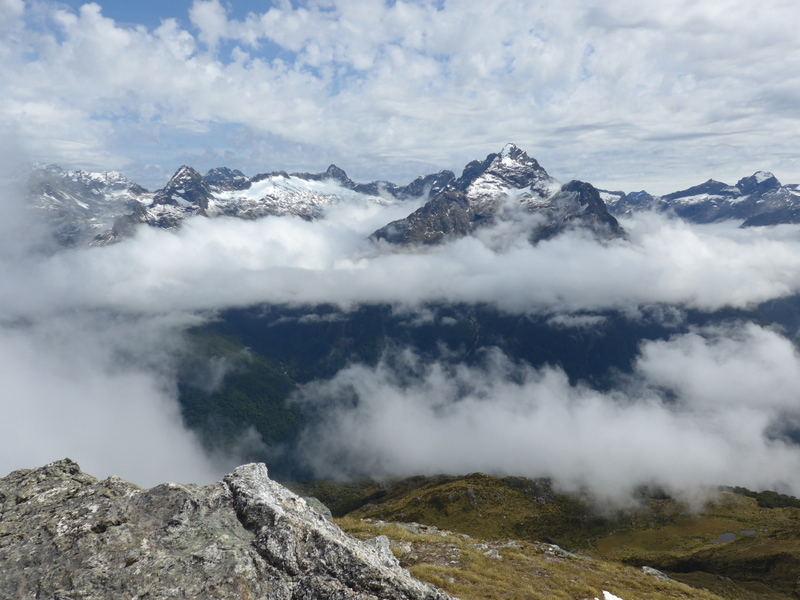
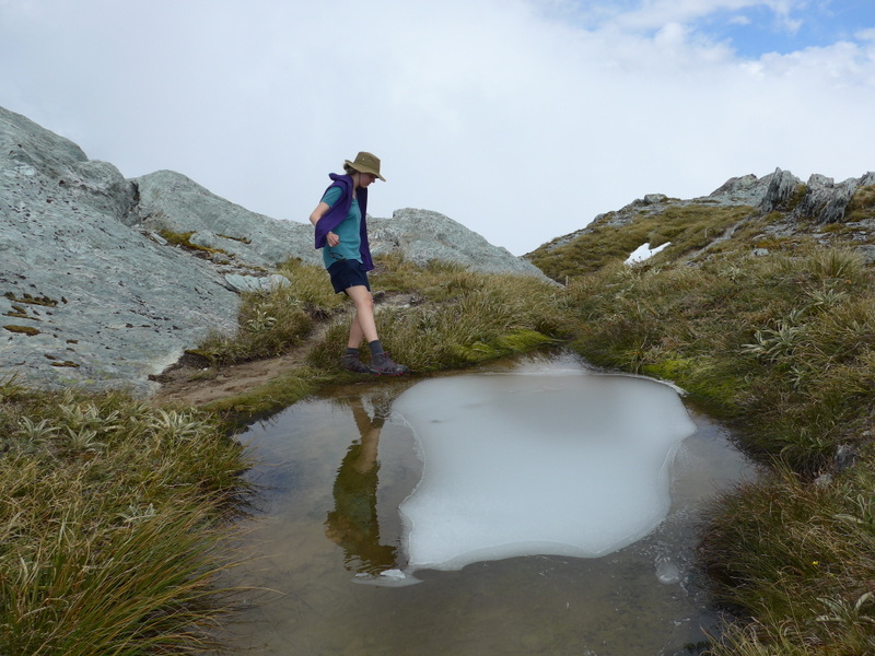
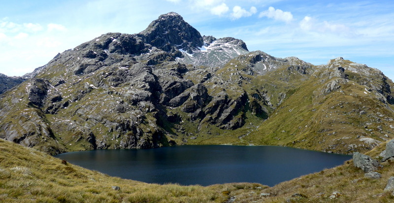
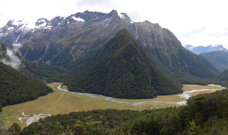
Today’s a rest day. I joined an optional trip to a lookout behind the lodge (a 3-hour return hike). It’s a fairly steep climb through the forest to the lookout (about 1300m) above the tree line. I was surprised to find knee-deep snow. We had fantastic views of the Greenstone River Valley, Lake McKellar and the Ailsa Mountains.
 |
 |
 |
 |
 |
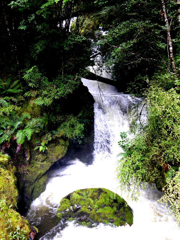
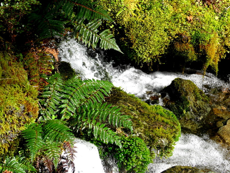
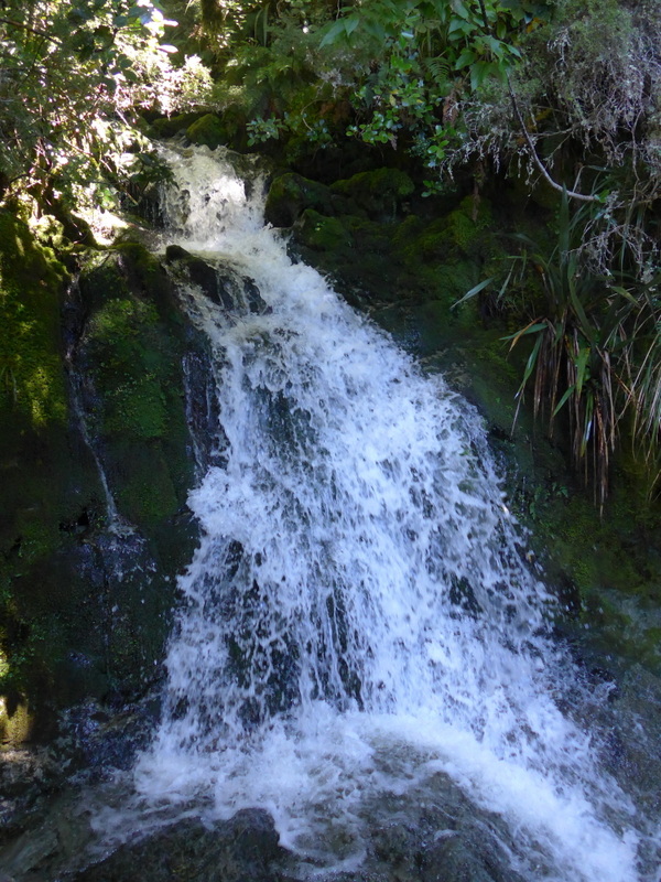
After lunch joined Jean, Jo and John on a short walk to the waterfall on the other side of the river. The track through the forest covered in ferns is beautiful.
 |
 |
 |
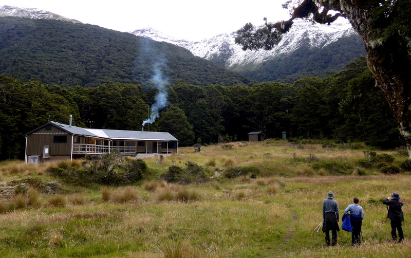 Refuge run by NZ Department of Conservation |
 Our lodge |
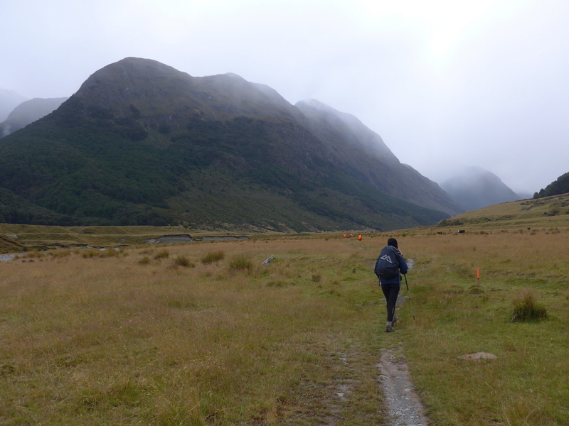
Day 4: Lake McKellar to Lake Mackenzie with side trip to Key Summit (20km)- Sunny and hot (9:30am-6pm)
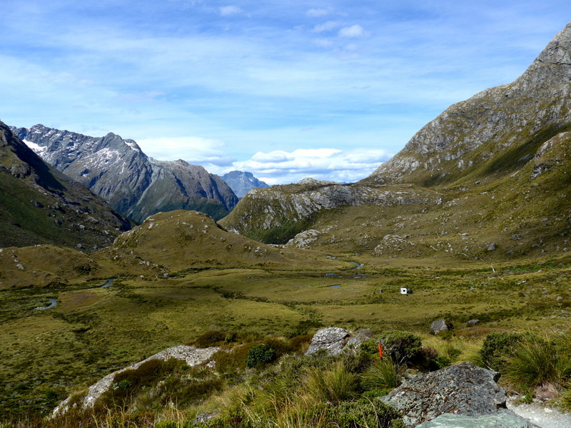
We had fantastic weather with blue sky. The first 2-hour walk (4km) along the shore of Lake McKellar, over the Greenstone Saddle (776m) and Lake Howden is easy.
 |
 |
 |
 |
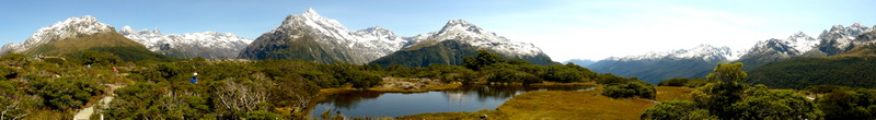
After leaving my backpack at the Howden hut, I walked leisurely to the Key Summit (5km return). The boardwalk at the summit is well-maintained offering fantastic panoramic views of three valleys from which the water flows to three different coasts, the Grenstone to the east, the Eglinton to the south and the Hollyford to the west. The majestic Mt Lyttleton and Mt Christina with amazing hanging valleys, cirque and glacier lakes are so close. With excellent visibility, I saw the mountain ranges in all directions. The illustrations of the formation of the mountain ranges, flora and fauna are very good.
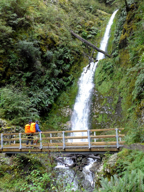
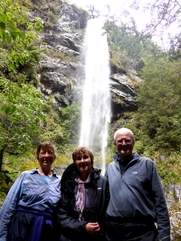
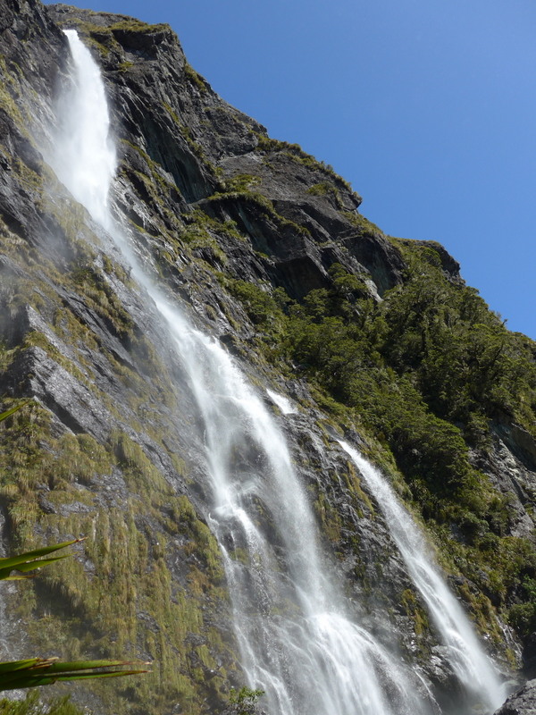
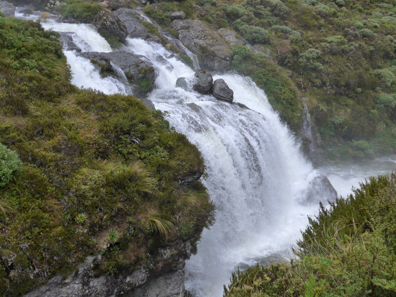
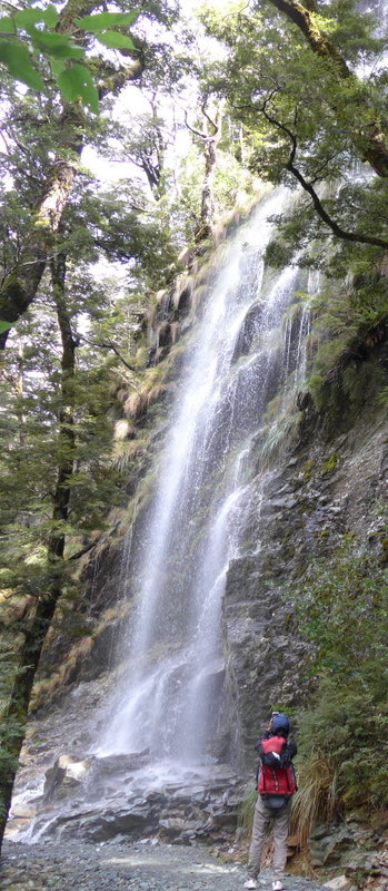
I had my sandwich by the Lake Howden around 1:30pm. Then I crossed the river and made my way up slowly to the Earland Waterfall. The track is well maintained. Owing to recent heavy rainfall, the 80m waterfall is spectacular: I got a shower from the spray though I was some 50m away from the fall!
 |
 |
 |
I had under-estimated the distance and difficulties of the mostly down-hill hike after the waterfall to the lodge: the track is rocky, steep and uneven at times. I lost a walking pole and had to tread carefully on rocky terrain. I was relieved when the Lake Mackenzie Lodge finally came into sight.
 |
 |
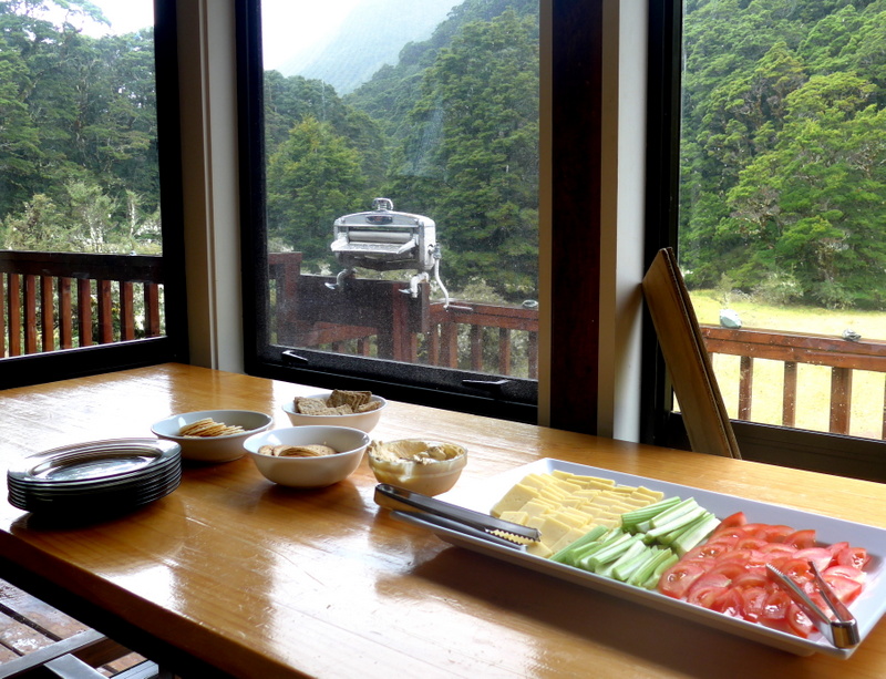
The luxurious lodge is modern with excellent facilities and eight staff. I had a room to myself as my young roommate Grace decided to join Sophie and Briony in their room.
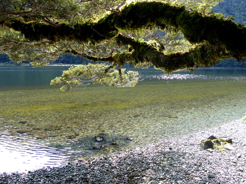
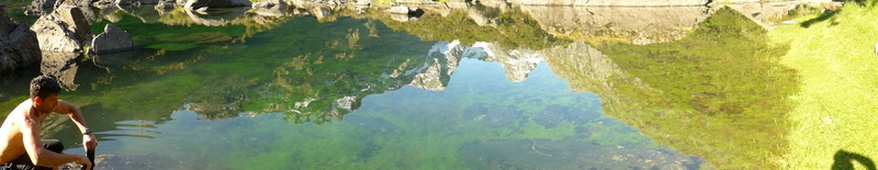
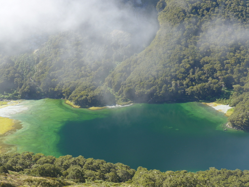
Only 100m away is the picturesque Lake Mackenzie. I took some lovely pictures both before and after dinner. Unfortunately, there was no gorgeous sunset.
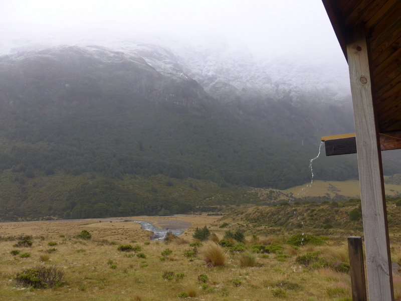
Day 5: Lake Mackenzie – Harris Saddle – Conical Hill – Routeburn Falls (16km): Mist and Sunshine (pouring rain from 11pm onwards) (9:30am-5pm)
 Lake Mackenzie taken on 7/1/2015pm |
 Lake Mackenzie taken on 8/1/15am |
I originally planned to get up early to watch sunrise. When I saw the mist outside the window, I gave up the idea. After breakfast, we walked to the lake for a group photo in the mist!
 |
 |
 |
 |
 |
 |
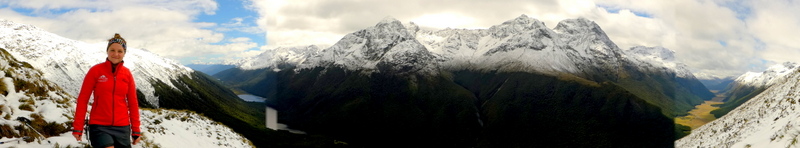
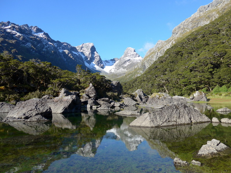
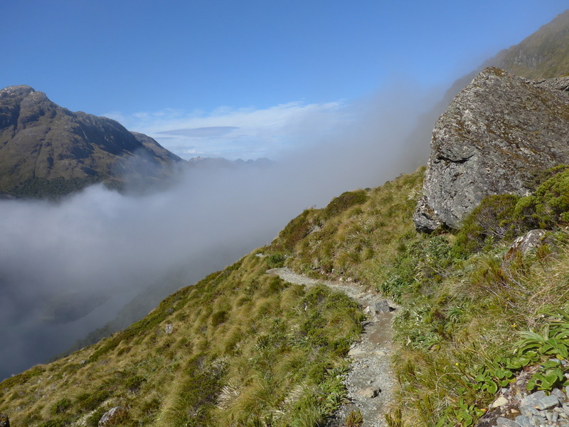
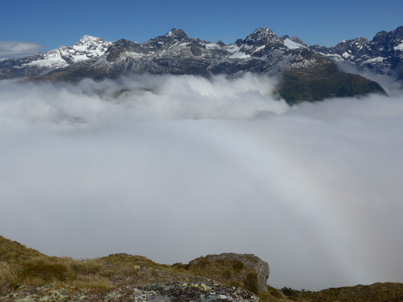
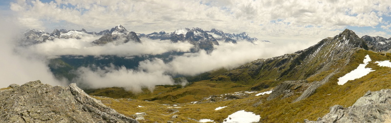
I spent almost two hours following a zig-zag track uphill to Ocean Peak Corner (3km). I walked slowly watching mist lifting from Lake Mackenzie and the surrounding peaks. What a splendid moment with unearthly beautiful scenery! The views at Ocean Peak Corner are awesome: the snow-cladded mountain ranges just floated above the clouds. The majestic and rugged peaks are brilliant.
 |
 |
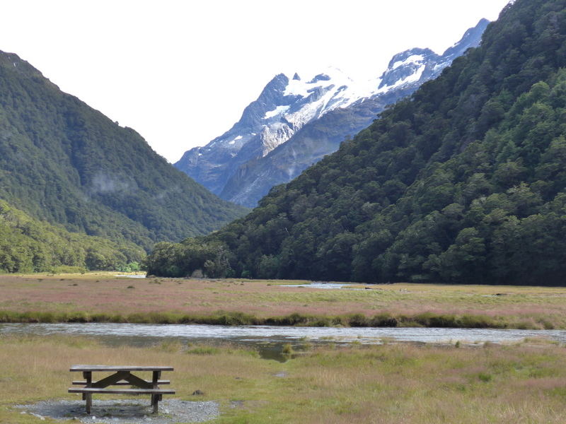
The next 4.5km-walk across the Hollyford Face to the Harris Saddle is easy. We had our sandwich lunch in our own private hut.
 |
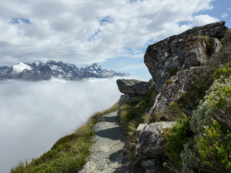 |
While some members went straight onto the Routeburn Falls Lodge, I joined a side trip to the Conical Hill led by Fraser. At first, I was a bit worried that the steep slope and climb over rocks might be too challenging for me. Luckily, the rocks are not slippery: with a walking pole and my hands, I made my way slowly but steadily. I got to the top within 45 minutes. Not bad! The views are fantastic after the mist had been lifted. I am glad that my perseverance and determination have propelled me forward reaching peaks that afford amazing views.
 |
 |
 |
 |
 |
 |
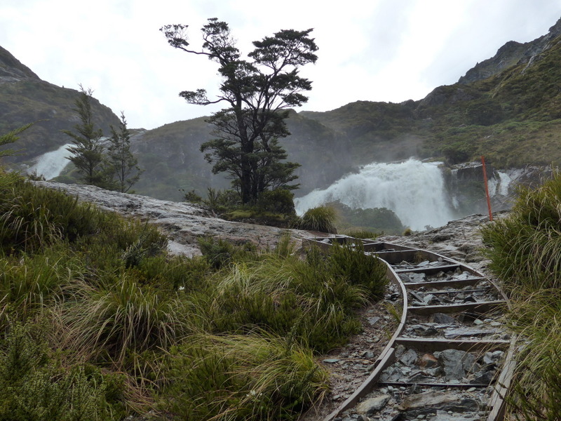
At 3:30pm, I set off for the Routeburn Falls Lodge which is relatively easy. Once I dropped my backpack, I headed to the spectacular falls which is next to the lodge. Then I realise that the waterfalls and stream I had been following on the way to the lodge end up here!
 |
 |
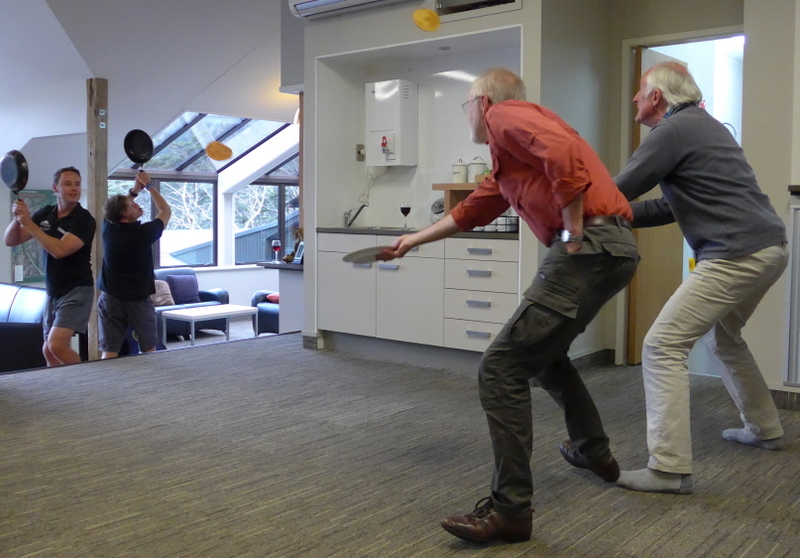
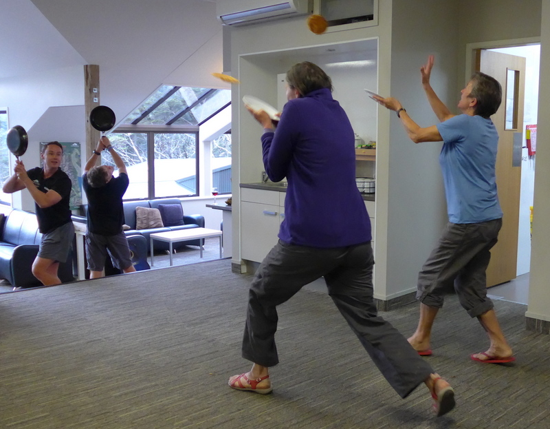
I had my best dinner on the track: rack of lamb and pancake. I brought a bottle of red wine and finish it with Tom and Fraser thanking them for the good weather and support for a slow hiker like me.
Tom is a good story-teller and a cheerful Oz. He told us how tourism and tracking began in the region. Then we had a pancake throwing game and only Jo, Sophie, Sue, Paul and Anthony managed to catch it.
 |
 |
I shared a room with Sue and Jean. I could not sleep and heard rain falling on the roof. I might have slept only for three or four hours.
Day 6: Routeburn Falls to Routeburn Road (9km): Fine weather (9:30am-1:30pm)
The sky was still gray at breakfast. I rushed out to take a last look at the waterfalls which looks even more spectacular after heavy downpour of rain. But it’s difficult if not impossible to take a good picture (with my lens) that captures the thundering waterfalls.
 |
 |
The rain miraculously stopped when we set off at 9:30am. The half-day walk is very easy. I enjoy the beech forests and alpine pastures of the Routeburn Flats.
 |
 |
 |
 |
 |
Our coach was already waiting us at the car park. We had a drink in a pub in Glenorchy where Tom and Fraser presented each of us a certificate with a group photo as a souvenir of this memorable trip.
I felt sorry to be back in Queenstown after spending five wonderful nights in lodges in the wilderness. Tonight I found myself in the X-base Hostel which is crowded and noisy. The noises coming from the bar and the street kept me awake.
February 10, Tuesday: Queenstown – Invercargill by bus
Around 5am, I could no longer stand the noises coming from garbage collection vehicles. I got up at 6am, left the worst hostel I had stayed in NZ during this trip.
My bus departed at 7am and I arrived at the Invercargill Apartment Hotel before 11:30am. I spent the whole afternoon in my room emailing my family and friends, writing and uploading travel notes and photos to my website.
The weather was fine and I pulled myself away at 5pm from the computer. I had a pleasant walk along the Tay Street and Dee Street and decided to get some fresh mussels from the supermarket. I had the most delicious steamed mussels for dinner which cost me only $3!
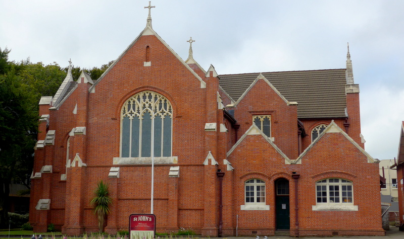 Anglican Church |
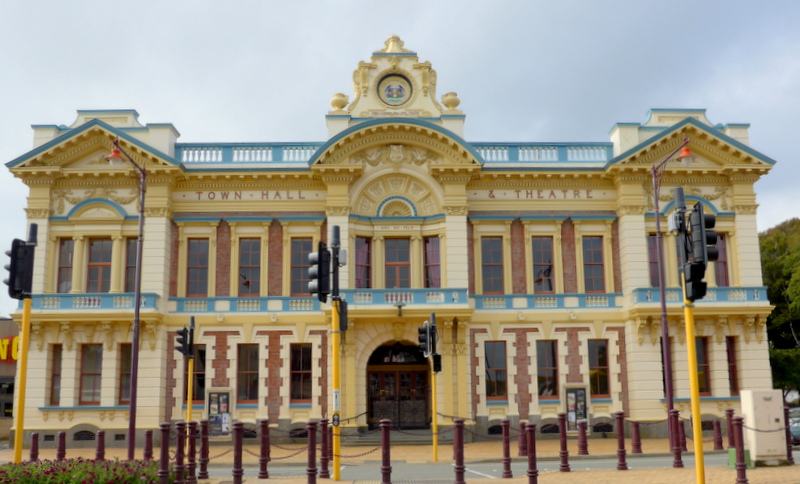 Town Hall |
 |
 |
I worked on my website till almost 1am. It gave me so much joy to finish the entry on my journey in the North Island.
February 11, Wednesday: Invercargill – Bluff – on board Ortelius
This would be the last day with free Wi-Fi connection till mid March. Hence, I made the best use of the facilities to do e-banking and emailing. At noon, I checked out and brought my stuff to Kelvin Hotel, the meeting place of the expedition.
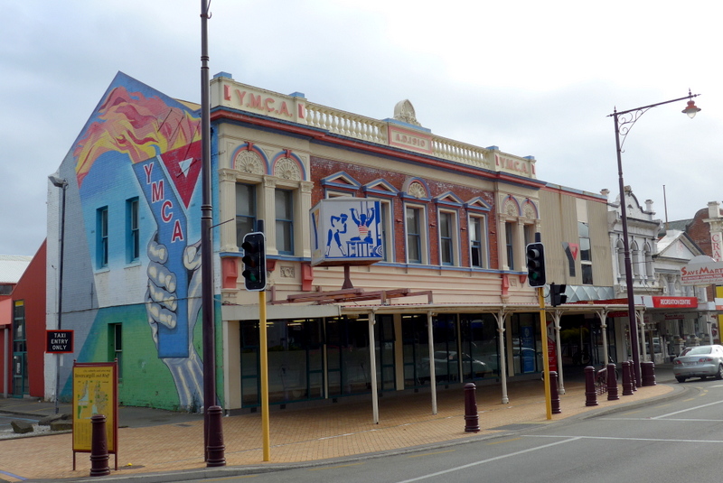
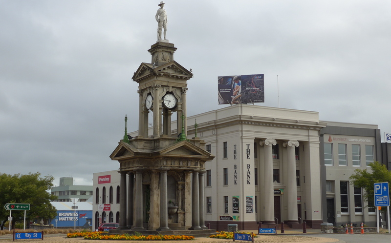
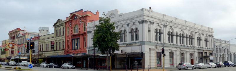
I spent the last few hours wandering around in this sleepy town which has numerous buildings with interesting architectural styles of the late 19th and early 20th centuries. I went to the Queens Park, visited the Art Gallery and tried to follow the heritage trail mainly along the Dee Street, Tay Street, Esk Street and Kelvin Street. I had sashimi and sushi for lunch but was somewhat disappointed. I should have gone back to the supermarket and brought a kilo of mussels for lunch!
 |
 |
 |
 |
At 3pm, I was on board a coach heading to Bluff and learnt that 84 passengers would be on this expedition. As we were too early, the bus took us to a lookout point for a quick glimpse of the port from the bus. Shortly after 4:15pm, I walked up the gangway of MV Ortelius beginning my 31-day life at sea.
Remarks
My 2-week trip in NZ exceeds my expectations. Many friends have told me not to go to the North Island as there is not much to see. During my brief visit, I am thrilled to see the Wai-O-Tapu Thermal Wonderland and have enjoyed tubing in the Waitomo caves which are lit up with millions of glowworms. However, it is the tour from the Bay of Islands to Cape Reinga which enables me to better appreciate NZ of the past and today. A stroll in Russell and a visit to the Waitangi Treaty Grounds have brought the loose ends of the Maori, explorers, whalers and colonisers together. I wish I had a couple more days to visit the Tongariro National Park (one of the three World Heritage Sites in NZ) and do the one-day Tongariro Alpine Crossing.
I am also glad that I have picked the right hike in the South Island. Hiking is the best way to appreciate the gorgeous Alpine scenery. The guide hike with Ultimate Hikes is not cheap by my standards. But it is value-for-money: a steaming hot shower at the end of a wet and cold day, excellent food and service worth every penny I have spent! Above all, I enjoy my hiking buddies from NZ, England and Australia. Perhaps, I shall meet them again one day. I am most impressed by the passion, knowledge and energy of Tom, Fraser and Charlotte and wish them good luck in their career.